Maine
- Boston: Weeks, Jordan & Company, 1838
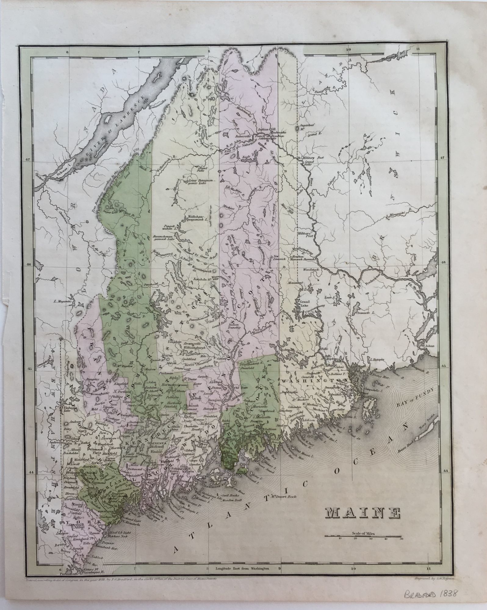
Boston: Weeks, Jordan & Company, 1838. Very good. G.W. BOYNTON. Hand-colored. 11 3/8'' x 14 1/8'' within the neat lines; light age toning and soiling to margins; very good. Map of Maine showing its 12 counties: Cumberland, Franklin, Hancock, Kennebeck, Lincoln, Oxford, Penobscot, Piscataquis, Somerset, Waldo, Washington and York; and Augusta as the capital. Both Franklin and Piscataquis counties were established in 1838. The northern boundary with Canada is described as the "True Boundary according to the Treaty of 1783" [Treaty of Paris], the "Line as proposed by the King of the Netherlands" is shown south of the Treaty line following thte St. Francois and River St. John, and "Line claimed by Great Britain" south of the Aroostook River and cutting through Mars Hill to the east is also delineated. The map also features an area labeled "Indian Villages", "French or Acadian Settlements" and locates a British military post.
Details
Title
Maine
Author
BRADFORD, T. G. [Thomas Gamaliel]
Condition
Very Good
Publisher
Weeks, Jordan & Company: Boston
Date
1838