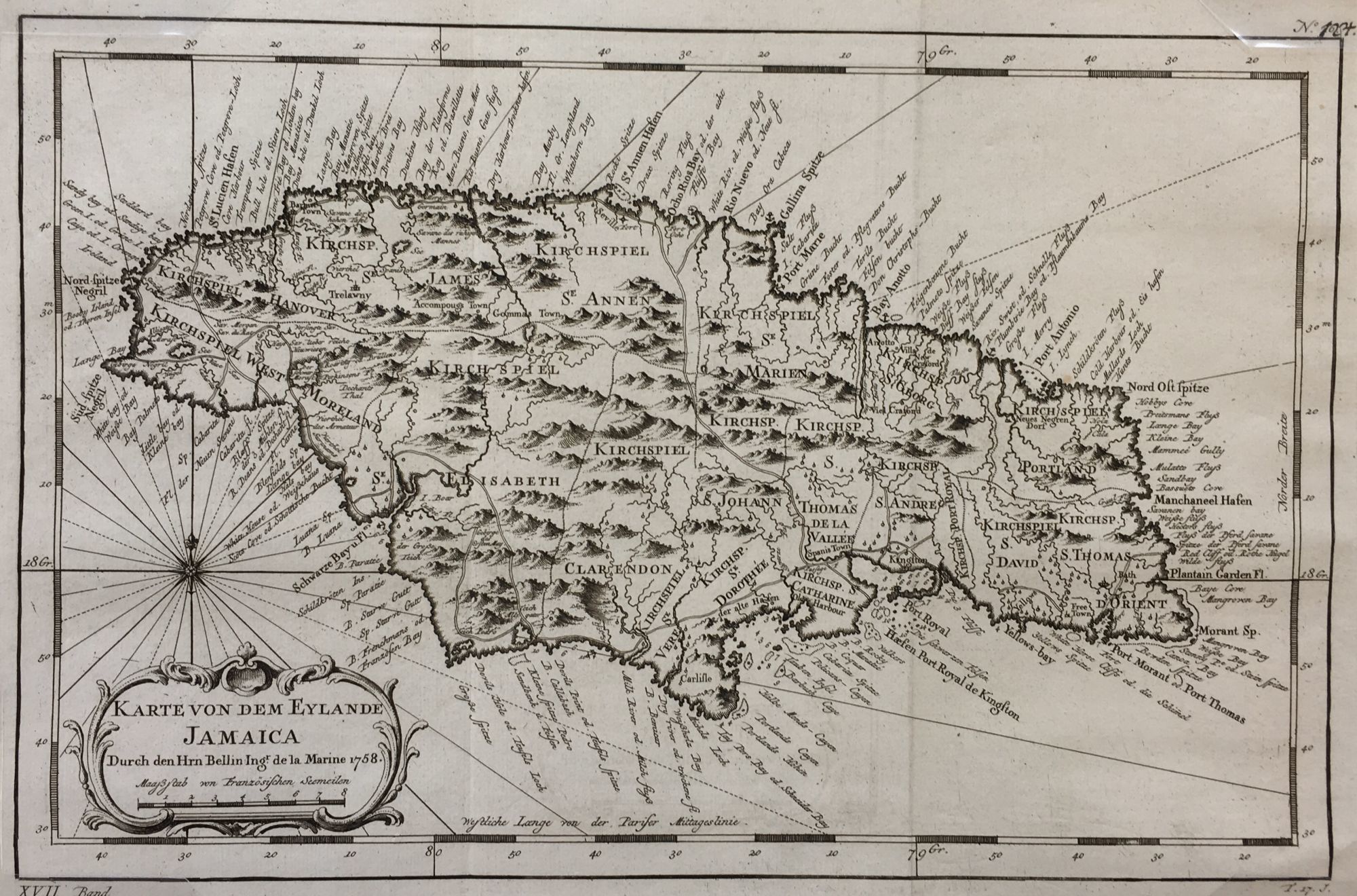
Karte von dem Eylande Jamaica
- Leipzig: J.J. Schwabe, 1760
Leipzig: J.J. Schwabe, 1760. Fine. English translation: Map of the Island of Jamaica.
9 x 14 1/2", 8 x 12 3/8" within the neat line; plate mark visible, two vertical folds as issued; decorative ornate cartouche with title and date; rose compass over cartouche; fine. This map produced by Jacque Nicolas Bellin (1703-1772) a French cartographer and hydrographer, Bellin produced important maps of his time. He was a member of the Royal Society of London and the Académie de Marine in France. He served as a hydrographer to the French navy from the age of 18 and rose to the title of Official Hydrographer to the King. This map issued in 1760.
9 x 14 1/2", 8 x 12 3/8" within the neat line; plate mark visible, two vertical folds as issued; decorative ornate cartouche with title and date; rose compass over cartouche; fine. This map produced by Jacque Nicolas Bellin (1703-1772) a French cartographer and hydrographer, Bellin produced important maps of his time. He was a member of the Royal Society of London and the Académie de Marine in France. He served as a hydrographer to the French navy from the age of 18 and rose to the title of Official Hydrographer to the King. This map issued in 1760.
Details
Title
Karte von dem Eylande Jamaica
Author
BELLIN, Jacques Nicolas
Condition
Fine
Publisher
J.J. Schwabe: Leipzig
Date
1760