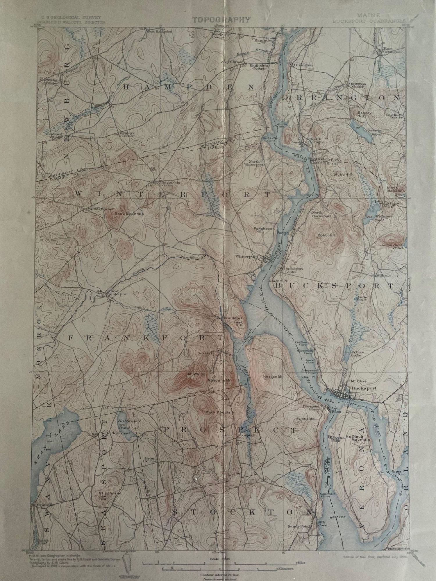
Maine Bucksport Quadrangle, Topography, State of Maine, U.S. Geological Survey, Charles D. Walcott, Director
- Map no binding
- [U.S. Government], 1906
[U.S. Government], 1906. Map no binding. Near fine. 20" x 16 5/8", 17 ½" x 12 ½ "within the neat line; map printed in sepia, blue and black, verso has description of topographic maps and Conventional Signs listed; center fold as issued; light age-toning to edges; pin holes at fold line; near fine. Includes the following areas and towns in Maine: Bucksport, Frankfort, Hampden, Monroe, Newburg, Orland, Orrington, Prospect, Searsport, Stockton, Swanville, Verona, Winterport.
***SUGGEST: if planning to frame the map, cut the archival top-loader down the sides with a box-cutter to remove the fragile map.***.
***SUGGEST: if planning to frame the map, cut the archival top-loader down the sides with a box-cutter to remove the fragile map.***.
Details
Title
Maine Bucksport Quadrangle, Topography, State of Maine, U.S. Geological Survey, Charles D. Walcott, Director
Author
LEE, Leslie A., William ENGEL, C.S. HICHBORN, Commissioners [Topographic Survey Commissioners, 1903]
Binding
Map no binding
Condition
Near Fine
Publisher
[U.S. Government]
Date
1906