Map of Hollywood-by-the-Sea Hollywood Fla. Scale = 1 inch = 1/2 mile
- 53 x 47 cm
- 1928
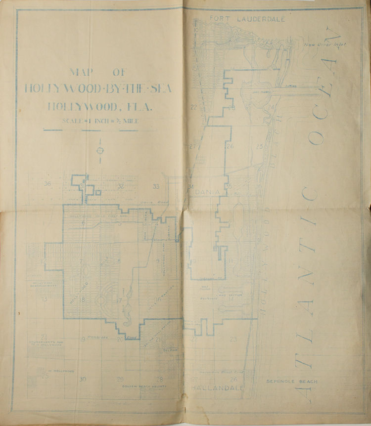
1928. 53 x 47 cm. Blue line map. Lines somewhat muted as if fading, small stain at center of lower margin, old folds, good condition. 53 x 47 cm. Blue line cadastral map with Fort Lauderdale at the top, Hallendale at the bottom, and Hollywood in between.
The city of Hollywood "By-the-Sea" was incorporated in 1925 and planned in large part by Joseph W. Young Jr. who built a boardwalk, hotels and a casino in order to draw interest to the beachfront, where he was selling house lots. The name "Hollywood "By-the-Sea" was meant to both capitalize on the 1920s craze for Hollywood, California, and to differentiate this development from Young's other development endeavor, Hollywood "In the Hills" which was in New York state. Hollywood by the Sea was damaged severely in the 1926 hurricane.
This unique map features the city limits, streest, golf links, and Hollywood Beach prominently, and is dated to three years after the official incorporation of Hollywood-by-the-Sea as a city and two years after the city's first major hurricane.
No copies found in OCLC.
Details
Title
Map of Hollywood-by-the-Sea Hollywood Fla. Scale = 1 inch = 1/2 mile
Binding
53 x 47 cm
Condition
Good
Date
1928