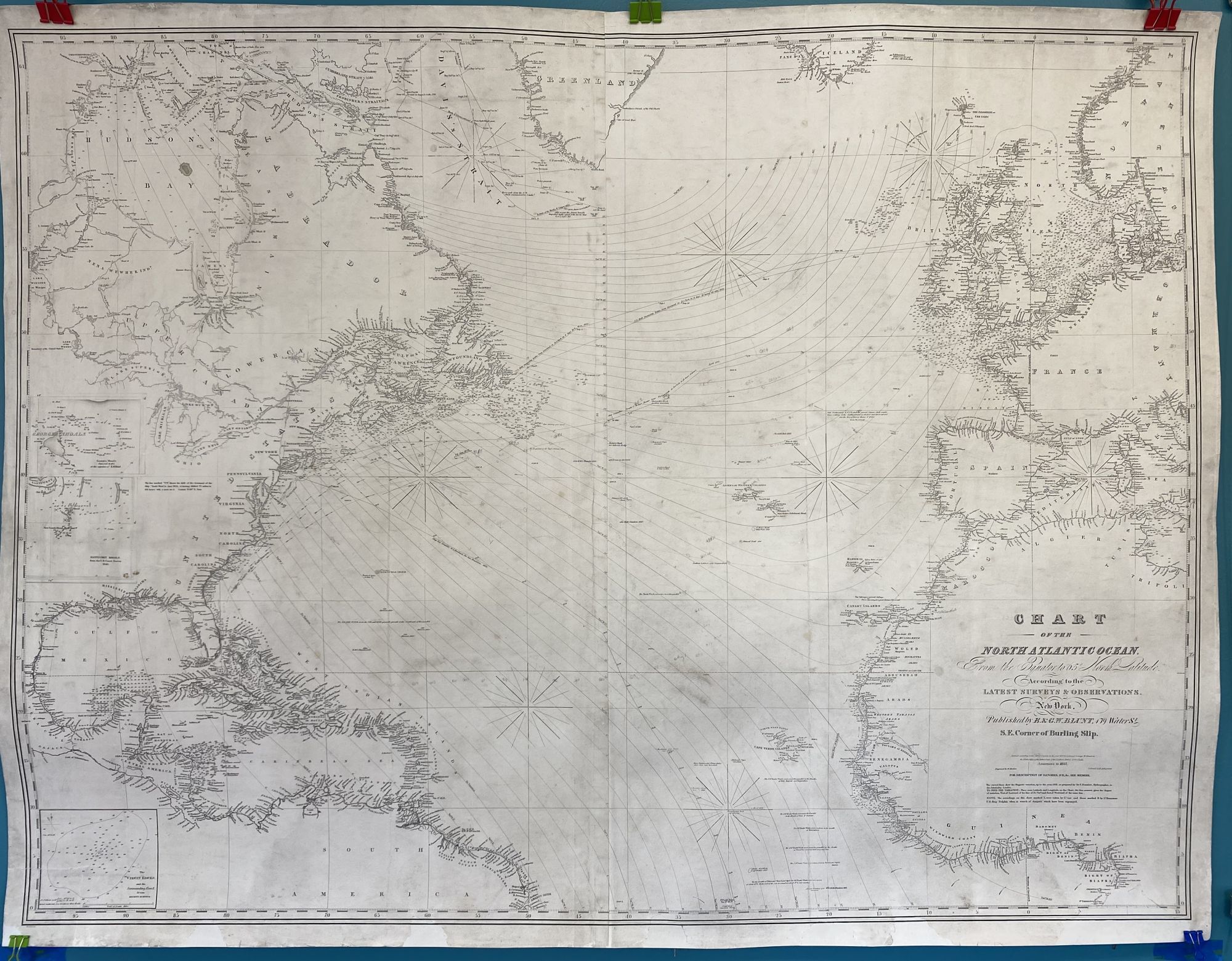
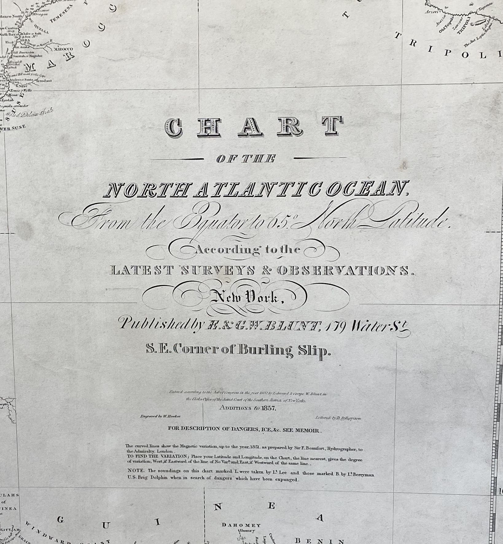
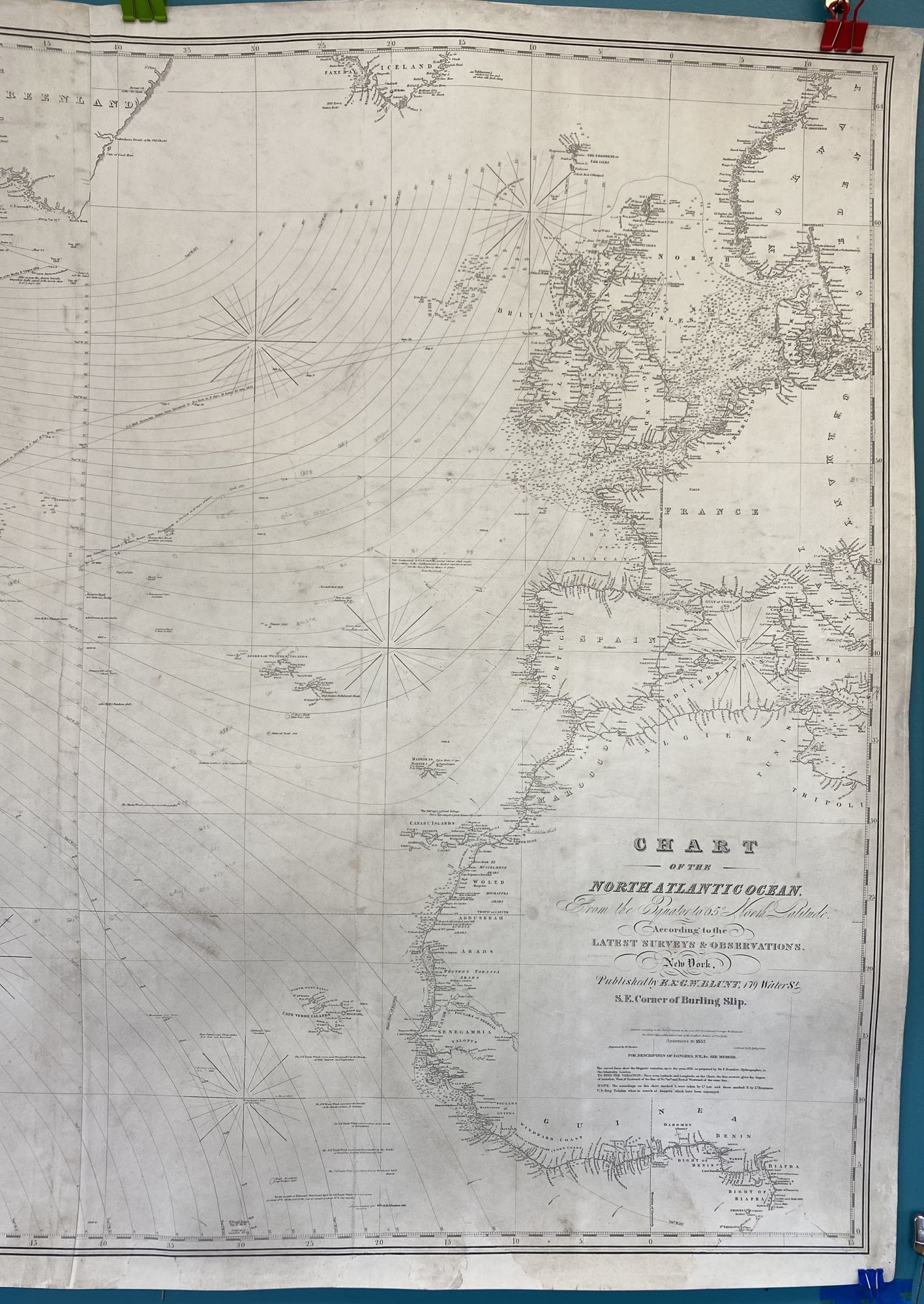
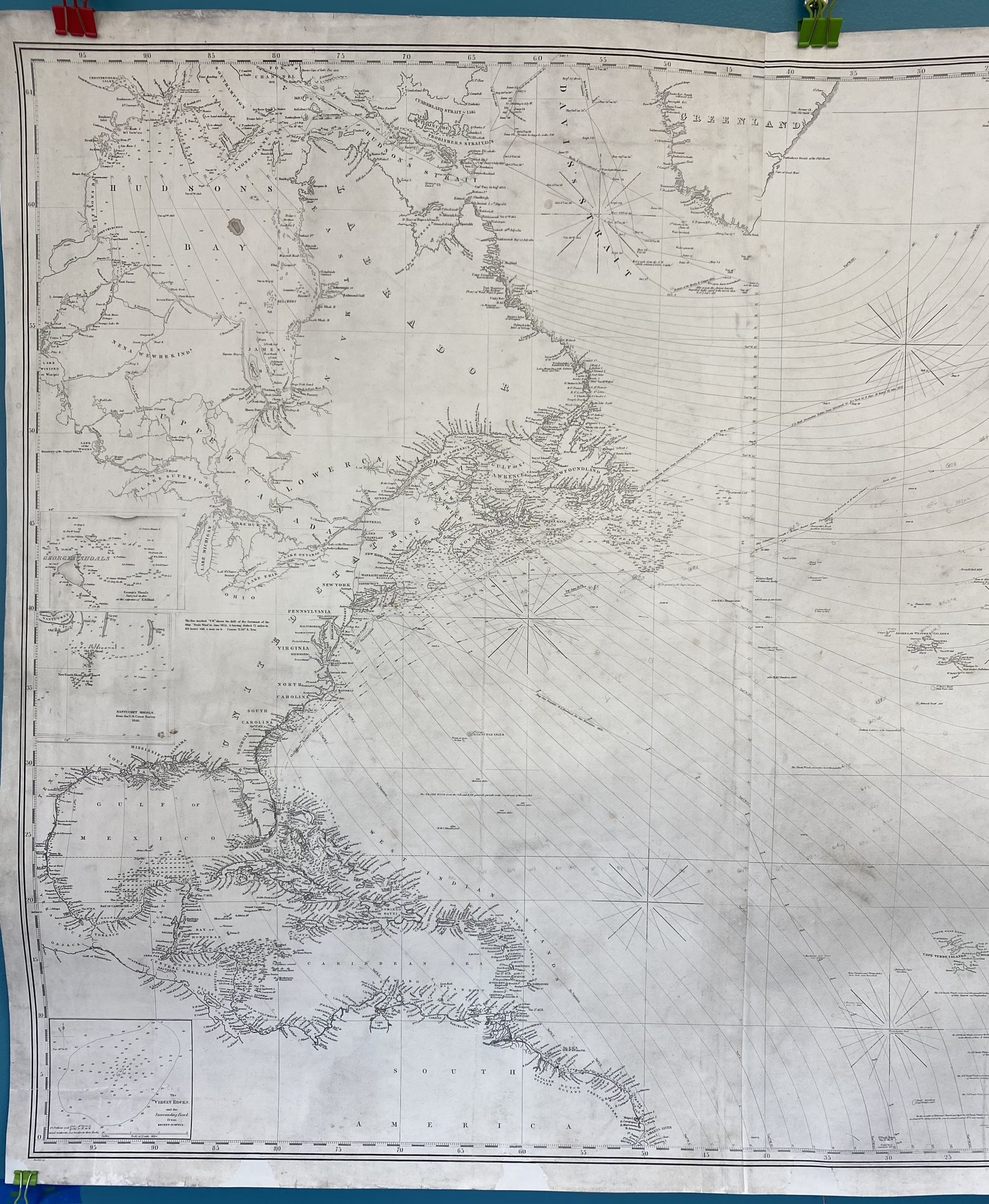
Chart of the North Atlantic Ocean from the Equator to 65 North Latitude According to the Latest Surveys and Observations
- Map no binding
- New York: E. & G. Blunt, 179 Water Street, SE Corner Burling Slip, 1857
New York: E. & G. Blunt, 179 Water Street, SE Corner Burling Slip, 1857. Map no binding. Very good +. W. Hooker, engraver; D.R. Harrison, lettering. Three hydrographic detail insets: The Virgin Rocks and the Surrounding Bank from Recent Surveys; Georges Shoals; and Nantucket Shoals from the U.S. Coast Survey, 1846.
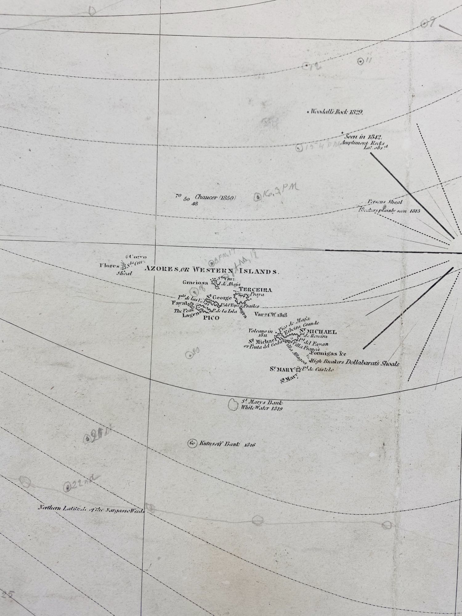
36 ½" x 48" within the neat line; two sheet blue-back chart; pencil notes and lines added by owner still visible; cleaned, conserved, and infill to areas of loss, new blue back by Green Dragon Bindery, Shrewsbury, MA; very good plus. This edition not located in any WorldCat libraries. Scarce. A stunning chart of the Atlantic Ocean north of the Equator, showing land mass as far west as Lake Winnipeg in North America, as far southwest as French Guyana in South America, as far north as the southern coasts of Iceland and Greenland, as far northeast as the coast of Norway, and as far southeast as Biafra and the Bight of Biafra on the continent of Africa. Minor infills mostly affecting the margins and neat line. From a local Maine coastal barn, this uncommon nautical chart has been professionally conserved. A working chart, small light notations in pencil remain, showing progress in navigation.
36 ½" x 48" within the neat line; two sheet blue-back chart; pencil notes and lines added by owner still visible; cleaned, conserved, and infill to areas of loss, new blue back by Green Dragon Bindery, Shrewsbury, MA; very good plus. This edition not located in any WorldCat libraries. Scarce. A stunning chart of the Atlantic Ocean north of the Equator, showing land mass as far west as Lake Winnipeg in North America, as far southwest as French Guyana in South America, as far north as the southern coasts of Iceland and Greenland, as far northeast as the coast of Norway, and as far southeast as Biafra and the Bight of Biafra on the continent of Africa. Minor infills mostly affecting the margins and neat line. From a local Maine coastal barn, this uncommon nautical chart has been professionally conserved. A working chart, small light notations in pencil remain, showing progress in navigation.
Details
Title
Chart of the North Atlantic Ocean from the Equator to 65 North Latitude According to the Latest Surveys and Observations
Author
BLUNT, E. & G.W. [Edmund and George William]
Binding
Map no binding
Condition
Very Good
Publisher
E. & G. Blunt, 179 Water Street, SE Corner Burling Slip: New York
Date
1857