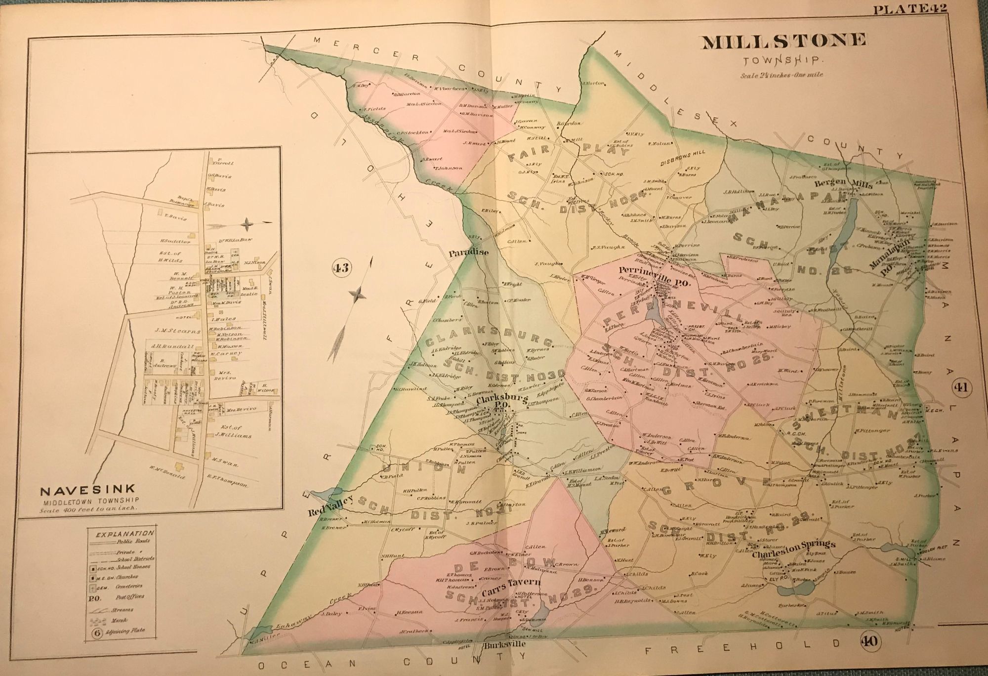
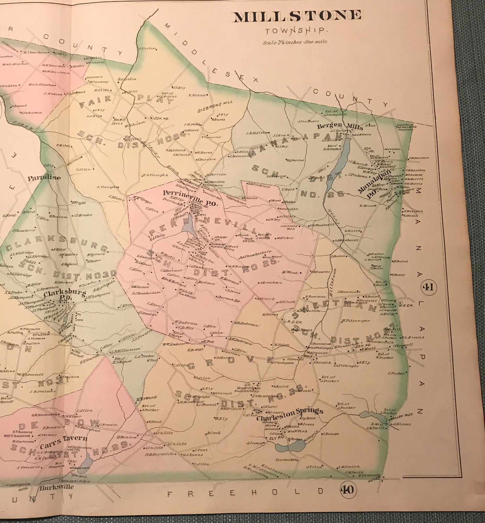
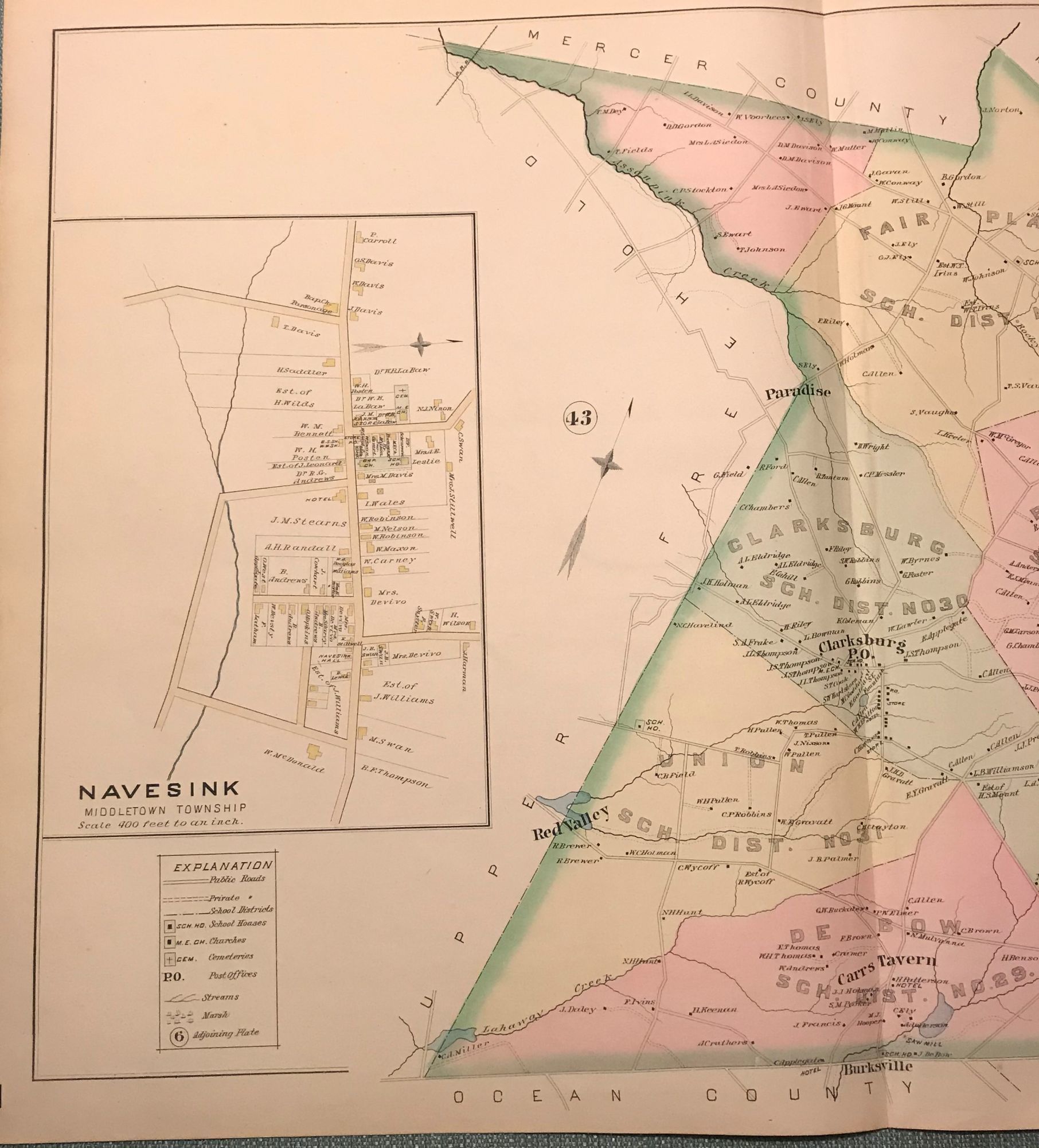
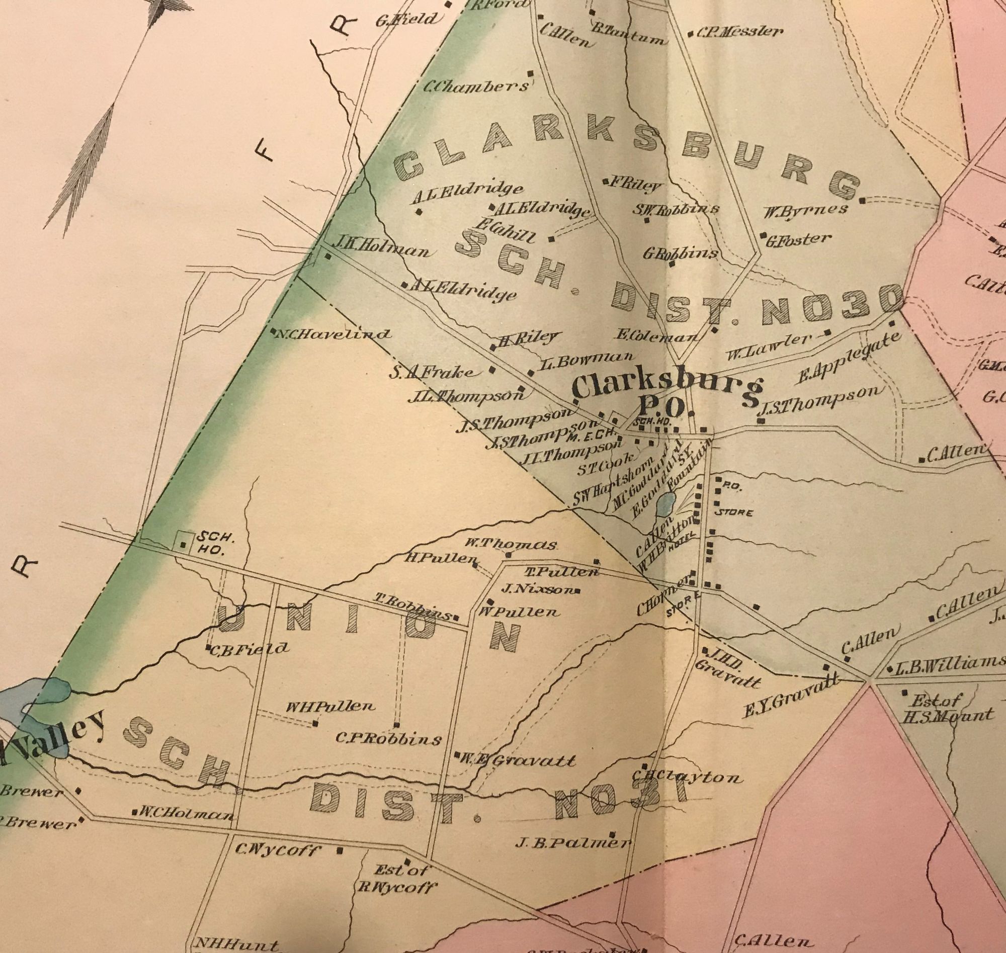
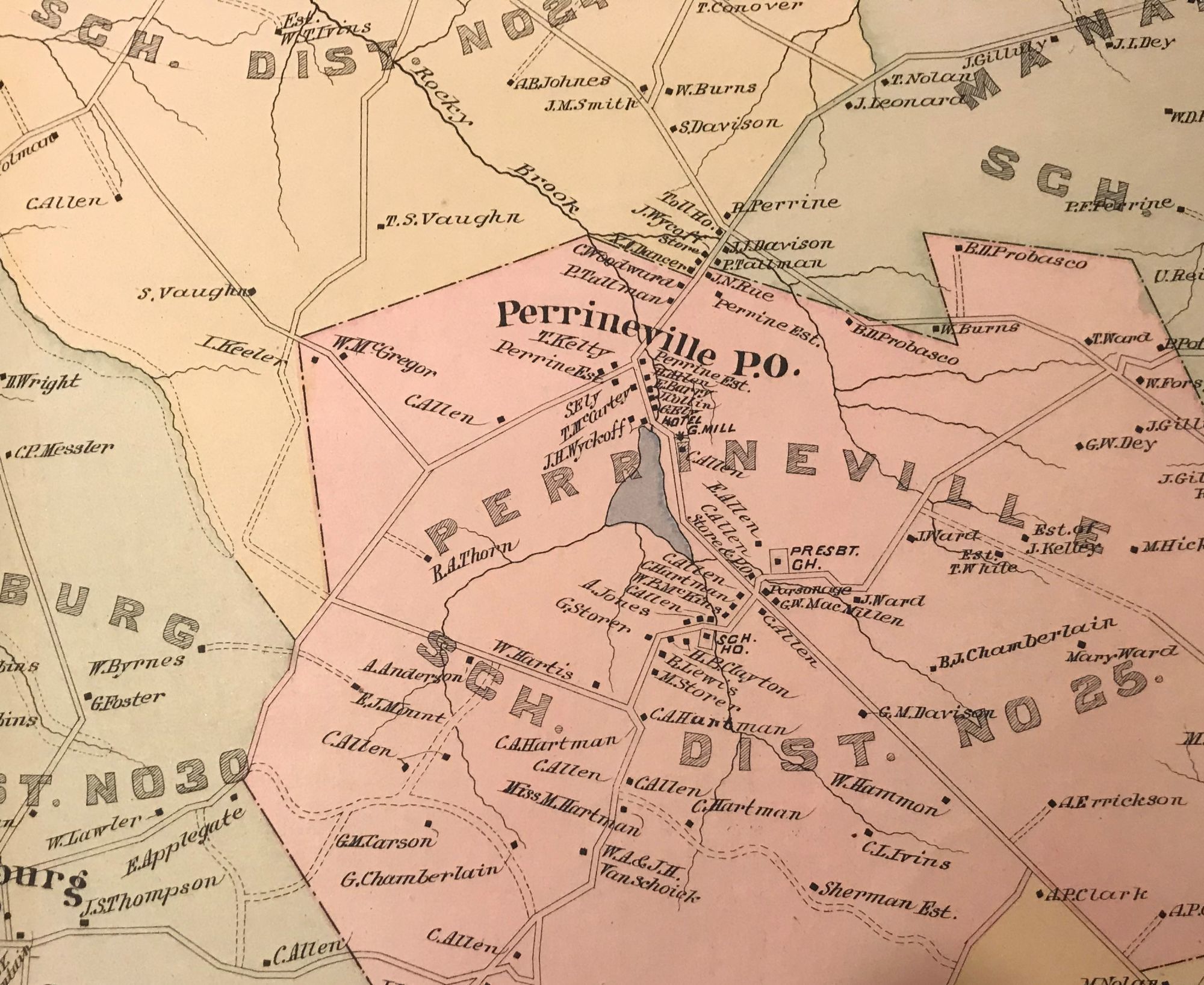
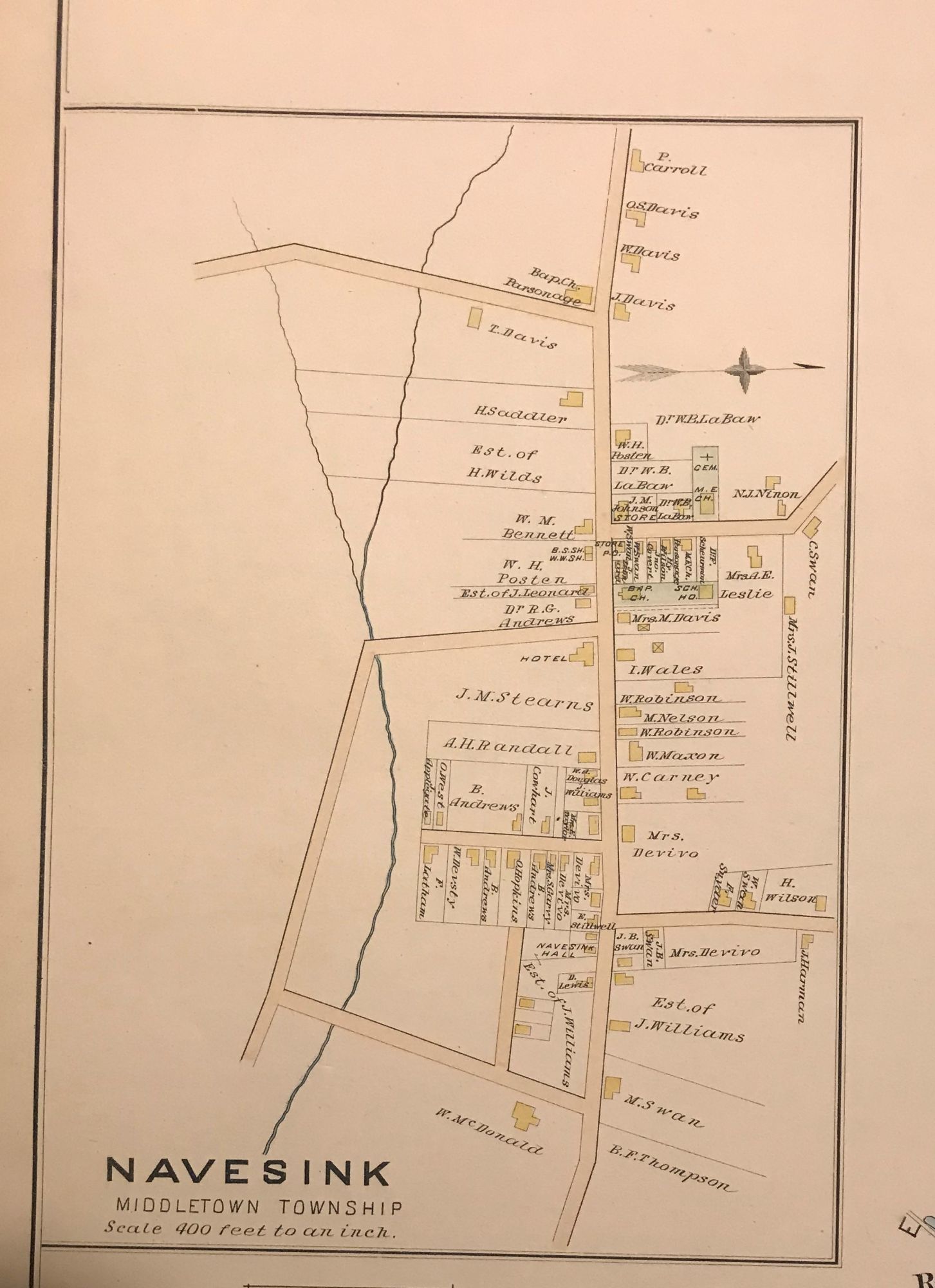
MILLSTONE TOWNSHIP/NAVESINK (MIDDLETOWN TOWNSHIP) NJ MAP. FROM WOLVERTON'S “ATLAS OF MONMOUTH COUNTY,” 1889
- NY: Chester Wolverton, 1889
NY: Chester Wolverton, 1889. An original 30-inch by 22-inch linen-backed color map published in 1889. Map depicts Millstone Township from the Burksville area to the Mercer/Middlesex county border; and from the Upper Freehold Township border to the Manalapan Township border. Contains in set of the Navesink section of Middletown Township. The original hand-colored map (Plate 42), not a reproduction! Wolverton maps are among the best you can get of Monmouth County. A nice copy!
Details
Title
MILLSTONE TOWNSHIP/NAVESINK (MIDDLETOWN TOWNSHIP) NJ MAP. FROM WOLVERTON'S “ATLAS OF MONMOUTH COUNTY,” 1889
Author
WOLVERTON, Chester
Condition
Unknown
Publisher
Chester Wolverton: NY
Date
1889
Edition
An original 30-inch by 22-inch linen-backed color map published