MATAWAN MAP, 1889
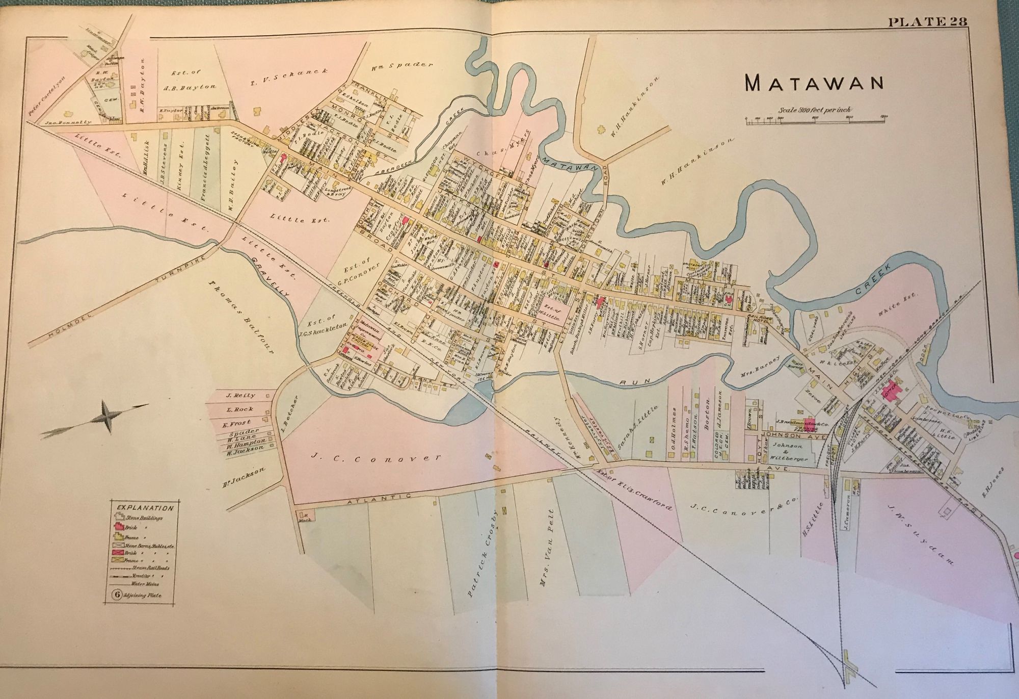
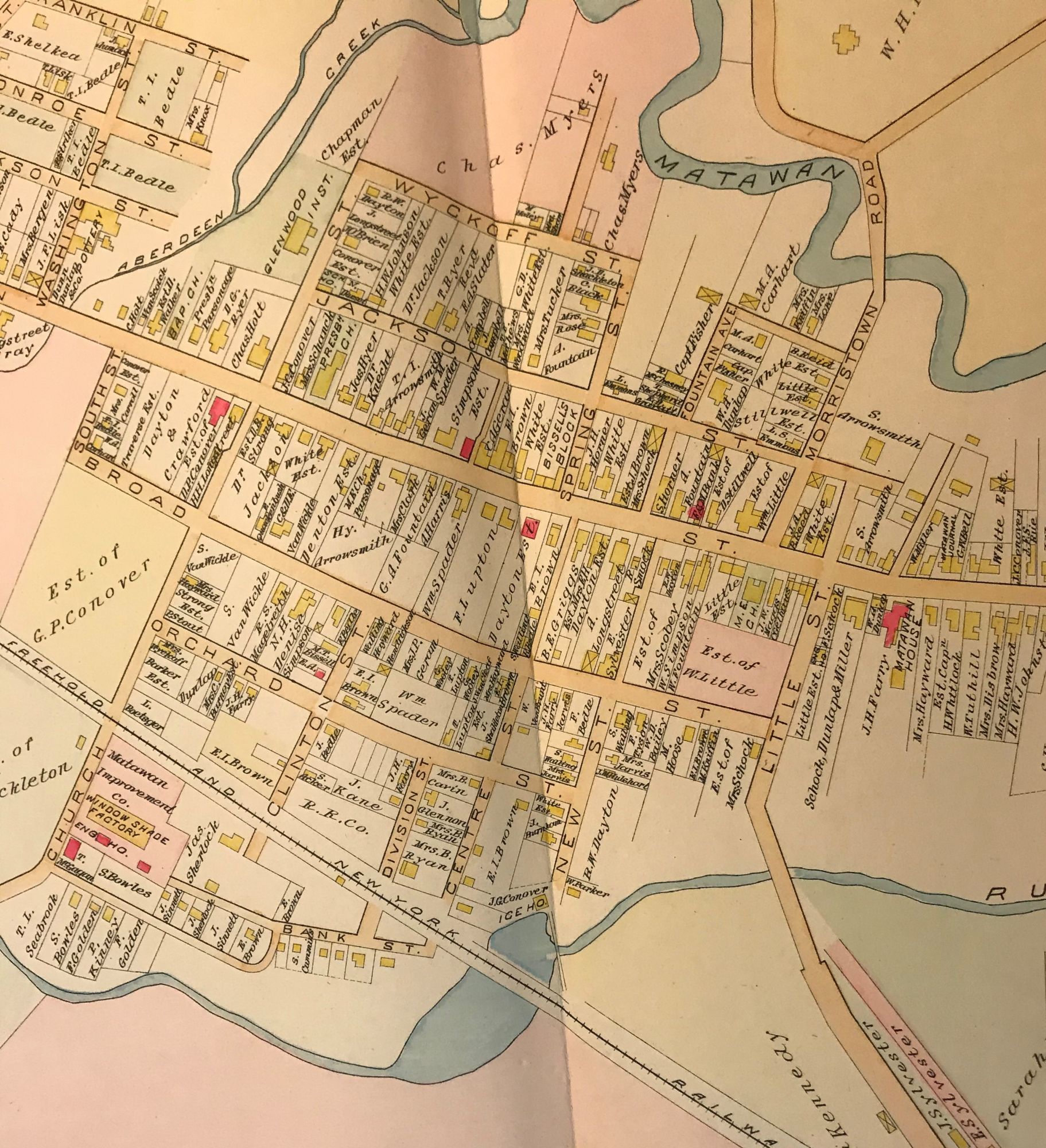
- NY: Chester Wolverton, 1889
NY: Chester Wolverton, 1889. An original 30-inch by 22-inch linen-backed color map published in 1889. Map depicts Matawan. From Atlantic Avenue to the Matawan Creek; and from the railroad depot area to the Holmdel Turnpike area. Includes downtown areas. The original hand-colored map (Plate 28), not a reproduction! Wolverton maps are among the best you can get of Monmouth County. Very Good. Very Good condition.
Details
Title
MATAWAN MAP, 1889
Author
WOLVERTON, Chester
Condition
Unknown
Publisher
Chester Wolverton: NY
Date
1889
Edition
An original 30-inch by 22-inch linen-backed color map published