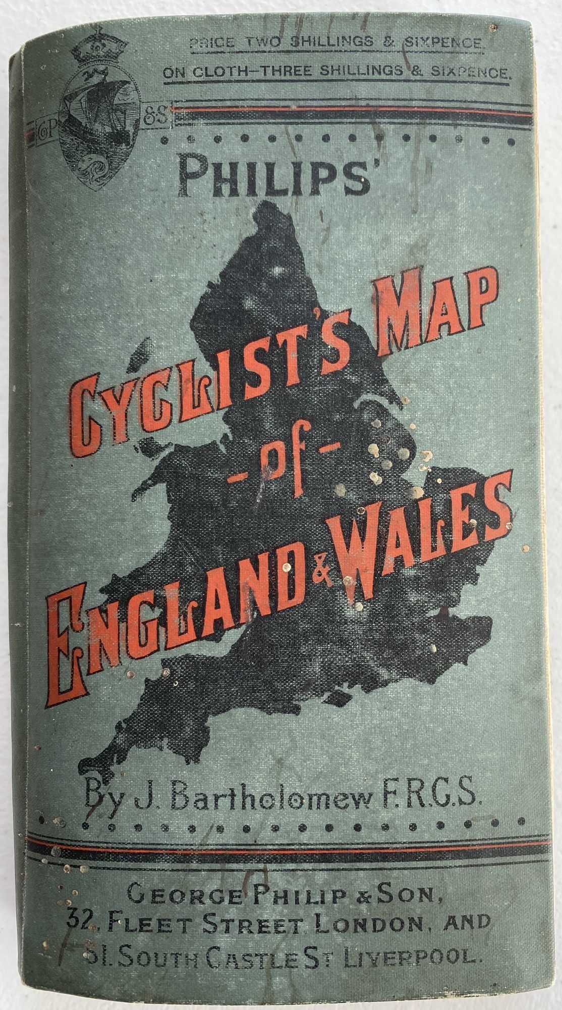
Tourist's Map of England & Wales from the Ordnance Survey; Cover title: Philips' Cyclist's Map of England & Wales, by J. Bartholomew FRGS
- Cloth
- London: George Philip & Son, 32 Fleet Street, and Liverpool, 1890
London: George Philip & Son, 32 Fleet Street, and Liverpool, 1890. Cloth. Very good. [POCKET MAP]. Wrapper: 57 5/8" x 4 ½"; glazed green cloth wrapper printed in red and black, silhouette of England on front; publisher's ad to front pastedown and back of map; light scuffing and soiling to wrapper; very good.
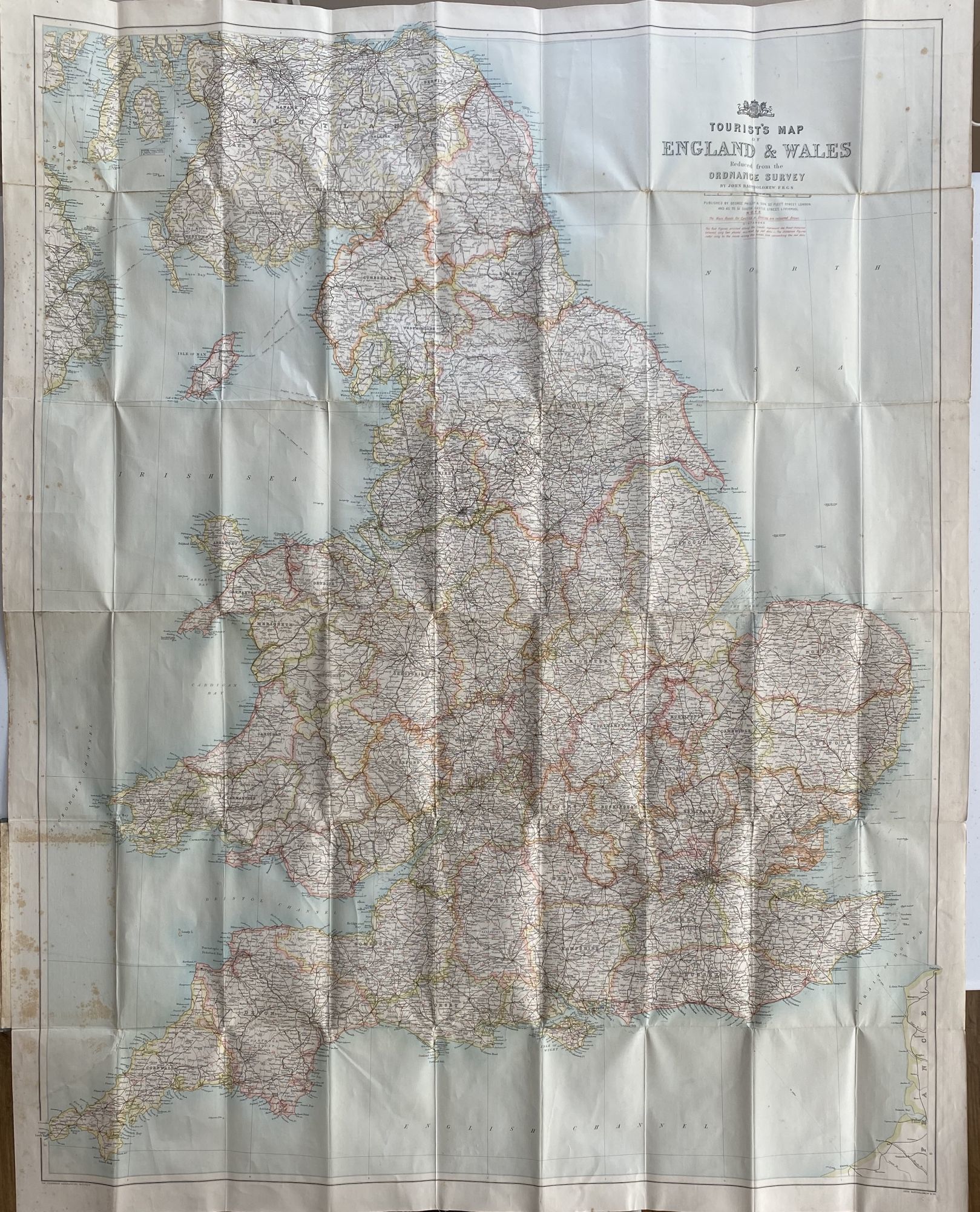
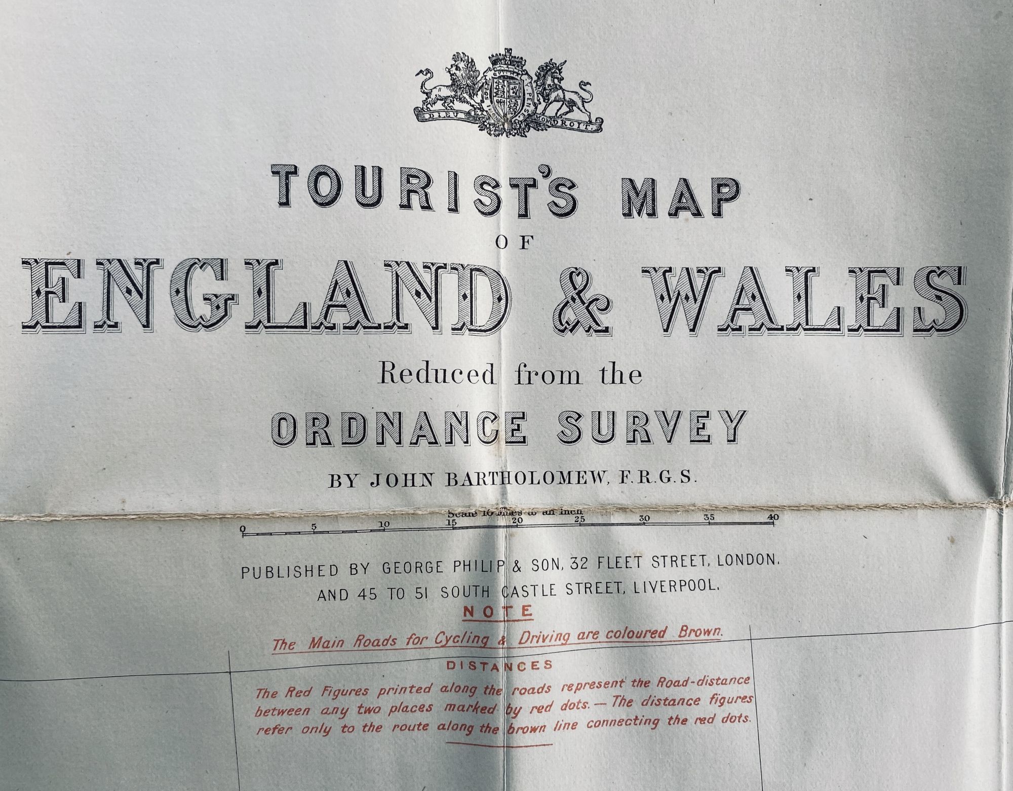
Map: 43 ½" x 34 ¼" sheet size; 41 x 31 ¾" within neat line; cloth backed paper; printed in color half-tone; foxing to left side map and pastedown; very good. Large bright map of England and Wales with routes clearly noted in color. Key notes, Main roads for cycling and driving are coloured in Brown. Distances also noted.
Map: 43 ½" x 34 ¼" sheet size; 41 x 31 ¾" within neat line; cloth backed paper; printed in color half-tone; foxing to left side map and pastedown; very good. Large bright map of England and Wales with routes clearly noted in color. Key notes, Main roads for cycling and driving are coloured in Brown. Distances also noted.
Details
Title
Tourist's Map of England & Wales from the Ordnance Survey; Cover title: Philips' Cyclist's Map of England & Wales, by J. Bartholomew FRGS
Author
BARTHOLOMEW, John
Binding
Cloth
Condition
Very Good
Publisher
George Philip & Son, 32 Fleet Street, and Liverpool: London
Date
1890