Land Indentures And Other Land Ownership Documents From The Eastern Shore Of Maryland During The Eighteenth And Nineteenth Centuries
- SIGNED
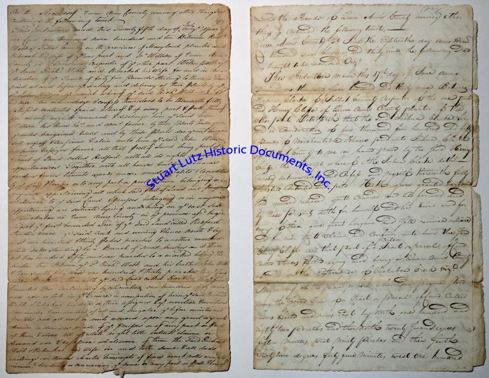
(EASTERN SHORE OF MARYLAND). Archive. 14 pieces. 1710-1864. Queen Annes County and Caroline County, Maryland. An archive of fourteen legal documents relating to land ownership on the Eastern Shore of Maryland. Most of the documents date to the mid 18th and early 19th centuries and relate to the estates of Hackton and Bayards Large Range, and areas along the Tuckahoe Creek. Prominent Maryland residents whose names appear in the several hand indentures include Scottish-born businessman Francis Sellers, his father-in-law Henry Downes, John and William Tillotron, and the Troup family. The majority of the documents are land indentures; other contents include hand-drawn maps and wills. The archive is in good to fair condition, with tears, toning, and water stains.Highlights include:a)2pgs. April 23, 1741 October 3, 1743. A survey of land in Queen Annes County, belonging to John Bayard. Surveyed, written, and signed by George G. Brewer. Damp-stained.b)DS. 2pgs. February 6, 1812 March 4, 1813. The will of Francis Sellers of Caroline County, Maryland, signed Francis Sellers. In good condition with some significant tears.c)DS. 2pgs. 1821. An agreement to rent a farm in Queen Anne County: Articles of agreement made and concluded upon this the first day of January in the year of our Lord one thousand eight hundred and twenty one Between William B. Tillotson of Caroline County and State of Maryland of the one part, and Denwood Fisher of Queen Anns County, and the State aforesaid of the other part. Witnesseth that William B. Tillotson for the consideration hereafter mentioned hath agreed and doth hereby agree to Rent his Farm lying and being in Talbot County adjoining the village of Thimble Town and whereon Anderson O. Layton lately resided, for the year eighteen hundred and twenty one for the sum of two hundred and thirty dollars current money of Maryland to be paid on the ninth day of January of the year aforesaid and the said Denwood Fisher doth hereby covenant and agree to keep the said farm in good order. Signed by all parties. It is in good condition with some spotting.d)February 14, 1864. Caroline County. A hand-drawn map of a 375-acre tract of land, certified and signed by surveyor Geo. W. Taylor. It is labelled Hackton on verso and water stained.
Details
Title
Land Indentures And Other Land Ownership Documents From The Eastern Shore Of Maryland During The Eighteenth And Nineteenth Centuries
Author
(MARYLAND EASTERN SHORE)
Condition
Unknown
Pages
0