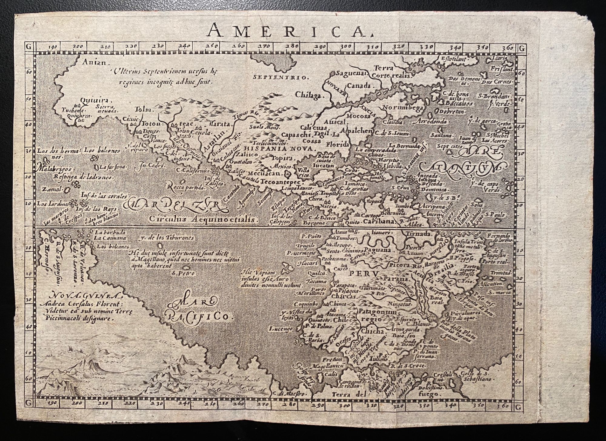
[AMERICA. Engraved map ca. 1600, North and South America with portion of Australia]. "America
- [Cologne?] , 1600
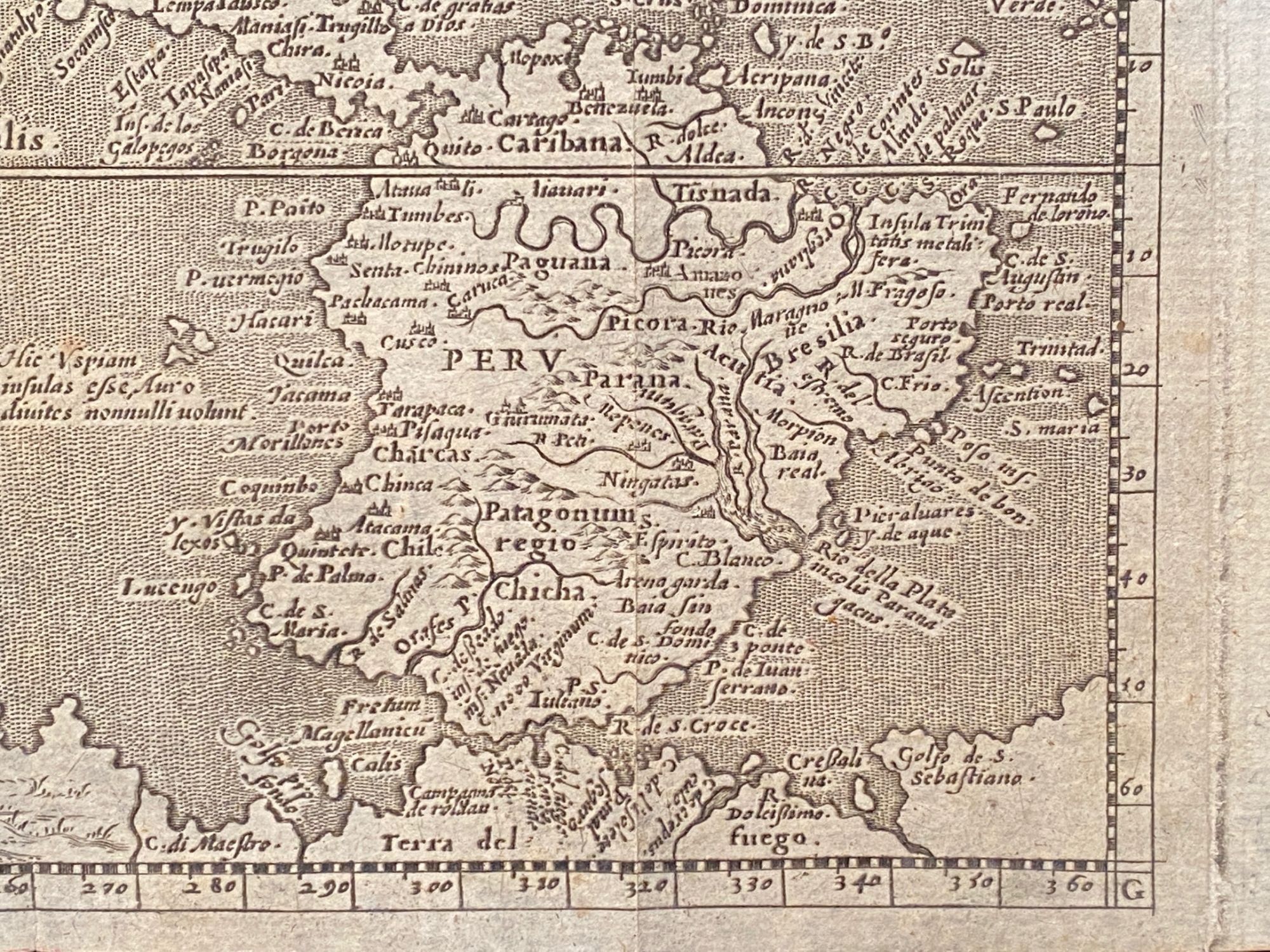
[Cologne?], 1600. Very good. Copperplate engraved map (uncolored). 13.5 x 17.4 cm. (5 5/16 x 6 7/8 inches), trimmed around the platemark. Scale not stated. Stipple engraved seas. Unmatted, unframed. An attractive, early map of North and South America. THIS IS AN ORIGINAL ENGRAVED MAP, not a facsimile. JUSTLY FAMOUS MAP OF NORTH AND SOUTH AMERICA. The present map appeared without change in five editions of Ptolemy's "Geographiae universae" published between 1596 and 1621. The verso is blank, and there are two vertical folds suggesting that it was published in an octavo volume, possibly Matthias Quad's "Compendium universi complectens geographicarum enarrationum Libros sex" (Cologne: W. Lutzenkirch, 1600). The digitized National Library of the Czech Republic copy of 1600 "Compendium" shows that copies of the present map were bound between pp. 652-653.
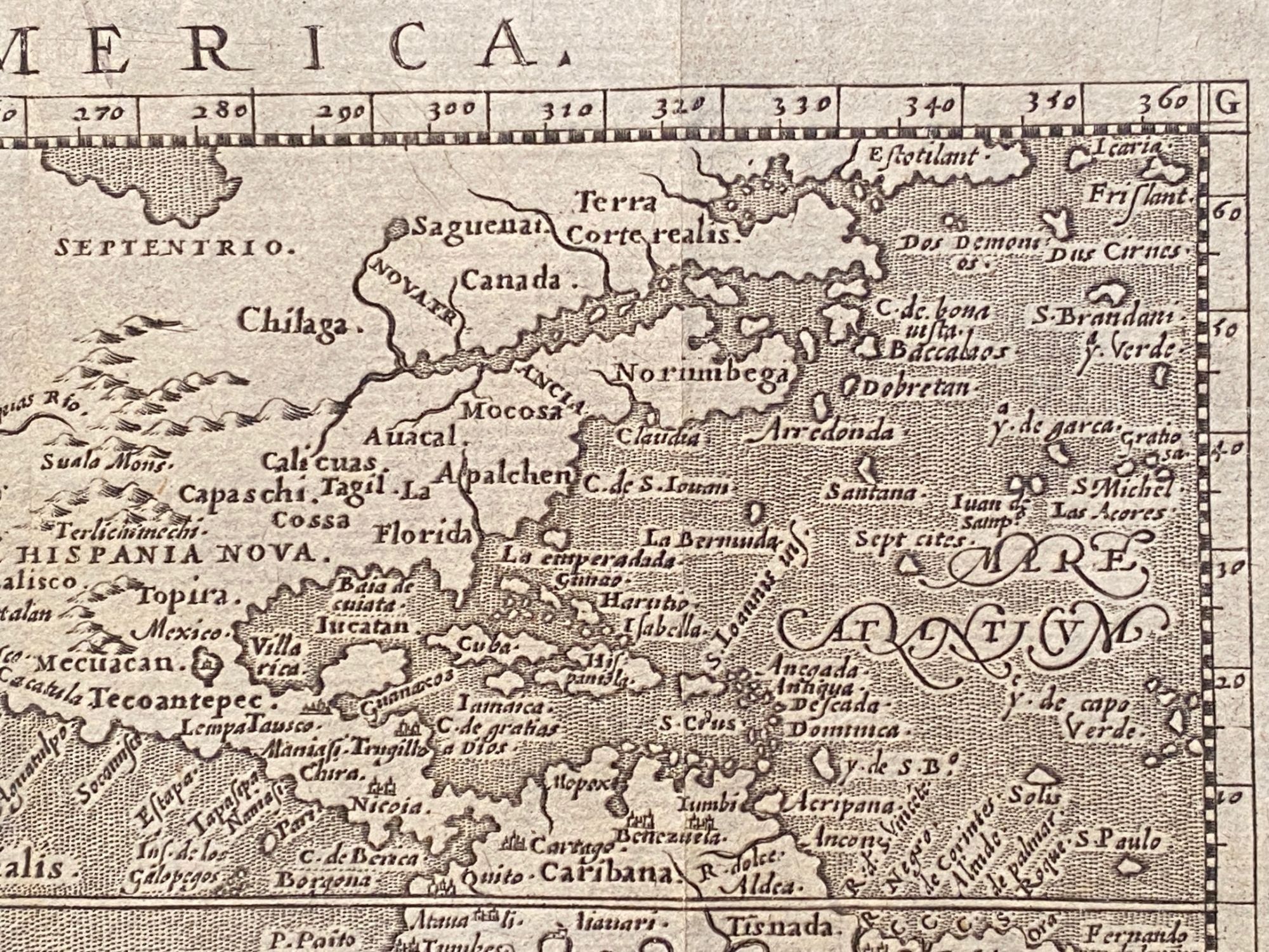
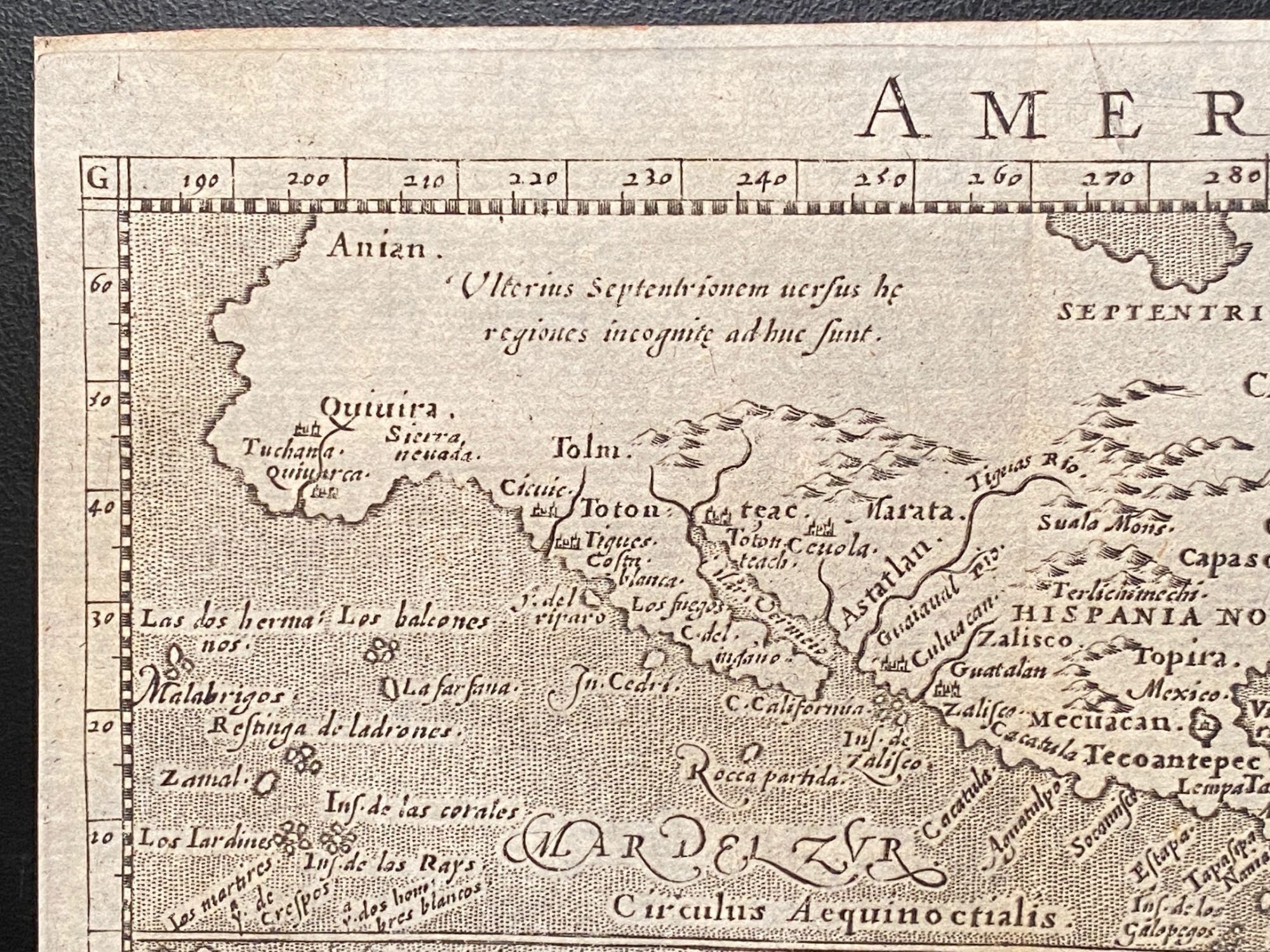
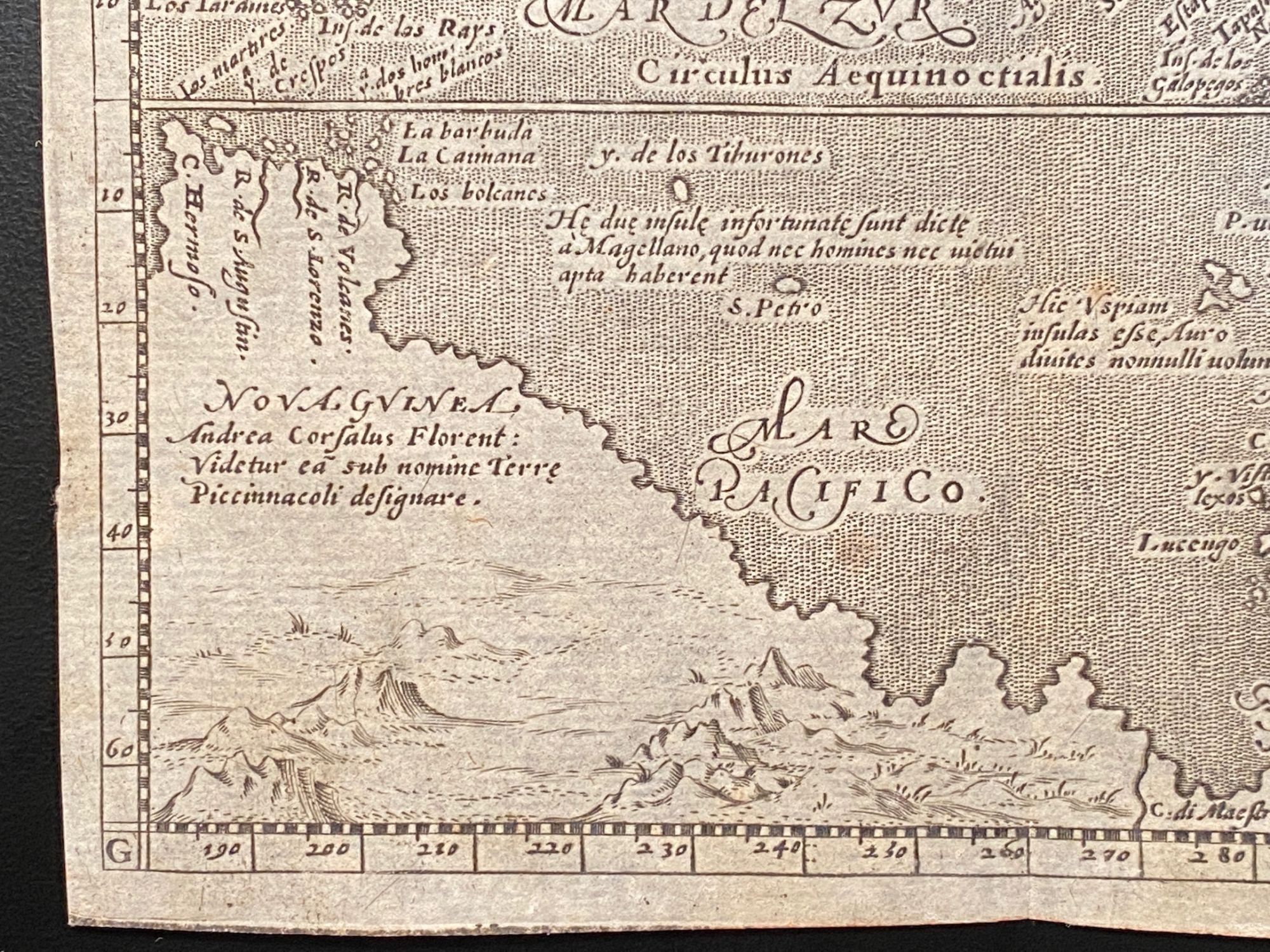
In the present map are depicted "Hispania Nova," "Fretum Magellanicu[m]" and there is a dotted sea between the words "Mare Pacifico." Geographically, the map derives from D'Anania's map of 1582 and Ortelius' map of 1579, retaining the bulge on the southwest coast of South America. The map depicts North and South America with the mythical great southern continent below. This quaint little map had a long life, appearing as late as 1713 in Raphael Savonarola's "Universus Terrarum Orbis Scriptorum."
Burden 93: "This new edition of Ptolemy's Geography was edited by Giovanni Antonio Magini, a noted geographer from Padua. The neatly engraved copperplates for this work are attributed to Girolamo Porro." Nordenskiöld 278. Phillips, Atlases 403, 405, & 436. Wagner, Northwest Coast 186.
Details
Title
[AMERICA. Engraved map ca. 1600, North and South America with portion of Australia]. "America
Author
[Magini, Giovanni Antonio]
Condition
Very Good
Publisher
[Cologne?]
Date
1600