Il Paese de' Selvaggi Outauacesi, e Kilistinesi Intorno al Lago Superiore
- Venice: Antonio Zatta, 1778
Venice: Antonio Zatta, 1778. Map. Engraving with original hand coloring. Measures 16 3/4" x 13 1/4". Some worm holes to center fold and toning but otherwise in good condition.
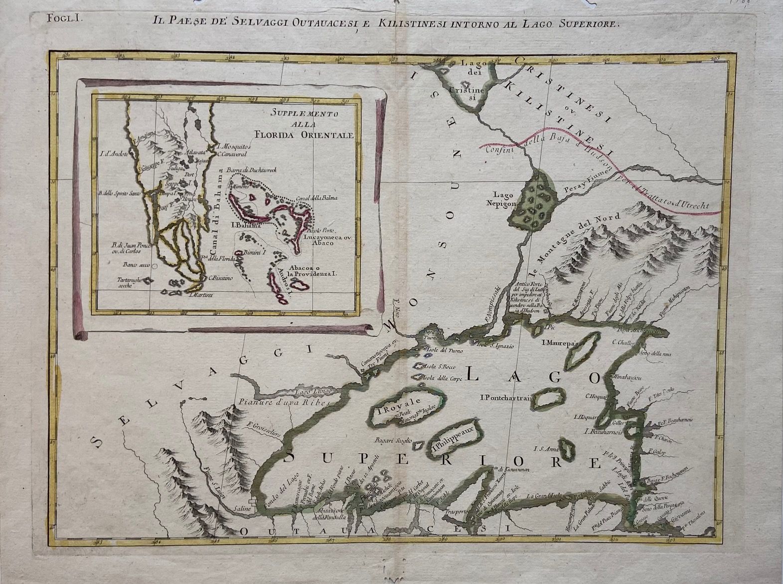
This unusual map depicting Lake Superior and southern Florida appeared in the two-volume Italian edition of Raynal's "Storia dell' America Settentrionale", published in 1778. The map primarily features Lake Superior, and refers to the native inhabitants of the region, including the Kilistinesi (known as Cree), in both the title and throughout the map. Surrounding mountain ranges are depicted pictorially. Rivers and islands are labeled. A loose line transects the map just north of the lake, signifying the boundary line set by the Utrecht Treaty. An inset in the left portion of the map shows the Southern tip of Florida, and the islands of the Bahamas to the east. The map forms a large set of Americas map or functions on its own as a fascinating study of 18th century Great Lakes mapping.
This unusual map depicting Lake Superior and southern Florida appeared in the two-volume Italian edition of Raynal's "Storia dell' America Settentrionale", published in 1778. The map primarily features Lake Superior, and refers to the native inhabitants of the region, including the Kilistinesi (known as Cree), in both the title and throughout the map. Surrounding mountain ranges are depicted pictorially. Rivers and islands are labeled. A loose line transects the map just north of the lake, signifying the boundary line set by the Utrecht Treaty. An inset in the left portion of the map shows the Southern tip of Florida, and the islands of the Bahamas to the east. The map forms a large set of Americas map or functions on its own as a fascinating study of 18th century Great Lakes mapping.
Details
Title
Il Paese de' Selvaggi Outauacesi, e Kilistinesi Intorno al Lago Superiore
Author
ZATTA, Antonio
Condition
Unknown
Publisher
Antonio Zatta: Venice
Date
1778