Beaverhead Recreation Area
- Beaverhead National Forest, MT: U.S. Department of Agriculture, Forest Service, 1942
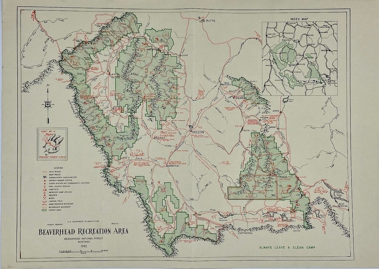
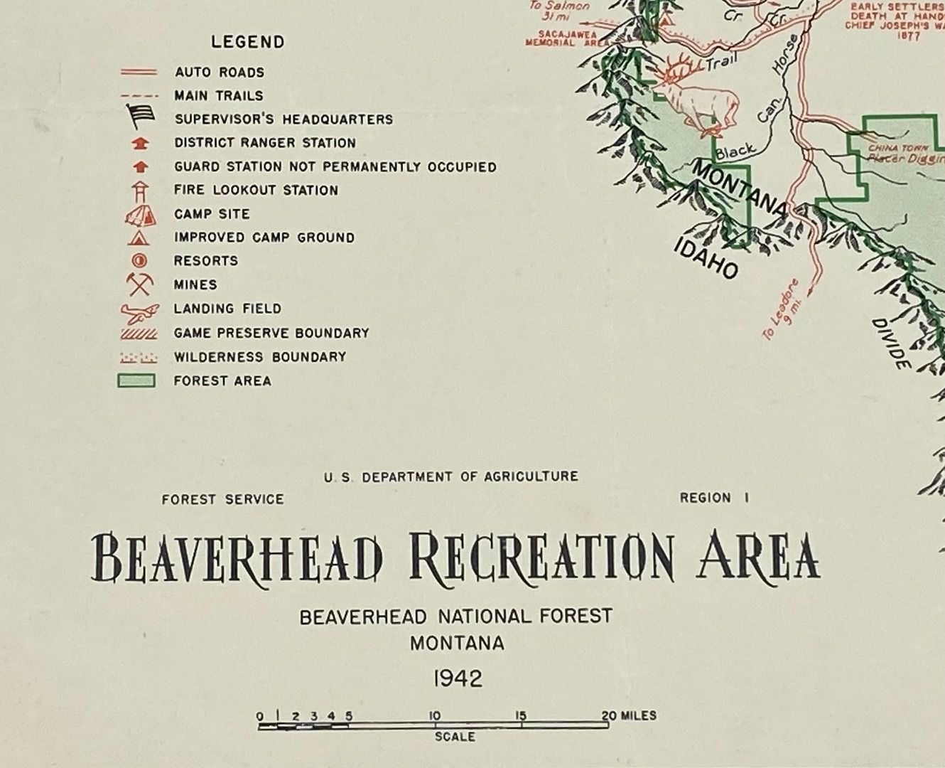
Beaverhead National Forest, MT: U.S. Department of Agriculture, Forest Service, 1942. Map [23 cm x 31 cm] on a single sheet [25.5 cm x 35 cm] printed in black, red, and green ink. Vertical fold at center - two horizontal folds. About very good. Inset map [7 cm x 7 cm] at the upper right corner showing the greater area. Nice map of this area of southern Montana and western Idaho with Dillon, Montana at the center. Map locates the area that encompasses the national forests; towns; main roads; mines; airstrips/landing fields; fire lookouts; ranger stations; trails; resorts; camp sites; and game preserves.
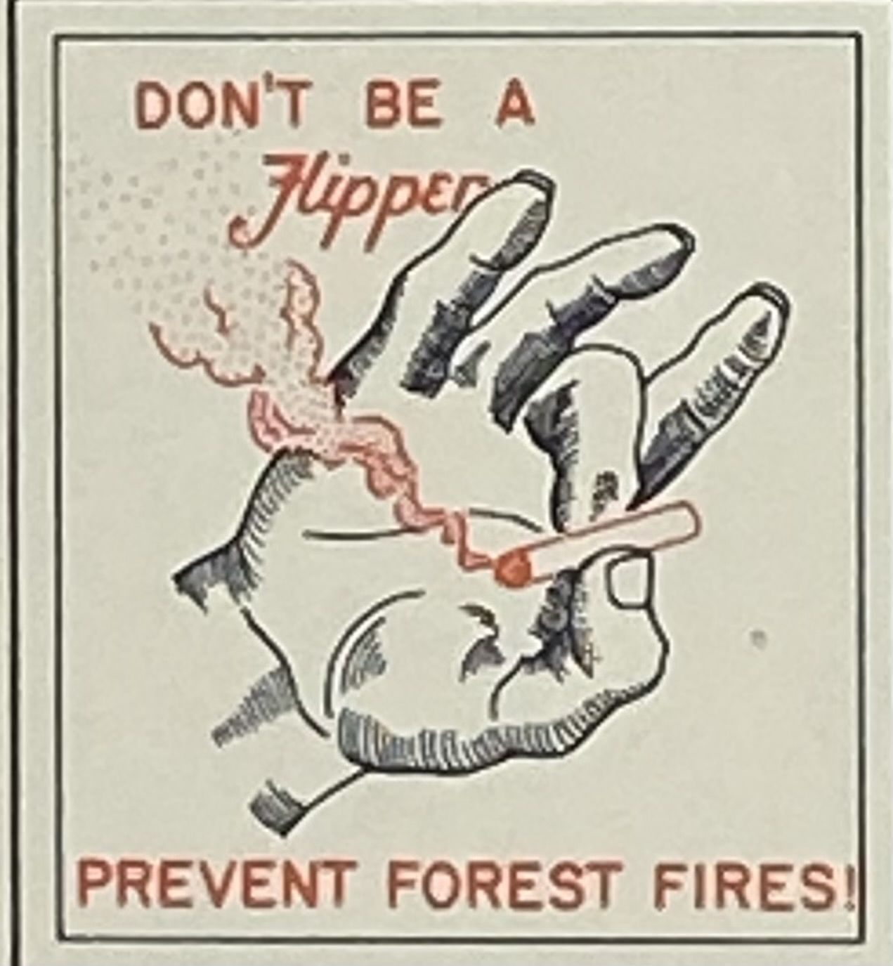
Small printed notice at the left: "Don't be a Flipper - Prevent Forest Fires.
Small printed notice at the left: "Don't be a Flipper - Prevent Forest Fires.
Details
Title
Beaverhead Recreation Area
Author
[Forest Service]
Condition
Unknown
Publisher
U.S. Department of Agriculture, Forest Service: Beaverhead National Forest, MT
Date
1942