E-Z Guide Map of Los Angeles [cover title]
![E-Z Guide Map of Los Angeles [cover title]](https://d3525k1ryd2155.cloudfront.net/h/612/163/1424163612.0.x.jpg)
- San Francisco: Fred S. Bain, Inc, 1922
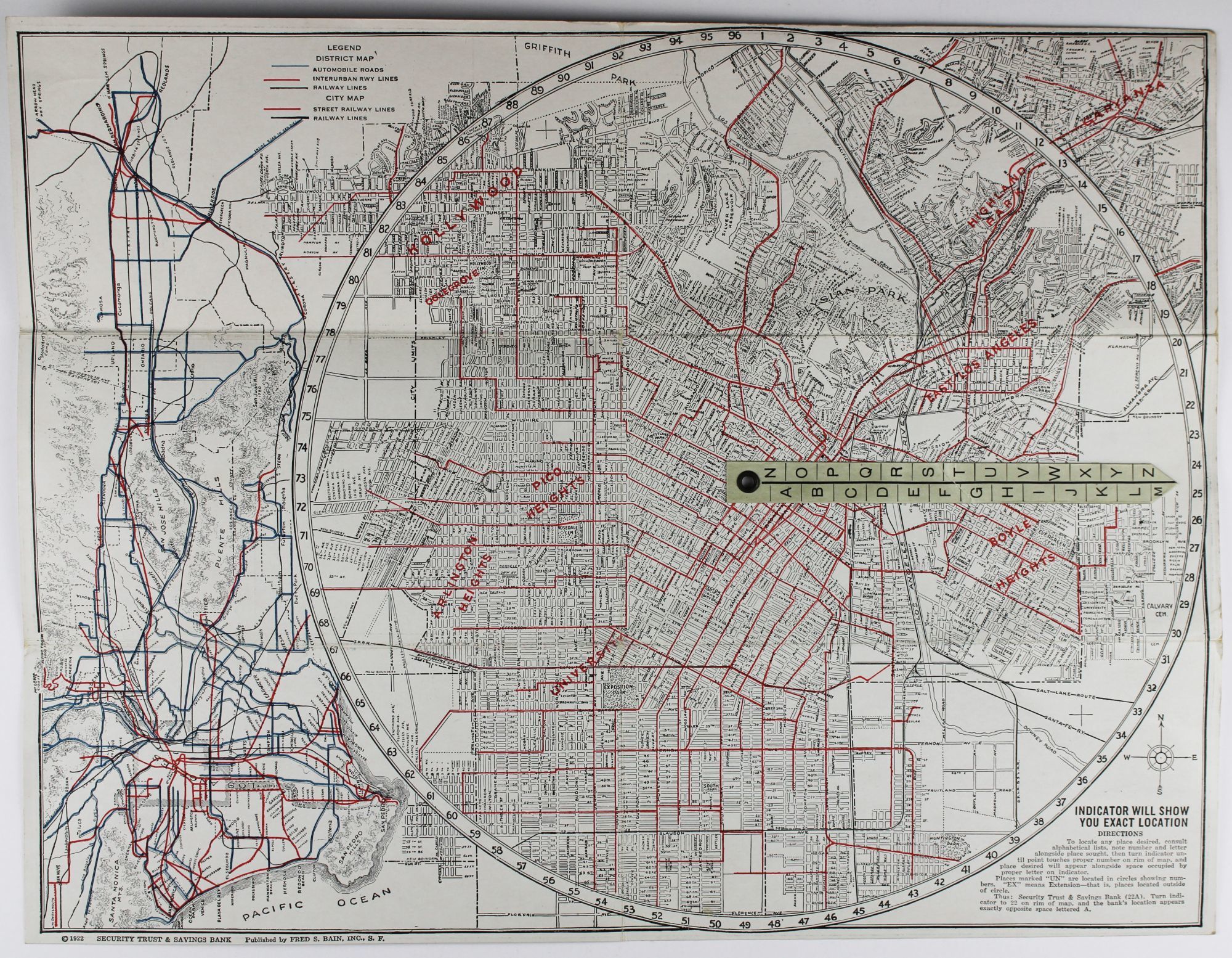
San Francisco: Fred S. Bain, Inc, 1922. Very good.. Folding map, approximately 13 x 17 inches. Light wear along folds. Minor staining and dust soiling. A neat promotional map of early-1920s Los Angeles, distributed by the Security Trust & Savings Bank. The reverse of the map carries a detailed street index as well as lists of hotels, railroad offices, and other significant municipal and commercial buildings. The map itself delineates Los Angeles from Hollywood and Highland Park in the north to Huntington Park in the south. Attached is a volvelle indicator which can be used to locate streets on the map in conjunction with the index. A second map, oriented along the left edge of the sheet, shows the major rails and roads of greater Los Angeles, from Santa Monica and San Pedro to San Bernardino and Riverside.
Details
Title
E-Z Guide Map of Los Angeles [cover title]
Author
[California]
Condition
Very Good
Publisher
Fred S. Bain, Inc: San Francisco
Date
1922