Outlines of Physical Geography, Illustrated by Six Maps and Numerous Engravings, Second Edition
- cloth
- New York: J.H. Colton and Company, 172 William Street, 1855
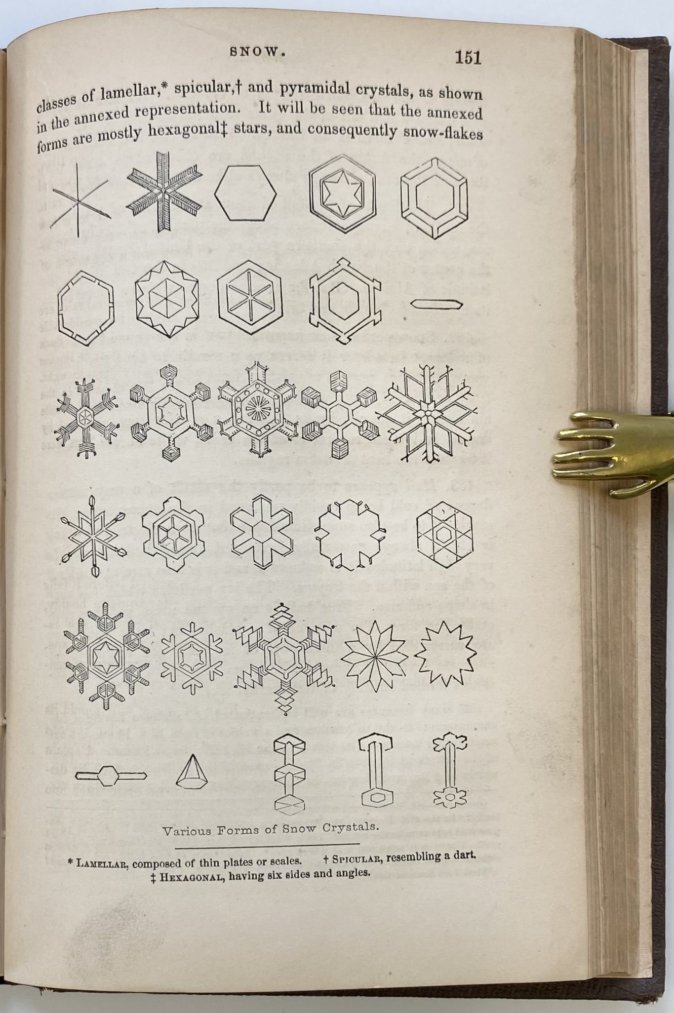
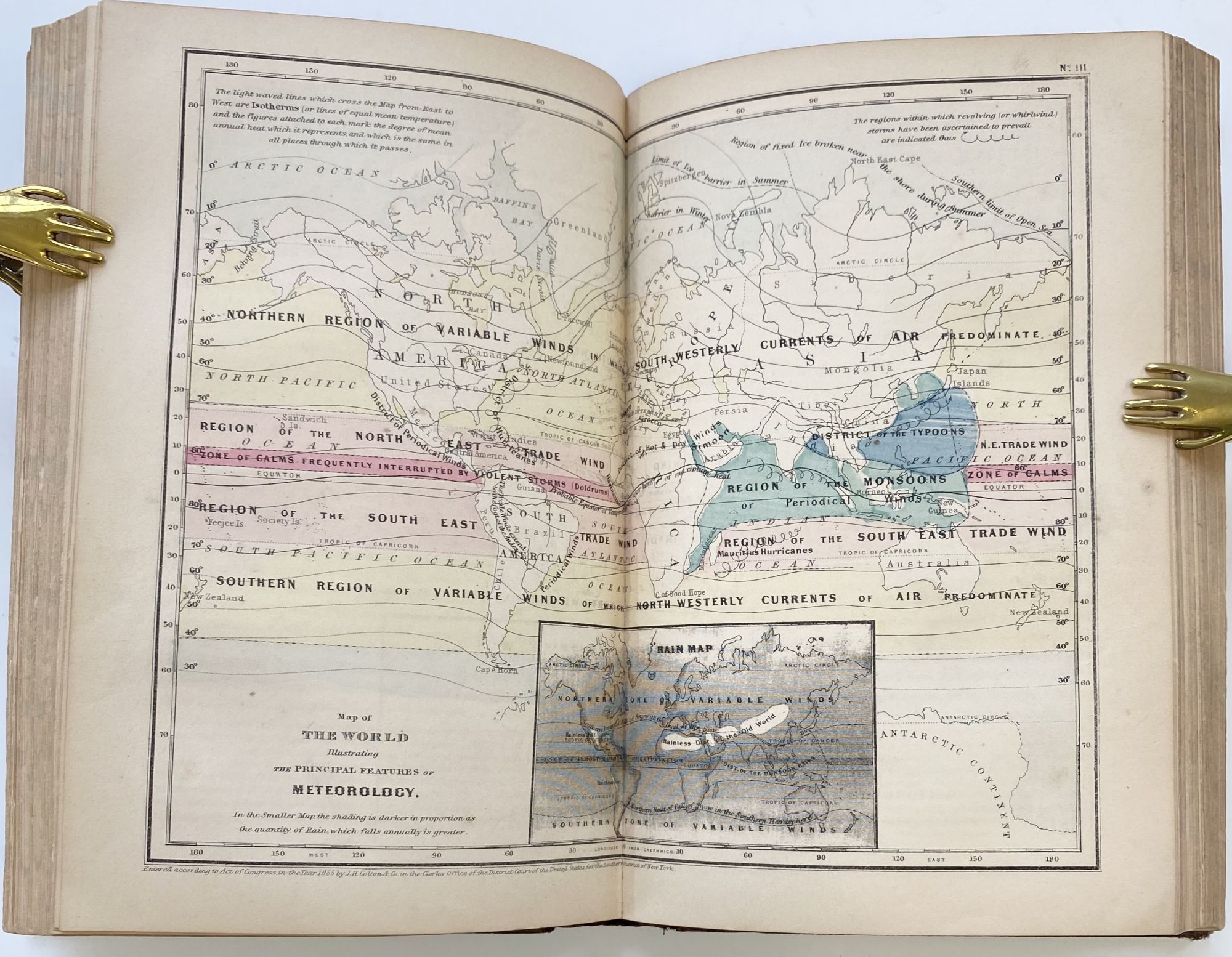
New York: J.H. Colton and Company, 172 William Street, 1855. Second Edition. cloth. Very good +. 12mo; 225pp +[5]pp publisher's ads; blind-stamped decoration in brown cloth over board, gilt title on spine; marbled edges; ownership in pencil on ffep; 6 hand-colored double-page maps, one b&w map; numerous engraved illustrations; rear eps with neat notes in pencil; light bumping to corners, light age-toning of paper; very good plus. A small geography book covering a broad range of subjects in science ranging from land masses and their physical description to plants, weather, animals, and people.
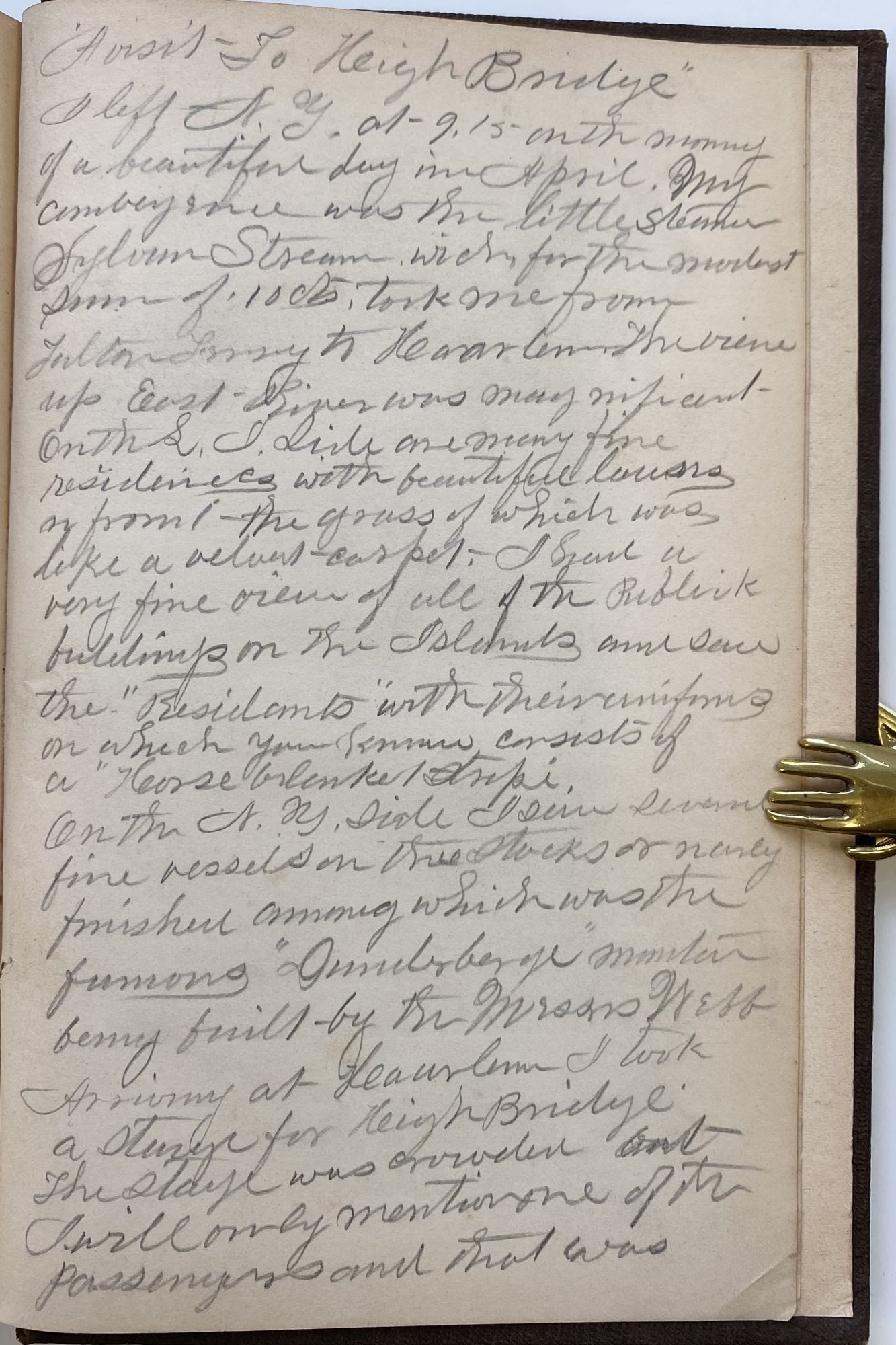
Owner's notes on rear endpapers are a hand-written account dated 1865 about a visit to the "Heigh Bridge" (either a misspelling or the name spelling has changed), correctly called the "High" Bridge which crosses from Westchester County, New York to New York City.
Owner's notes on rear endpapers are a hand-written account dated 1865 about a visit to the "Heigh Bridge" (either a misspelling or the name spelling has changed), correctly called the "High" Bridge which crosses from Westchester County, New York to New York City.
Details
Title
Outlines of Physical Geography, Illustrated by Six Maps and Numerous Engravings, Second Edition
Author
FITCH, George W.
Binding
cloth
Condition
Very Good
Publisher
J.H. Colton and Company, 172 William Street: New York
Date
1855
Edition
Second Edition