Carousel content with 1 slides.
A carousel is a rotating set of images, rotation stops on keyboard focus on carousel tab controls or hovering the mouse pointer over images. Use the tabs or the previous and next buttons to change the displayed slide.

-
 Slide 1:
-
 Slide 2: no title
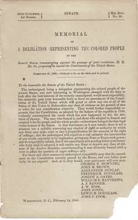
1764 · [Paris
by Bellin, Jacques Nicolas
[Paris: Jean-Baptiste Croisey, n.d., 1764. Two engraved maps hand-colored in outline, each approx. 12¾" x 17¾" overall (image size 8¾" x 14"); previous central folds, all else very good. Map nos. 87 and 88 extracted from Bellin's Le petit atlas maritime, 1764. Relief shown by hachures, depths shown by soundings, oriented with north to the left.
(Inventory #: 59232)