(MAP-BEIJING) LATEST MAP OF PEKING AND CHINA 最新版北京和中国地图
- Beijing: Wenbao Zhai, Langfang Toutiao Hutong, 1912-1928
(MAP-BEIJING) LATEST MAP OF PEKING AND CHINA 最新版北京和中国地图
Beijing: Distributed by No. 1 Building Wenbao Zhai, Langfang Toutiao Hutong, Qianmen Wai Street, Beijing, circa 1912-1928.
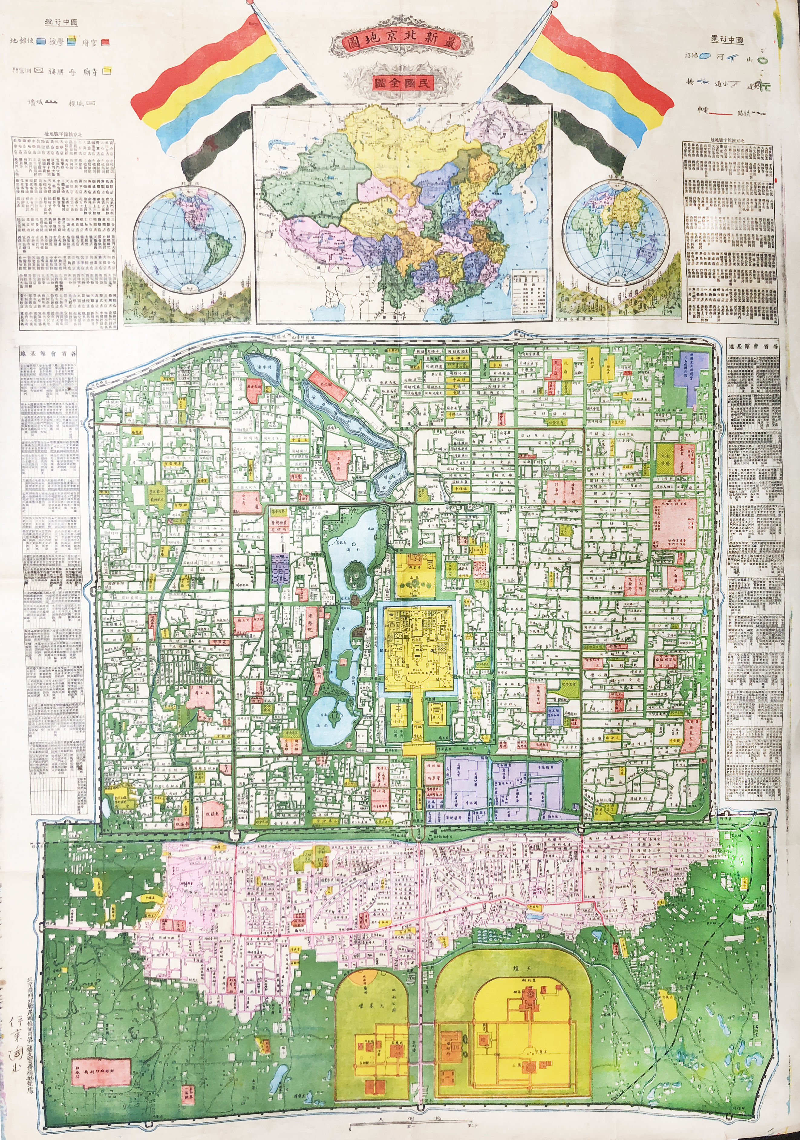
Large colored map of downtown Beijing with the Forbidden City in the center. Two crossed flags of Republic of China (Beiyang Government) on the top of a map of China flanked by two maps of hemispheres; hotels, and Beijing Offices of other provinces of China were also listed and marked on the map. Map scale is on the bottom, signs are also provided on the two sides of the map on the top. Overall measurement: 31-1/4×21-3/4 inches, creased where folded, fine condition.
北京:北京前门外廊房头条胡同文宝斋总批发处,由国旗可推断时间在1912-1928年期间。
北京中心城区大型彩色地图,上面有中国全国地图和世界两个半球的地图,顶端有两个中华民国国旗。地图中列出了酒店、各省在北京的办事处信息,还有比例尺和符号注释。尺寸为31-1/4×21-3/4英尺,折叠处有折痕,其他品相非常好。
Details
Title
(MAP-BEIJING) LATEST MAP OF PEKING AND CHINA 最新版北京和中国地图
Author
MAP-BEIJING
Condition
Fine
Publisher
Wenbao Zhai, Langfang Toutiao Hutong: Beijing
Date
1912-1928
Size
31-1/4×21-3/4 inches
Pages
1