Map of Kings County, California
- Hanford, Ca: Hanford Morning Journal, 1909
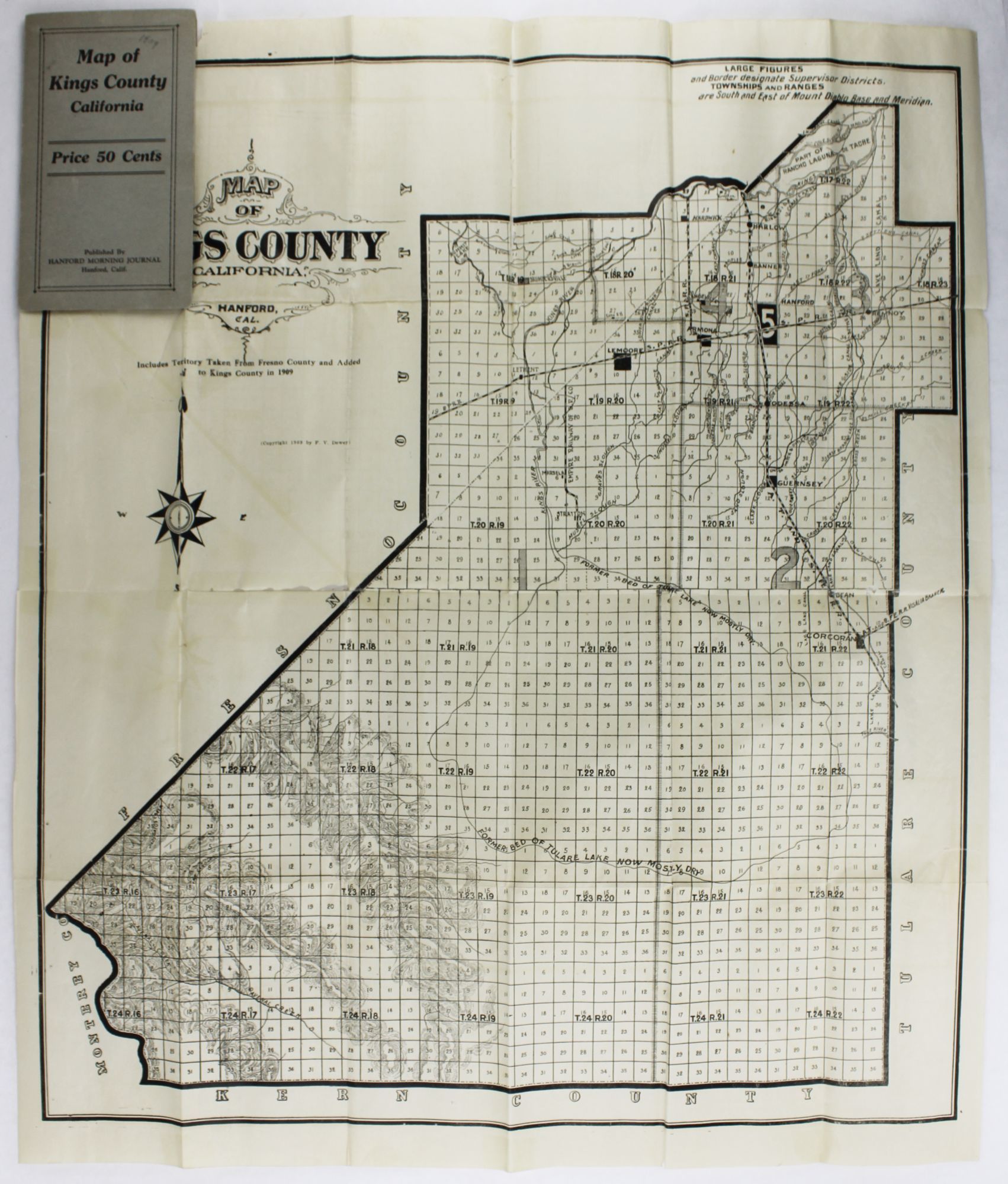
Hanford, Ca: Hanford Morning Journal, 1909. Good plus.. Folding map, approximately 25.5 x 22 inches. Original printed card wrappers. A couple internal tears and separations along fold lines, repaired with tape on blank verso, with resultant minor losses, slightly affecting printed areas. Otherwise unrecorded, early 20th-century plat map of Kings County, California, published by the newspaper of its county seat, the Hanford Morning Journal. The county, south of Fresno and west of Visalia in the Central Valley, was formed from Tulare County in 1893, and just over 200 acres were added in its northwestern region from Fresno County, perhaps the impetus for the production of the map in the same year. In addition to the plat of the entire county, the map shows the cluster of towns in the northern portion of the county, the routes of the Southern Pacific and A.T. & S.F. Railroads, which crossed in Hanford, the outline of the "mostly dry" Tulare Lake bed, and other water and geological features. Not in OCLC.
Details
Title
Map of Kings County, California
Author
[California]
Condition
Good
Publisher
Hanford Morning Journal: Hanford, Ca
Date
1909