Heald-Menerey's Geographical, Commercial and Recreational Map of California
- [San Francisco and Los Angeles: The Heald-Menerey Company, 1928
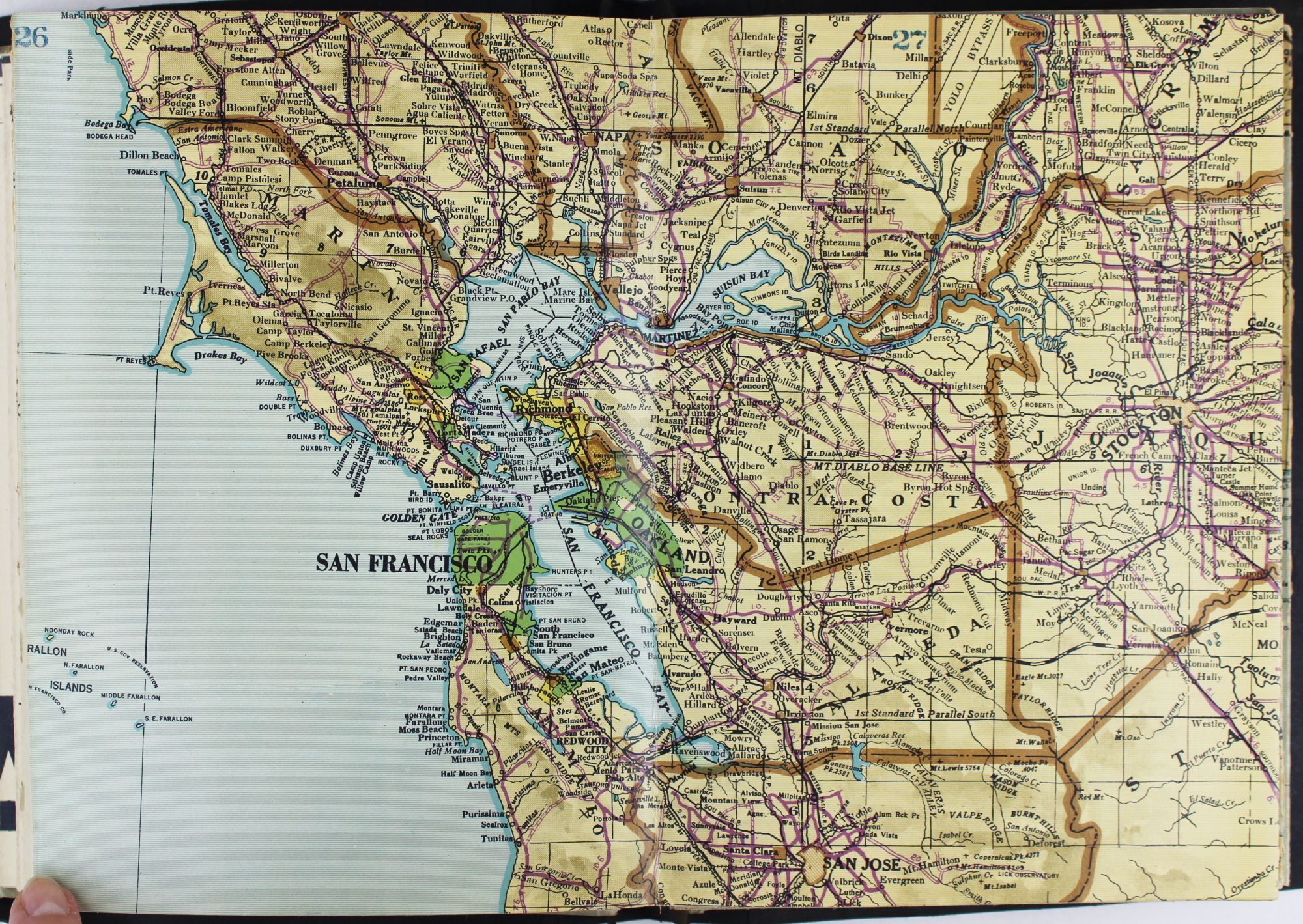
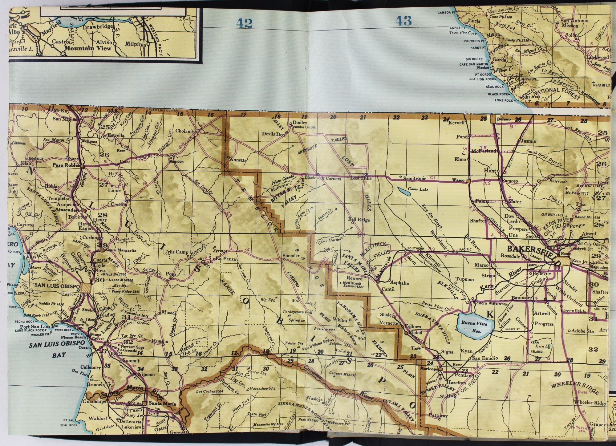
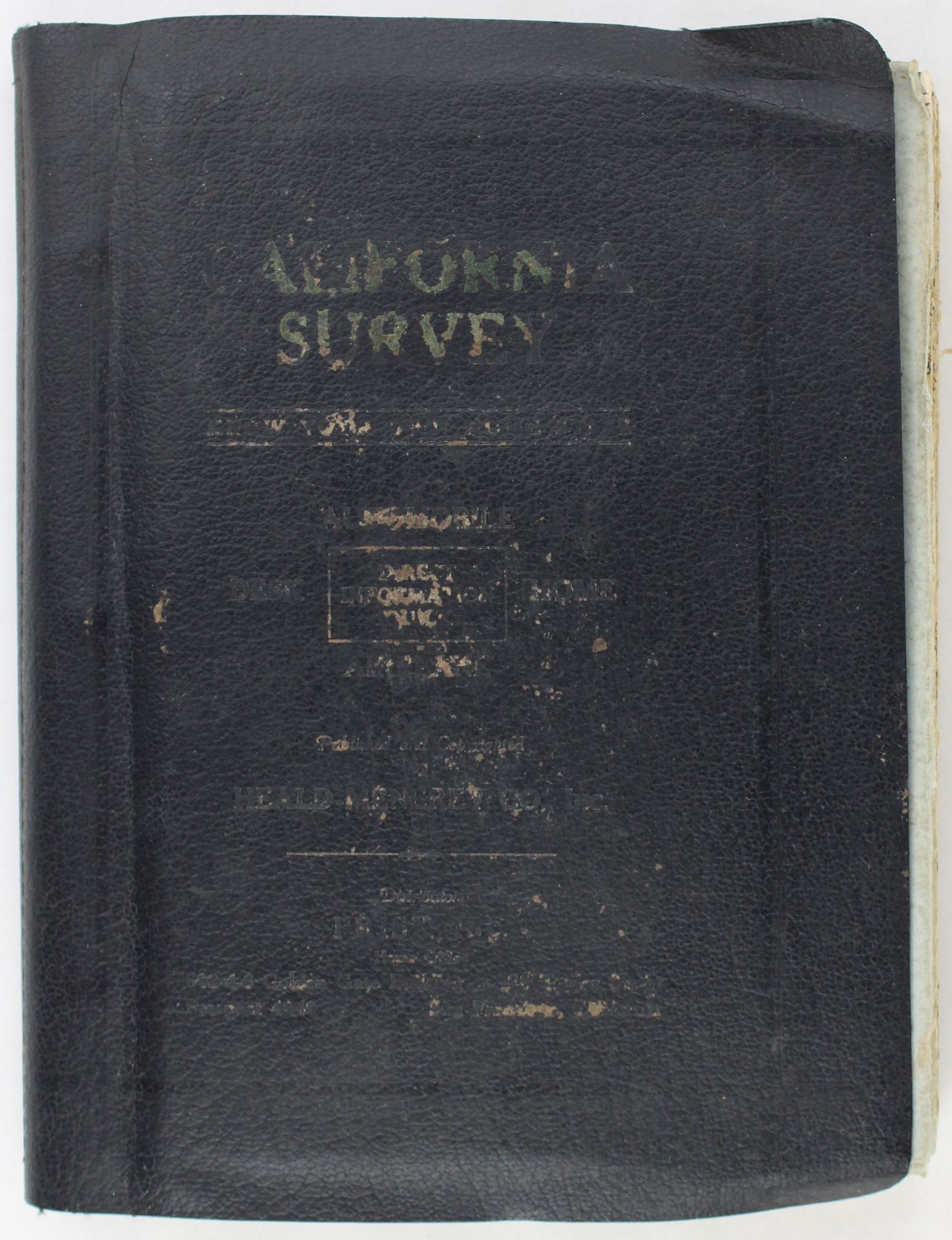
[San Francisco and Los Angeles: The Heald-Menerey Company, 1928. Very good.. Large color map, measuring 44 x 64 inches, cut into eight sections and folded into book form. Original black limp textured cloth, yapp edges, titled in pale yellow on front cover. Moderate edge wear, titles on front cover almost completely worn away. Internally clean. A rare portable version of the large and impressive Heald-Menerey's Geographical, Commercial and Recreational Map of California, produced in the late-1920s. According to the sheet of instructions bound before the map: "The first of its kind ever devised for desk, home or automobile use. It consists of the California Survey, 44 x 64 inches in size, cut into eight strips and folded to make a book of 64 pages. Page No. 1 is the extreme northwest corner of our Survey and page No. 64 is the extreme southwest corner." The instructions proceed to inform the user on how to locate points on the map given its form as a book. The verso of the instructions page is a county index keyed to the pages of the map. The cover title begins, "California Survey" but the remainder is rubbed beyond readability.
The map was produced by the Schmidt Lithograph Company of San Francisco. The legend of the map contains symbols representing roads, trails, railroads, streams, springs, swamps, aqueducts, lighthouses, county and state boundary lines, national forests, mountain peaks, township and range lines, base and meridian lines, and more. There are also two inset maps - one showing San Francisco and vicinity and the other Los Angeles and its immediate surroundings. OCLC records just a handful of copies of this book-form map published between 1928 and 1933.
The map was produced by the Schmidt Lithograph Company of San Francisco. The legend of the map contains symbols representing roads, trails, railroads, streams, springs, swamps, aqueducts, lighthouses, county and state boundary lines, national forests, mountain peaks, township and range lines, base and meridian lines, and more. There are also two inset maps - one showing San Francisco and vicinity and the other Los Angeles and its immediate surroundings. OCLC records just a handful of copies of this book-form map published between 1928 and 1933.
Details
Title
Heald-Menerey's Geographical, Commercial and Recreational Map of California
Author
[California]. [Maps]. Heald, Ralph P., compiler
Condition
Very Good
Publisher
The Heald-Menerey Company: [San Francisco and Los Angeles
Date
1928