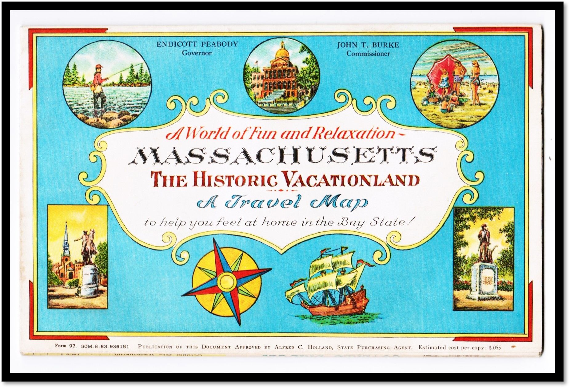
A World of Fun & Relaxation: Massachusetts, The Historic Vacationland [State Tourism Promotion] [Mid-Century Pictorial Cartography] [Ernest Dudley Chase]
- Color pictorial folding map
- Boston: Massachusetts Department of Commerce, 1960
Boston: Massachusetts Department of Commerce, 1960. Color pictorial folding map. Near Fine.
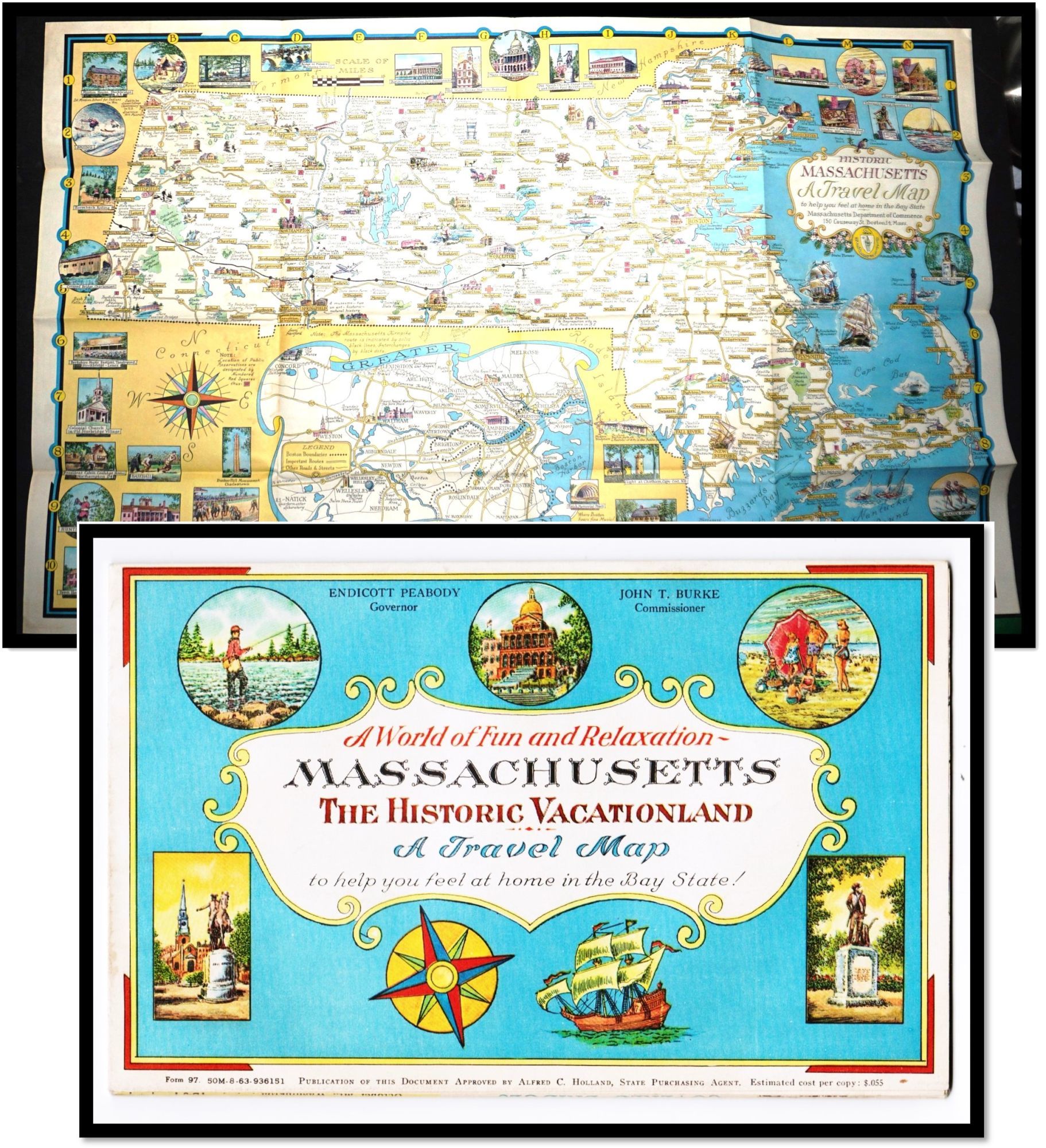
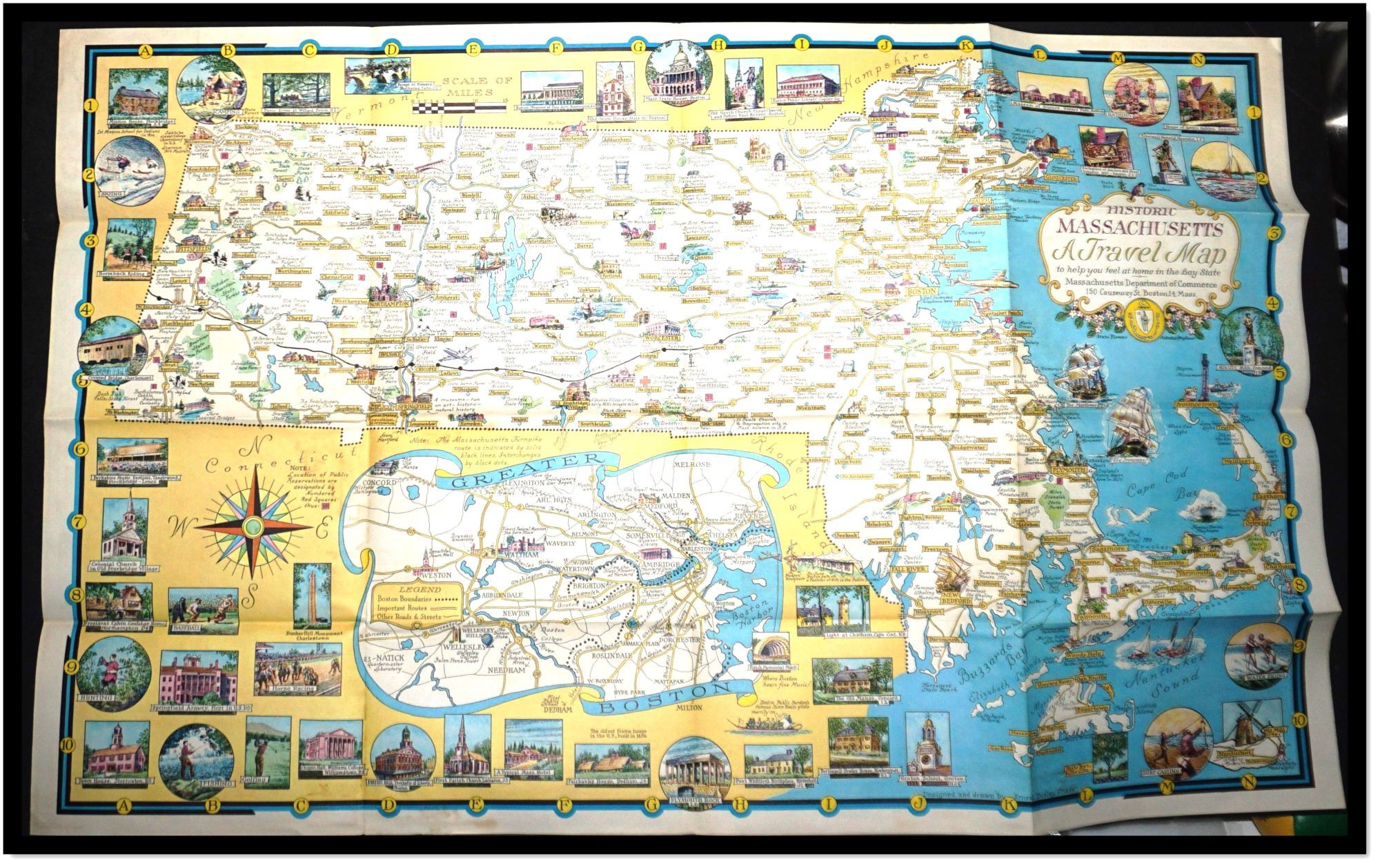
A richly illustrated mid-century Massachusetts travel map by Ernest Dudley Chase, blending tourism promotion with pictorial cartographic design.
Issued by the Massachusetts Department of Commerce around 1960, this vibrant folding travel map presents the Bay State as a year-round destination through detailed pictorial cartography by Ernest Dudley Chase. Equal parts guide, souvenir, and promotional artifact, it reflects the optimism and visual clarity of postwar American state tourism design.
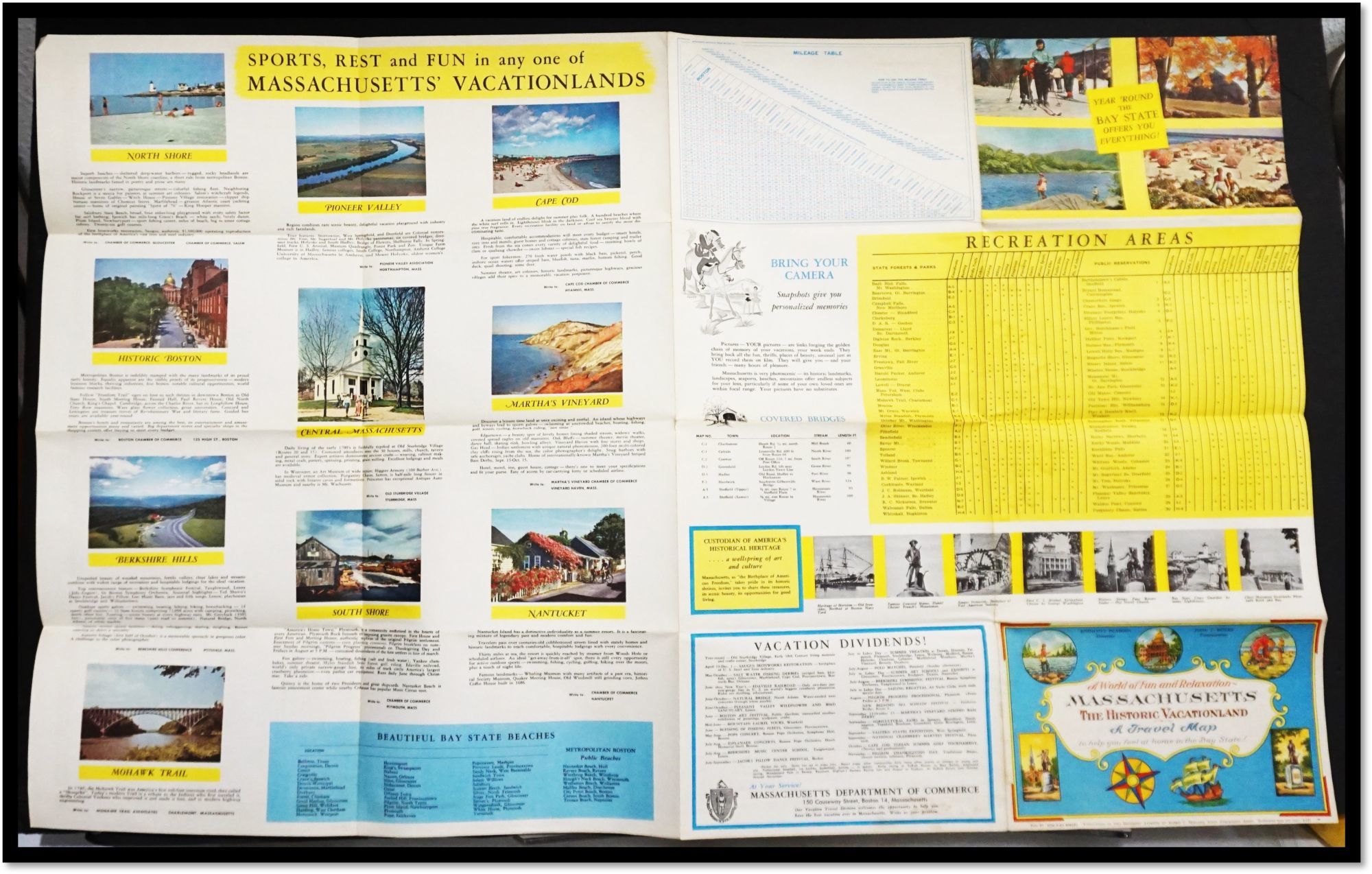
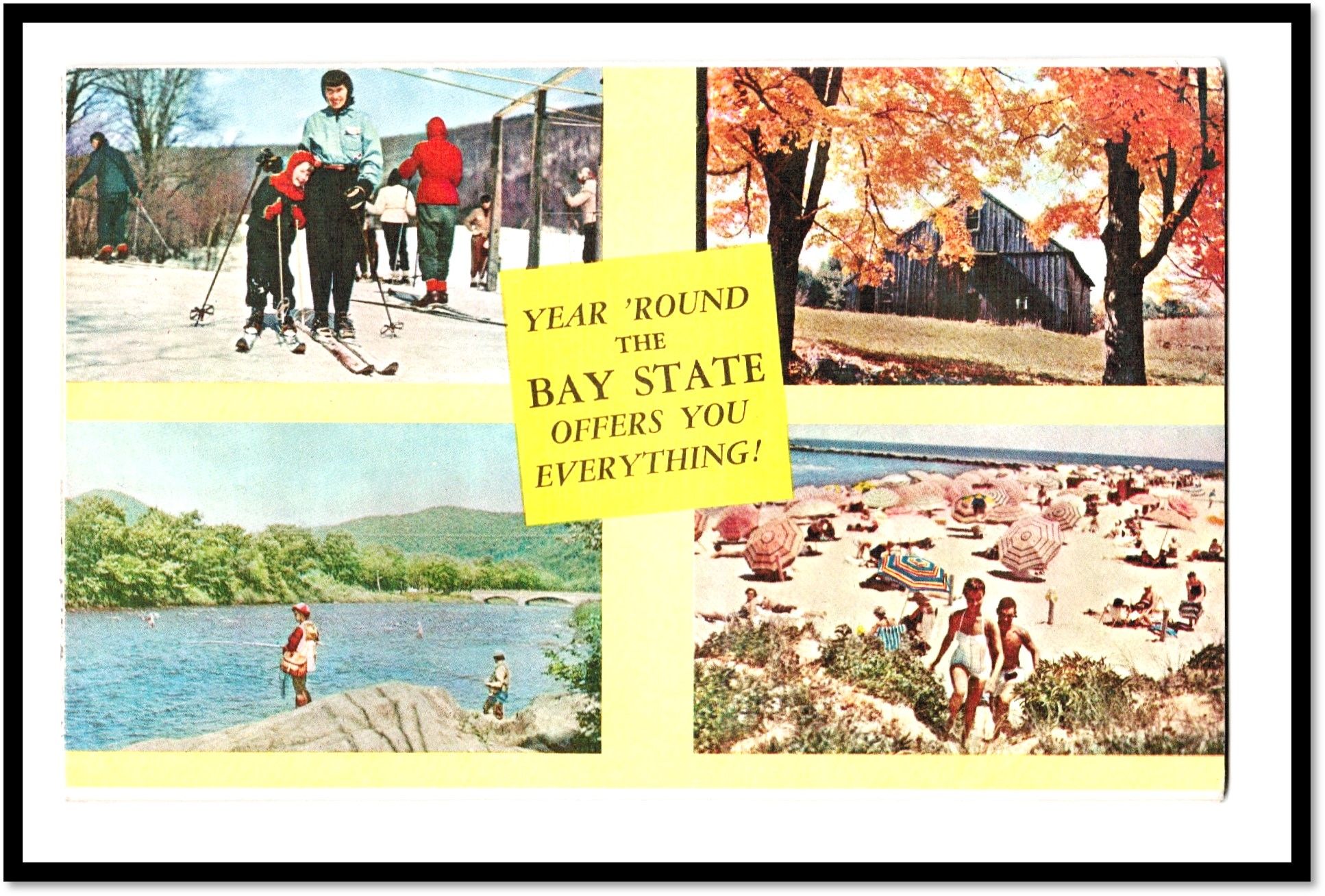
Physical Description: Color pictorial map printed on a single sheet, folding to approximately 8.5 × 5.5 inches and opening to 33.5 × 21.25 inches (approx. 51 × 82 cm). Illustrated throughout with labeled vignettes, pictorial index to points of interest, mileage table, covered bridge index, beach directory, calendar of events, and state forests and parks. Includes inset map of Greater Boston and extensive color halftone illustrations on the verso. Printed form designation: Form 97, 50M-9-60-928745.
Condition: Paper clean and supple with bright color retention throughout. Text and imagery crisp and fully legible. Minimal handling wear and a faint, even age-toning consistent with paper stock. No tears, stains, or losses observed. First state tourism issue.
Scarcity Note: Examples survive, but well-preserved copies with strong color and no structural issues are increasingly difficult to locate. Maps by Ernest Dudley Chase remain actively collected within the pictorial cartography field. This map exemplifies Ernest Dudley Chase's mature style, characterized by densely composed yet legible illustrations that balance informational clarity with visual charm.
Towns, landmarks, recreational areas, and historic sites are rendered through small, carefully captioned scenes that invite close inspection. The design functions both as a navigational aid and as a narrative portrait of Massachusetts, presenting history, leisure, and modern infrastructure as a cohesive cultural identity. --- Contextual / Historical Significance: Produced during the postwar expansion of domestic tourism, the map reflects a broader effort by American states to promote regional identity through graphic design.
Chase's work occupies a key position within mid-20th-century pictorial cartography, bridging traditional mapmaking with illustration and popular graphic culture.
Subjects: Massachusetts Tourism, State-Sponsored Travel Promotion, Mid-Century Graphic Design, Illustrated Maps, Ernest Dudley Chase, New England Cultural History, Pictorial Cartography, Travel Ephemera, Americana.
Bibliographic References: +++ "A Meticulous Maker of Maps" (biographical study of Ernest Dudley Chase) +++ OCLC/WorldCat listings for Ernest Dudley Chase pictorial maps and state tourism publications.
A richly illustrated mid-century Massachusetts travel map by Ernest Dudley Chase, blending tourism promotion with pictorial cartographic design.
Issued by the Massachusetts Department of Commerce around 1960, this vibrant folding travel map presents the Bay State as a year-round destination through detailed pictorial cartography by Ernest Dudley Chase. Equal parts guide, souvenir, and promotional artifact, it reflects the optimism and visual clarity of postwar American state tourism design.
Physical Description: Color pictorial map printed on a single sheet, folding to approximately 8.5 × 5.5 inches and opening to 33.5 × 21.25 inches (approx. 51 × 82 cm). Illustrated throughout with labeled vignettes, pictorial index to points of interest, mileage table, covered bridge index, beach directory, calendar of events, and state forests and parks. Includes inset map of Greater Boston and extensive color halftone illustrations on the verso. Printed form designation: Form 97, 50M-9-60-928745.
Condition: Paper clean and supple with bright color retention throughout. Text and imagery crisp and fully legible. Minimal handling wear and a faint, even age-toning consistent with paper stock. No tears, stains, or losses observed. First state tourism issue.
Scarcity Note: Examples survive, but well-preserved copies with strong color and no structural issues are increasingly difficult to locate. Maps by Ernest Dudley Chase remain actively collected within the pictorial cartography field. This map exemplifies Ernest Dudley Chase's mature style, characterized by densely composed yet legible illustrations that balance informational clarity with visual charm.
Towns, landmarks, recreational areas, and historic sites are rendered through small, carefully captioned scenes that invite close inspection. The design functions both as a navigational aid and as a narrative portrait of Massachusetts, presenting history, leisure, and modern infrastructure as a cohesive cultural identity. --- Contextual / Historical Significance: Produced during the postwar expansion of domestic tourism, the map reflects a broader effort by American states to promote regional identity through graphic design.
Chase's work occupies a key position within mid-20th-century pictorial cartography, bridging traditional mapmaking with illustration and popular graphic culture.
Subjects: Massachusetts Tourism, State-Sponsored Travel Promotion, Mid-Century Graphic Design, Illustrated Maps, Ernest Dudley Chase, New England Cultural History, Pictorial Cartography, Travel Ephemera, Americana.
Bibliographic References: +++ "A Meticulous Maker of Maps" (biographical study of Ernest Dudley Chase) +++ OCLC/WorldCat listings for Ernest Dudley Chase pictorial maps and state tourism publications.
Details
Title
A World of Fun & Relaxation: Massachusetts, The Historic Vacationland [State Tourism Promotion] [Mid-Century Pictorial Cartography] [Ernest Dudley Chase]
Author
Massachusetts Department of Commerce
Binding
Color pictorial folding map
Condition
Near Fine
Publisher
Massachusetts Department of Commerce: Boston
Date
1960