Nord-America and West Indien
- [Upsala, SWE]: Palmblad & Co, 1825
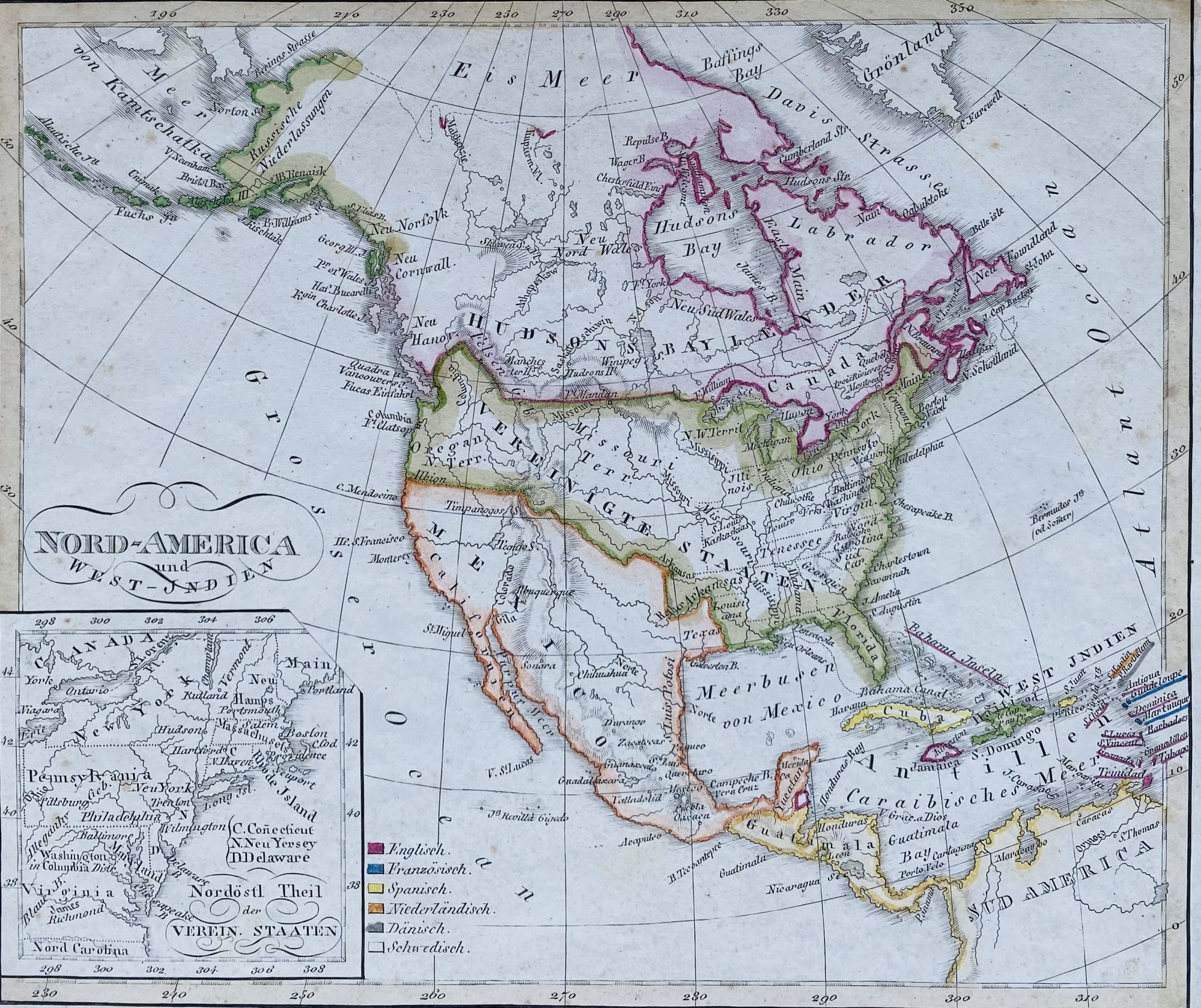
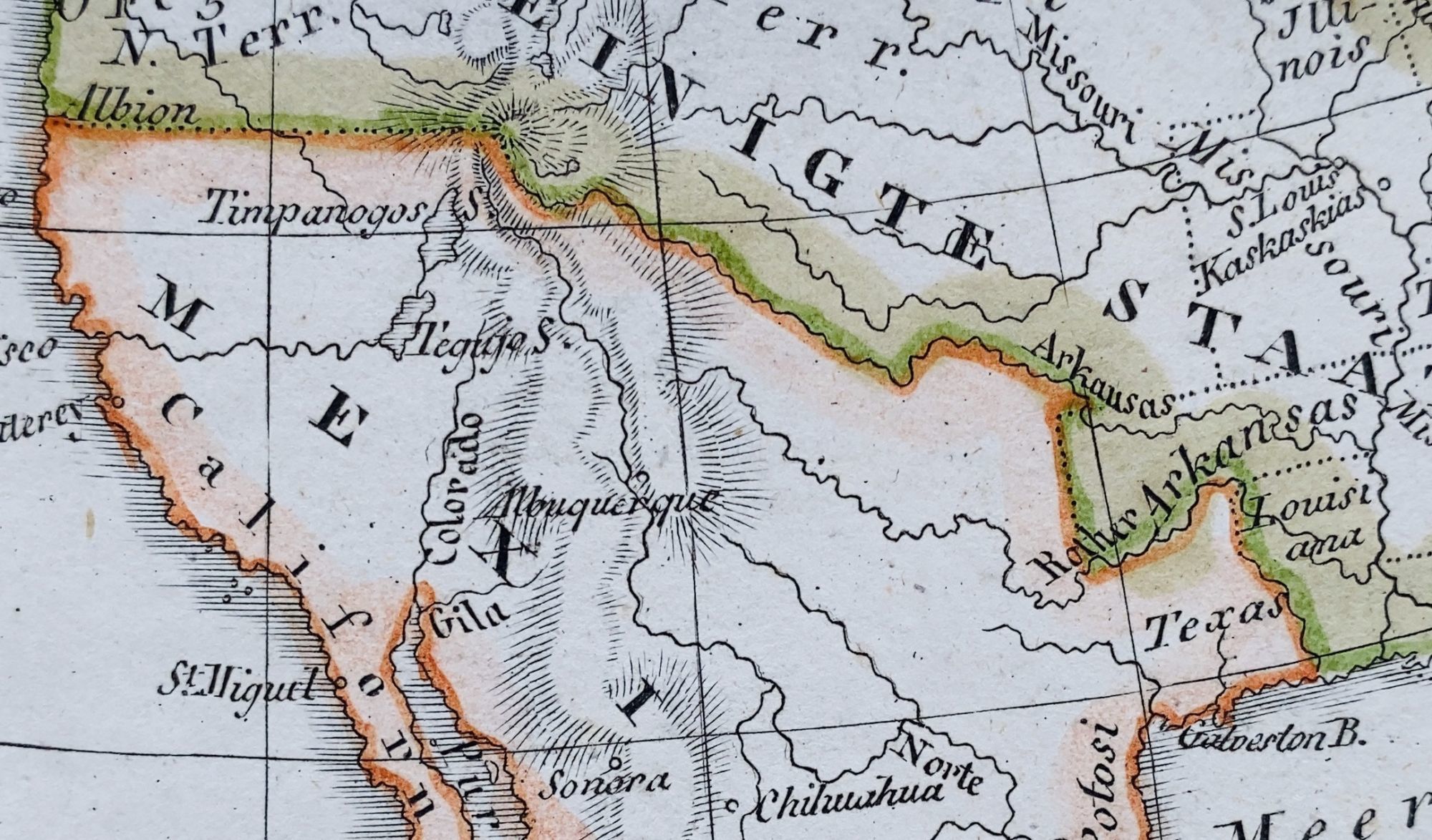
[Upsala, SWE]: Palmblad & Co, 1825. Map [18 cm x 21 cm] / [7" x 8.25"] on a single sheet [23 cm x 30.5 cm] / [9" x 12"] Hand tinted borders. Gentle overall foxing with top left corner nicked (does not effect map). Inset map at lower left labeled "Nordostl Theil Verein Staaten" [Northeast part of the United States] that shows the Eastern Seaboard, from North Carolina to Maine. Canada is labeled "Hudsons Bay Lander." Texas is shown and labeled, but as part of Mexico. Plate XIX [19] from first Swedish edition of the Stieler school atlas based on the first 1821 German edition. The Great Salt Lake ["Timpanogos"] and Utah Lake ["Tegigo"] are both shown with an unnamed Buenaventura River flowing from Utah Lake to Monterey. Rare. Not in Moffat. Not in Wheat.
Details
Title
Nord-America and West Indien
Author
Stieler, Adolph
Condition
Unknown
Publisher
Palmblad & Co: [Upsala, SWE]
Date
1825