Play Places of the Monterey Peninsula : A Cartographic Map by Lowell Butler
- Los Angeles: Westways, Automobile Club of Southern California, 1937
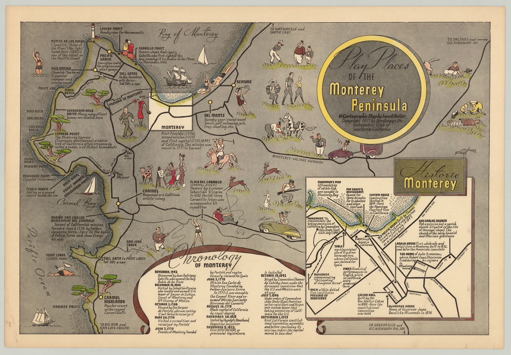
An entertaining pictorial map of the Monterey Peninsula replete with playful illustrations highlighting the area's numerous tourist attractions.
Created for the Southern California Automobile Club's Westways Magazine, this map serves as a tourist guide to Monterey Peninsula, spanning from Lover's Point and Punta de Los Pinos in the north to Yankee Point and Carmel Highlands in the south; the Pacific Ocean and the Bay of Monterey occupy the left portion of the map where boats sail along. Numerous illustrations depict tourist activities and destinations, resorts, a lovestruck woman admiring her man, fishing spots, cypress trees, a couple lounging on the beach, the regions principal roads, etc. Accompanying the illustrations and locales are descriptions by turns humorous and informative. An inset map in the lower right corner depicts historic Monterey, including the house in which Robert Louis Stevenson lived during his stay there. A chronology of the city appears at the bottom, spanning from 1542-when the land was "discovered" by Jan Rodriguez Cabrillo-to 1849, when the first California constitutional convention assembled.
In 1906, the Automobile Club of Southern California (est. 1900) started mapping the roads of Southern California, and four years later began a monthly publication, Westways Magazine, that focused on automotive tourism and covered such subjects as Western national parks, deserts, California's coastal regions and Hawaii. Around this time the organization became involved in shaping transportation policy. The Club issued the first systematic traffic survey of Los Angeles in 1922 and in 1937 composed the first extensive plan for a region-wide freeway system.
Lowell Butler, who served as the club's art director, created multiple pictorial maps for the organization from the 1930s to the mid-50s, including A Map of the Marked Historical Sites of California (1952) and Spanish California: A Map of the Missions, Presidios, Pueblos and Some of the More Interesting Ranchos (1956). This present map is one of Butler's earliest productions.
REFERENCES: "Automobile Club of Southern California collection, 1892-1963" at University of Southern California Libraries online.
Details
Title
Play Places of the Monterey Peninsula : A Cartographic Map by Lowell Butler
Author
Butler, Lowell
Condition
Unknown
Publisher
Los Angeles: Westways, Automobile Club of Southern California, 1937