Jinkoku ki [or] Jinkokki 人國記 [Record of People & Their Provinces] [or] Shinkan jinkoku ki 新刊人國記 [Record of People & Their Provinces, Newly Published]
![Jinkoku ki [or] Jinkokki 人國記 [Record of People & T](https://d3525k1ryd2155.cloudfront.net/h/493/254/1609254493.0.x.jpg)
Numerous woodcut illus. in text. Four vols. 8vo, orig. semi-stiff wrappers, new stitching, orig. title-slips on covers (partially perished). Tokyo: Suhara[ya] Mohei 須原茂兵衛, 1701.
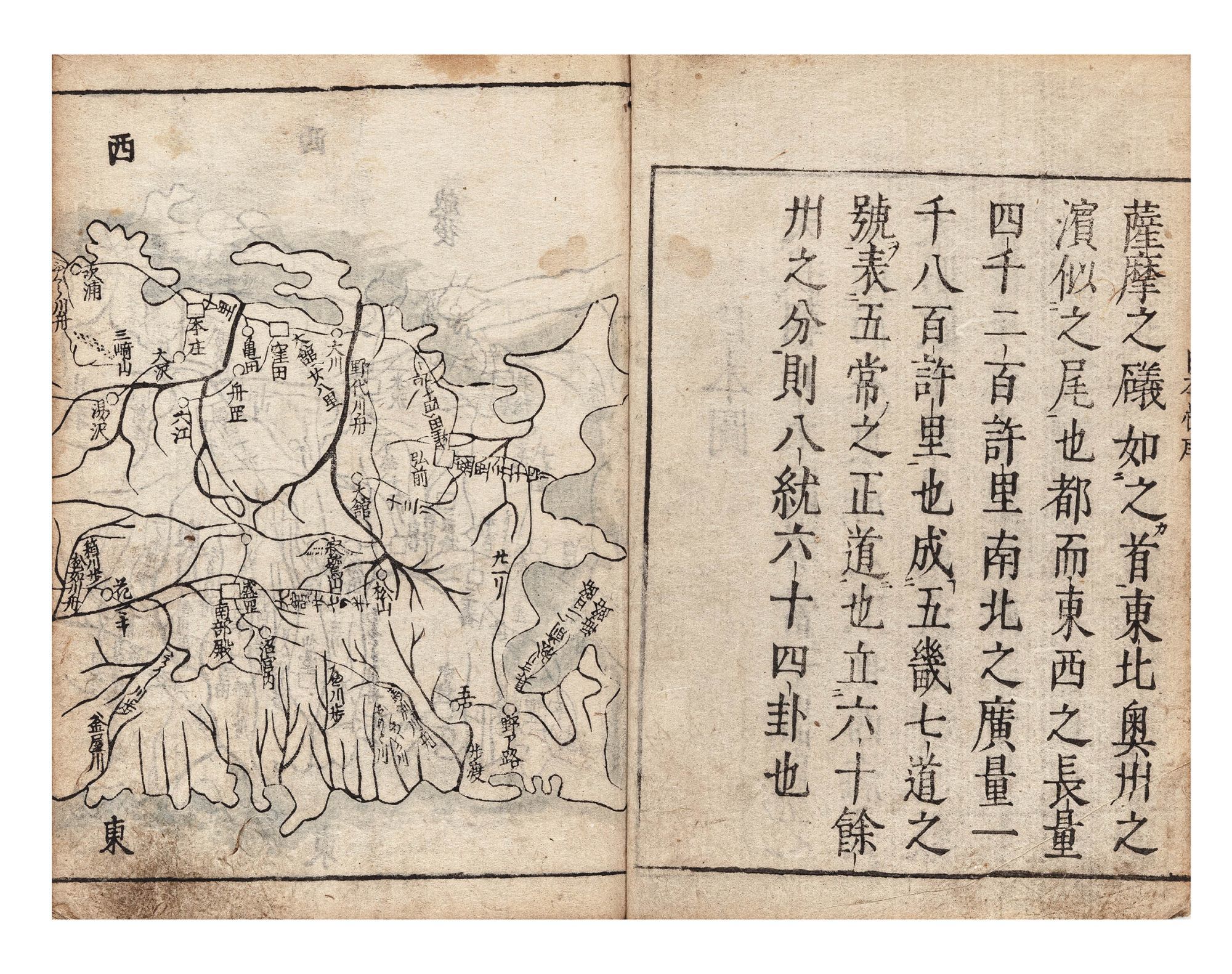
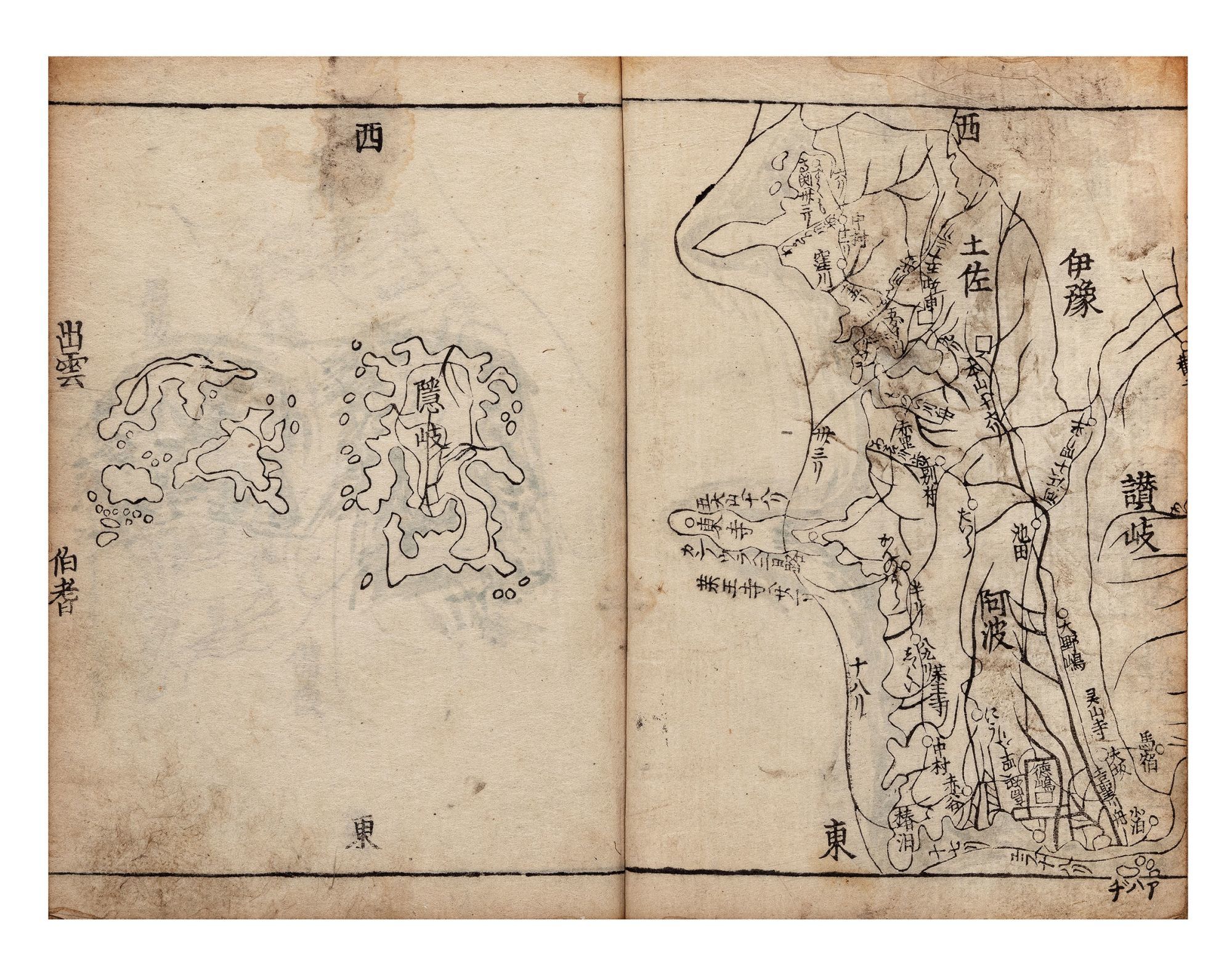
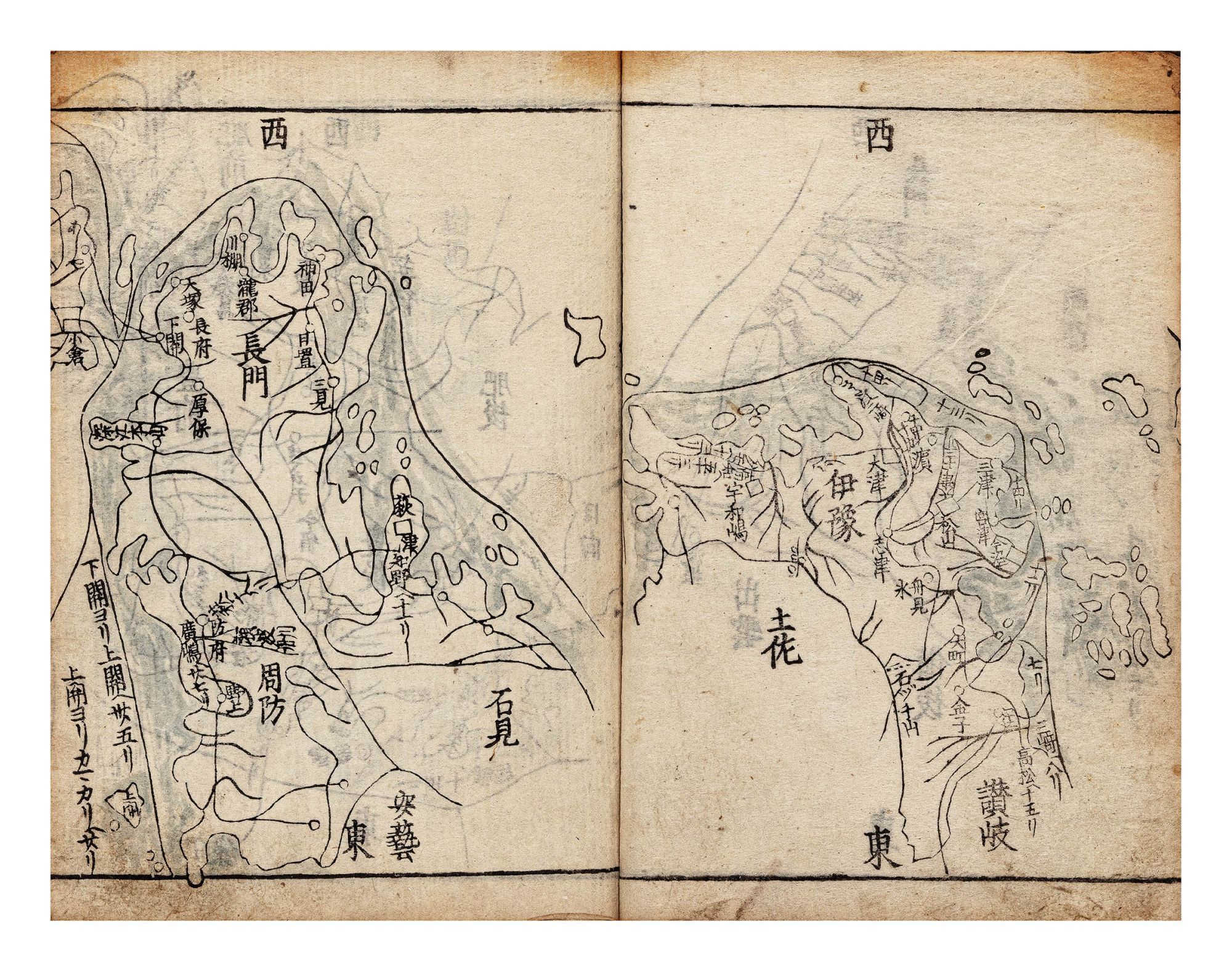
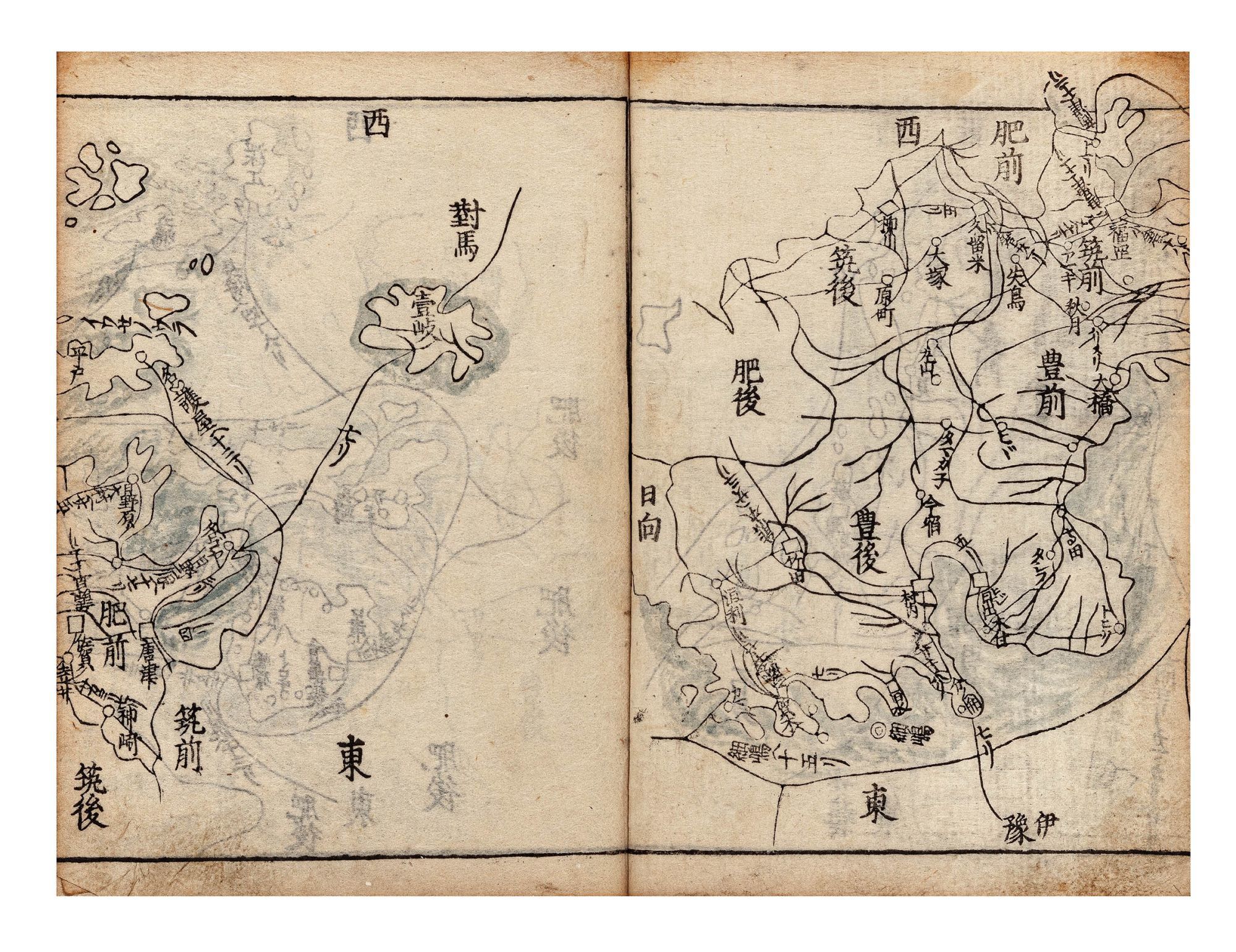
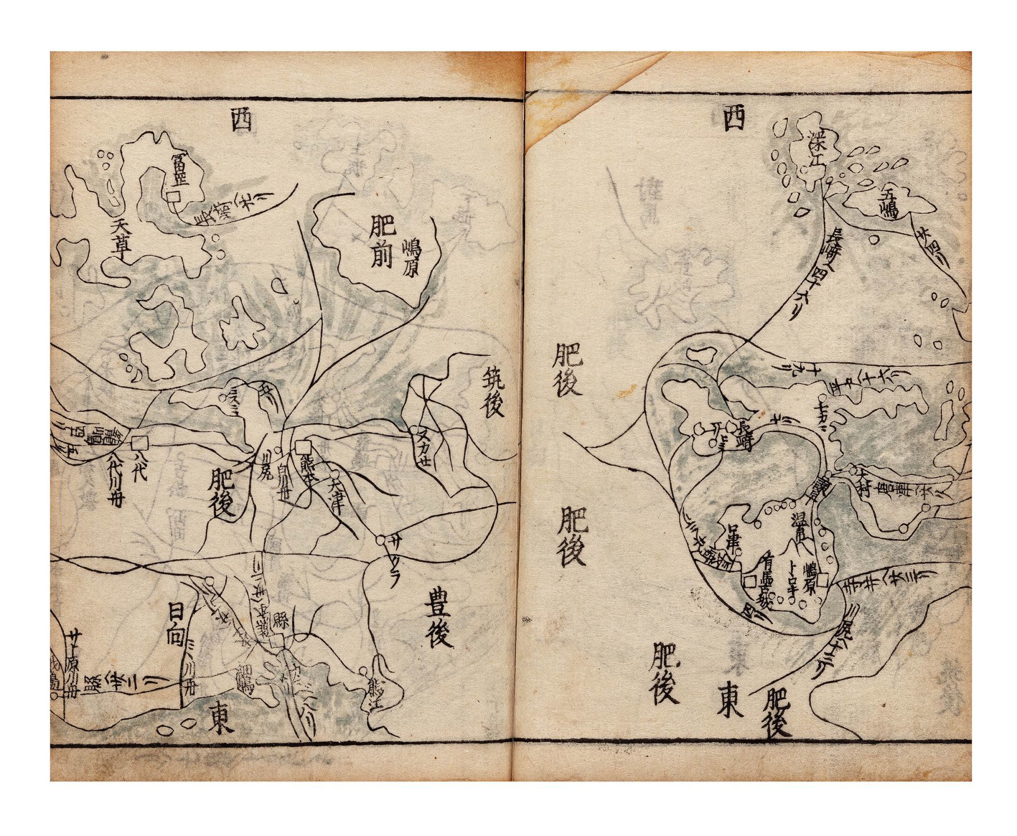
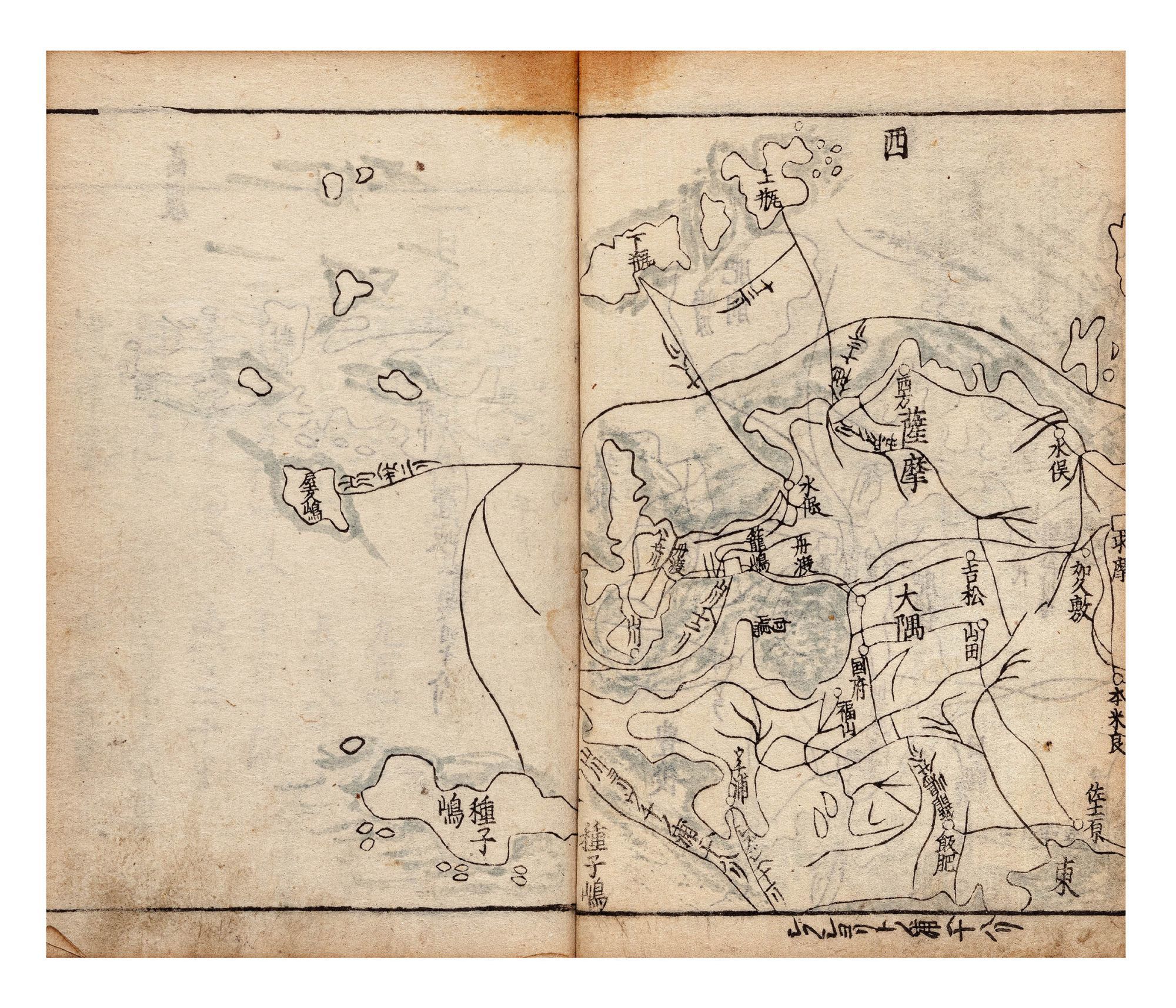
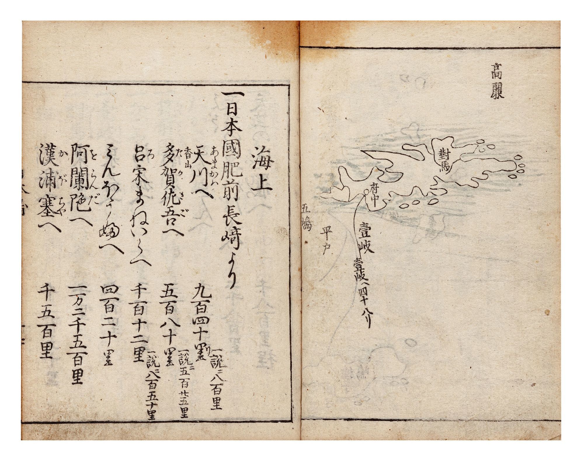
First edition of this rare work on the customs of Japan’s provinces. The book is of unknown authorship. There are two versions, the older being from the Muromachi period (1336-1573), the second being the edition of our book. The revision was made by Seki Sokō (d. ca. 1716-29), who also added the maps seen in our book.
The territories covered include all of present-day Japan except for Okinawa and Hokkaido. The provinces of Japan were ancient territorial divisions that were nominally in place until 1868. During the period of warrior rule, they lost political importance in favor of the domains of feudal lords, but as our book shows, they still played an important role in people’s imagination of the territory and its people.
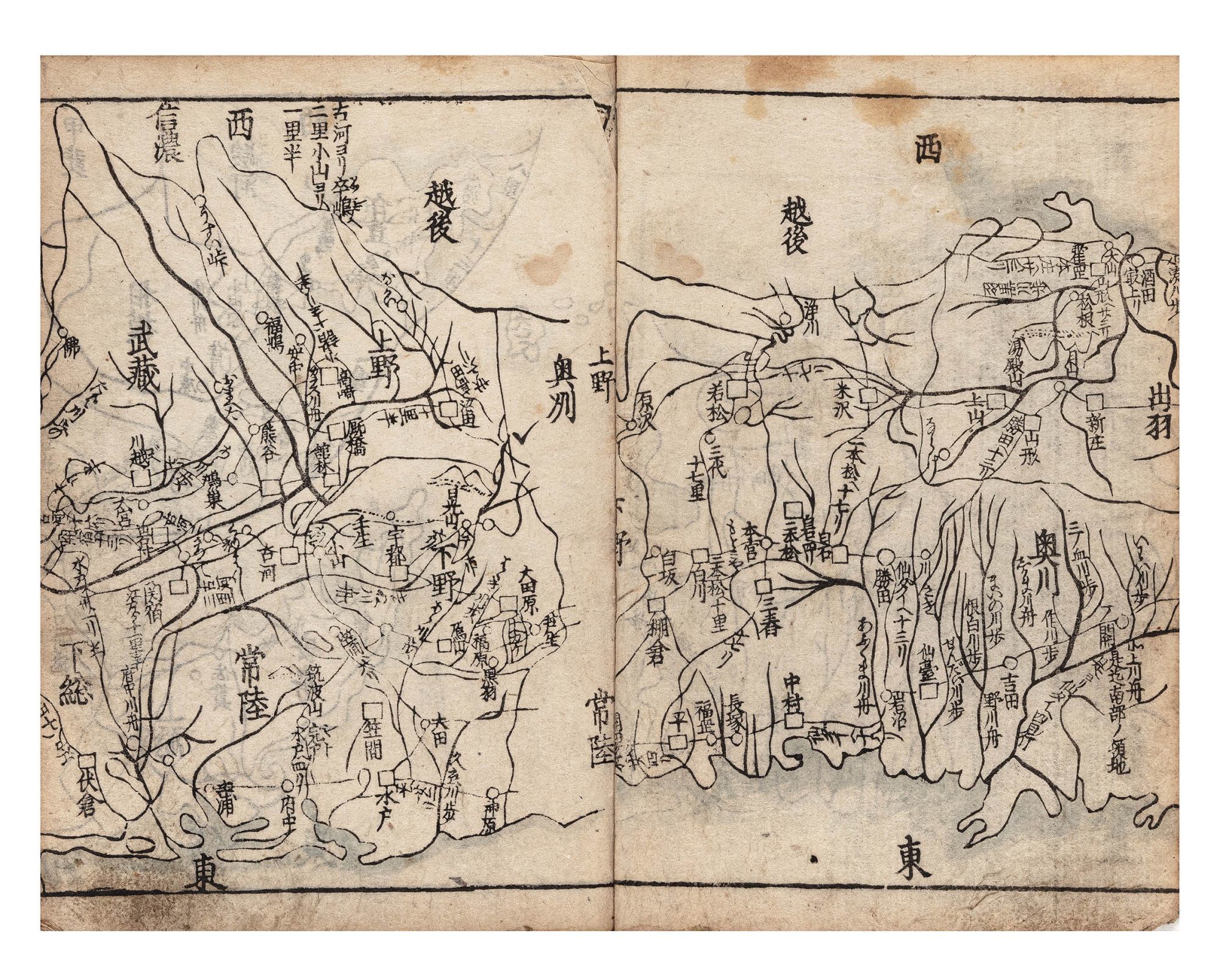
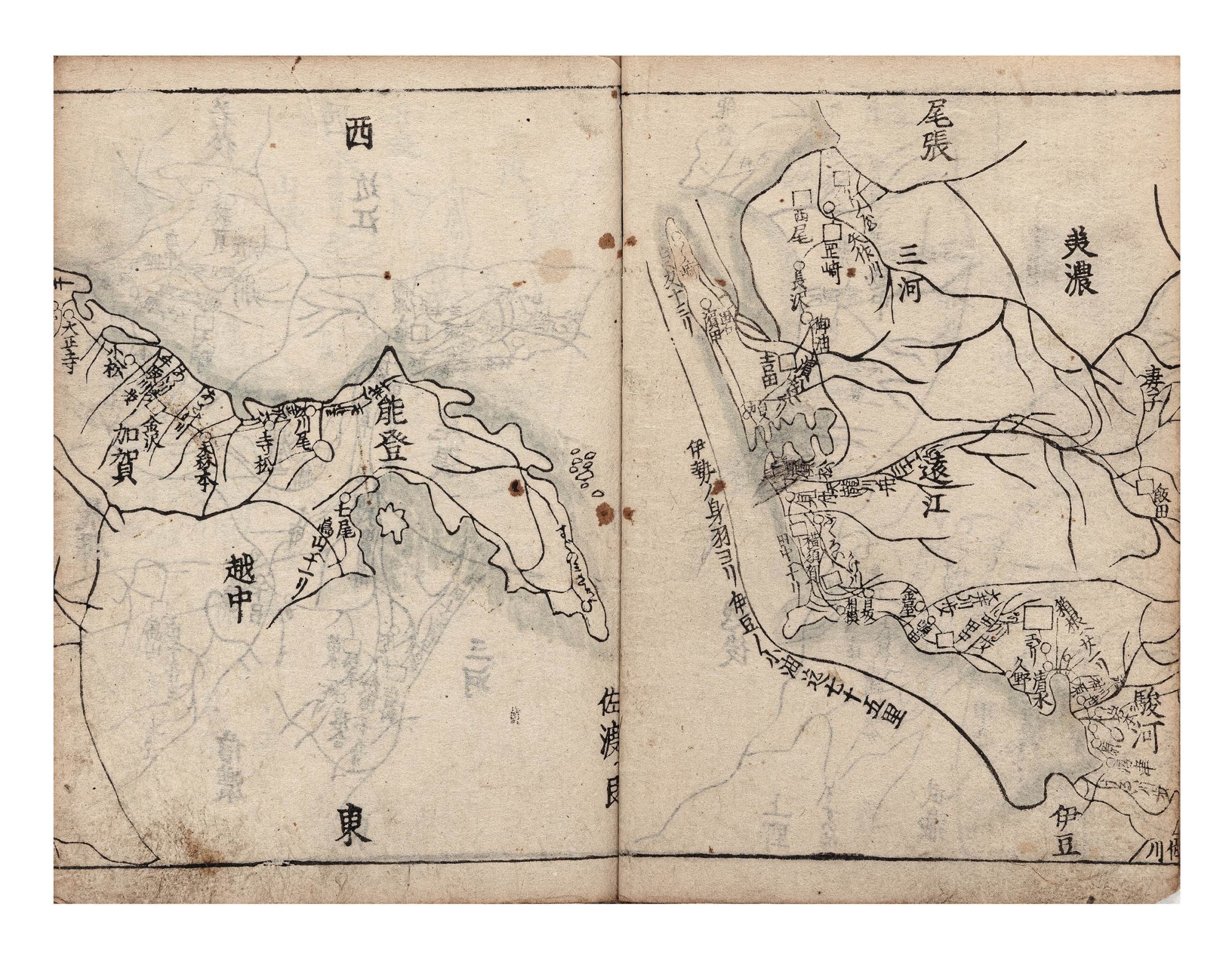
The book is divided into two parts, each spanning two volumes. Part One begins with the five provinces surrounding the imperial capital of Kyoto: Yamashiro, Yamato, Kawachi, Izumi, and Settsu. These are followed by the provinces of Tōkaidō, the East Sea Circuit, through which the road ran that connected Kyoto to the bakufu’s capital at Edo: Iga, Ise, Shima, Owari, Mikawa, Tōtōmi, Suruga, Kai, Izu, Sagami, Musashi, Awa, Kazusa, Shimōsa, and Hitachi. Next come the provinces of the Tōsandō, the East Mountain Circuit, comprising central and northern Honshū: Ōmi, Mino, Hida, Shinano, Kōzuke, Shimotsuke, Mutsu, and Dewa. Finally, at the end of Part One, the book surveys the provinces of the Hokurikudō, the North Land Circuit, covering the western coast of Honshū: Wakasa, Echizen, Kaga, Noto, Etchū, Echigo, and Sado.
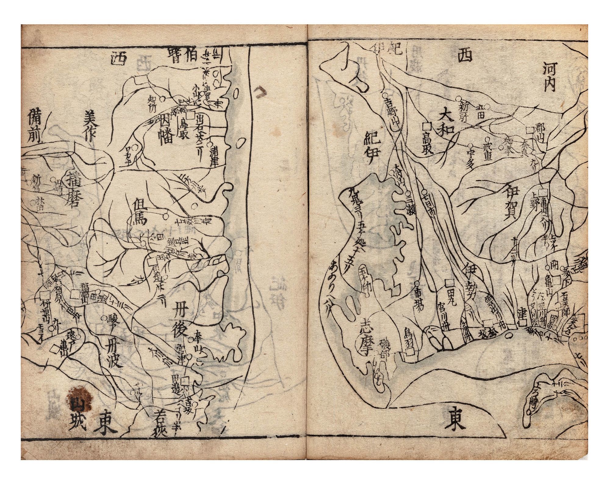
Part Two covers southern Honshū and the other Japanese islands. First are listed the provinces of San’indō, the Northern Side of the Mountains Circuit: Tanba, Tango, Tajima, Inaba, Hōki, Izumo, Iwami, and Oki. Next follow the provinces of San’yōdō, the Southern Side of the Mountains Circuit: Harima, Mimasaka, Bizen, Bitchū, Bingo, Aki, Suō, and Nagato. The book then lists the provinces of the Nankaidō, the South Sea Circuit, including a part of Honshū and all of the island of Shikoku: Kii, Awaji, Awa, Sanuki, Iyo, and Tosa. Finally, the last provinces listed are those of the Saikaidō or West Sea Circuit, comprising Kyūshū and outlying islands: Chikuzen, Chikugo, Buzen, Bungo, Hizen, Higo, Hyūga, Ōsumi, Satsuma, Iki, and Tsushima.
A map is supplied for each province. There is then a discussion of the customs (fūzoku 風俗) of the province. Regarding Shinano, for example, we learn that the customs of the province are the “customs of the samurai.” In Harima, the people are “wise.”
The publisher, whose name is usually written Suharaya Mohei 須原屋茂兵衛, operated for nine generations, into the Meiji period. The publishing house is said to have been established by a transplant from Kii province in 1658 by Nihonbashi bridge in Tokyo, but the earliest surviving printing dates from 1684.
Very good set; some worming touching characters and illustrations.
❧ Kazutaka Unno, “Cartography in Japan,” pp. 412 & 414, in The History of Cartography (University of Chicago Press: 1994), Vol. 2, Book 2.
First edition of this rare work on the customs of Japan’s provinces. The book is of unknown authorship. There are two versions, the older being from the Muromachi period (1336-1573), the second being the edition of our book. The revision was made by Seki Sokō (d. ca. 1716-29), who also added the maps seen in our book.
The territories covered include all of present-day Japan except for Okinawa and Hokkaido. The provinces of Japan were ancient territorial divisions that were nominally in place until 1868. During the period of warrior rule, they lost political importance in favor of the domains of feudal lords, but as our book shows, they still played an important role in people’s imagination of the territory and its people.
The book is divided into two parts, each spanning two volumes. Part One begins with the five provinces surrounding the imperial capital of Kyoto: Yamashiro, Yamato, Kawachi, Izumi, and Settsu. These are followed by the provinces of Tōkaidō, the East Sea Circuit, through which the road ran that connected Kyoto to the bakufu’s capital at Edo: Iga, Ise, Shima, Owari, Mikawa, Tōtōmi, Suruga, Kai, Izu, Sagami, Musashi, Awa, Kazusa, Shimōsa, and Hitachi. Next come the provinces of the Tōsandō, the East Mountain Circuit, comprising central and northern Honshū: Ōmi, Mino, Hida, Shinano, Kōzuke, Shimotsuke, Mutsu, and Dewa. Finally, at the end of Part One, the book surveys the provinces of the Hokurikudō, the North Land Circuit, covering the western coast of Honshū: Wakasa, Echizen, Kaga, Noto, Etchū, Echigo, and Sado.
Part Two covers southern Honshū and the other Japanese islands. First are listed the provinces of San’indō, the Northern Side of the Mountains Circuit: Tanba, Tango, Tajima, Inaba, Hōki, Izumo, Iwami, and Oki. Next follow the provinces of San’yōdō, the Southern Side of the Mountains Circuit: Harima, Mimasaka, Bizen, Bitchū, Bingo, Aki, Suō, and Nagato. The book then lists the provinces of the Nankaidō, the South Sea Circuit, including a part of Honshū and all of the island of Shikoku: Kii, Awaji, Awa, Sanuki, Iyo, and Tosa. Finally, the last provinces listed are those of the Saikaidō or West Sea Circuit, comprising Kyūshū and outlying islands: Chikuzen, Chikugo, Buzen, Bungo, Hizen, Higo, Hyūga, Ōsumi, Satsuma, Iki, and Tsushima.
A map is supplied for each province. There is then a discussion of the customs (fūzoku 風俗) of the province. Regarding Shinano, for example, we learn that the customs of the province are the “customs of the samurai.” In Harima, the people are “wise.”
The publisher, whose name is usually written Suharaya Mohei 須原屋茂兵衛, operated for nine generations, into the Meiji period. The publishing house is said to have been established by a transplant from Kii province in 1658 by Nihonbashi bridge in Tokyo, but the earliest surviving printing dates from 1684.
Very good set; some worming touching characters and illustrations.
❧ Kazutaka Unno, “Cartography in Japan,” pp. 412 & 414, in The History of Cartography (University of Chicago Press: 1994), Vol. 2, Book 2.
Details
Title
Jinkoku ki [or] Jinkokki 人國記 [Record of People & Their Provinces] [or] Shinkan jinkoku ki 新刊人國記 [Record of People & Their Provinces, Newly Published]
Author
SEKI, Sokō 関祖衡, ed
Condition
Unknown