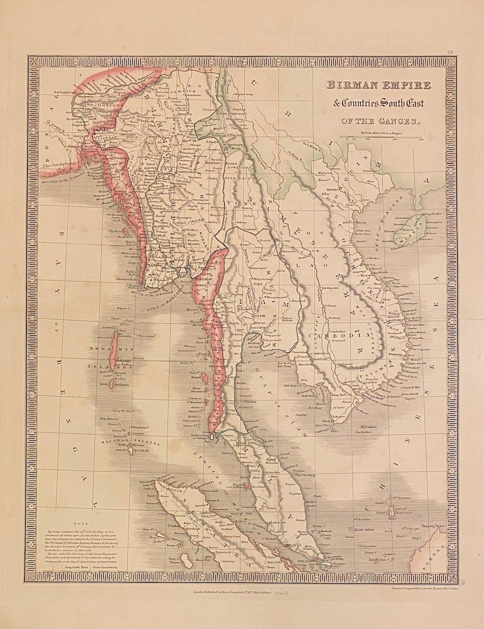
Birman Empire & Countries South East of the Ganges
- Henry Teesdale & Co, 1844
Henry Teesdale & Co, 1844. Map. Engraving with hand-coloring. Image measures 16 x 13".
This lovely map of Southeast Asia includes the regions of present-day Myanmar, Thailand, Cambodia, Vietnam, Malaysia, and the tip of Singapore, all labeled with their mid-19th century names. A note in the lower left corner describes the Treaty of Yandabo, signed in 1826, which ended the First Anglo-Burmese War and ceded substantial territory to the British. This map, published in 1844, appeared in Teesdale's "New General Atlas of the World." It is in very good condition with lovely hand-coloring. Center fold as issued, slight staining. John Dower was a 19th-century British mapmaker and publisher. This map exemplifies the accuracy and clarity of his work.
This lovely map of Southeast Asia includes the regions of present-day Myanmar, Thailand, Cambodia, Vietnam, Malaysia, and the tip of Singapore, all labeled with their mid-19th century names. A note in the lower left corner describes the Treaty of Yandabo, signed in 1826, which ended the First Anglo-Burmese War and ceded substantial territory to the British. This map, published in 1844, appeared in Teesdale's "New General Atlas of the World." It is in very good condition with lovely hand-coloring. Center fold as issued, slight staining. John Dower was a 19th-century British mapmaker and publisher. This map exemplifies the accuracy and clarity of his work.
Details
Title
Birman Empire & Countries South East of the Ganges
Author
DOWER, John
Condition
Unknown
Publisher
Henry Teesdale & Co
Date
1844