Mapping the Transmississippi West, 1540-1861
- SIGNED
- San Francisco: Institute of Historical Cartography, 1963
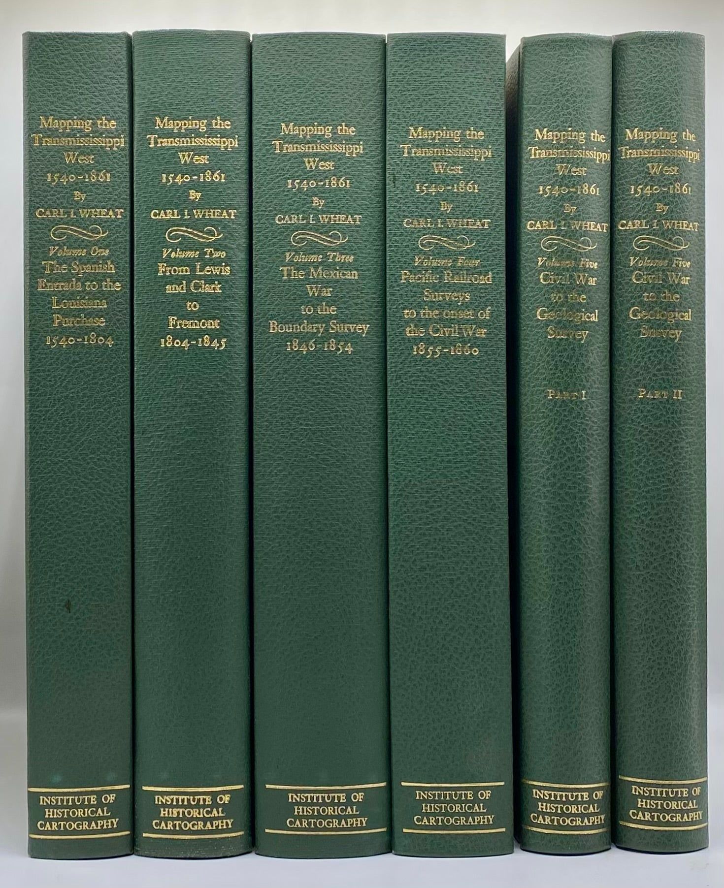
San Francisco: Institute of Historical Cartography, 1963. First Edition. 6 volume set. 264,281,349,260,222,223-487pp. Folios [37 cm] 1/4 green buckram over gray cloth with the titles gilt stamped on the backstrips. Near fine. Complete with all fold-out maps.
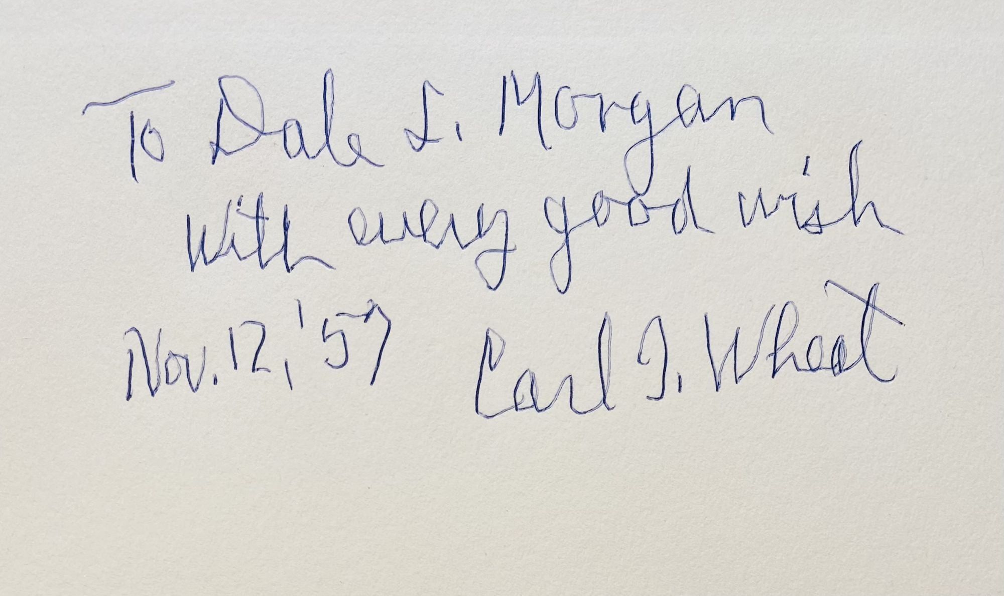
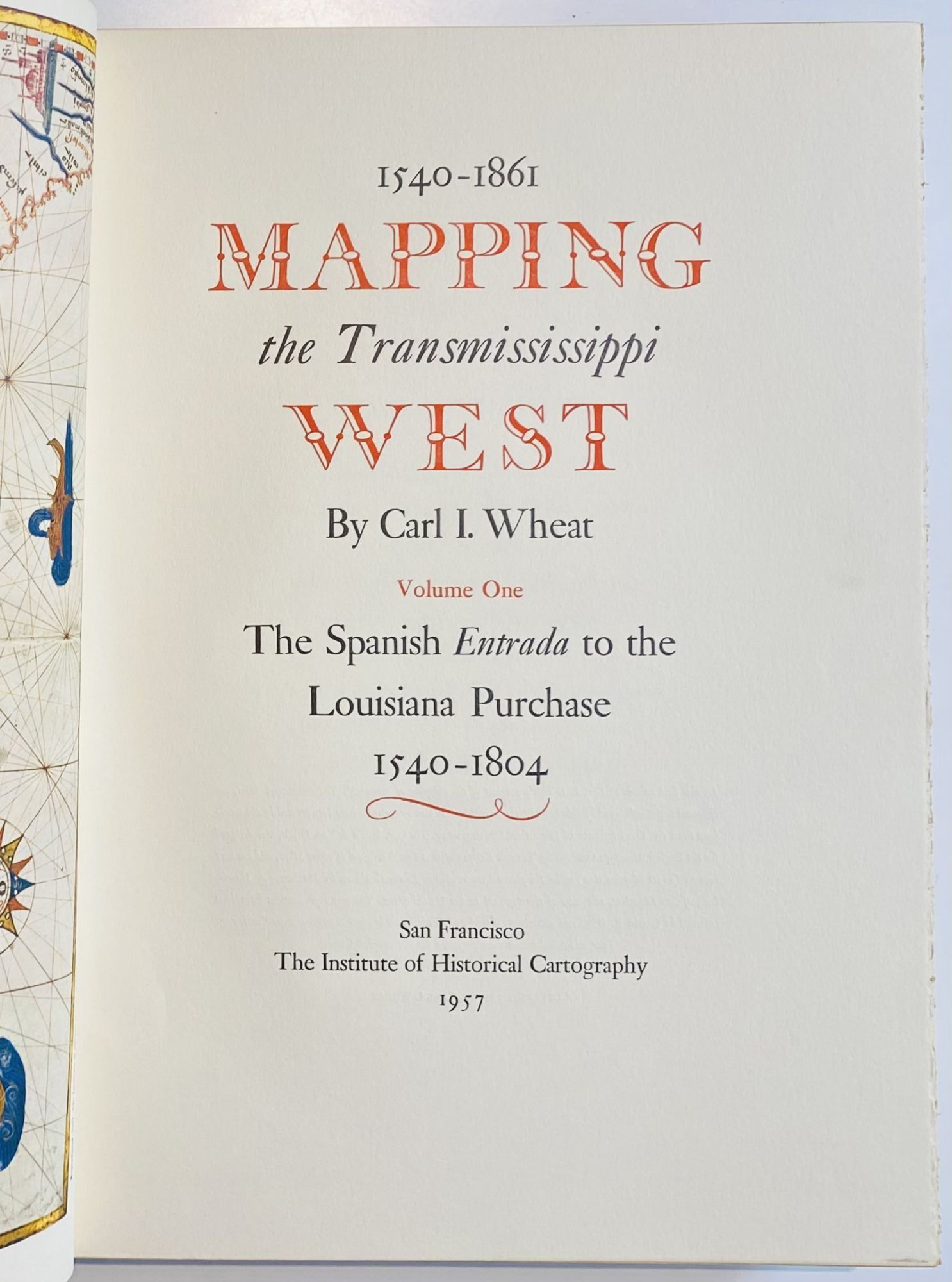
Exlibris Dale Morgan. Inscribed by Wheat to Morgan on the front free endsheet of Volume 1: "To Dale L. Morgan, with every good wish Nov. 12, 1957 Carl I. Wheat." Excellent association copy. Volume 1: The Spanish Entrada to the Louisiana Purchase, 1540-1804. - Volume 2: From Lewis and Clark to Fremont, 1804-1845. - Volume 3: From the Mexican War to the Boundary Surveys, 1846-1854. - Volume 4: From the Pacific Railroad Surveys to the Onset of the Civi War, 1855-1860. - Volume 5: From the Civil to the Geological Survey. This five volume work describes the maps of Western America from the earliest cartographic conjectures to Spanish explorations of the fifteenth century, through early exploration and overland travel up to the beginnings of the great surveys and the Civil War. Morgan's contribution to this classic work was greater than is generally recognized. From the forewords to the individual volumes it seems that Morgan functioned as an unofficial editor and research fellow. Wheat gratefully acknowledged his liberal contributions of information, footnotes, and editorial work. Of the text itself, chapter 36 on Mormon maps in the fourth volume, and all of volume five (two books) was Morgan's work. Additionally, because Wheat was victimized by several strokes, about one-half of the second volume and ninety percent of the third is apocryphally attributed to Morgan's authorship, though he claimed only the complete volume five on his own bibliography in the Morgan Papers. Saunders 29.
Exlibris Dale Morgan. Inscribed by Wheat to Morgan on the front free endsheet of Volume 1: "To Dale L. Morgan, with every good wish Nov. 12, 1957 Carl I. Wheat." Excellent association copy. Volume 1: The Spanish Entrada to the Louisiana Purchase, 1540-1804. - Volume 2: From Lewis and Clark to Fremont, 1804-1845. - Volume 3: From the Mexican War to the Boundary Surveys, 1846-1854. - Volume 4: From the Pacific Railroad Surveys to the Onset of the Civi War, 1855-1860. - Volume 5: From the Civil to the Geological Survey. This five volume work describes the maps of Western America from the earliest cartographic conjectures to Spanish explorations of the fifteenth century, through early exploration and overland travel up to the beginnings of the great surveys and the Civil War. Morgan's contribution to this classic work was greater than is generally recognized. From the forewords to the individual volumes it seems that Morgan functioned as an unofficial editor and research fellow. Wheat gratefully acknowledged his liberal contributions of information, footnotes, and editorial work. Of the text itself, chapter 36 on Mormon maps in the fourth volume, and all of volume five (two books) was Morgan's work. Additionally, because Wheat was victimized by several strokes, about one-half of the second volume and ninety percent of the third is apocryphally attributed to Morgan's authorship, though he claimed only the complete volume five on his own bibliography in the Morgan Papers. Saunders 29.
Details
Title
Mapping the Transmississippi West, 1540-1861
Author
Wheat, Carl I. [Dale L. Morgan]
Condition
Unknown
Publisher
Institute of Historical Cartography: San Francisco
Date
1963
Edition
First Edition