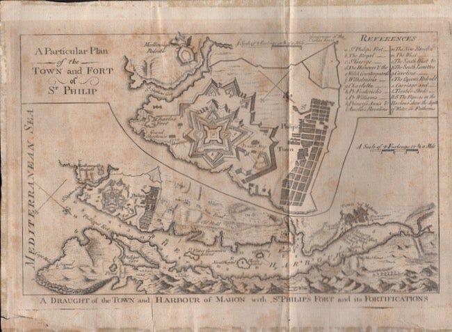
A Draught of the Town and Harbour of Mahon with St. Philip's Fort and its Fortifications
- Map
- [Britain]: n.p., 1756
[Britain]: n.p., 1756. Map. Fair. Approx. 11" x 8" map. Vertical crease. Light foning to the paper. Edges on the verso have a thin paper reinforcement. Bottom left corner tear. Fair condition.
From the British Museum: Map of the town and harbour of Mahon, with a larger scale plan of the town and fort of St. Philip inset above. Etching and engraving dated 1756. No publisher information. Subject term: Naval Engagements. Places include Europe, Spain, Balearic Islands, Menorca, Mahón.
From the British Museum: Map of the town and harbour of Mahon, with a larger scale plan of the town and fort of St. Philip inset above. Etching and engraving dated 1756. No publisher information. Subject term: Naval Engagements. Places include Europe, Spain, Balearic Islands, Menorca, Mahón.
Details
Title
A Draught of the Town and Harbour of Mahon with St. Philip's Fort and its Fortifications
Author
[Spain] Mahon] [St. Philip's Fort] [Military and War]
Binding
Map
Condition
Good
Publisher
n.p.: [Britain]
Date
1756