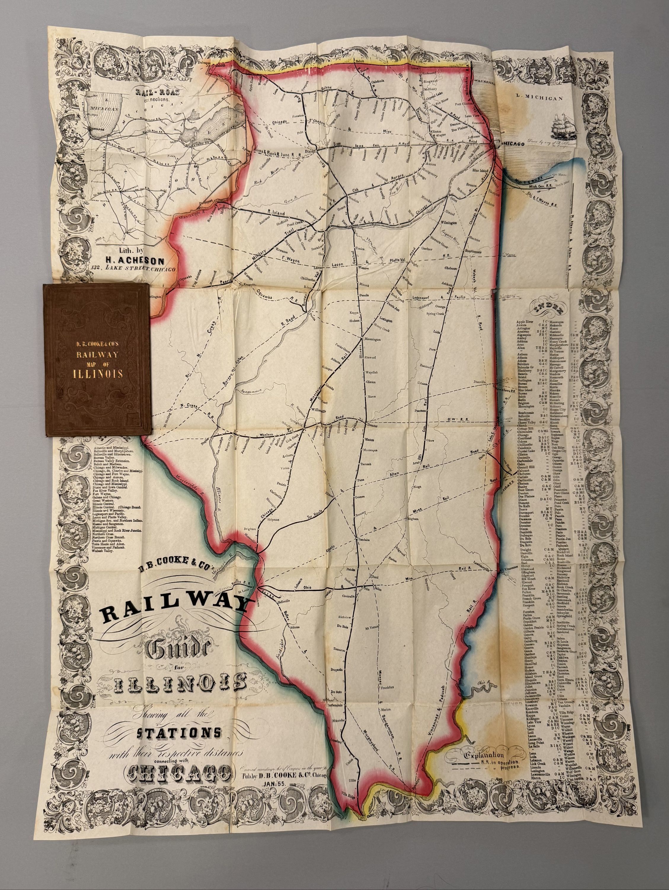
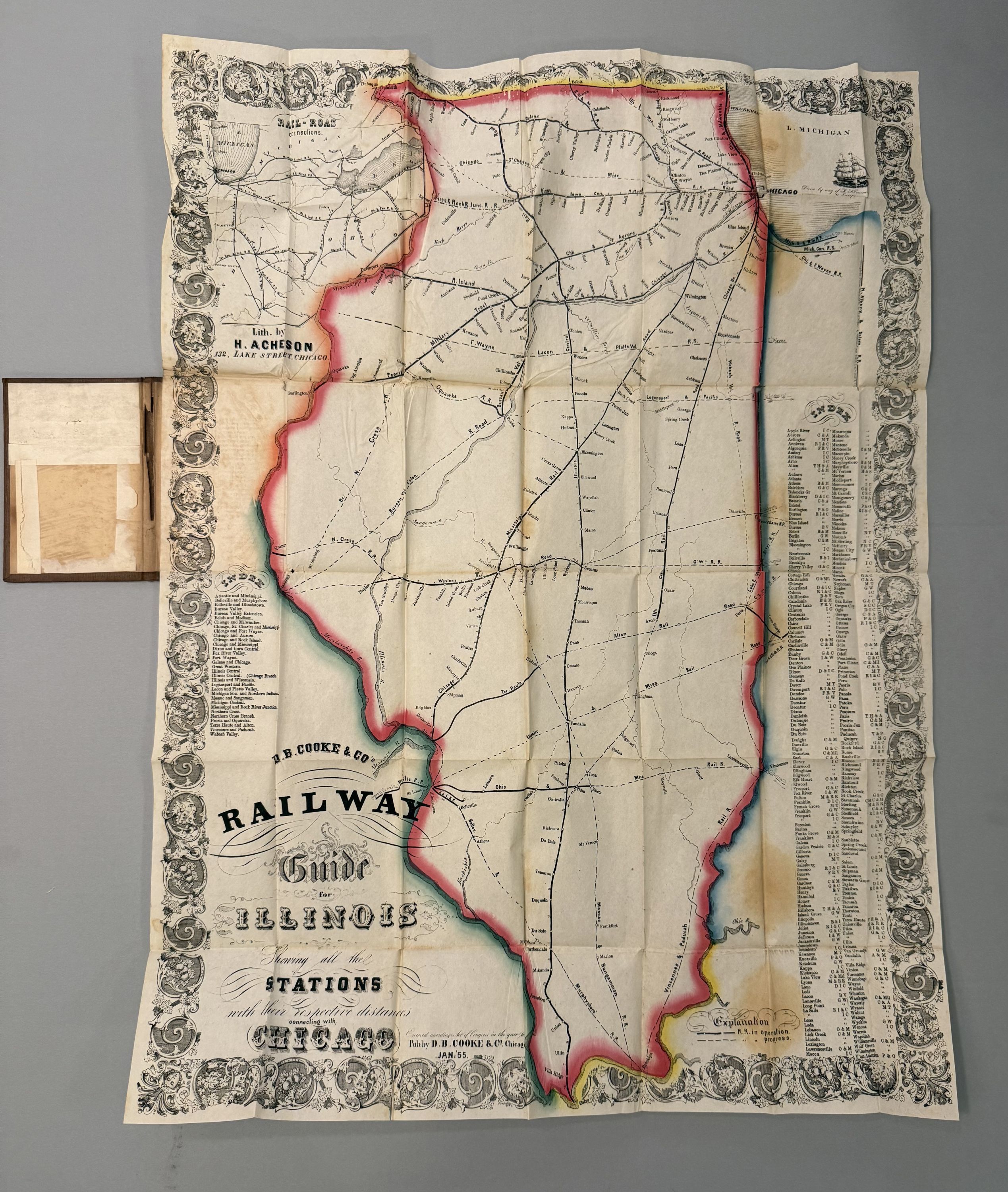
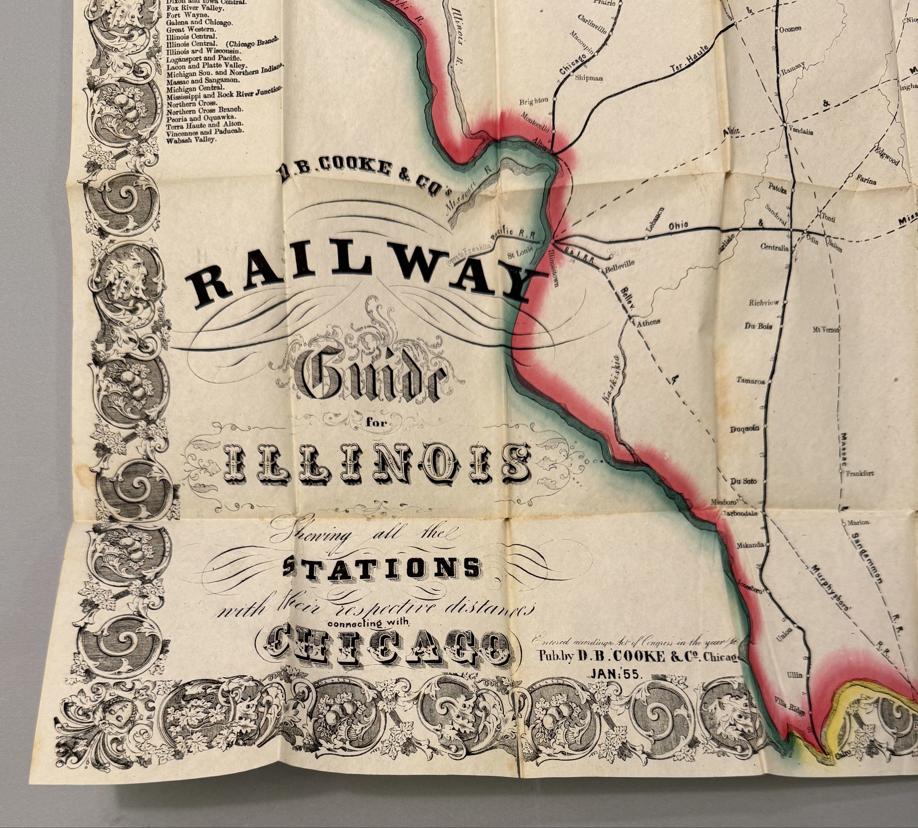
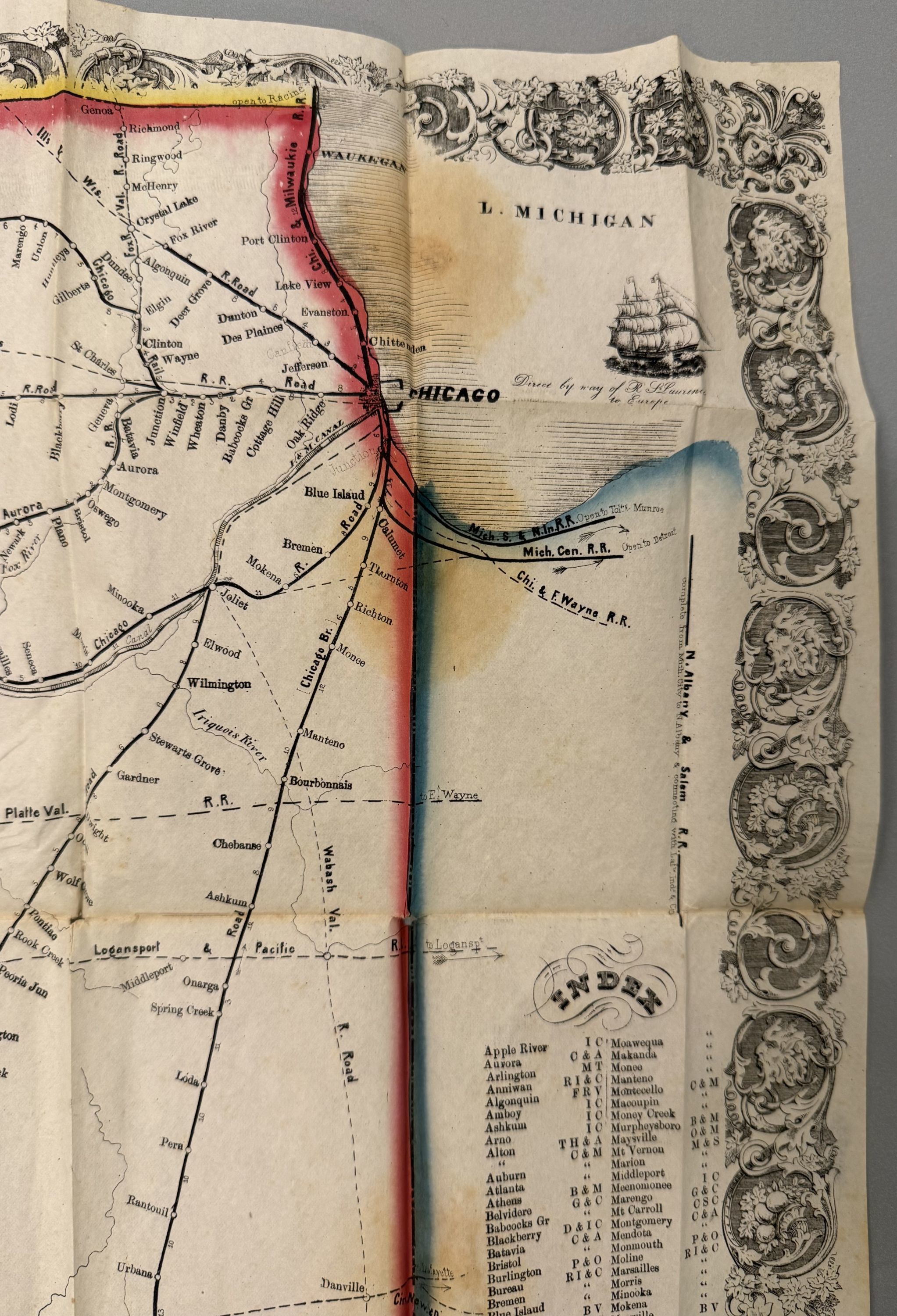
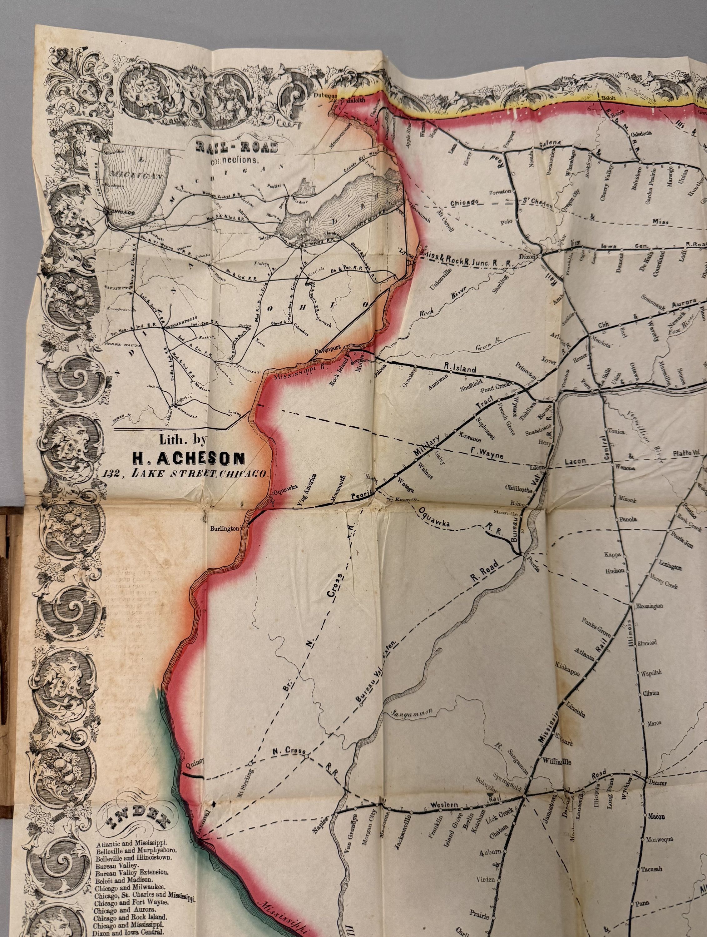
Railway Guide for Illinois. Shewing all the Stations with their Respective Distances Connecting with Chicago
- Chicago: D. B. Cooke, 1855
Chicago: D. B. Cooke, 1855. Map. Hand painted lithograph. 27 3/4 x 21", stains and foxing but otherwise in good condition. Folding into publisher's 12mo format gilt and blind stamped brown cloth case. Chicago: H. Acheson, 1855.
Large pocket map of Illinois showing Railroad lines in operation and those in progress. A corresponding steam engine index and table included with towns and railroads listed. David B. Cooke & Company began in Chicago with a store containing school, law, and medical books and stationery as well as maps. This map is a good example of his work
Large pocket map of Illinois showing Railroad lines in operation and those in progress. A corresponding steam engine index and table included with towns and railroads listed. David B. Cooke & Company began in Chicago with a store containing school, law, and medical books and stationery as well as maps. This map is a good example of his work
Details
Title
Railway Guide for Illinois. Shewing all the Stations with their Respective Distances Connecting with Chicago
Author
ACHESON, Henry
Condition
Unknown
Publisher
D. B. Cooke: Chicago
Date
1855