Map No. 10. United States [Oregon, California, Utah, New Mexico, Nebraska]
- Map
- New York
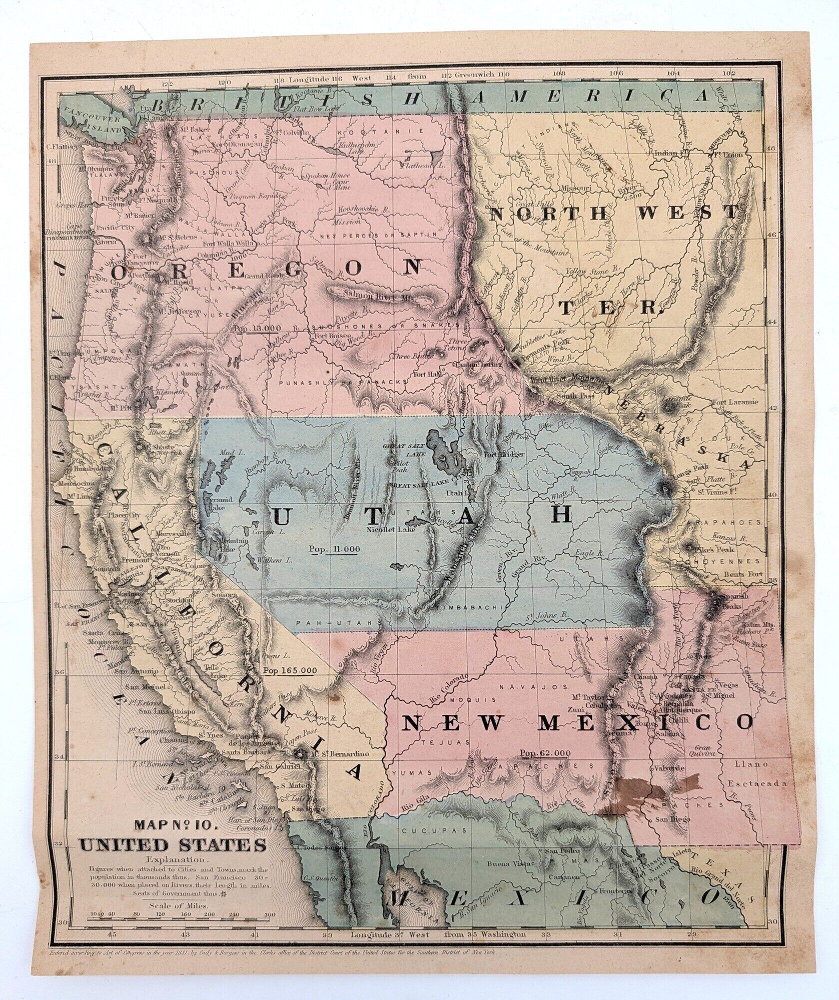
New York. Map. Very Good. Hand-colored map [9 1/4" x 11 1/8"]. Small ink stain in lower right corner. Lightly foxed. Contemporary notation on the reverse. Page from an atlas. Entered according to Act of Congress in the year 1851, by Cady & Burgess in the Clerks office of the District Court of the United States for the Southern District of New York.
Shows the newly formed Territory of Utah right in the center. Fort Bridger lies in the Territory of Utah.
Shows the newly formed Territory of Utah right in the center. Fort Bridger lies in the Territory of Utah.
Details
Title
Map No. 10. United States [Oregon, California, Utah, New Mexico, Nebraska]
Binding
Map
Condition
Very Good
Publisher
New York