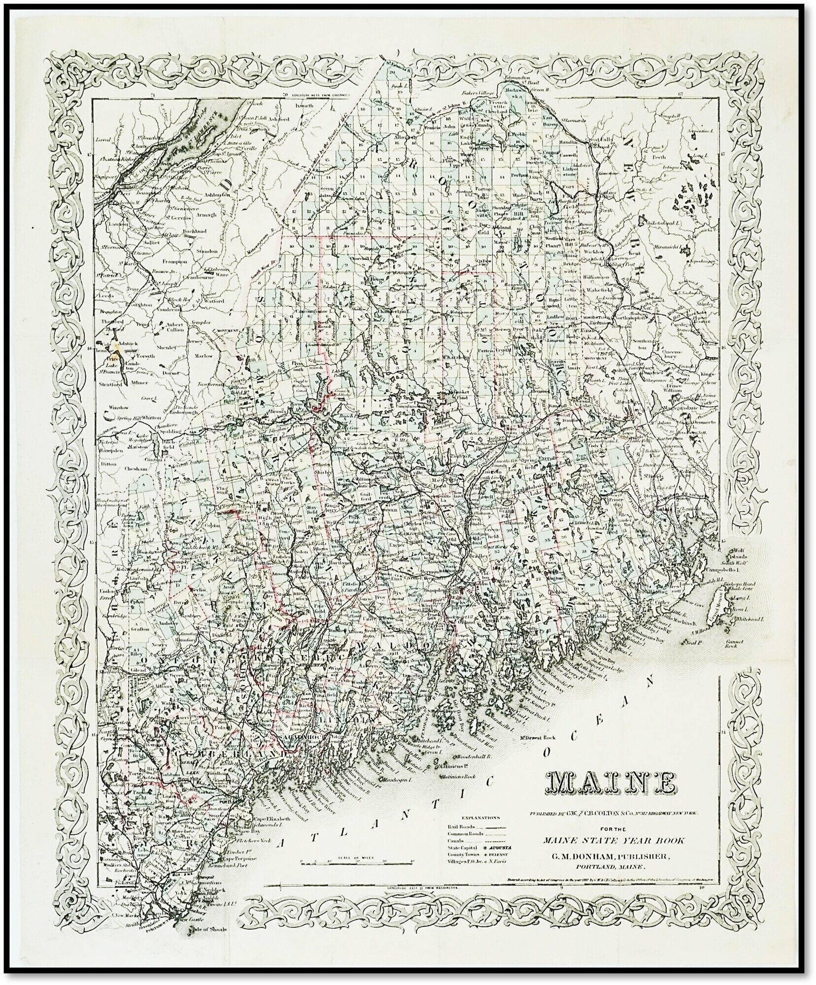
'Maine' [1887 G.W. & C.B. Colton Map - Railroad & Canal Infrastructure]
- New York: G.W. & C.B. Colton & Co., 1887
New York: G.W. & C.B. Colton & Co., 1887. Very Good.
A highly detailed late-19th-century cartographic survey of Maine, published specifically for the Maine State Year Book.
This map captures the state's complex coastal topography and rapidly expanding interior transportation networks during the height of the Victorian industrial era.
KEY FEATURES
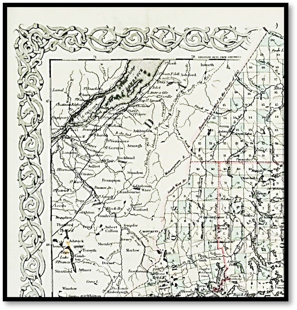
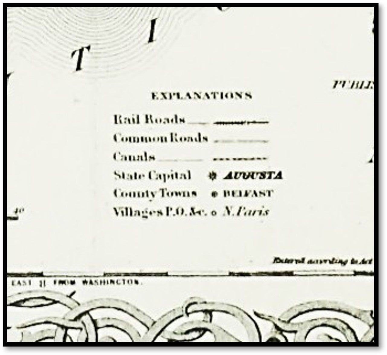
+++ Visuals: Hand-colored in pastel washes to delineate county boundaries; features an elaborate, stylized interlocking vine border characteristic of the Colton studio.
+++ Binding: Originally issued as a folding map (as evidenced by standard folds); now flat.
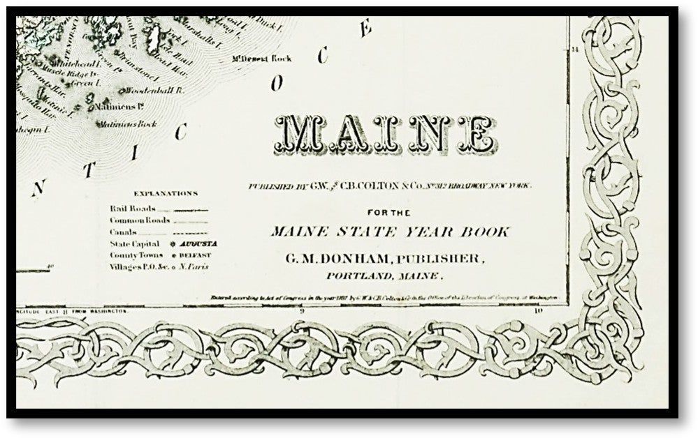
+++ Content: Includes a detailed 'Explanations' key identifying Railroads, Common Roads, Canals, County Towns, and Post Offices.
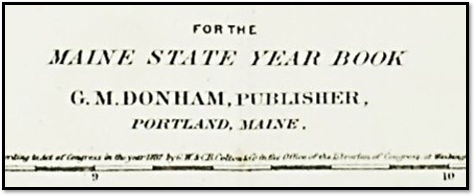
+++ Associated Names: Published by the prestigious firm of G.W. & C.B. Colton at 312 Broadway, New York, for G.M. Donham of Portland.
+++ Rarity: Uncommon in this crisp, hand-colored state; these maps were typically used heavily as reference tools in State Year Books and often survived with significant tanning or losses. +++ Imprint: Entered according to Act of Congress in the year 1887 by G.W. & C.B. Colton & Co.
+++ Specs: 17 x 14 inches.
CONDITION Very Good -- Standard folds as issued; minor edge wear and light creasing. Hand-coloring remains vivid and the paper is remarkably bright for a Victorian-era municipal map. HISTORICAL SIGNIFICANCE --
The Colton family defined American cartography for over 60 years. By 1887, their maps had moved beyond mere exploration into the realm of precise commercial and political tools. This specific map, produced for the Maine State Year Book, was the 'GPS' of its day for legislators, merchants, and industrialists navigating the Pine Tree State.
It documents a pivotal moment in New England history where the 'Common Roads' were being superseded by the "Rail Roads" and 'Canals' that funneled timber and textiles to the Atlantic ports. For the New England collector, it is a primary document of the state's transition into the modern industrial age.
SUBJECTS: Maine History, Cartography, Railroad History, G.W. & C.B. Colton, 19th Century Infrastructure, New England Geography, Portland Maine, Map, Engraving, Ephemera, Americana.
BIBLIOGRAPHIC REFERENCE: Cf. Thompson, 'Maps of Maine' (for Colton iterations); Phillips, 'Maps of America'.
A highly detailed late-19th-century cartographic survey of Maine, published specifically for the Maine State Year Book.
This map captures the state's complex coastal topography and rapidly expanding interior transportation networks during the height of the Victorian industrial era.
KEY FEATURES
+++ Visuals: Hand-colored in pastel washes to delineate county boundaries; features an elaborate, stylized interlocking vine border characteristic of the Colton studio.
+++ Binding: Originally issued as a folding map (as evidenced by standard folds); now flat.
+++ Content: Includes a detailed 'Explanations' key identifying Railroads, Common Roads, Canals, County Towns, and Post Offices.
+++ Associated Names: Published by the prestigious firm of G.W. & C.B. Colton at 312 Broadway, New York, for G.M. Donham of Portland.
+++ Rarity: Uncommon in this crisp, hand-colored state; these maps were typically used heavily as reference tools in State Year Books and often survived with significant tanning or losses. +++ Imprint: Entered according to Act of Congress in the year 1887 by G.W. & C.B. Colton & Co.
+++ Specs: 17 x 14 inches.
CONDITION Very Good -- Standard folds as issued; minor edge wear and light creasing. Hand-coloring remains vivid and the paper is remarkably bright for a Victorian-era municipal map. HISTORICAL SIGNIFICANCE --
The Colton family defined American cartography for over 60 years. By 1887, their maps had moved beyond mere exploration into the realm of precise commercial and political tools. This specific map, produced for the Maine State Year Book, was the 'GPS' of its day for legislators, merchants, and industrialists navigating the Pine Tree State.
It documents a pivotal moment in New England history where the 'Common Roads' were being superseded by the "Rail Roads" and 'Canals' that funneled timber and textiles to the Atlantic ports. For the New England collector, it is a primary document of the state's transition into the modern industrial age.
SUBJECTS: Maine History, Cartography, Railroad History, G.W. & C.B. Colton, 19th Century Infrastructure, New England Geography, Portland Maine, Map, Engraving, Ephemera, Americana.
BIBLIOGRAPHIC REFERENCE: Cf. Thompson, 'Maps of Maine' (for Colton iterations); Phillips, 'Maps of America'.
Details
Title
'Maine' [1887 G.W. & C.B. Colton Map - Railroad & Canal Infrastructure]
Author
Colton, G.W. & C.B. (Publishers)
Condition
Very Good
Publisher
G.W. & C.B. Colton & Co.: New York
Date
1887