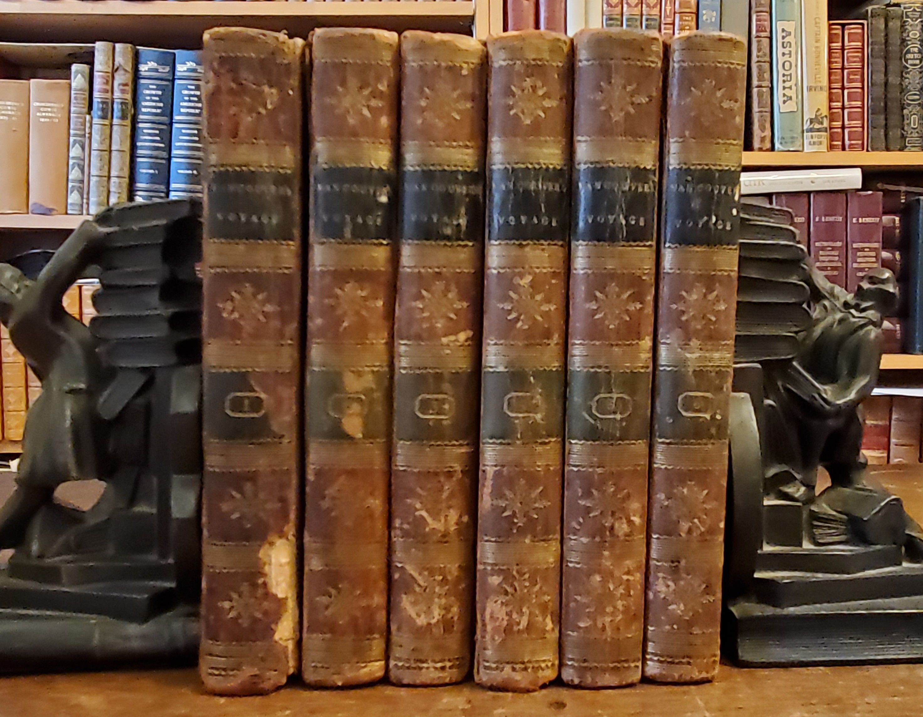
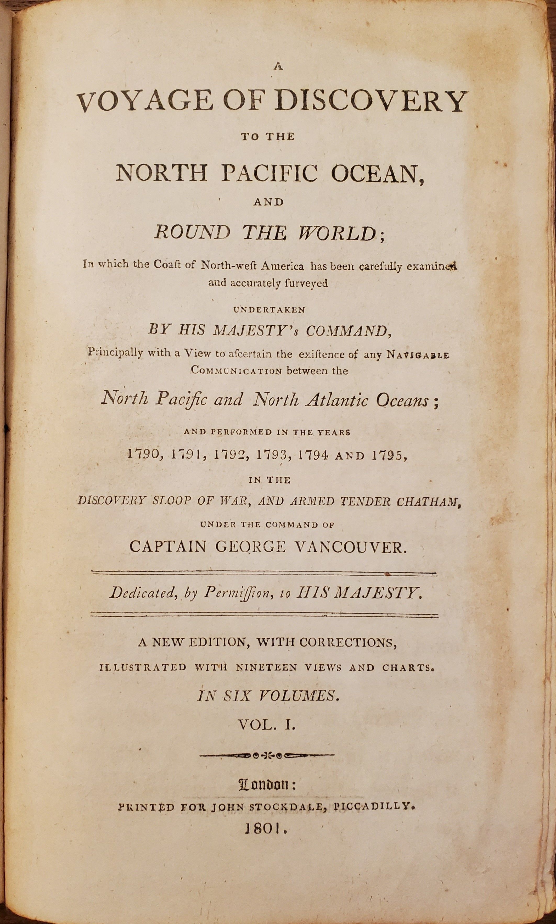
A Voyage of Discovery to the North Pacific Ocean, and Round the World; In which the Coast of North-west America has been carefully examined and accurately surveyed. Undertaken by his Maesty’s Command, Principally with a View to ascertain the existence of any Navigable Communications between the North Pacific and North Atlantic Oceans; and Performed in the Years 1790, 1791, 1792, 1793, 1794 and 1795, in the Discovery Sloop of war, and Armed Tender Chatham, under the command of Captain George Vancouver… A New Edition, with Corrections, Illustrated with Nineteen Views and Charts, In Six Volumes. [Six Volumes].
- London: Printed for John Stockdale, 1801
One of the most important voyages ever made in the interests of geographical knowledge
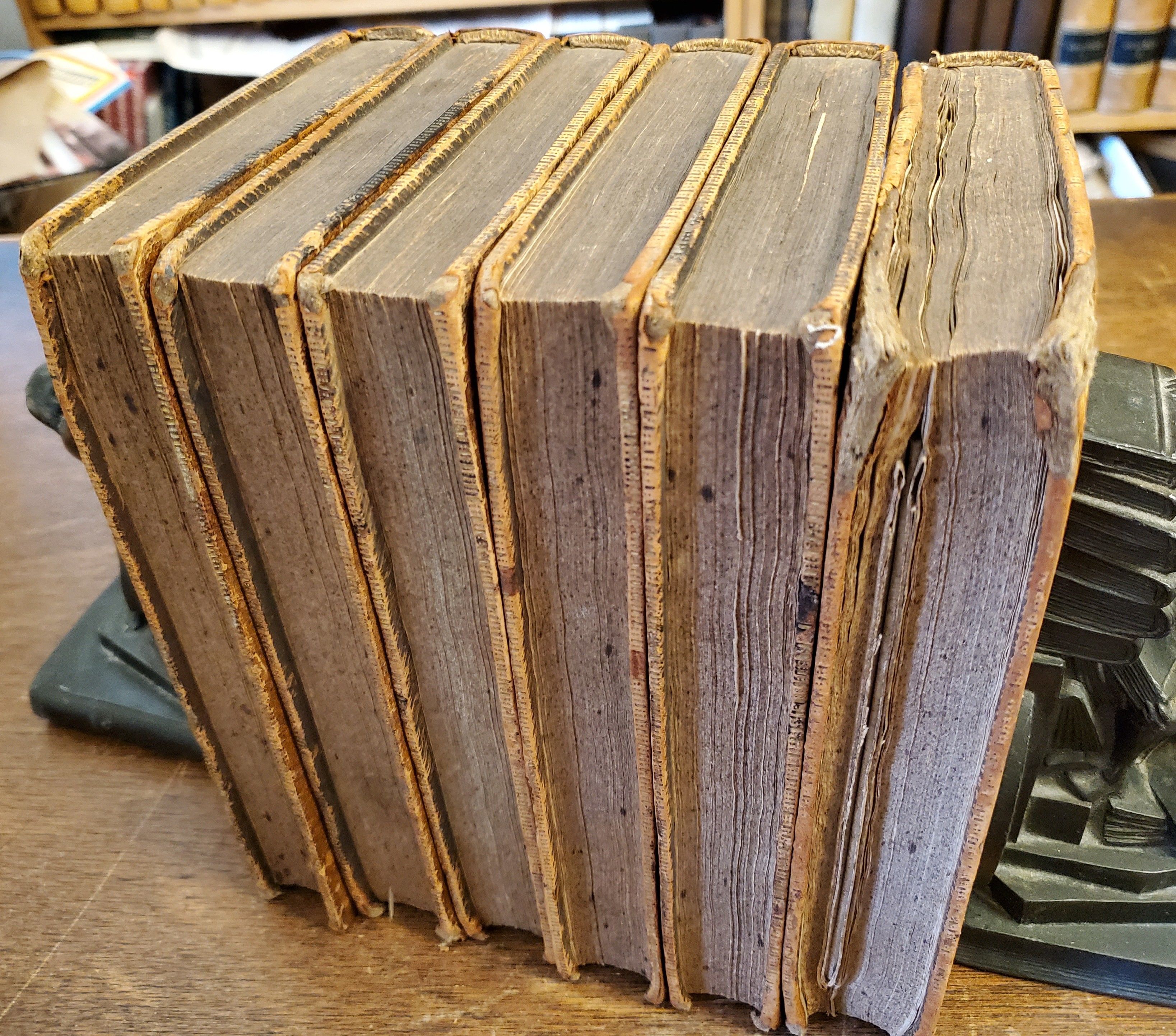
Six volumes. Octavo. 8½ x 5¾ inches. 410, [4] + [2], 418, [2] + [2], 435, [3] + [2], 417 [3], + [4], 454, [2] + [4], 412 [2]. Eighteen (of nineteen) engraved charts and views. Original leather boards with gilt rule and decoration on spine, black leather spine labels. General wear to each volume, particularly at corners and ends of spines, some hinges starting, some loss to spine of volume 1, last blank pastedown in volume 3 torn away, minor spotting to edges of textblock. Large folding map with two minor slits at folds, bound upside-down. Internally, bright and clean. Overall a very good set.
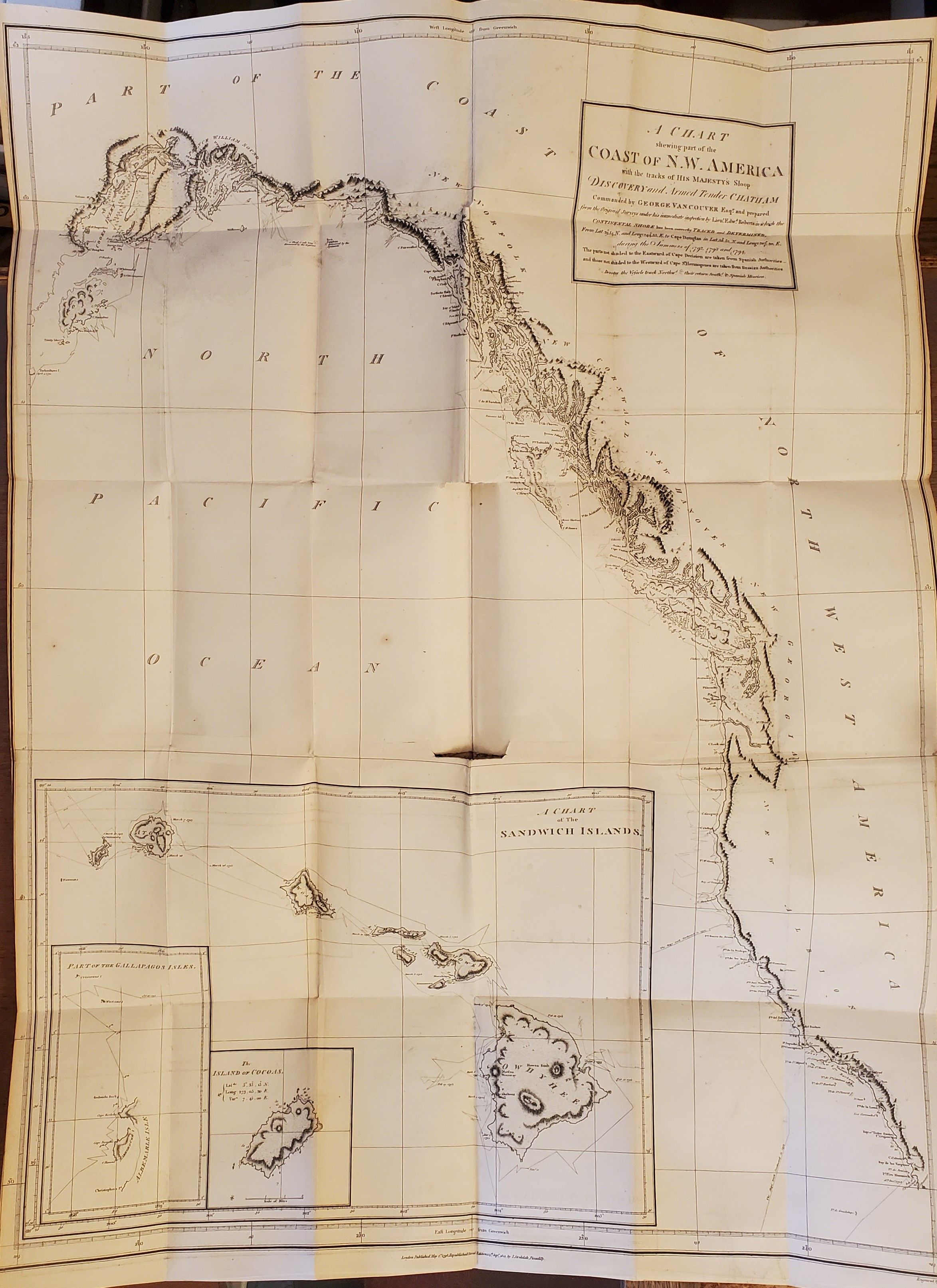
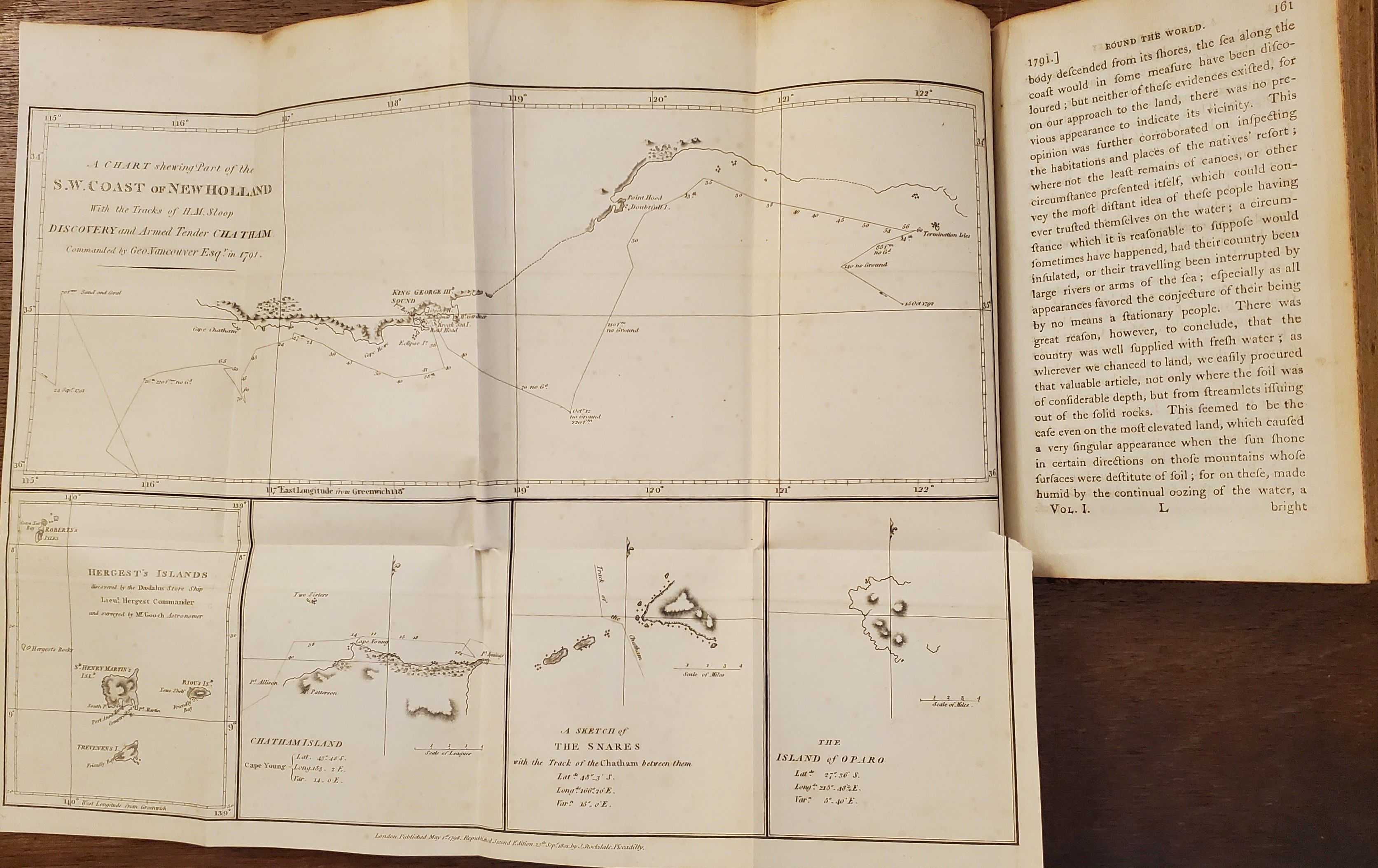
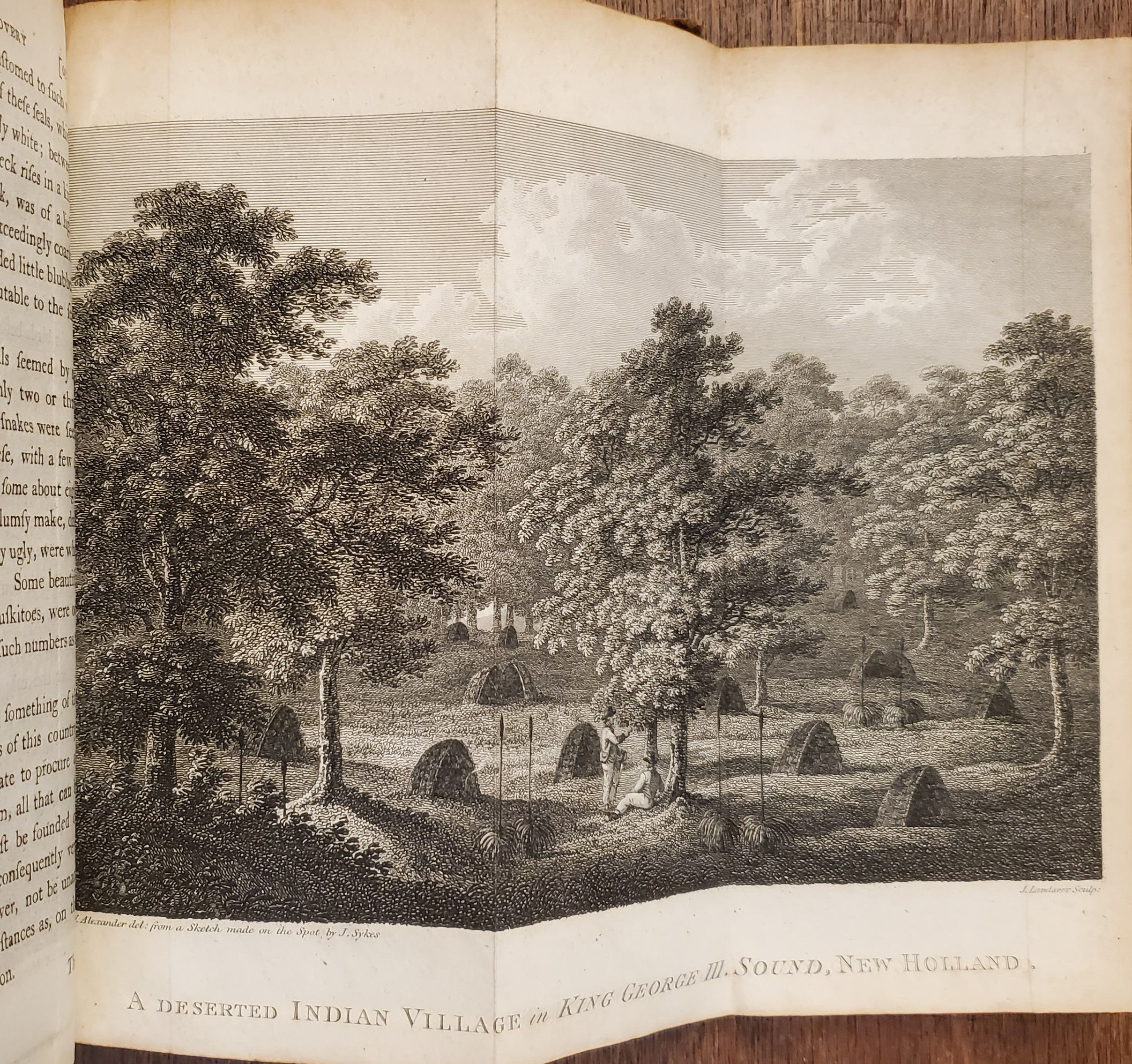
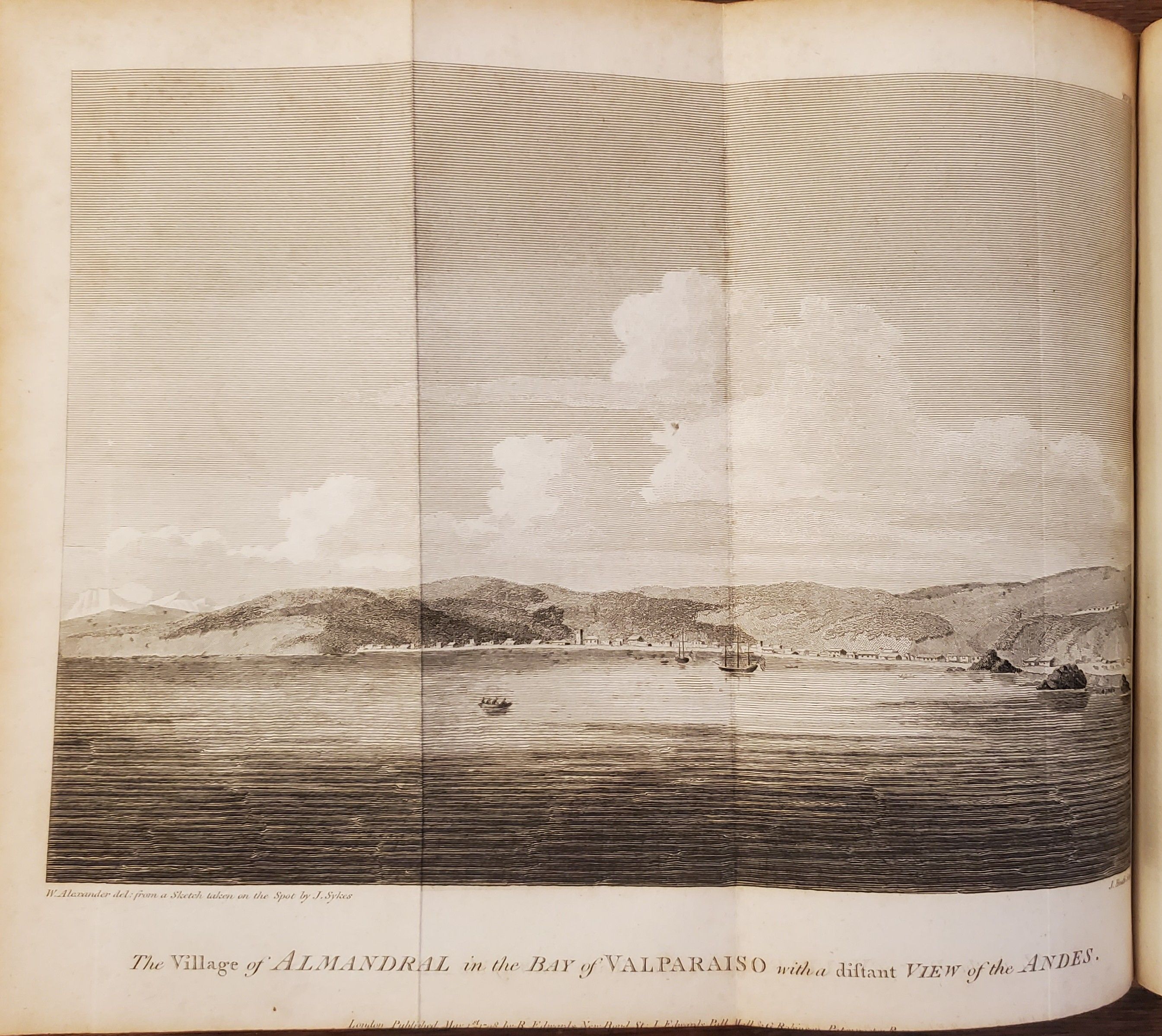
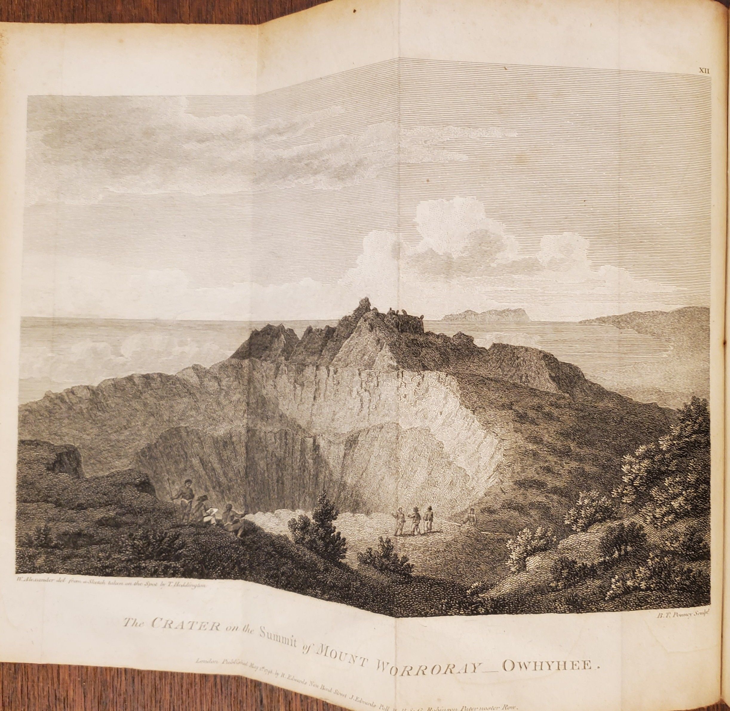
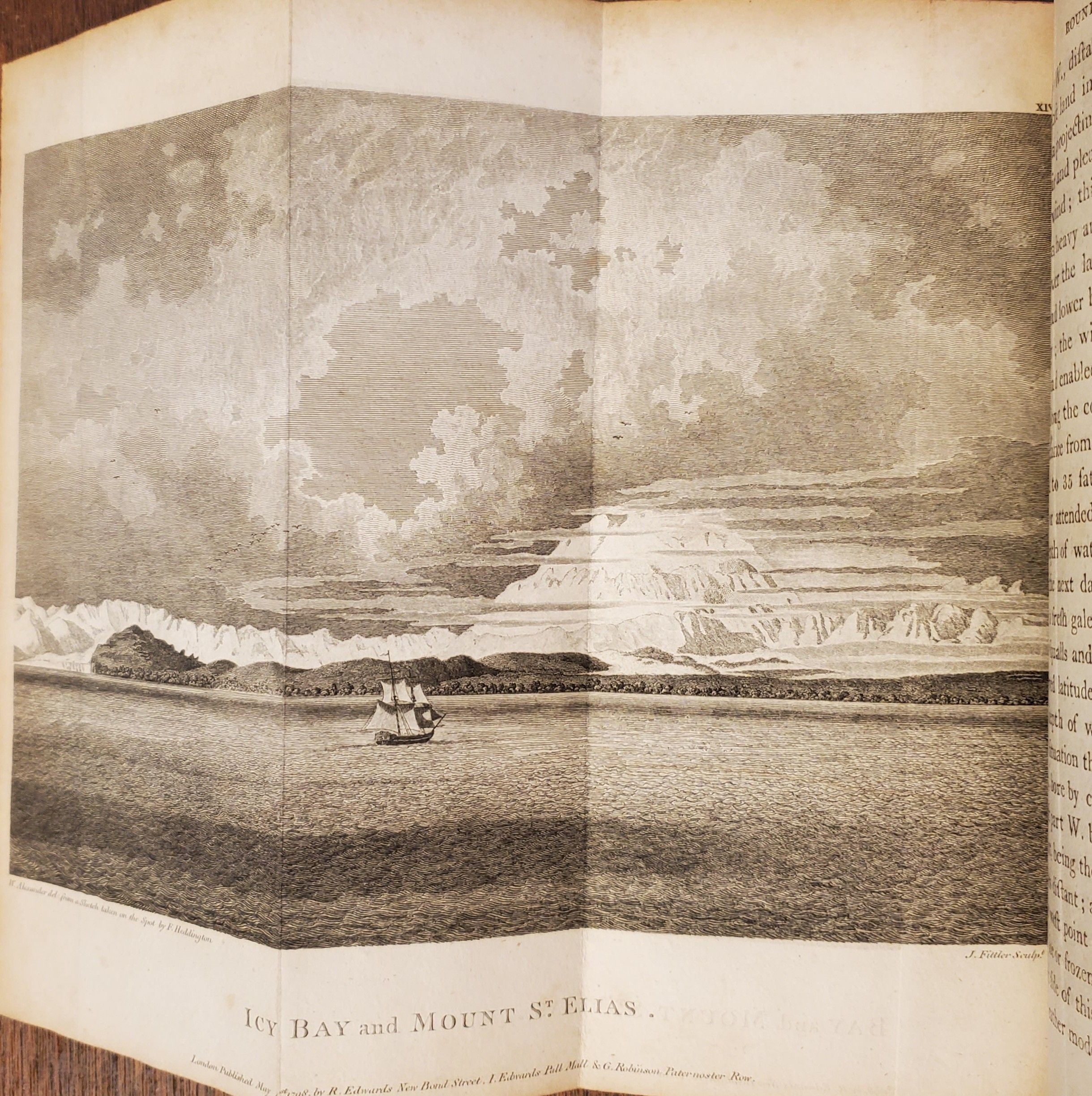
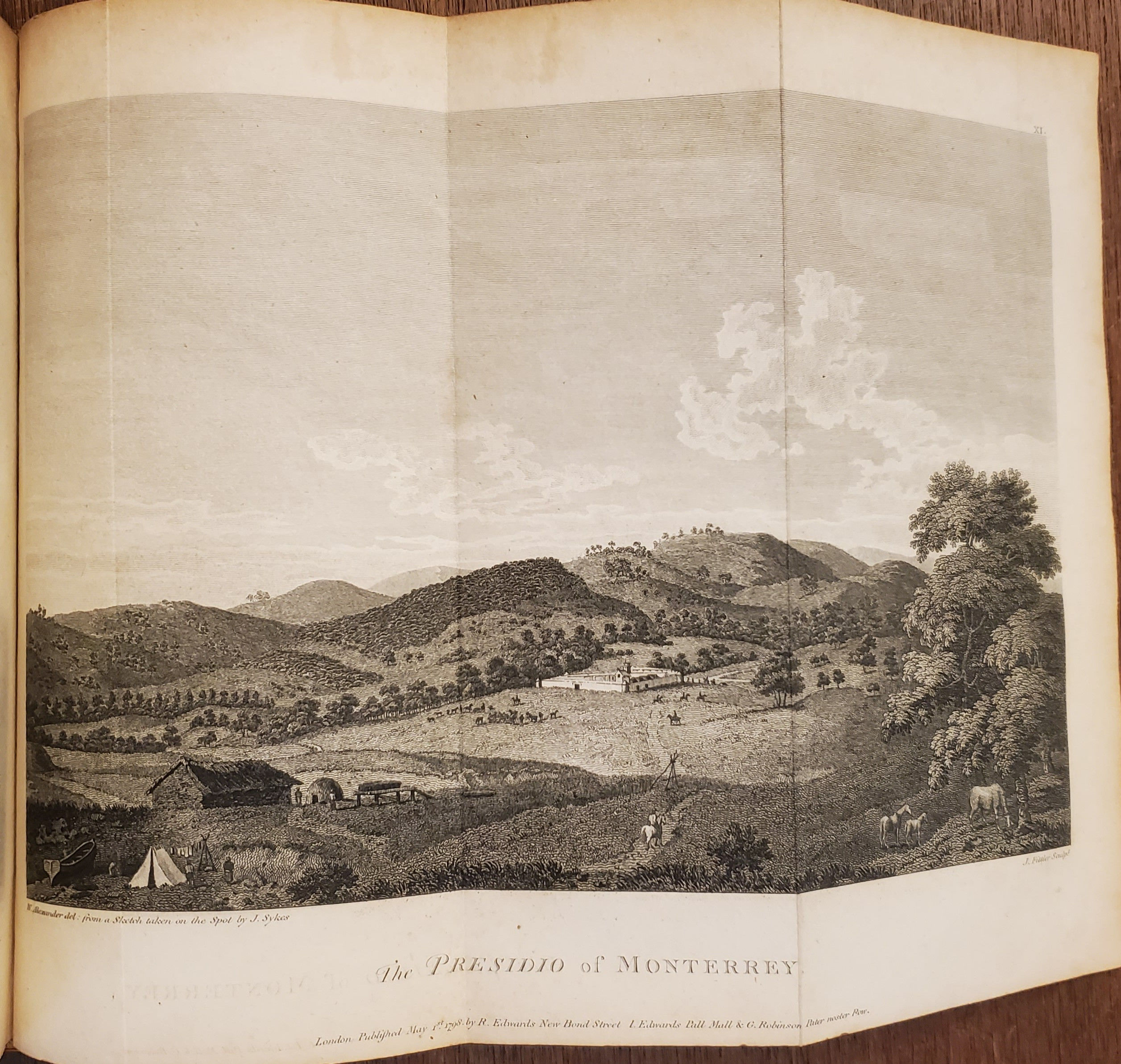
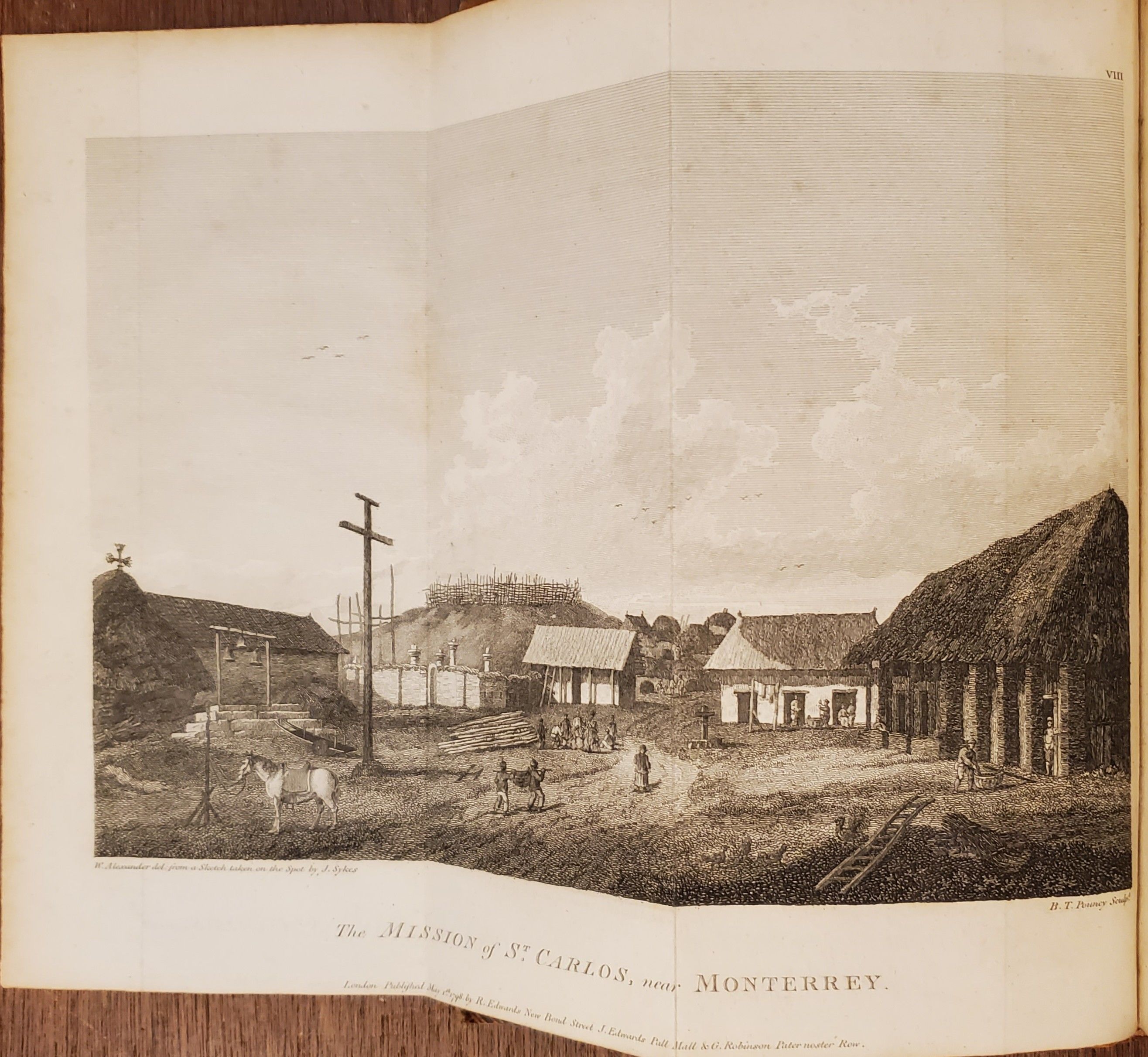
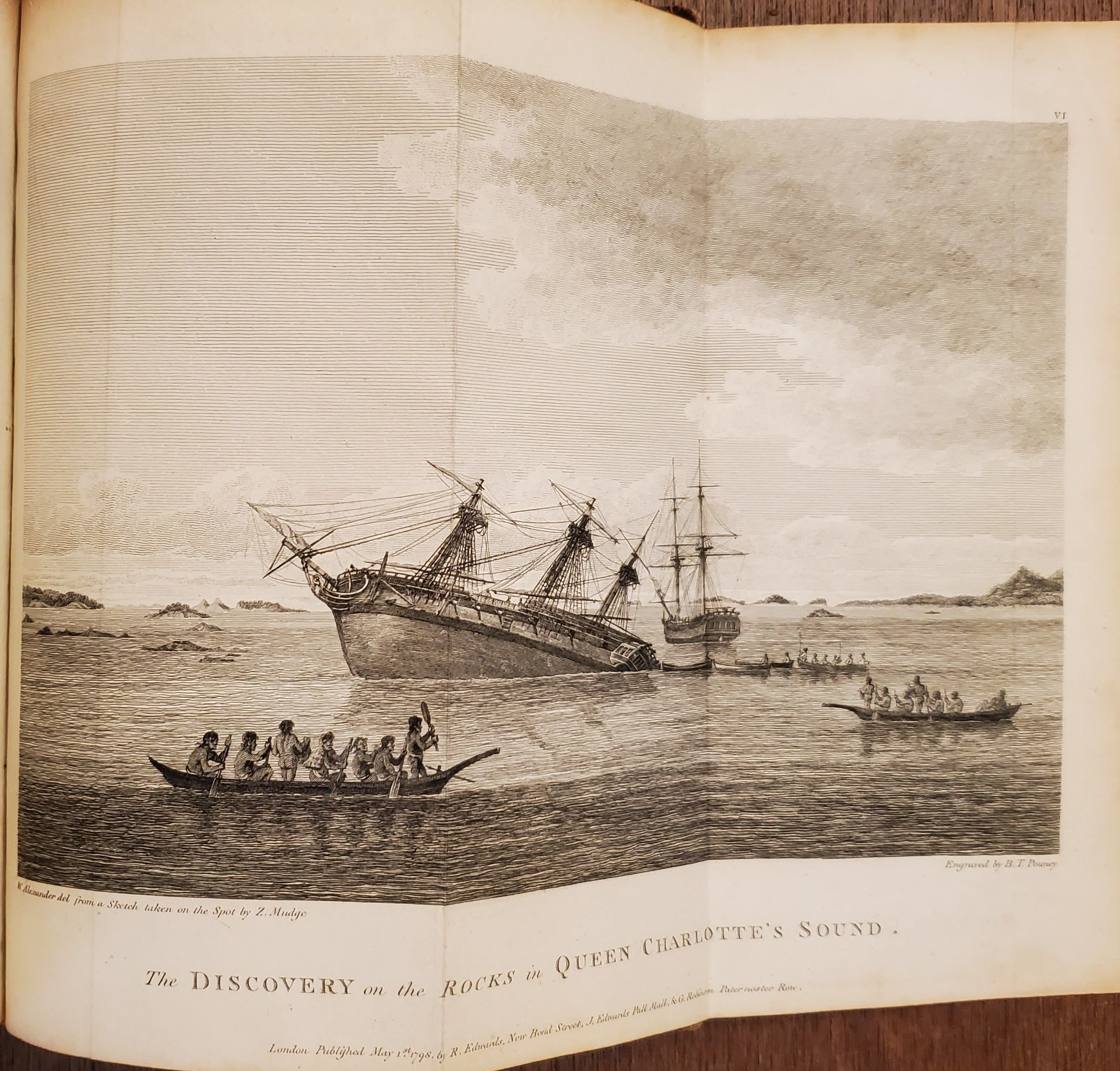
Second, revised, English edition. An important voyage exploring the northwest coast of America and producing the first accurate charts of the area. The views include the Mission of San Carlos and the Presidio of Monterey, most likely the first published views of California. Also included is the important folding map of New Albion showing the California coastline from San Francisco to San Diego. George Vancouver, who had served with Captain Cook's second and third voyages, was made commander of a grand-scale expedition to reclaim Britain's rights, resulting from the Nootka Convention, at Nootka Sound; to thoroughly examine the coast south of 60º in order to find a possible passage to the Atlantic; and to learn what establishments had been founded by other powers. This voyage became one of the most important ever made in the interests of geographical knowledge. Vancouver surveyed the northwest coast, visited San Francisco and Monterey, spent the winter in the Hawaiian Islands, returned to California and visited San Francisco (again), Cape Mendocino, Bodega Bay, and Monterey. He again visited the Sandwich Islands, took possession of Owhyhee and then returned again to the northwest coast and on to Monterey. From there he set sail for England by Cape Horn. Vancouver died during the preparation of the work, and the final editing was done by his brother, John. [Forbes: 335, Howes I: V-23; Howes II: V-23; Hill: 1754, Rocq: 17211, Sabin: 98444, Zamorano Eighty: 77, see also Cowen, p.655].
Details
Title
A Voyage of Discovery to the North Pacific Ocean, and Round the World; In which the Coast of North-west America has been carefully examined and accurately surveyed. Undertaken by his Maesty’s Command, Principally with a View to ascertain the existence of any Navigable Communications between the North Pacific and North Atlantic Oceans; and Performed in the Years 1790, 1791, 1792, 1793, 1794 and 1795, in the Discovery Sloop of war, and Armed Tender Chatham, under the command of Captain George Vancouver… A New Edition, with Corrections, Illustrated with Nineteen Views and Charts, In Six Volumes. [Six Volumes].
Author
VANCOUVER, George.
Condition
Unknown
Publisher
Printed for John Stockdale: London
Date
1801