Narrative of the United States Exploring Expedition. During the Years 1838, 1839, 1840, 1841, 1842… in Five Volumes with Thirteen Maps. [5 volumes].

- Philadelphia , 1849
THE FIRST U.S. EXPLORING EXPEDITION BY SEA
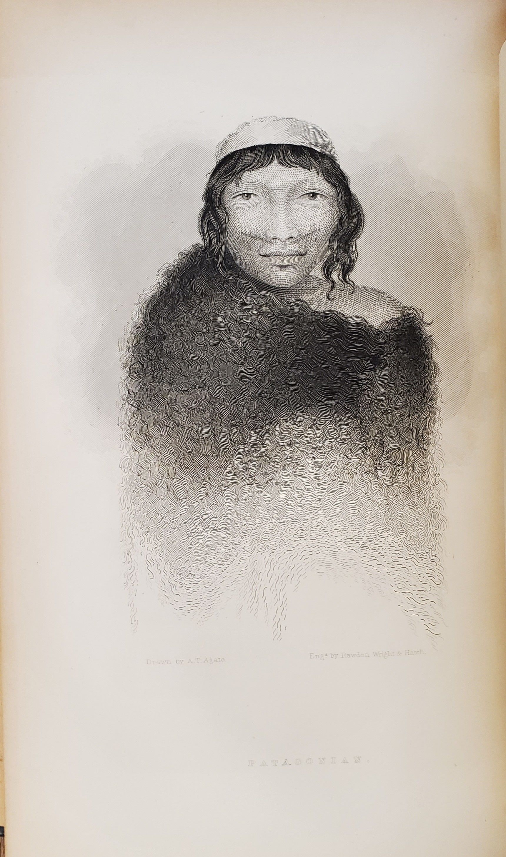
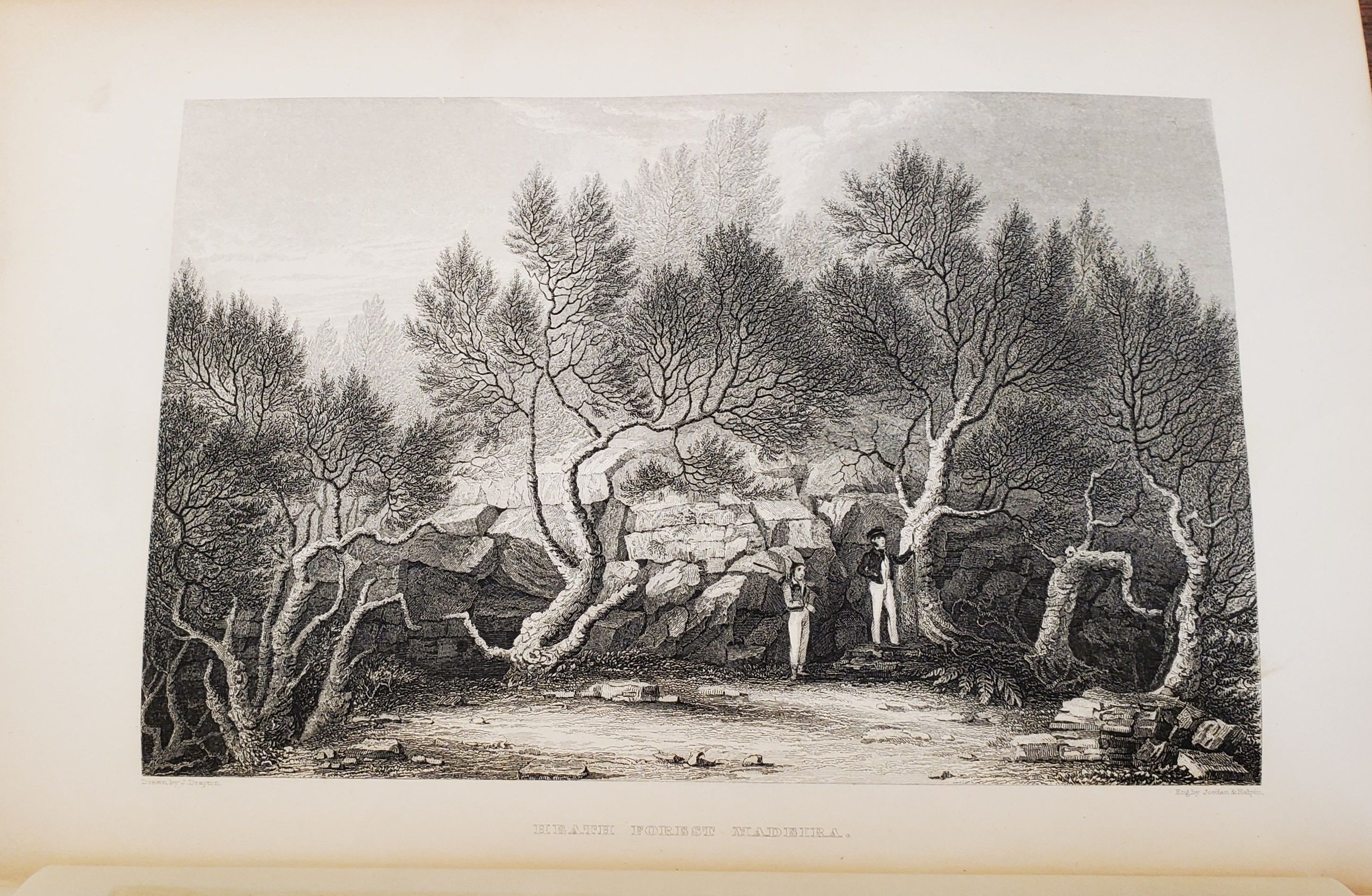
5 volumes. Large octavo. 10 x 6½ inches. lx, 434 + xv, [1], 476 + xv [1], 438 + xvi, 539 + xv, [1], 558pp. 64 fine engraved portraits and views, hundreds of woodcut text-illustrations throughout, 12 folding maps; 1 single-page map. Collated complete. Handsomely bound in new three-quarter navy blue leather over navy cloth, 5 raised bands and gilt on spines, with tan leather spine labels. Spines very slightly faded. Volume 1: one map torn at fold, but present. Volume 2: small tear to leaf 325-326, affecting a few words of text. Offsetting from plates, as usual. Overall, a very nice, fine set with the plates and maps bright and clean and with no foxing.
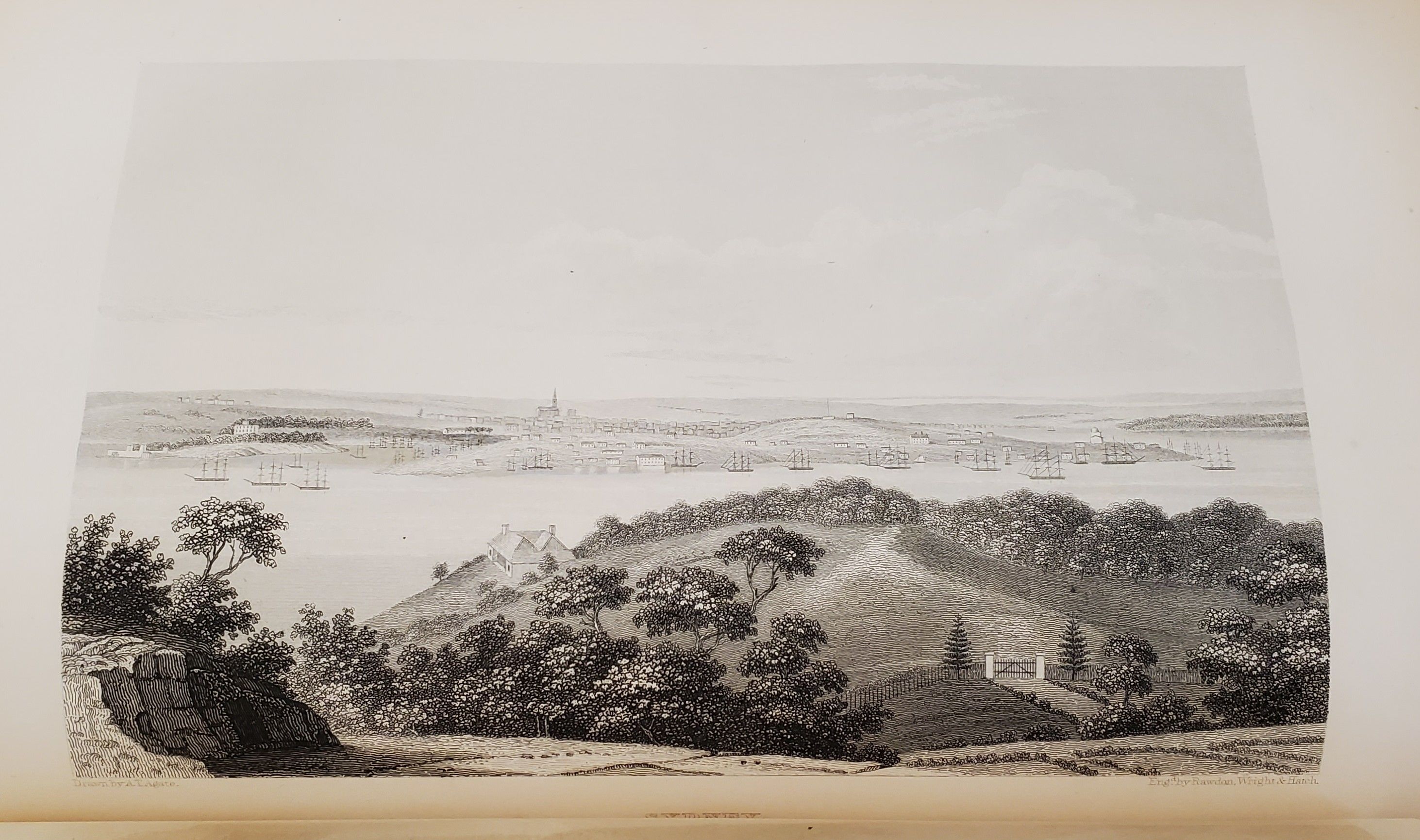
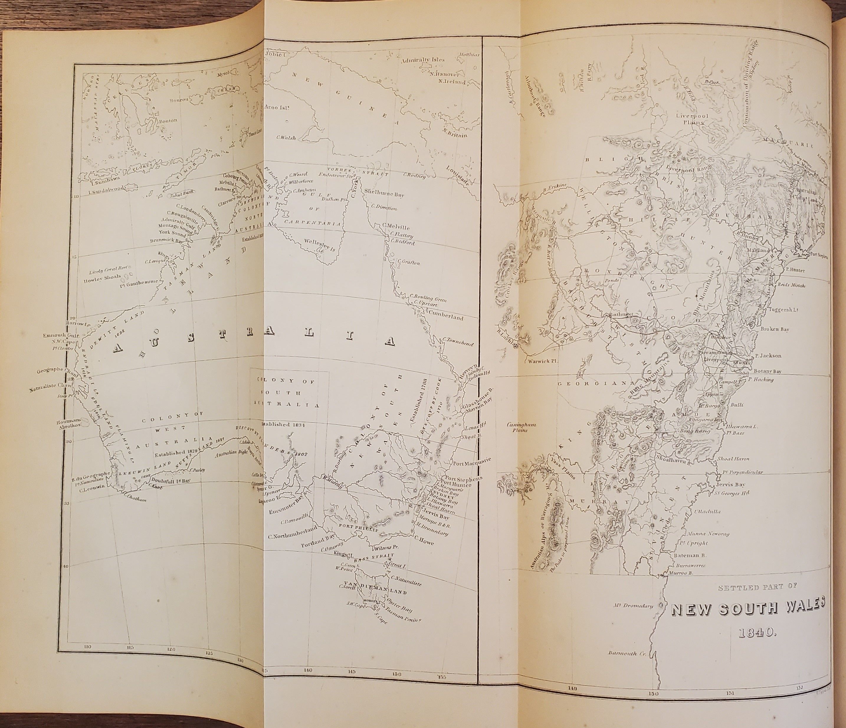
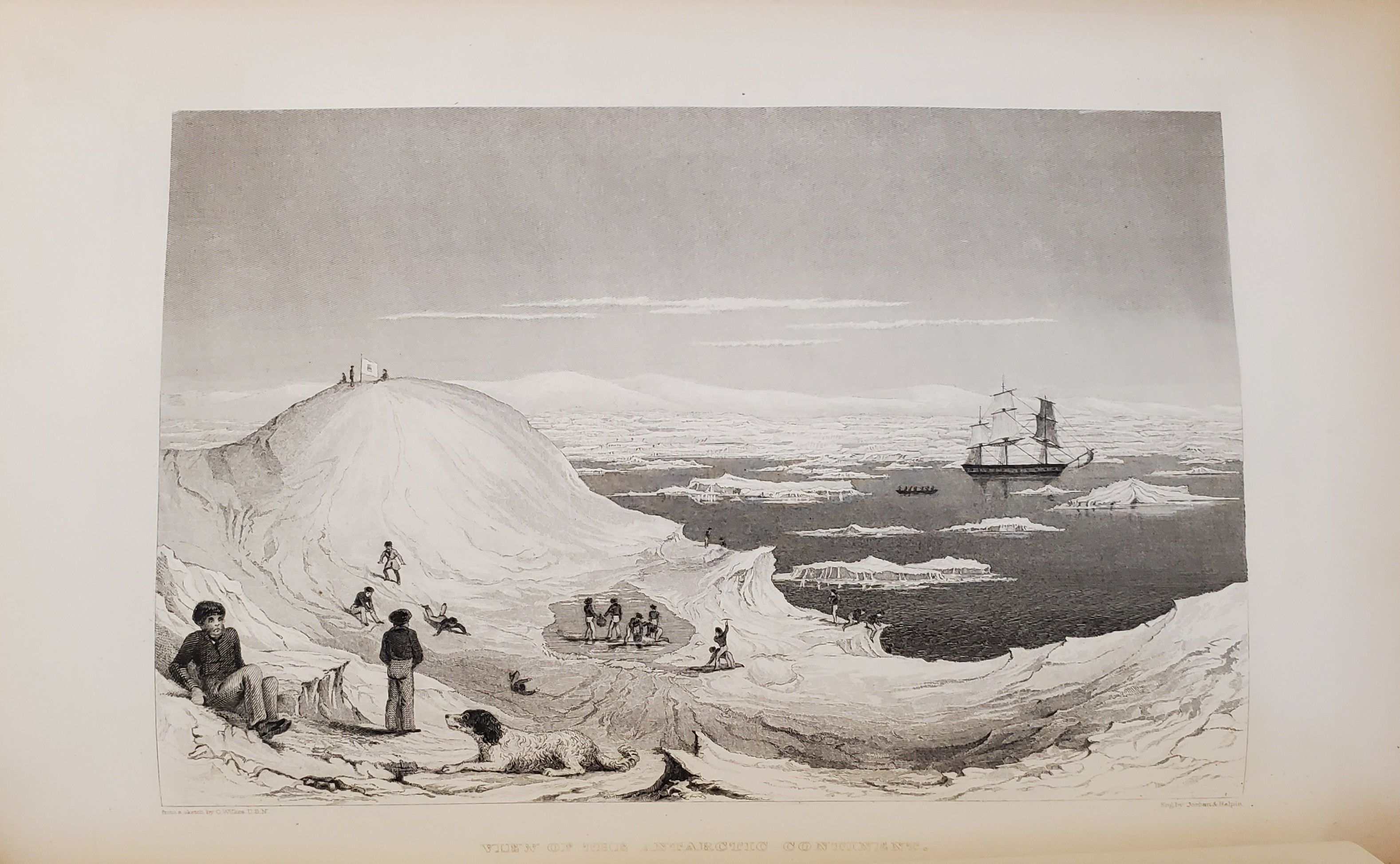
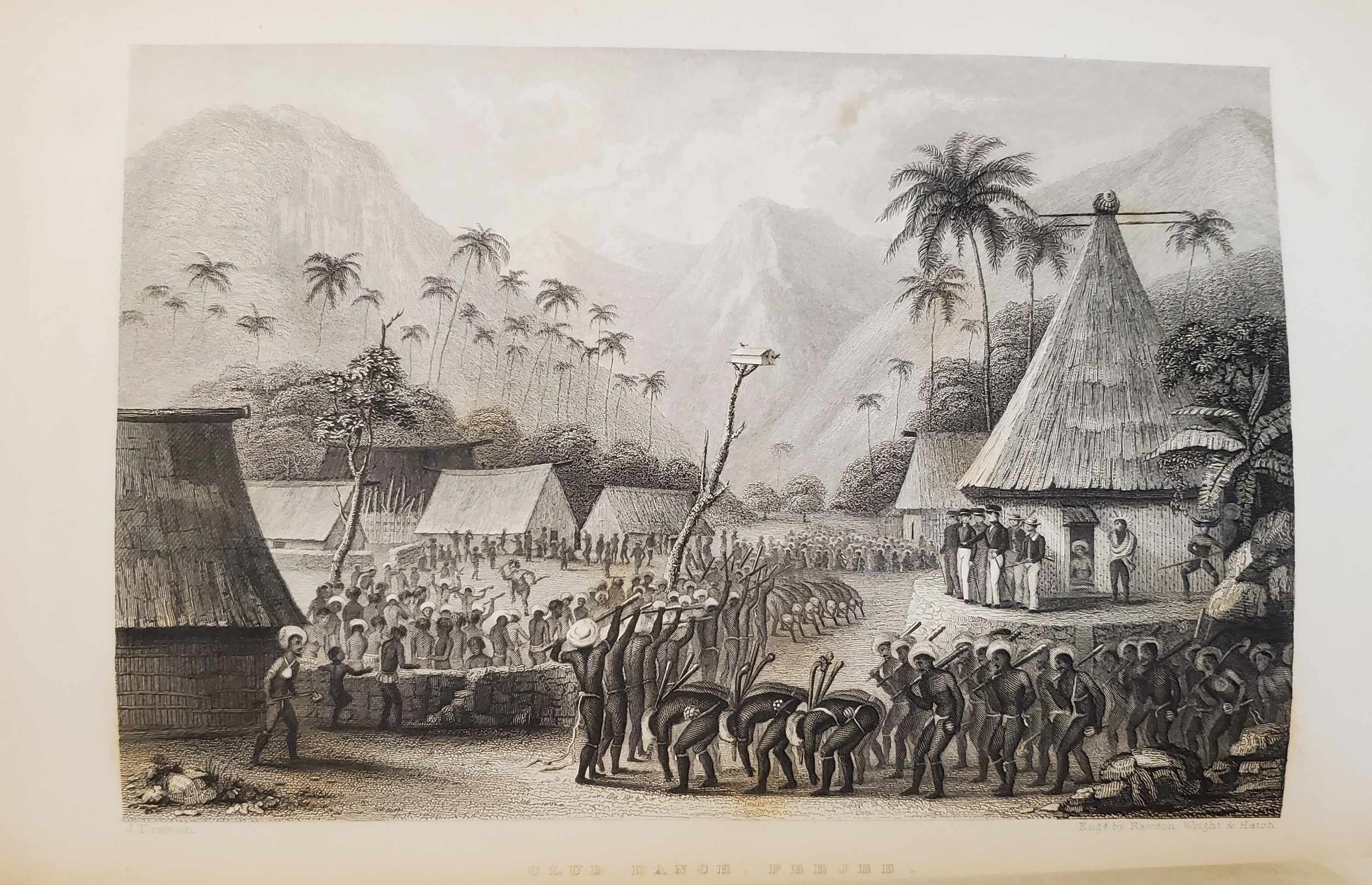
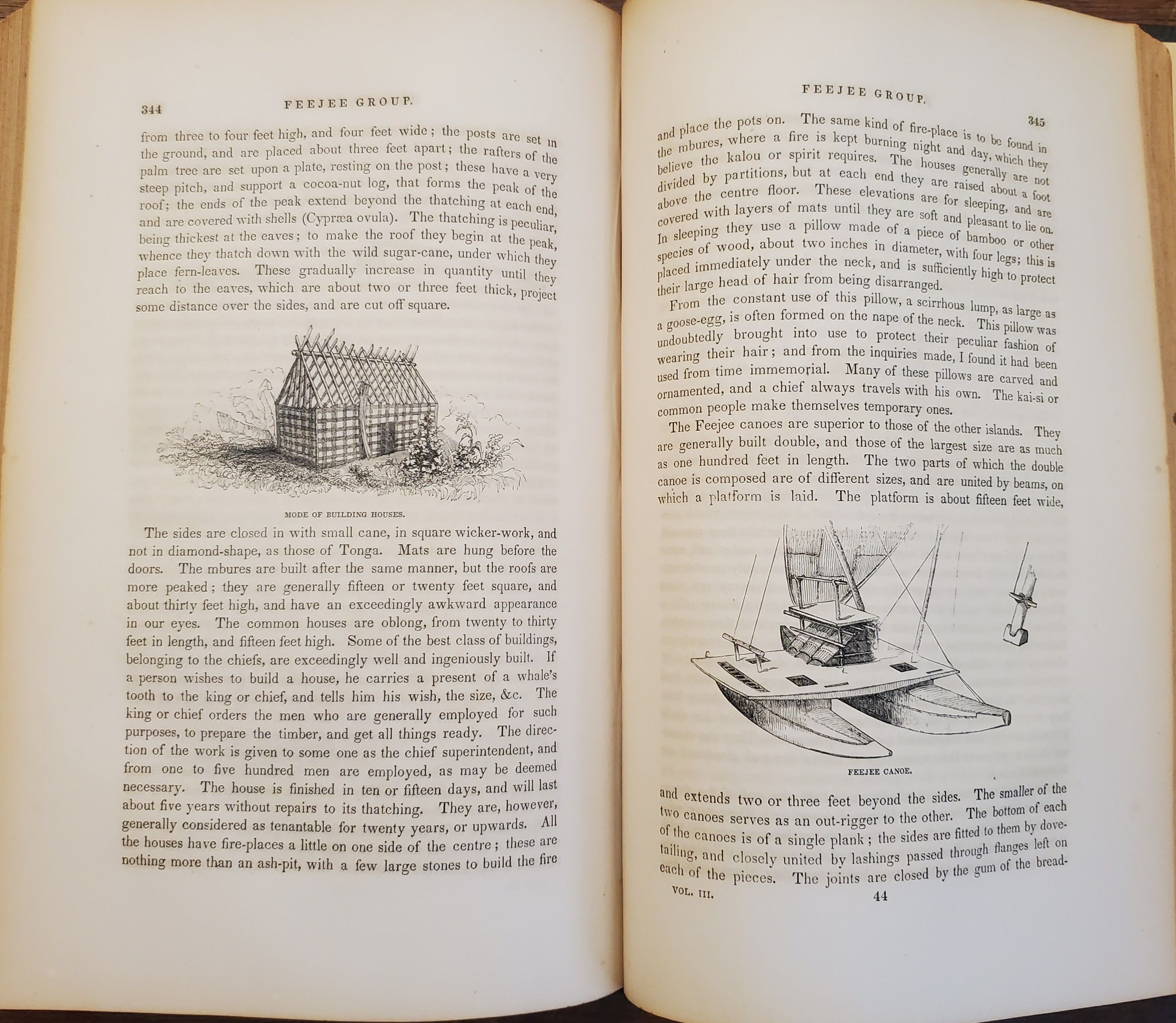
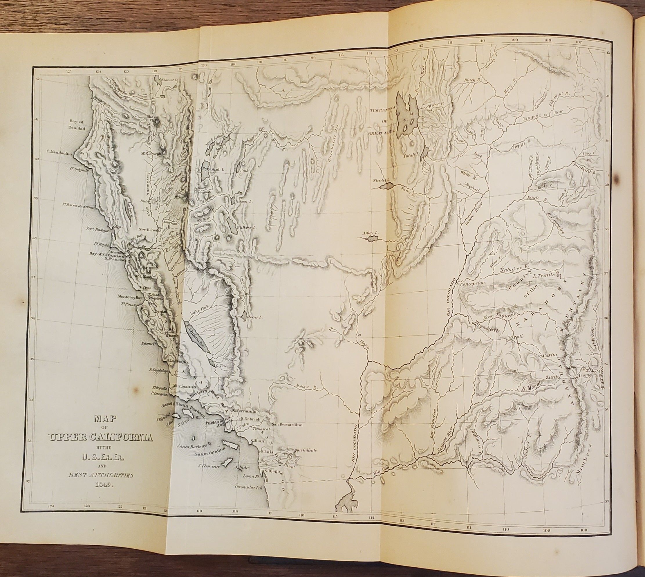
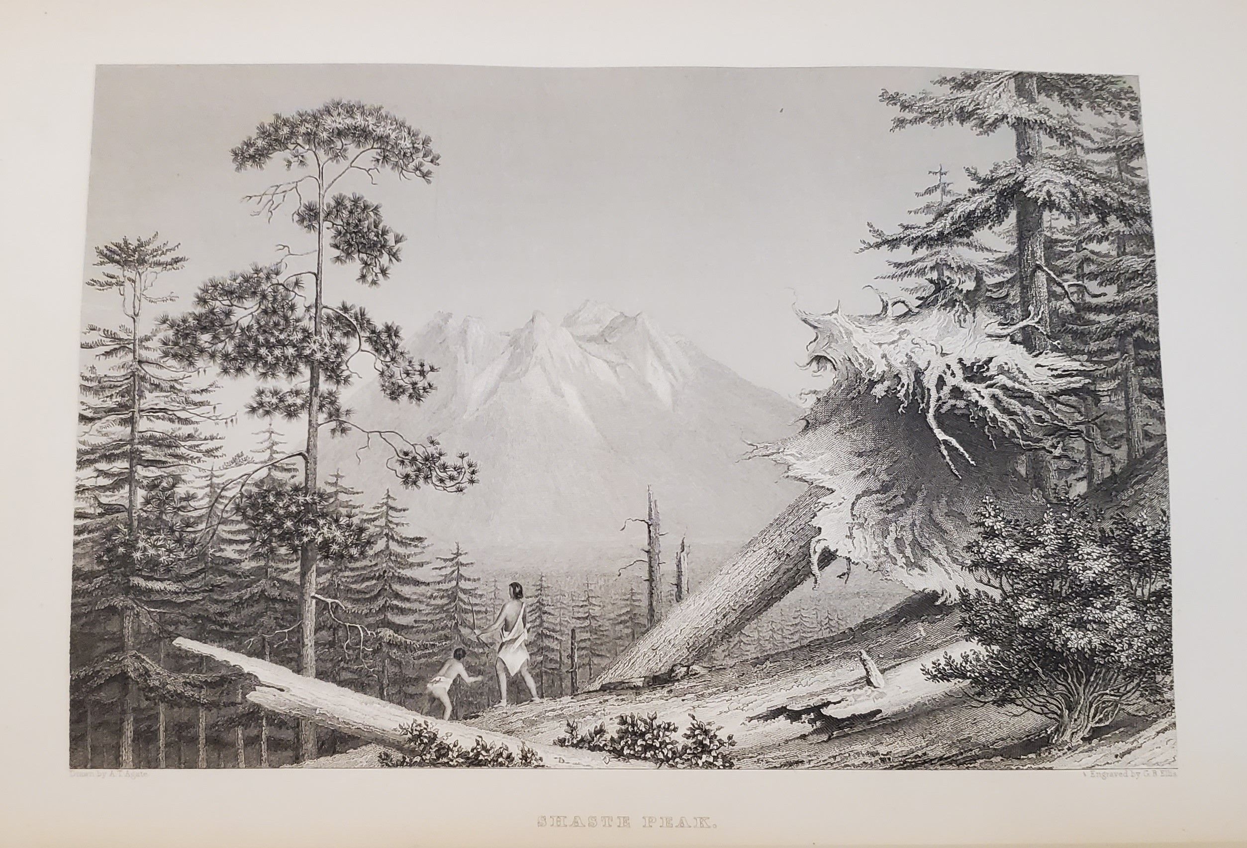
First published in 1844, this set is a later printing, issued without the atlas that was published with earlier editions. Though the title page says "with thirteen maps", and that is the total number present, the number called for in the List of Illustrations adds up to only nine. The official narrative of the first United States exploring expedition by sea. Between 1838 and 1842, the expedition, under Wilkes' command, visited various ports in South America, the South Pacific islands, Australia and New Zealand, and Hawaii. Wilkes sailed along the coast of Antarctica from 150° to 90° during the winter of 1839-40, reporting land in the region that now bears his name. He surveyed the northwest coast of North America, particularly what later became Oregon and Washington, and visited San Francisco and Sacramento as well. [Cowan: p.683; Haskell: 8; Howes I:W-414; Howes II:W-413, Tweney:83].
Details
Title
Narrative of the United States Exploring Expedition. During the Years 1838, 1839, 1840, 1841, 1842… in Five Volumes with Thirteen Maps. [5 volumes].
Author
WILKES, Charles
Condition
Unknown
Publisher
Philadelphia
Date
1849