Asher & Adams' Texas
- unbound
- New York: Asher & Adams, 1874
New York: Asher & Adams, 1874. unbound. Map. Engraving with original hand coloring. Each image measures 22 3/4" x 16"
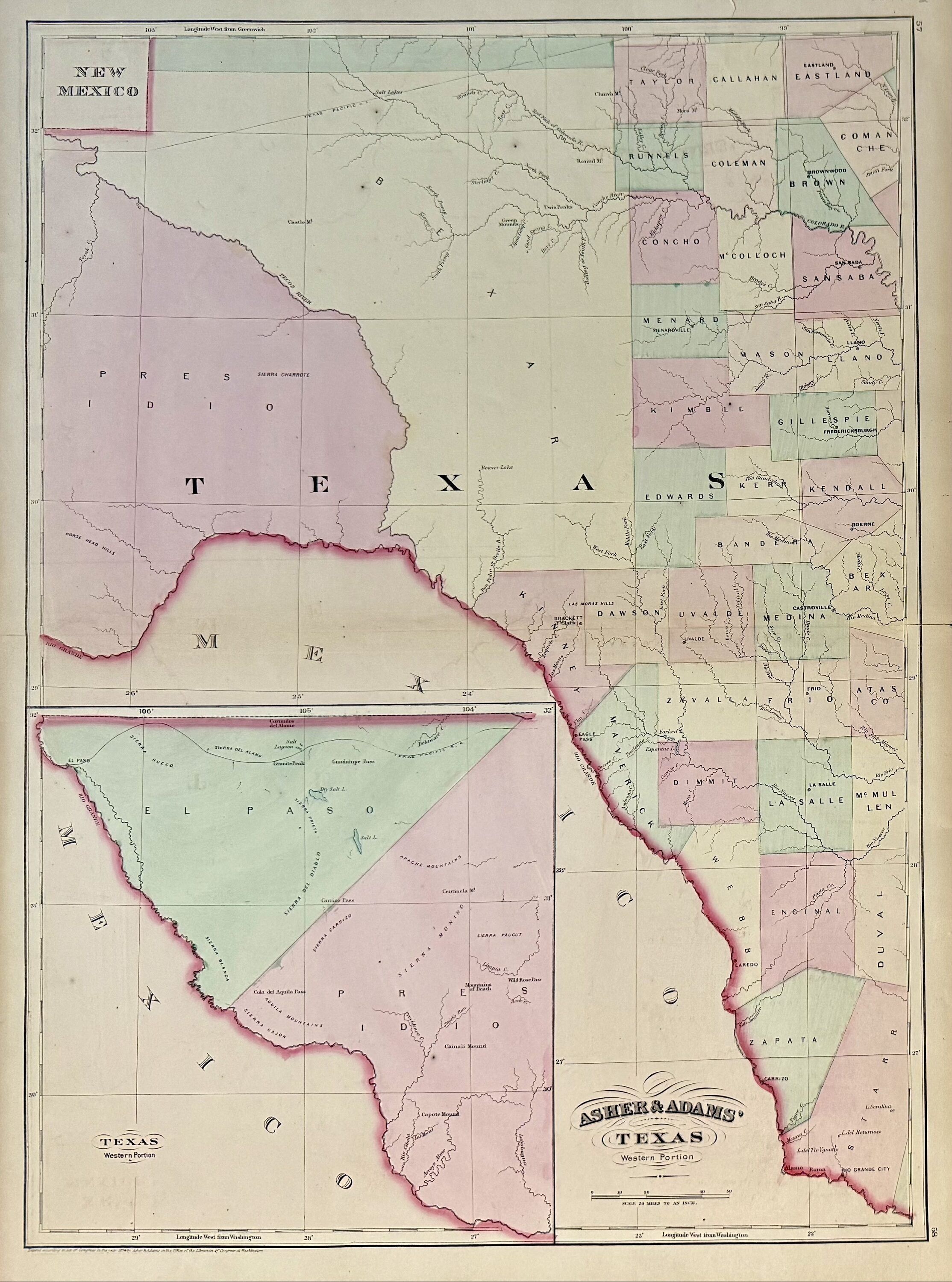
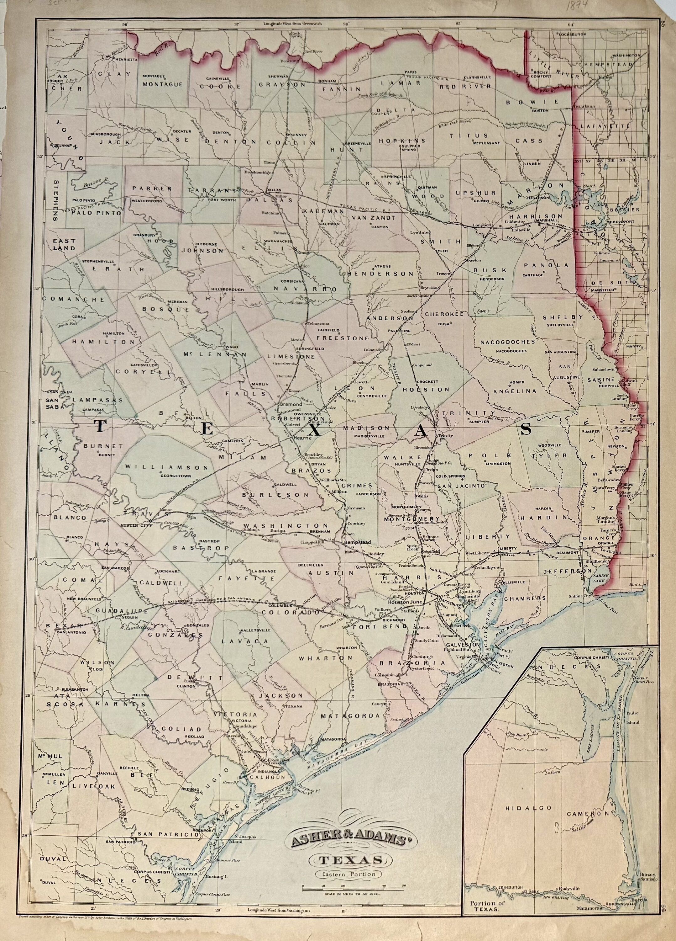
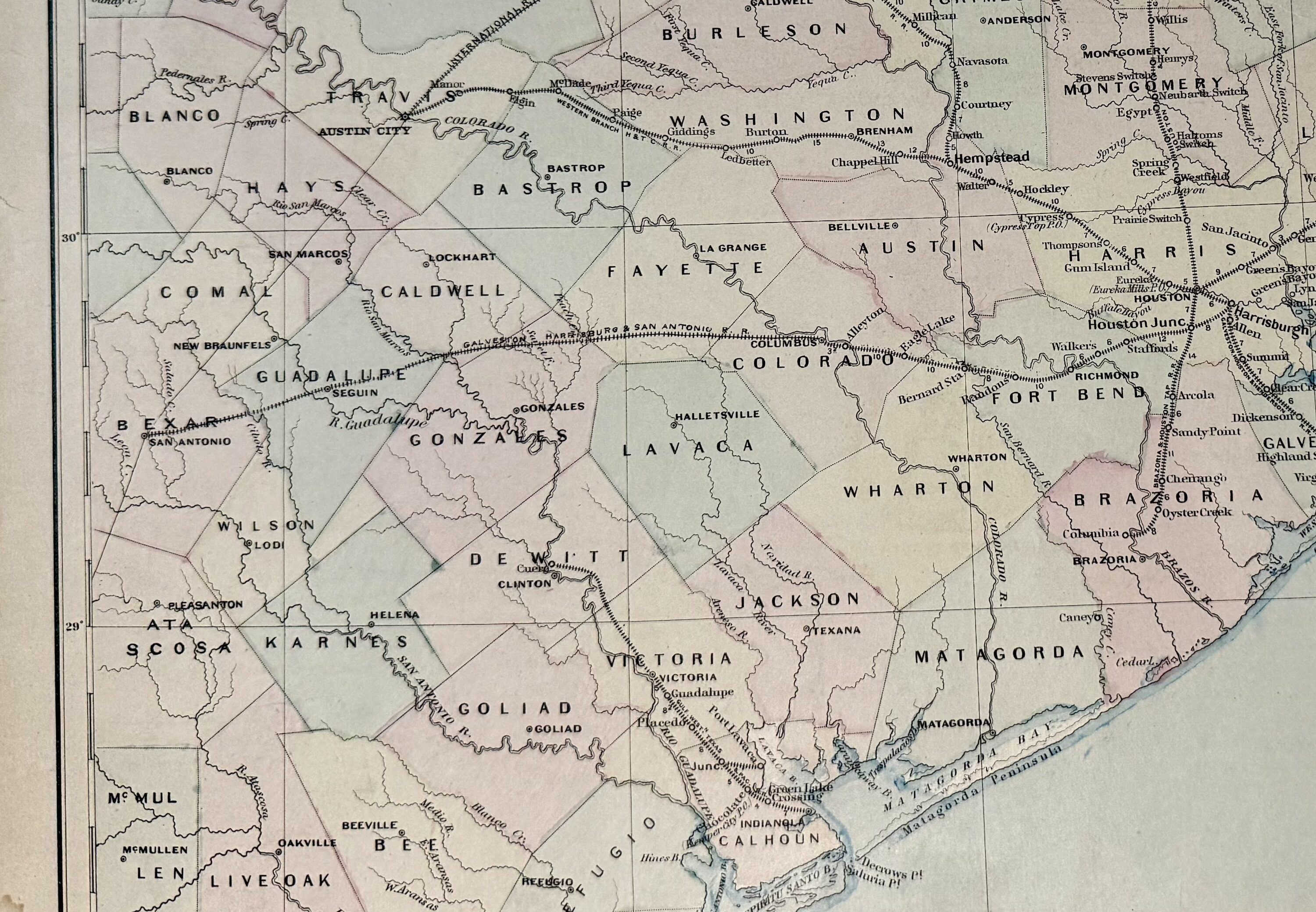
This scarce set of 2 maps of Texas depict the eastern and western portions of the state on separate sheets. The Eastern Portion extends from San Antonio to the Sabine River, with an inset map depicting the area south of Corpus Christi to the Rio Grande. The Western Portion extends from the New Mexico border to Rio Grande City, with an inset map showing the Mexican border from El Paso south. Delineates towns, waterways, topographical features, and railroad lines. Interestingly, the eastern portion map features several rail lines connecting major cities including Galveston, Houston, and Dallas. This edition in particular shows the railroad extending to San Antonio, compared to early editions which only reach Columbus. In very good condition. Minor chips and tears to edges, and damp-stain to lower left corner of eastern map. Hard to find as a set.
Asher & Adams were publishers based in Washington and New York in the late 19th century.
Details
Title
Asher & Adams' Texas
Author
ASHER & ADAMS
Binding
unbound
Condition
Unknown
Publisher
Asher & Adams: New York
Date
1874