Plano del Alumbrado de la Ciudad de México. 1904
- Mexico , 1904
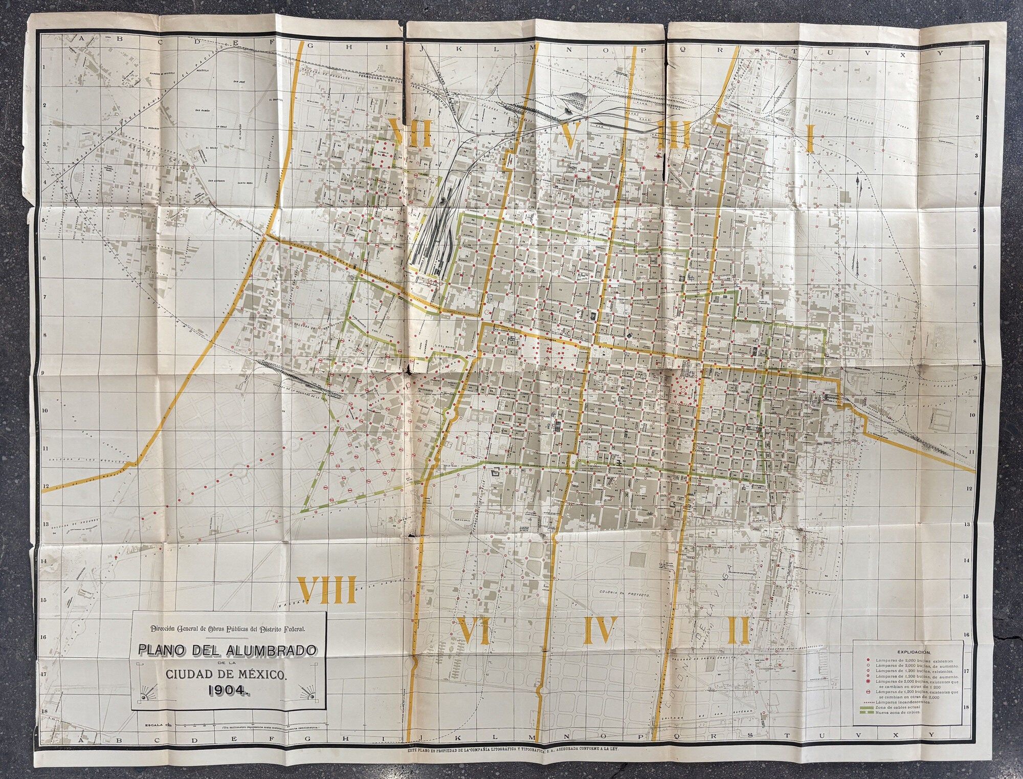
Mexico, 1904. Good.. Map, 31 x 41 inches. Old folds; slight loss and wear at some folds, wear and chipping at edges. Lightly toned at folds, minor soiling. A large and wonderful map depicting the streetlight illumination of Mexico City. The map puts the Alameda Central at the center of the sheet, with eight outlined districts divided around it. A key provides a series of varying red dots which denote streetlights at various bulb levels, as well as those planned for an increase. Green lines show electric lines both planned and in place. Various railroads snake throughout the city, with the central train yard featured in the upper left center. The area with the most illumination left to do is the eighth district, centered on the Paseo de la Reforma. Though the Paseo does have a series of lamps in place, most of the rest of the area around it does not, as it is still under development. We find no copies of this map in OCLC, though with maps that is not uncommon. A fascinating look at the modernization and electrification of Mexico City at the turn of the 20th century.
Details
Title
Plano del Alumbrado de la Ciudad de México. 1904
Author
[Mexico]. [Technology]
Condition
Good
Publisher
Mexico
Date
1904