Collection of More Than 300 Original Photographs Documenting the Construction of the Dan Ryan Expressway
- (Chicago): n.p., 1962
(Chicago): n.p., 1962. Very good.. Richly detailed photo archive of the construction of the Dan Ryan Expressway, which destroyed or isolated the predominantly Black communities of Chicago's South Side. An extensive collection of over 300 photographs documenting one of Chicago's largest-ever infrastructure projects. The twelve-mile, $180 million, fourteen-lane Dan Ryan Expressway was conceived to connect Chicago's southern suburbs with the heart of its downtown. The superhighway's construction, however, had two far-reaching (though not entirely unforeseen) consequences. The first was that it accelerated the movement of affluent white residents to these now more accessible suburbs ("white flight"). The second, more immediate result was the destruction of tens of thousands of homes and the displacement of over 80,000 (predominantly African American) residents - a scope of dislocation that dwarfed even that of the Eisenhower Expressway built just a few years earlier, which affected thousands of (again predominantly lower class and non-White) families and hundreds of businesses.
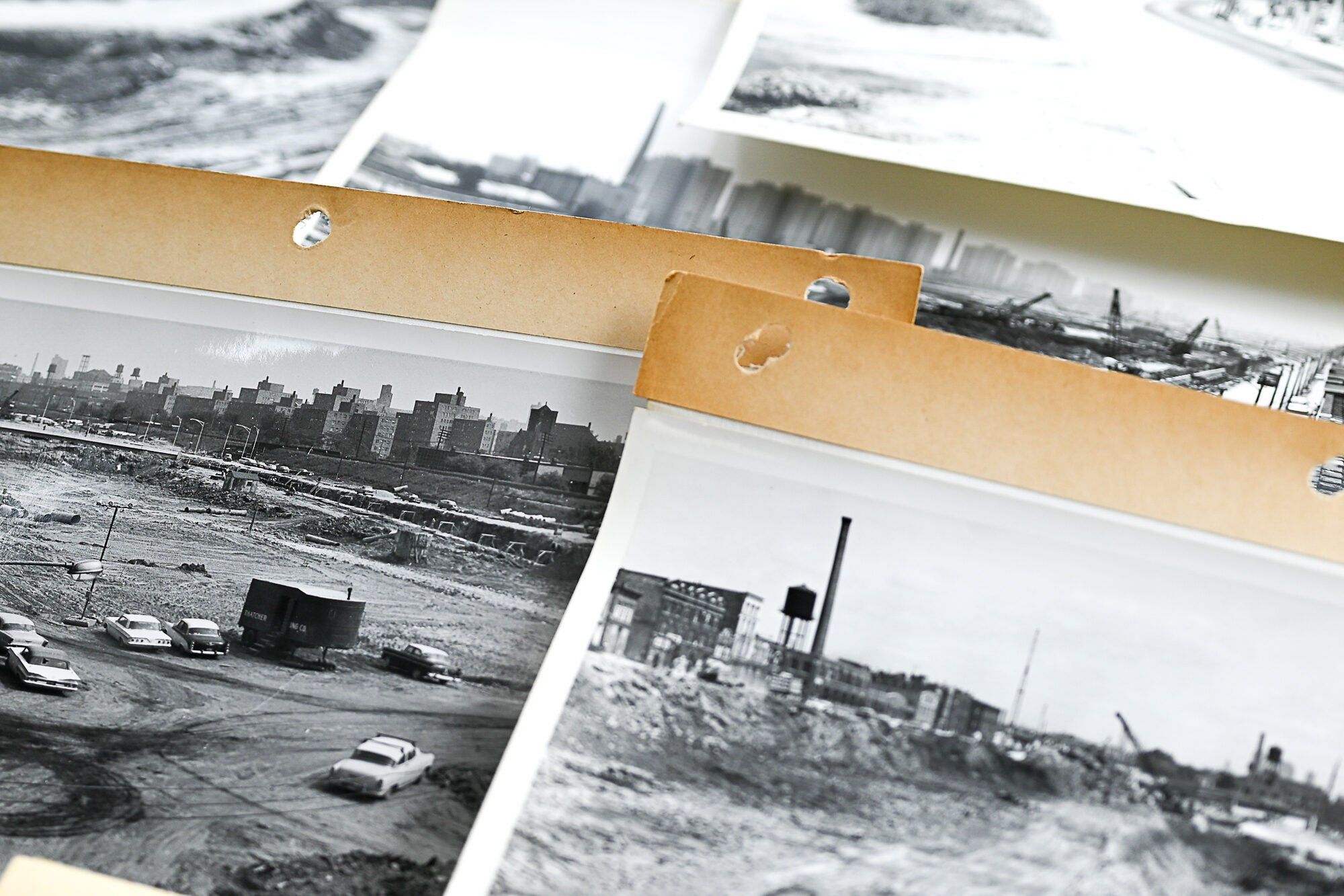
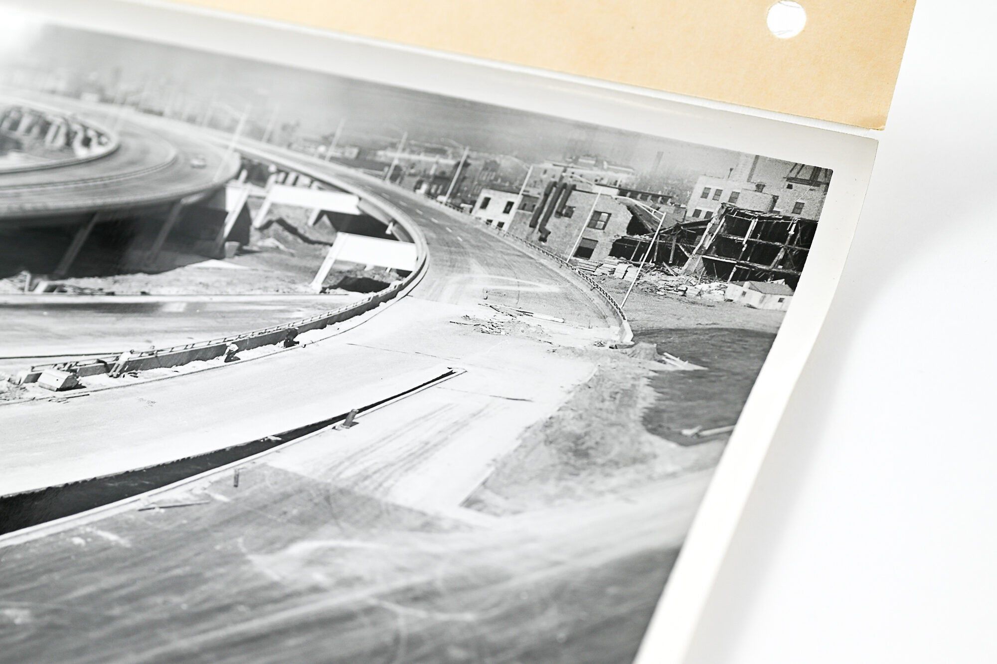
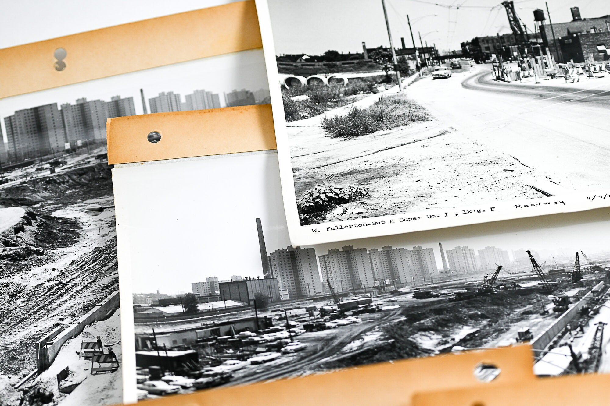
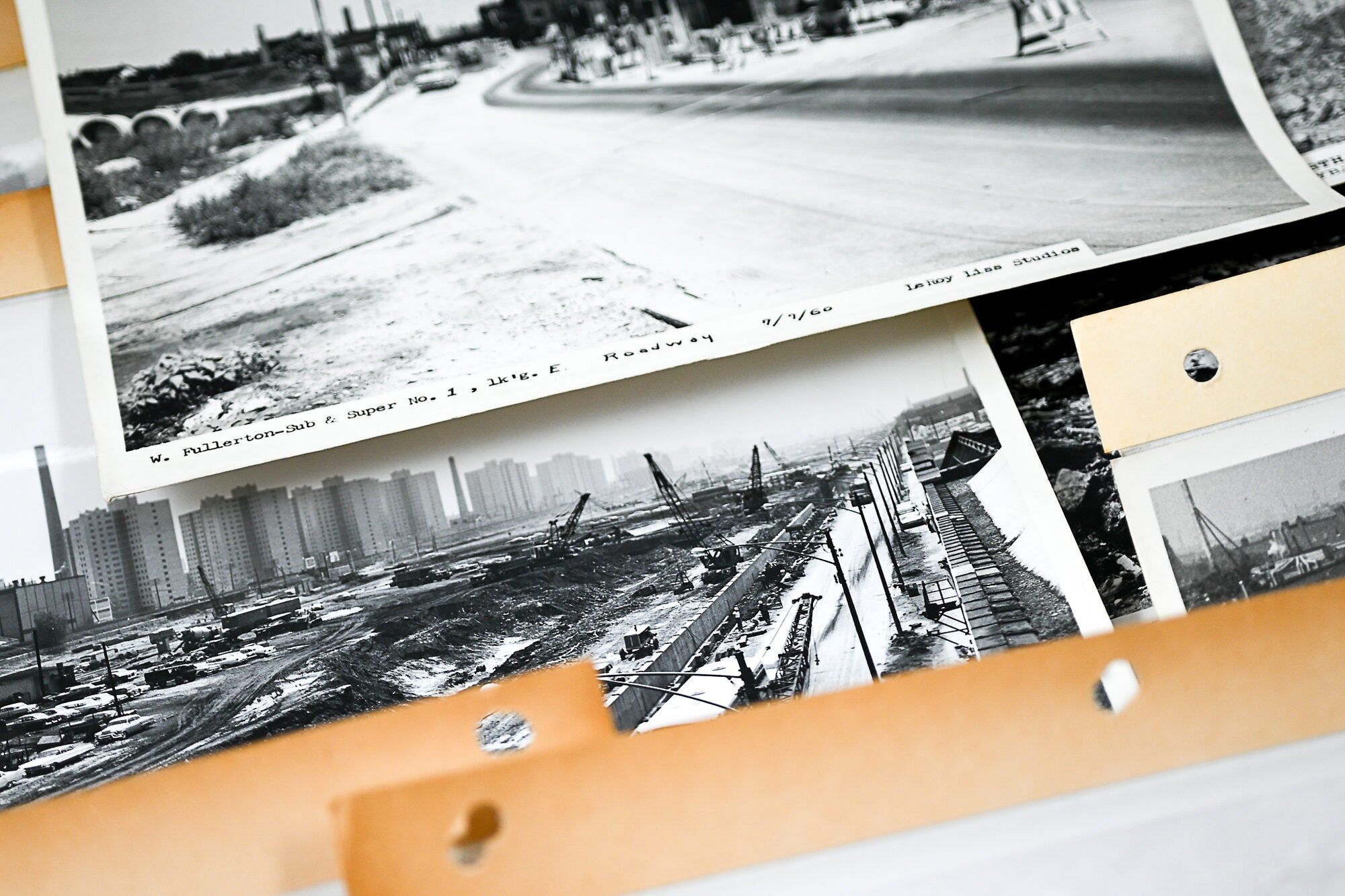
The Dan Ryan Expressway literally cemented the divide between the historically Black neighborhoods (like Bronzeville) and those it bordered, including Armour Square (home to Chicago's Chinatown), and the predominantly white working-class Bridgeport (perhaps not coincidentally the original home of then-mayor Richard J. Daley). This isolation would only exacerbate the poverty and violence of the area over the coming decades. This socio-economically enforced segregation is perhaps best represented in the archive by the regular presence throughout of the notorious Robert Taylor Homes, an infamous group of looming high-rise tenements, part of "the largest concentration of public housing in the nation [that] [t]he Dan Ryan was purposefully designed to run immediately alongside" (Hagan et al, 67).
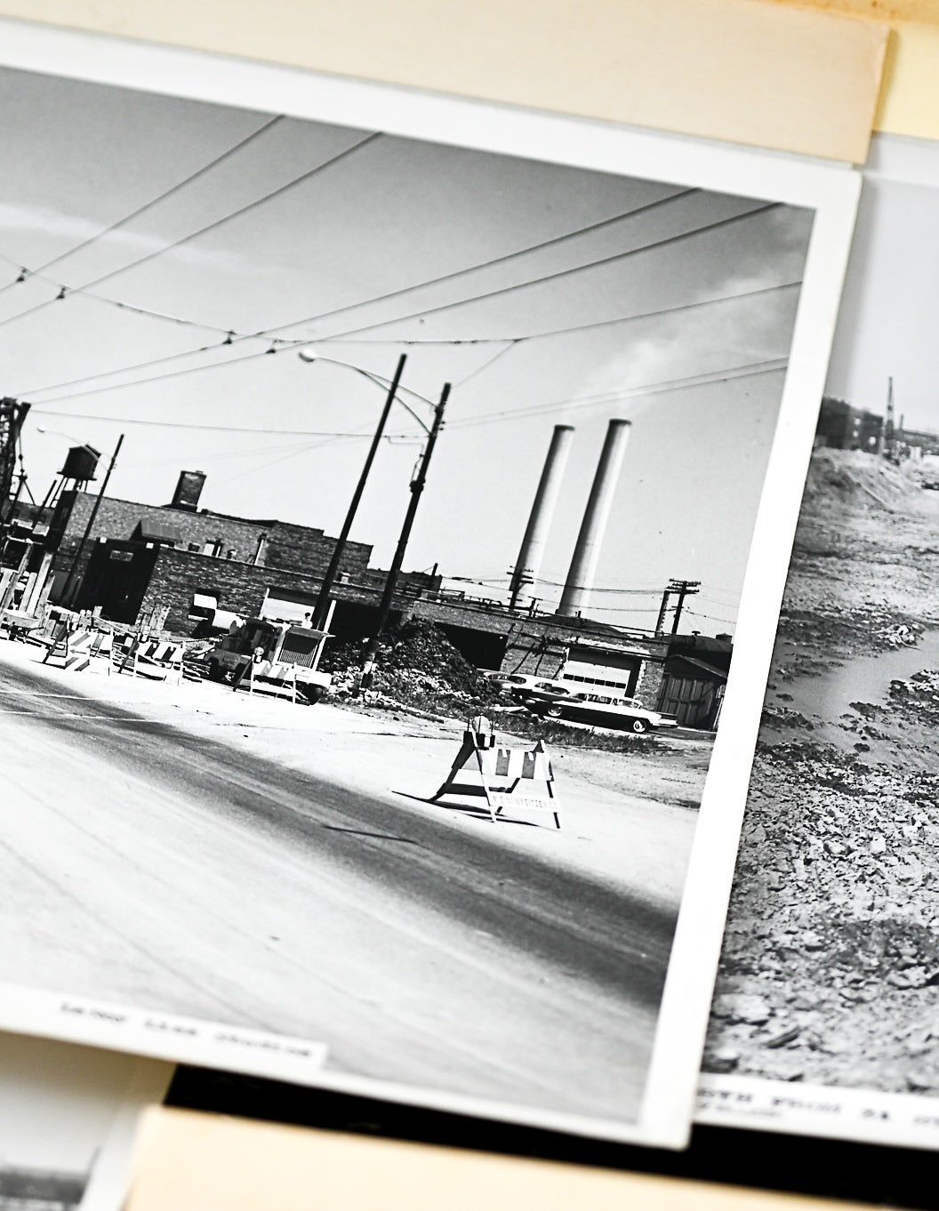
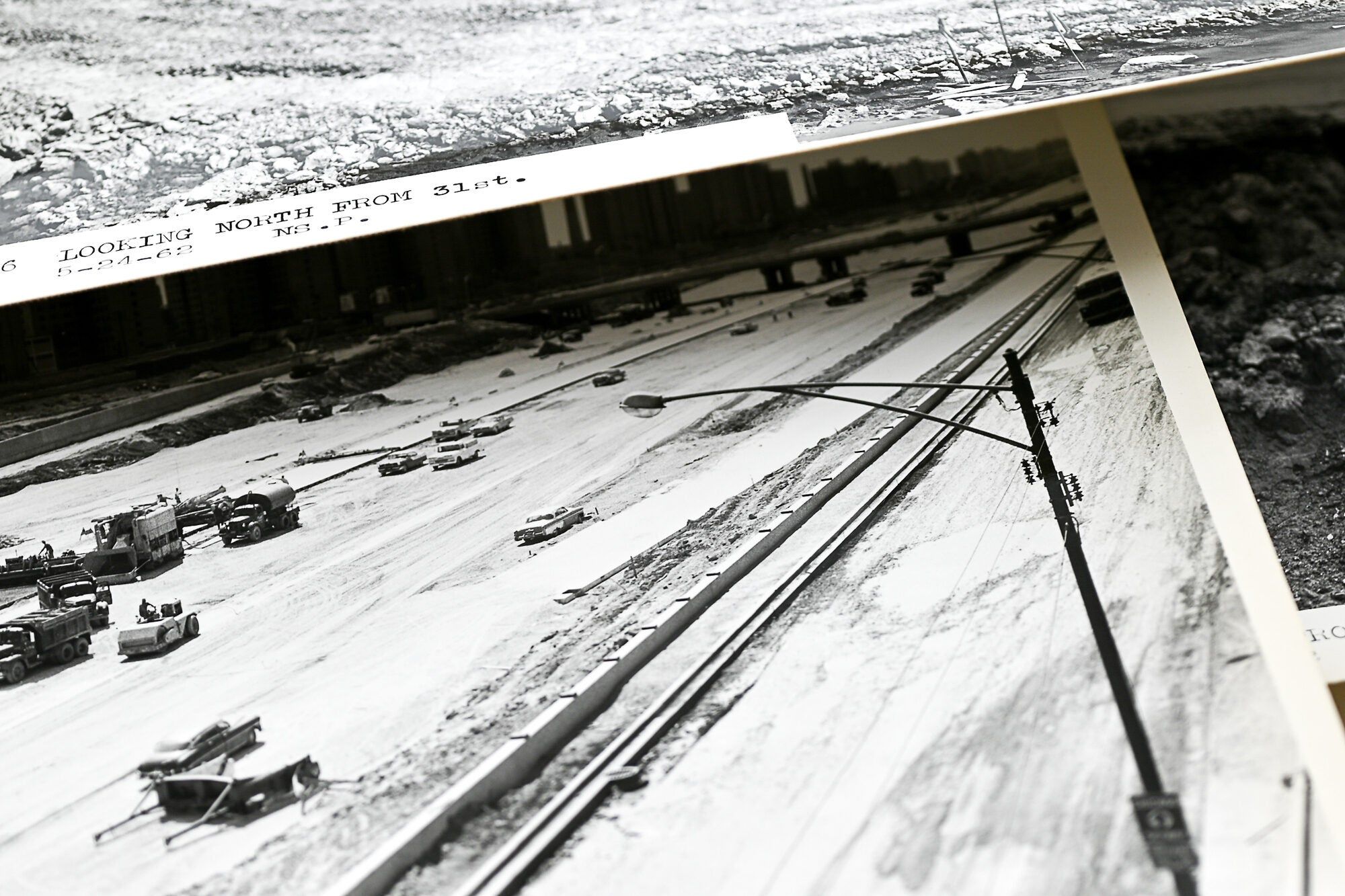
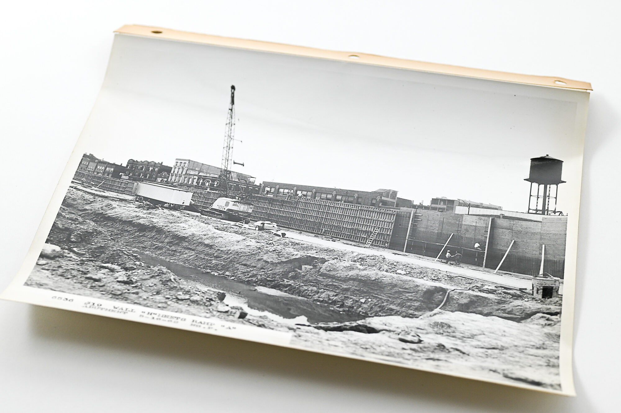
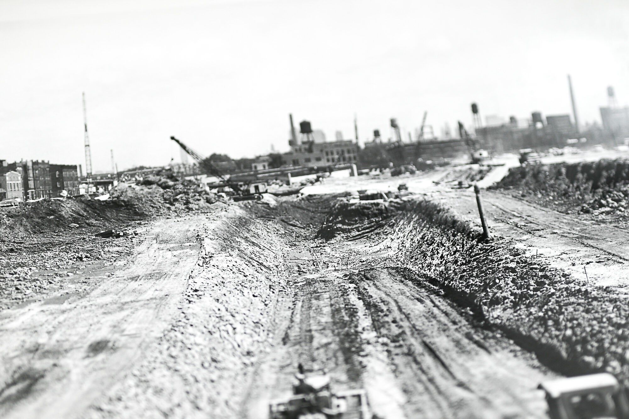
Most of the photos document the period between March 1962 and the end of construction (in December of the same year). Their purpose is not immediately clear. While many of the photos are stamped "Northside Photo Service" (with one or two retaining the stamp of individual photographers), a number of the images bear the stamp or adhered squib of "A.A.A. Photographers, Legal & Evidence Photos." The images' frequently aerial and wide-angle points-of-view, however, clearly and carefully document (likely unintentionally) the devastation of the project. Along the edges of the frames of most images can be seen rows of buildings, homes, and businesses (often identifiable) now suddenly abutting a huge swath of earthen demolition and construction - what would soon become in effect its own kind of Berlin Wall. A handful of images focus on individual blocks or buildings and sometimes capture Black residents in front of their homes. Though a few are annotated by hand ("Wrecking old buildings," "Picture shows blacktop spillage that we constantly had to pick up after Milburn's Blacktop Operation, J. McLean"), most simply describe in typed captions the view and date (i.e. "#131 Southeast from 33rd & Wentworth 10-10-62."). In addition, a number of South Side landmarks are also visible, including a few photos of Comiskey Park, original home of the White Sox.
A stark and revealing archive, worthy of further study, documenting an enormous urban public works project, whose impacts on segregation, economic and civil rights, and redlining - a term coined by Northwestern sociologist John McKnight shortly after this very construction was completed to describe similar discriminatory practices in Chicago - continue to reverberate throughout Chicago, which "has remained one of the most segregated regions in the United States" (Williams and Emamdjomeh). 10'' x 8'' all. Two green cloth commercial three-hole-punch binders with leather corners. Each containing 89 black-and-white gelatin silver photographs. Plus 149 loose photographs (binders presumably perished). 327 images in total. All photographs backed on linen, nearly all with extended reinforced margin punched with three holes (a handful lacking the extended margin). Most images curled at the edges, some spotting/foxing to versos of a handful of images (not effecting recto). Minor wear to binders. Otherwise bright and clean. Housed in two archival boxes.
The Dan Ryan Expressway literally cemented the divide between the historically Black neighborhoods (like Bronzeville) and those it bordered, including Armour Square (home to Chicago's Chinatown), and the predominantly white working-class Bridgeport (perhaps not coincidentally the original home of then-mayor Richard J. Daley). This isolation would only exacerbate the poverty and violence of the area over the coming decades. This socio-economically enforced segregation is perhaps best represented in the archive by the regular presence throughout of the notorious Robert Taylor Homes, an infamous group of looming high-rise tenements, part of "the largest concentration of public housing in the nation [that] [t]he Dan Ryan was purposefully designed to run immediately alongside" (Hagan et al, 67).
Most of the photos document the period between March 1962 and the end of construction (in December of the same year). Their purpose is not immediately clear. While many of the photos are stamped "Northside Photo Service" (with one or two retaining the stamp of individual photographers), a number of the images bear the stamp or adhered squib of "A.A.A. Photographers, Legal & Evidence Photos." The images' frequently aerial and wide-angle points-of-view, however, clearly and carefully document (likely unintentionally) the devastation of the project. Along the edges of the frames of most images can be seen rows of buildings, homes, and businesses (often identifiable) now suddenly abutting a huge swath of earthen demolition and construction - what would soon become in effect its own kind of Berlin Wall. A handful of images focus on individual blocks or buildings and sometimes capture Black residents in front of their homes. Though a few are annotated by hand ("Wrecking old buildings," "Picture shows blacktop spillage that we constantly had to pick up after Milburn's Blacktop Operation, J. McLean"), most simply describe in typed captions the view and date (i.e. "#131 Southeast from 33rd & Wentworth 10-10-62."). In addition, a number of South Side landmarks are also visible, including a few photos of Comiskey Park, original home of the White Sox.
A stark and revealing archive, worthy of further study, documenting an enormous urban public works project, whose impacts on segregation, economic and civil rights, and redlining - a term coined by Northwestern sociologist John McKnight shortly after this very construction was completed to describe similar discriminatory practices in Chicago - continue to reverberate throughout Chicago, which "has remained one of the most segregated regions in the United States" (Williams and Emamdjomeh). 10'' x 8'' all. Two green cloth commercial three-hole-punch binders with leather corners. Each containing 89 black-and-white gelatin silver photographs. Plus 149 loose photographs (binders presumably perished). 327 images in total. All photographs backed on linen, nearly all with extended reinforced margin punched with three holes (a handful lacking the extended margin). Most images curled at the edges, some spotting/foxing to versos of a handful of images (not effecting recto). Minor wear to binders. Otherwise bright and clean. Housed in two archival boxes.
Details
Title
Collection of More Than 300 Original Photographs Documenting the Construction of the Dan Ryan Expressway
Condition
Very Good
Publisher
n.p.: (Chicago)
Date
1962