Robinsons New Map of the Pacific Ocean [2nd Edition] [ca. 1941]
- Sydney: H.E.C. Robinson Pty Ltd, 1941
Sydney: H.E.C. Robinson Pty Ltd, 1941. Very Good.
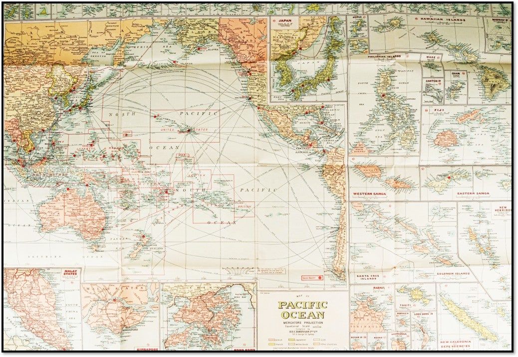
A vital and visually complex cartographic document of the Pacific Theater, issued on the immediate cusp of the Second World War.
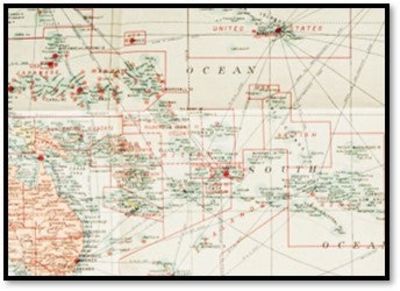
This 2nd Edition map, produced by Sydney's premier cartographic firm, H.E.C. Robinson, captures the geopolitical tensions of the Pacific through a meticulous color-coded system identifying British, Japanese, American, French, and Dutch possessions. Unlike earlier 1930s iterations, this variant is notable for its explicit inclusion of naval bases and strategic shipping routes, functioning as both a commercial navigation tool and a primary document of the era's escalating military footprint. The cartography is surrounded by 22 detailed insets, including Hong Kong, Singapore, and the mandated island groups that would soon become synonymous with the Pacific campaign.
This is the uncommon 2nd Edition of Robinson's definitive Pacific map, updated ca. 1940-1941 to reflect the intense militarization of the region. It is a cornerstone for any collection focusing on Pacific geopolitics or World War II maritime history.
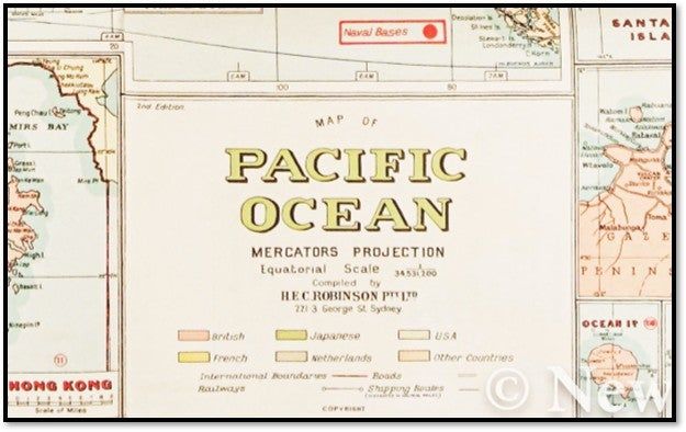
+++ The Strategic Shield: Explicitly marks Naval Bases with red circular icons, providing a 'frozen moment' of military infrastructure before the outbreak of hostilities.
+++ Regional Insets: Includes high-detail maps of Singapore, Hong Kong, and the Malay States, areas that would become critical flashpoints within months of this map's publication.
+++ Australian Cartographic Identity: H.E.C. Robinson was the dominant name in Australian mapmaking; this large-format folio represents their peak technical production.
+++ Pre-War Snapshot: Features the mandated territories and color-coded colonial borders that were entirely redrawn following 1945, making this a vital 'Before' document for historians.
KEY FEATURES
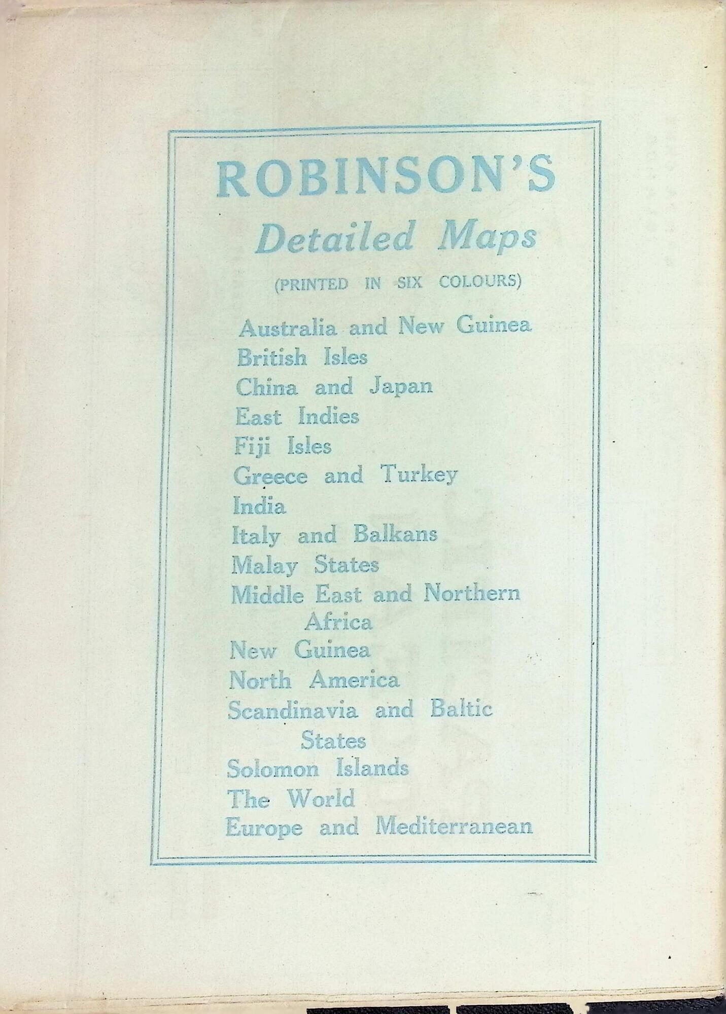
+++ Visuals: Large-scale map using Mercator's Projection; 22 detailed insets covering the Solomon Islands, Fiji, Hawaii, and major port cities; color-coded legend for national possessions.
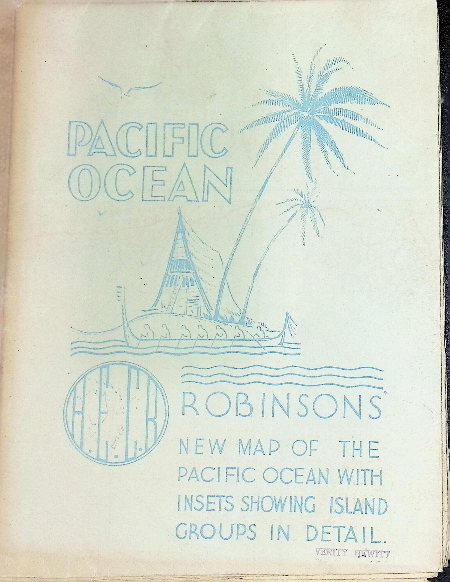
+++ Binding: Original light blue pictorial card wraps (7.5 x 10 inches) featuring a tropical island motif with palm trees and a traditional canoe.
+++ Imprint: H.E.C. Robinson Pty Ltd, 221-3 George St. Sydney. [Ref: Trove 46623707 / 2nd Edition].
+++ Specs: Approximately 40 x 29.75 inches (unfolded).
+++ Provenance: Includes contemporary retailer stamp on the front cover, grounding the map in its original commercial context.
CONDITION: Very Good.
+++ The Map: Vibrant full-color printing remains bright with no fading. The paper is crisp; usual mailing/folding creases are present but remain strong with only minor wear at the cross-folds. No significant tears or loss to the cartographic surface.
+++ The Wraps: Light blue pictorial covers show moderate shelf handling and light age-toning. The retailer's stamp is present on the front face. Structurally sound and well-preserved for its size.
SCHOLARLY FEATURES
+++ Military Cartography: Documents the transition of the Pacific from a colonial commercial zone to a militarized theater, specifically through the tracking of shipping routes and naval installations.
+++ Geopolitical Mandates: Provides a clear visual record of the League of Nations Mandates, particularly those held by Japan in the North Pacific, which were a point of high international friction in 1940.
+++ Commercial Utility: Serves as a primary source for early 20th-century maritime logistics, showing the interconnectedness of the British Commonwealth ports from Sydney to Hong Kong. HISTORICAL SIGNIFICANCE -
H.E.C. Robinson was more than a printer; they were the geographical record-keepers for the South Pacific. This map reflects the peak of their influence. While the first edition captured the peaceful colonial status quo of the mid-1930s, this 2nd Edition (identified by the 2nd Edition slug in the lower title block) is an artifact of urgency. It was the map used by Australian and British officers and civilians alike to visualize the coming storm in the 'Near North.'
SUBJECTS: Pacific Ocean Cartography, World War II History, Australian Printing, Naval History, Colonial Geography, Maritime Routes, Map, Ephemera, 20th-century Cartography.
BIBLIOGRAPHIC REFERENCE: Trove #46623707; NLA Bib ID 1528434. (Note: Only 2 institutional copies located in Australian libraries; scarce in North American holdings).
A vital and visually complex cartographic document of the Pacific Theater, issued on the immediate cusp of the Second World War.
This 2nd Edition map, produced by Sydney's premier cartographic firm, H.E.C. Robinson, captures the geopolitical tensions of the Pacific through a meticulous color-coded system identifying British, Japanese, American, French, and Dutch possessions. Unlike earlier 1930s iterations, this variant is notable for its explicit inclusion of naval bases and strategic shipping routes, functioning as both a commercial navigation tool and a primary document of the era's escalating military footprint. The cartography is surrounded by 22 detailed insets, including Hong Kong, Singapore, and the mandated island groups that would soon become synonymous with the Pacific campaign.
This is the uncommon 2nd Edition of Robinson's definitive Pacific map, updated ca. 1940-1941 to reflect the intense militarization of the region. It is a cornerstone for any collection focusing on Pacific geopolitics or World War II maritime history.
+++ The Strategic Shield: Explicitly marks Naval Bases with red circular icons, providing a 'frozen moment' of military infrastructure before the outbreak of hostilities.
+++ Regional Insets: Includes high-detail maps of Singapore, Hong Kong, and the Malay States, areas that would become critical flashpoints within months of this map's publication.
+++ Australian Cartographic Identity: H.E.C. Robinson was the dominant name in Australian mapmaking; this large-format folio represents their peak technical production.
+++ Pre-War Snapshot: Features the mandated territories and color-coded colonial borders that were entirely redrawn following 1945, making this a vital 'Before' document for historians.
KEY FEATURES
+++ Visuals: Large-scale map using Mercator's Projection; 22 detailed insets covering the Solomon Islands, Fiji, Hawaii, and major port cities; color-coded legend for national possessions.
+++ Binding: Original light blue pictorial card wraps (7.5 x 10 inches) featuring a tropical island motif with palm trees and a traditional canoe.
+++ Imprint: H.E.C. Robinson Pty Ltd, 221-3 George St. Sydney. [Ref: Trove 46623707 / 2nd Edition].
+++ Specs: Approximately 40 x 29.75 inches (unfolded).
+++ Provenance: Includes contemporary retailer stamp on the front cover, grounding the map in its original commercial context.
CONDITION: Very Good.
+++ The Map: Vibrant full-color printing remains bright with no fading. The paper is crisp; usual mailing/folding creases are present but remain strong with only minor wear at the cross-folds. No significant tears or loss to the cartographic surface.
+++ The Wraps: Light blue pictorial covers show moderate shelf handling and light age-toning. The retailer's stamp is present on the front face. Structurally sound and well-preserved for its size.
SCHOLARLY FEATURES
+++ Military Cartography: Documents the transition of the Pacific from a colonial commercial zone to a militarized theater, specifically through the tracking of shipping routes and naval installations.
+++ Geopolitical Mandates: Provides a clear visual record of the League of Nations Mandates, particularly those held by Japan in the North Pacific, which were a point of high international friction in 1940.
+++ Commercial Utility: Serves as a primary source for early 20th-century maritime logistics, showing the interconnectedness of the British Commonwealth ports from Sydney to Hong Kong. HISTORICAL SIGNIFICANCE -
H.E.C. Robinson was more than a printer; they were the geographical record-keepers for the South Pacific. This map reflects the peak of their influence. While the first edition captured the peaceful colonial status quo of the mid-1930s, this 2nd Edition (identified by the 2nd Edition slug in the lower title block) is an artifact of urgency. It was the map used by Australian and British officers and civilians alike to visualize the coming storm in the 'Near North.'
SUBJECTS: Pacific Ocean Cartography, World War II History, Australian Printing, Naval History, Colonial Geography, Maritime Routes, Map, Ephemera, 20th-century Cartography.
BIBLIOGRAPHIC REFERENCE: Trove #46623707; NLA Bib ID 1528434. (Note: Only 2 institutional copies located in Australian libraries; scarce in North American holdings).
Details
Title
Robinsons New Map of the Pacific Ocean [2nd Edition] [ca. 1941]
Author
[Robinson, H.E.C.]
Condition
Very Good
Publisher
H.E.C. Robinson Pty Ltd: Sydney
Date
1941