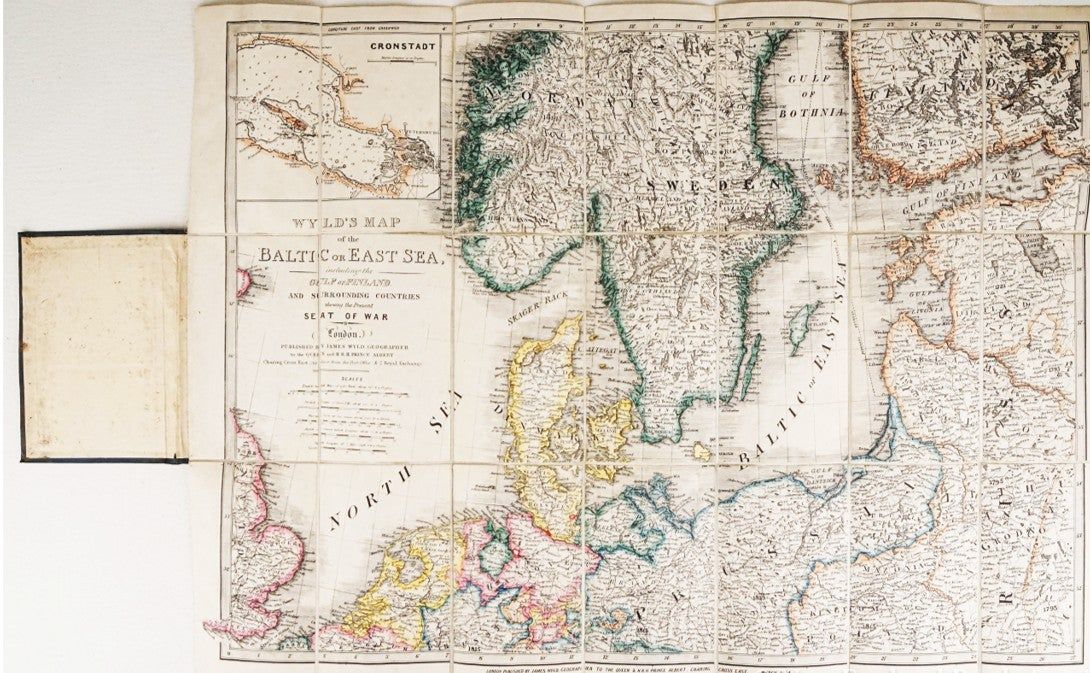
Wyld's Map of the Baltic [Embracing the Present Seat of War] [Linen-Backed Folding Map] [1854]

- London: James Wyld, 1854
London: James Wyld, 1854. Good.
A significant cartographic document of the naval campaign against Russia during the opening year of the Crimean War.
While historical attention often remains on the Black Sea, this map was produced to illustrate the vital Baltic theater, where the British and French fleets sought to pressure St. Petersburg. The map covers the strategic coastlines of Southern Norway, Sweden, Denmark, Prussia, and Finland, with a sophisticated level of detail regarding naval approaches and soundings.
Most critically, it includes a prominent inset of Cronstadt, providing the contemporary observer with a detailed view of the defenses protecting the Russian fleet. This folding edition, mounted on linen in 21 sections, represents the high-water mark of Victorian informational cartography during a time of active global conflict.
KEY FEATURES
+++ Visuals: Original hand-colored boundaries; detailed insets of Cronstadt and the approaches to St. Petersburg; topographical relief shown by hachures.
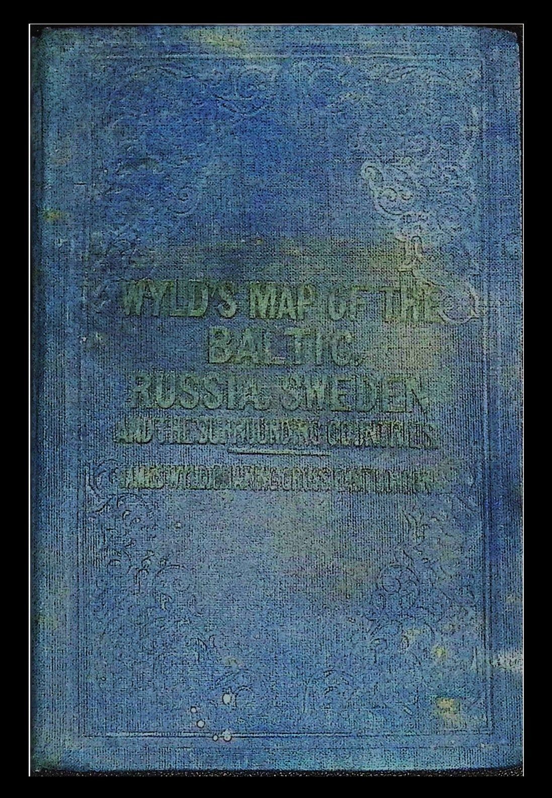
+++ Binding: Housed in original rigid board covers with a publisher's pictorial label on the front face; map is dissected into 21 sections and mounted on archival-grade linen for folding.
+++ Content: Extensive coverage of the Baltic Sea, Gulf of Finland, and surrounding sovereign territories; highlights lighthouses, soundings, and strategic naval stations.
+++ Imprint: James Wyld, Charing Cross East, 457 Strand & 2 Royal Exchange. London, March 1854.
+++ Specs: Map measures 20 x 27 inches; folds into boards measuring approximately 4.5 x 6.5 inches.
CONDITION: Good.
+++ The Map: The hand-color remains vibrant and clean. The linen backing is strong and intact, though the map shows typical wear and light rubbing along the folds consistent with use.
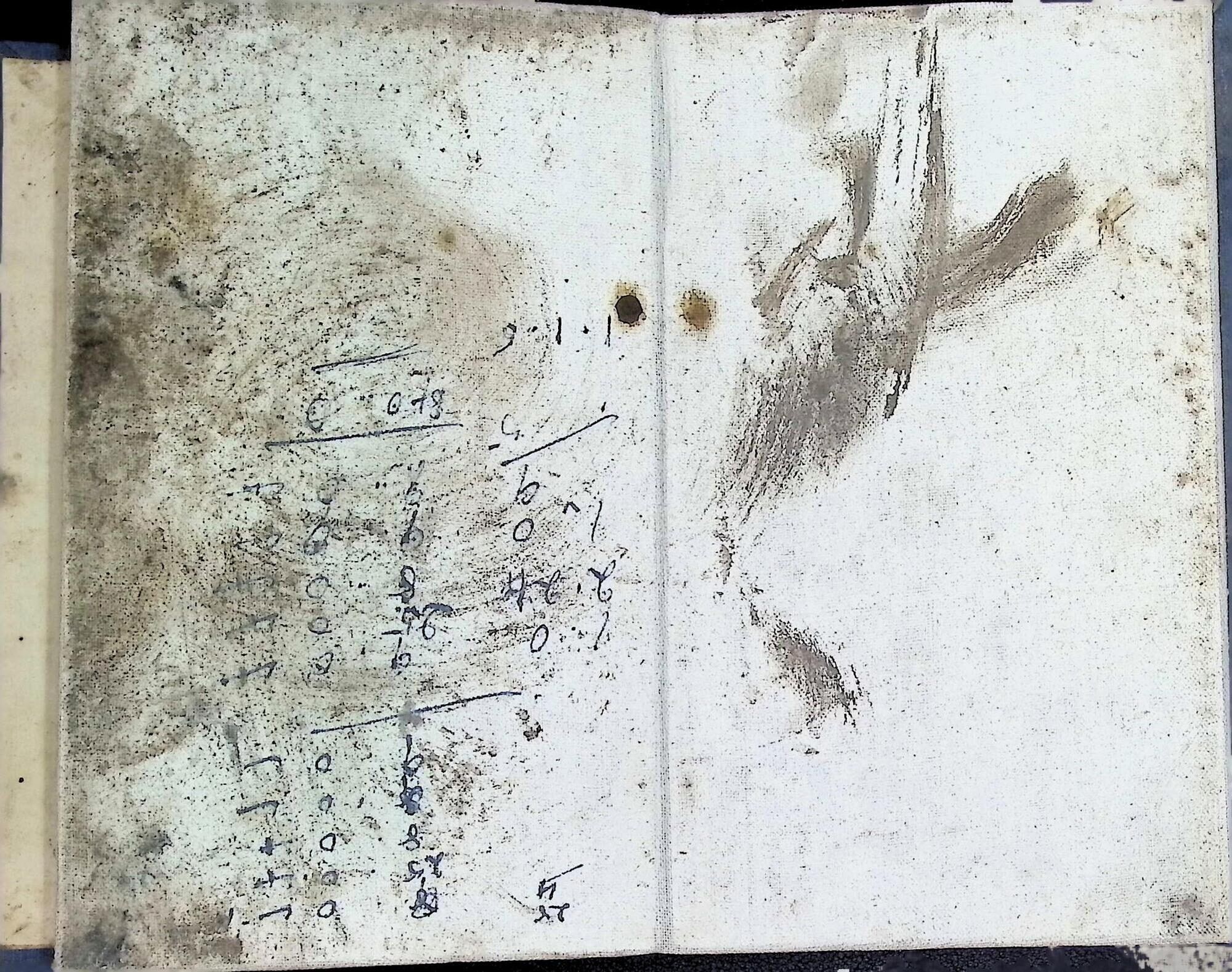
+++ The Boards: The original cloth-covered boards show significant shelf handling and rubbing. The internal rear pastedown of the book shows heavy soiling, though this is localized and does not affect the map surface itself. A solid, used example that reflects its history as a functional reference tool.
SCHOLARLY FEATURES
+++ Strategic Containment: Illustrates the British naval doctrine of the 1850s, which utilized the Baltic fleet as a diversionary force to prevent the transfer of Russian troops to the Crimea.
+++ Fortification Study: The Cronstadt inset provides a primary visual record of mid-19th-century naval defenses, highlighting why the British Admiralty ultimately decided against a direct assault on the Russian capital.
+++ Commercial Cartography: Demonstrates James Wyld's ability to pivot from general atlas work to 'event-driven' cartography, a precursor to modern military journalism. HISTORICAL SIGNIFICANCE
James Wyld was the most prolific and successful commercial cartographer of the Victorian era. His 'War Maps' were essential for a British public newly obsessed with international geopolitics. This Baltic map, published in the very month that Britain formally declared war on Russia, served as the primary visual aid for a nation watching the departure of the world's most powerful steam-powered fleet under Admiral Sir Charles Napier. It captures the intersection of colonial expansion, naval technology, and the birth of modern wartime news.
SUBJECTS: Crimean War, Baltic Sea Cartography, Naval Strategy, Russian Empire, Victorian Geography, James Wyld, Map, Folding Map, Military History, Ephemera.
A significant cartographic document of the naval campaign against Russia during the opening year of the Crimean War.
While historical attention often remains on the Black Sea, this map was produced to illustrate the vital Baltic theater, where the British and French fleets sought to pressure St. Petersburg. The map covers the strategic coastlines of Southern Norway, Sweden, Denmark, Prussia, and Finland, with a sophisticated level of detail regarding naval approaches and soundings.
Most critically, it includes a prominent inset of Cronstadt, providing the contemporary observer with a detailed view of the defenses protecting the Russian fleet. This folding edition, mounted on linen in 21 sections, represents the high-water mark of Victorian informational cartography during a time of active global conflict.
KEY FEATURES
+++ Visuals: Original hand-colored boundaries; detailed insets of Cronstadt and the approaches to St. Petersburg; topographical relief shown by hachures.
+++ Binding: Housed in original rigid board covers with a publisher's pictorial label on the front face; map is dissected into 21 sections and mounted on archival-grade linen for folding.
+++ Content: Extensive coverage of the Baltic Sea, Gulf of Finland, and surrounding sovereign territories; highlights lighthouses, soundings, and strategic naval stations.
+++ Imprint: James Wyld, Charing Cross East, 457 Strand & 2 Royal Exchange. London, March 1854.
+++ Specs: Map measures 20 x 27 inches; folds into boards measuring approximately 4.5 x 6.5 inches.
CONDITION: Good.
+++ The Map: The hand-color remains vibrant and clean. The linen backing is strong and intact, though the map shows typical wear and light rubbing along the folds consistent with use.
+++ The Boards: The original cloth-covered boards show significant shelf handling and rubbing. The internal rear pastedown of the book shows heavy soiling, though this is localized and does not affect the map surface itself. A solid, used example that reflects its history as a functional reference tool.
SCHOLARLY FEATURES
+++ Strategic Containment: Illustrates the British naval doctrine of the 1850s, which utilized the Baltic fleet as a diversionary force to prevent the transfer of Russian troops to the Crimea.
+++ Fortification Study: The Cronstadt inset provides a primary visual record of mid-19th-century naval defenses, highlighting why the British Admiralty ultimately decided against a direct assault on the Russian capital.
+++ Commercial Cartography: Demonstrates James Wyld's ability to pivot from general atlas work to 'event-driven' cartography, a precursor to modern military journalism. HISTORICAL SIGNIFICANCE
James Wyld was the most prolific and successful commercial cartographer of the Victorian era. His 'War Maps' were essential for a British public newly obsessed with international geopolitics. This Baltic map, published in the very month that Britain formally declared war on Russia, served as the primary visual aid for a nation watching the departure of the world's most powerful steam-powered fleet under Admiral Sir Charles Napier. It captures the intersection of colonial expansion, naval technology, and the birth of modern wartime news.
SUBJECTS: Crimean War, Baltic Sea Cartography, Naval Strategy, Russian Empire, Victorian Geography, James Wyld, Map, Folding Map, Military History, Ephemera.
Details
Title
Wyld's Map of the Baltic [Embracing the Present Seat of War] [Linen-Backed Folding Map] [1854]
Author
[Wyld, James] (1812-1887) ; [Geographer to the Queen]
Condition
Good
Publisher
James Wyld: London
Date
1854