Framed 1701 Survey Map of a Farm Property in Sturgon Creek [now spelled Sturgeon Creek] in Southern Maine
- Framed
- Kittery, or Eliot, Maine , 1701
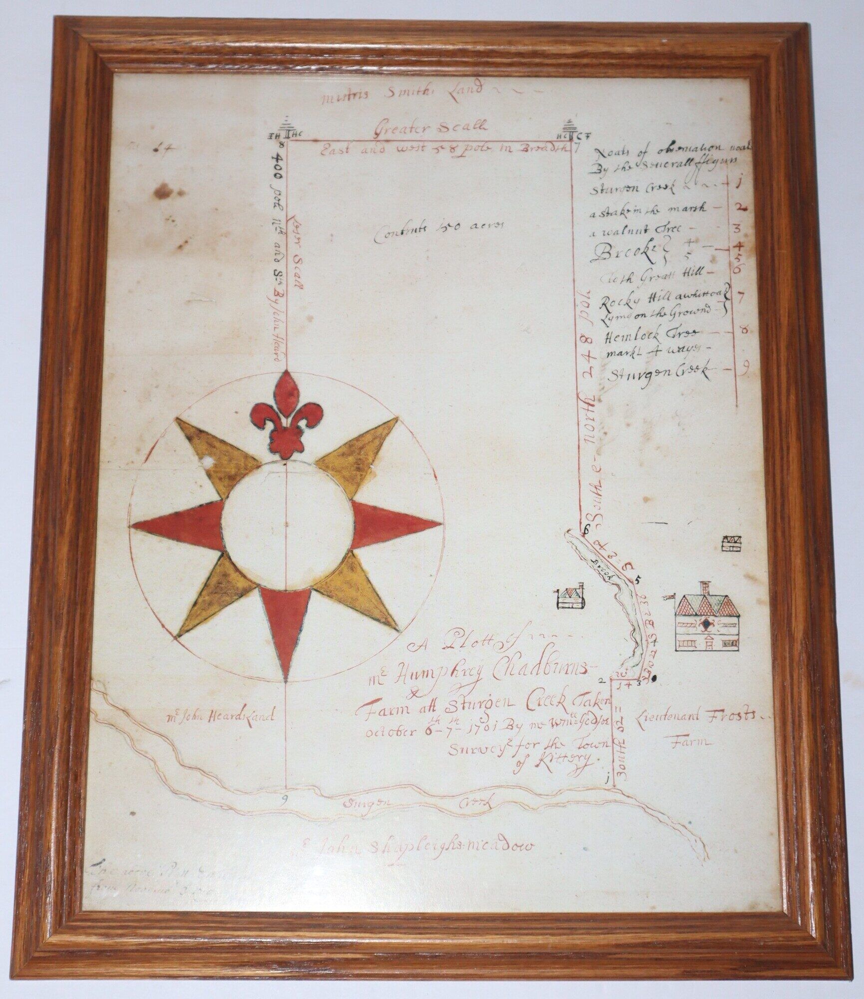
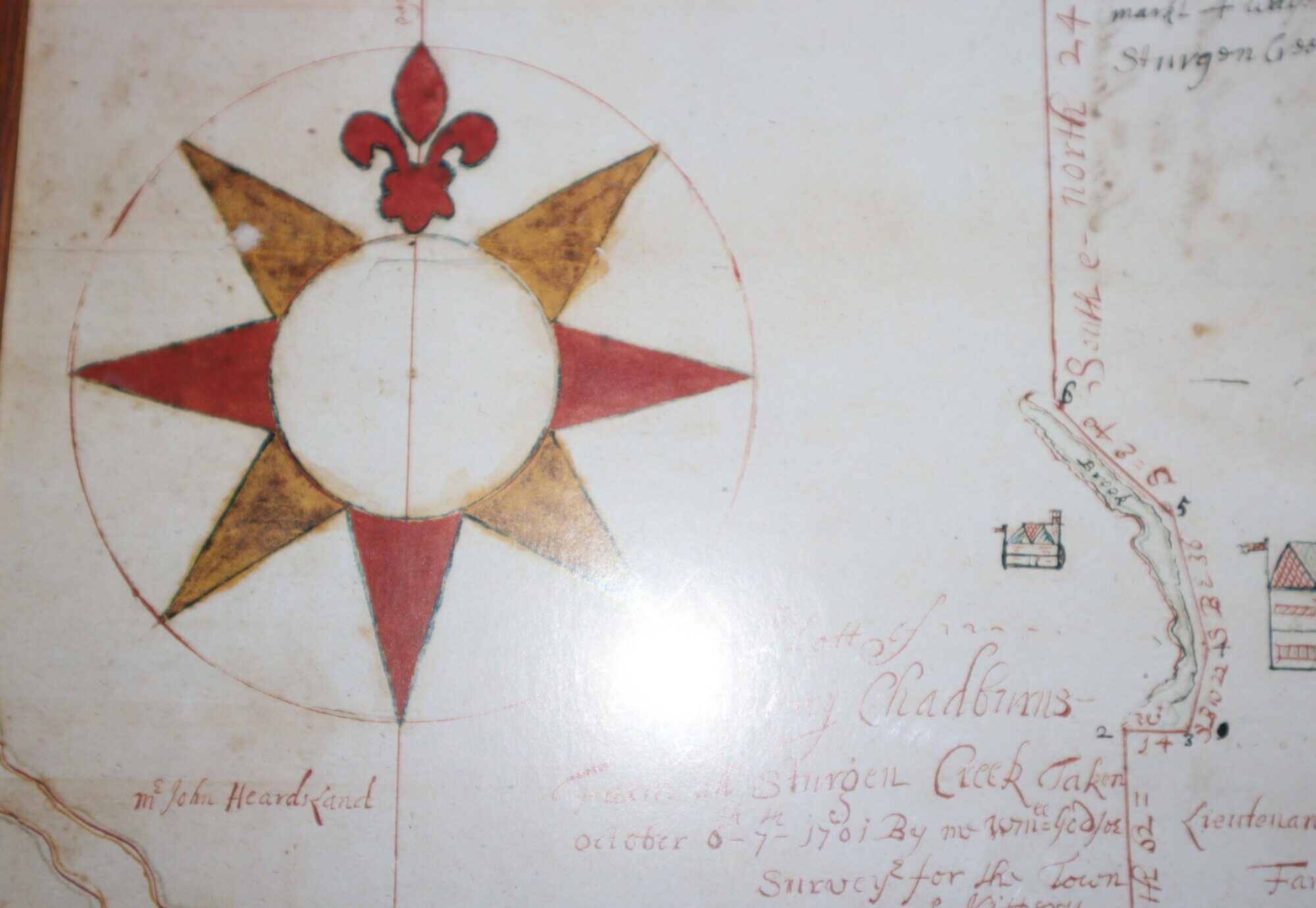
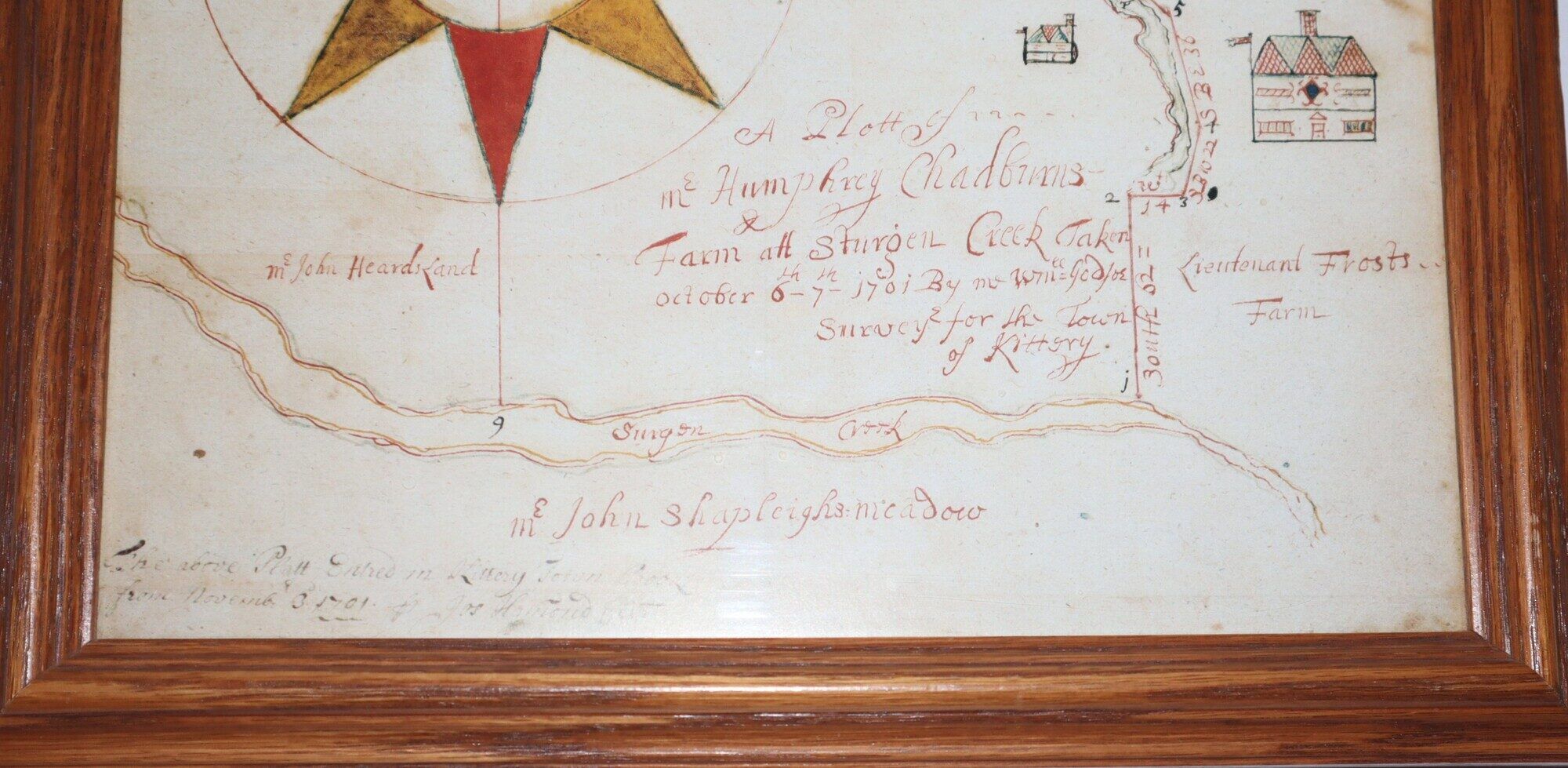
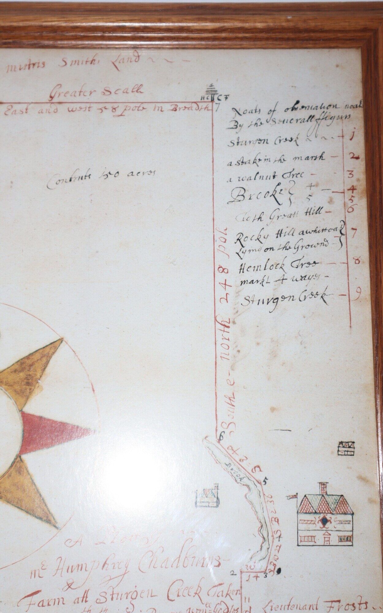
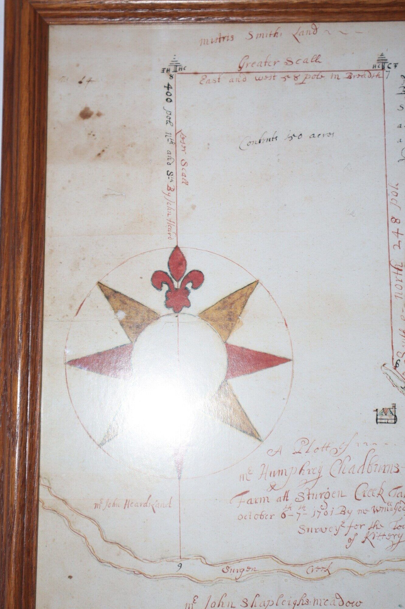
Kittery, or Eliot, Maine, 1701. Framed. Very Good. An immensely decorative and early manuscript survey map -- we would regard it as true Folk Art! The map principally shows a farm property owned by a Humphrey Chadburns. We believe that descendants, of which there are many, now spell the name "Chadbourne", and a good number of the words are spelled slightly differently today. The survey was from a time when spelling was also less standardized, and the spellings and what we would regard as misspellings have a quaintness about them. But the charm of the map comes from the drawings of structures, the directional star, and the like, rendered om several colors, rendered in ink and watercolors. The frame measures 39 by 31 cm, The map has a number of interesting elements besides its decoration. It number keys points-of-interest, and other properties are identified This map was also filed with the township of Kittery in November 1701, We believe the area depicted would now be a part of the Town of Eliot in Maine. The oak finish of the frame has a simplicity that is appropriate for the survey -- it invites us in without competing with the manuscript. The paper under glass has some stains and foxing, none of which detract from the map, in our view.
Details
Title
Framed 1701 Survey Map of a Farm Property in Sturgon Creek [now spelled Sturgeon Creek] in Southern Maine
Binding
Framed
Condition
Very Good
Publisher
Kittery, or Eliot, Maine
Date
1701