Map of Reeves County Texas
- Fort Worth: Logan Map Company, 1930
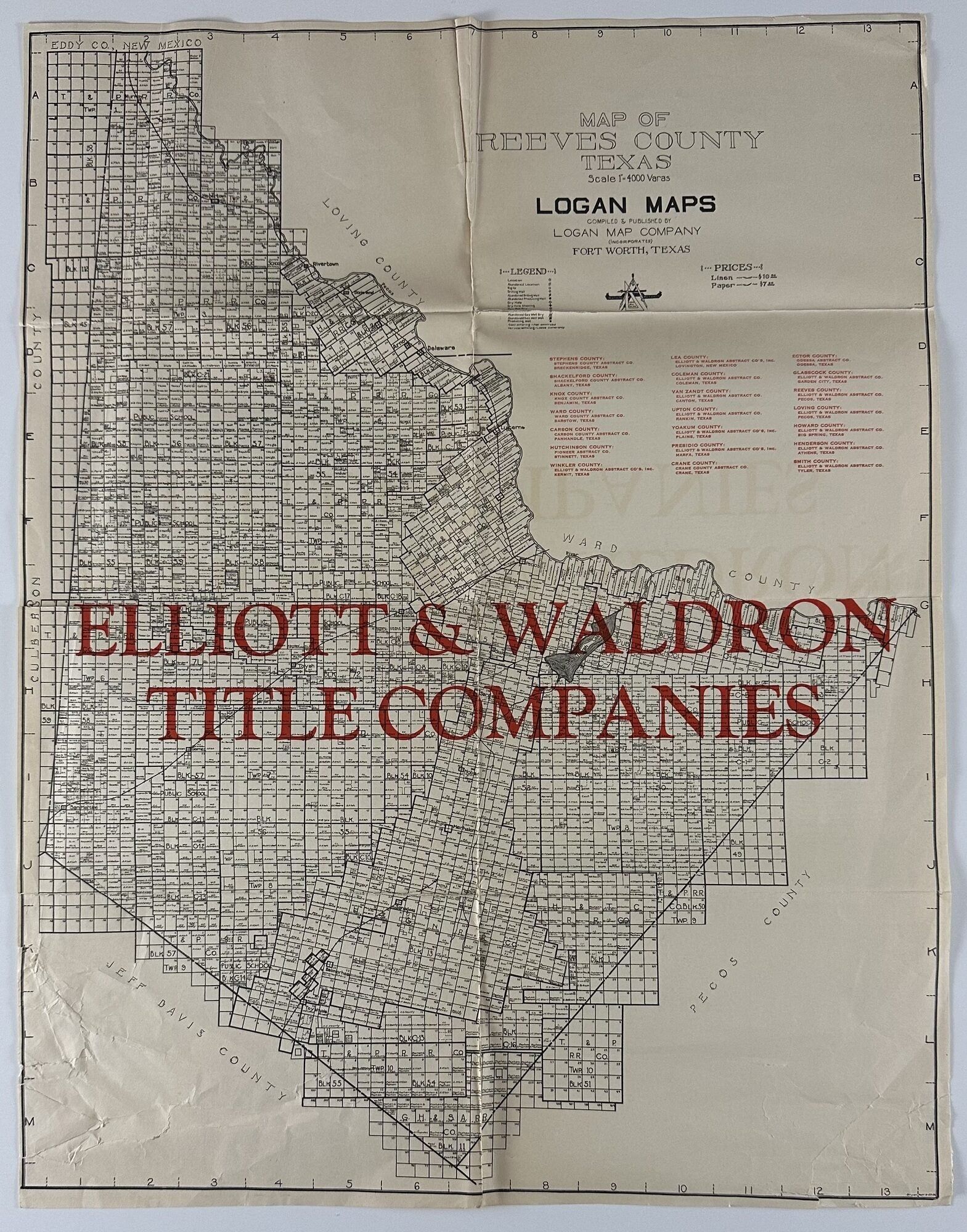
Fort Worth: Logan Map Company, 1930. Folded map, 23 x 17.75 inches. Old folds, minor wear, a few closed tears along folds repaired with tape on verso, bottom left marginal section a bit munched up. Good condition. A scarce and detailed plat map for Reeves County, Texas, in the crook of West Texas between Fort Stockton and New Mexico. This gridded county map provides numerous details on land ownership, oil leases, railroad lands, and other claims; a number of the major oil companies, including Humble, Texas, California, Marland, and Atlantic were active in the county at this time. A key is printed in the margin locating various types of oil and gas wells. The middle portion of the map is overprinted in large red letters, "Elliot & Waldron Title Companies," who provided information to prospective land buyers in Reeves and several surrounding West Texas counties at this time.
"In the early 1920s Pecos became the focus of Delaware Basin oil exploration and received substantial publicity, though little oil and gas were found in paying quantities. By 1930, however, oil excitement had brought a larger and more diversified population to the county" -- Handbook of Texas online. We find records for about twenty Logan Map Company maps, all recorded in single copies.
"In the early 1920s Pecos became the focus of Delaware Basin oil exploration and received substantial publicity, though little oil and gas were found in paying quantities. By 1930, however, oil excitement had brought a larger and more diversified population to the county" -- Handbook of Texas online. We find records for about twenty Logan Map Company maps, all recorded in single copies.
Details
Title
Map of Reeves County Texas
Author
[Texas]: [Oil]
Condition
Unknown
Publisher
Logan Map Company: Fort Worth
Date
1930