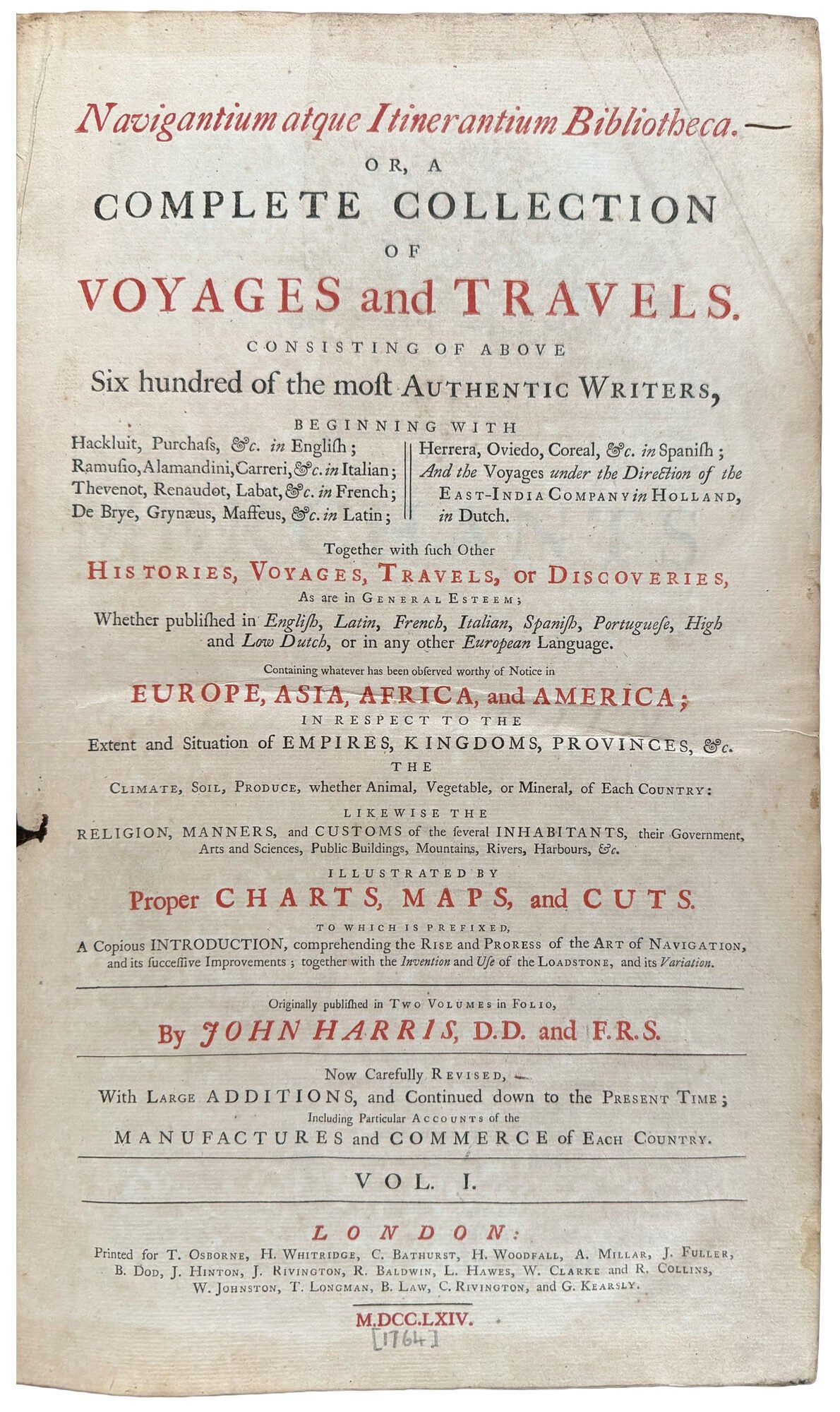
Navigantium atque Itinerantium Bibliotheca. Or, a complete collection of voyages and travels. Consisting of above six hundred of the most authentic writers ... Now carefully revised, with large additions, and continued down to the present time
- 2 volumes, folio
- London: printed for T. Osborne, H. Whitridge, C. Bathurst [inter alia], 1764
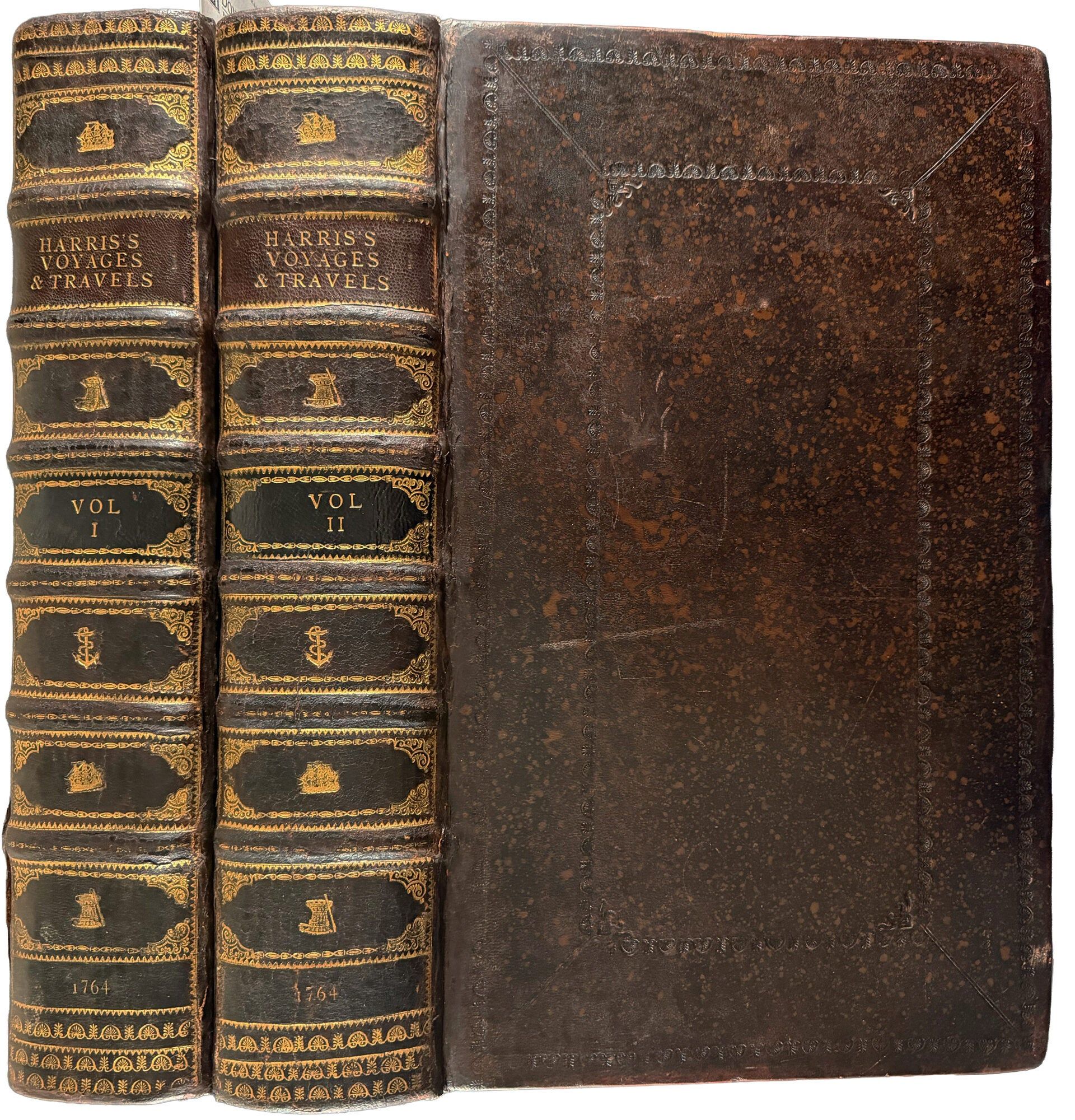
London: printed for T. Osborne, H. Whitridge, C. Bathurst [inter alia], 1764. 2 volumes, folio. (16 x 9 3/4 inches). Titles printed in red and black. 61 engraved maps, plans and plates (15 maps folding, and 2 plates folding). Bound to style in later mottled sheep, spines gilt in seven compartments with raised bands, red morocco lettering-piece in the second compartment, black morocco in the fourth, the other compartments panelled in gilt, each with a large centrally-placed nautical tool
A lovely copy of the third edition of Harris's important compilation, edited by John Campbell, with Emmanuel Bowen's important map of Georgia and the first English map of Australia.
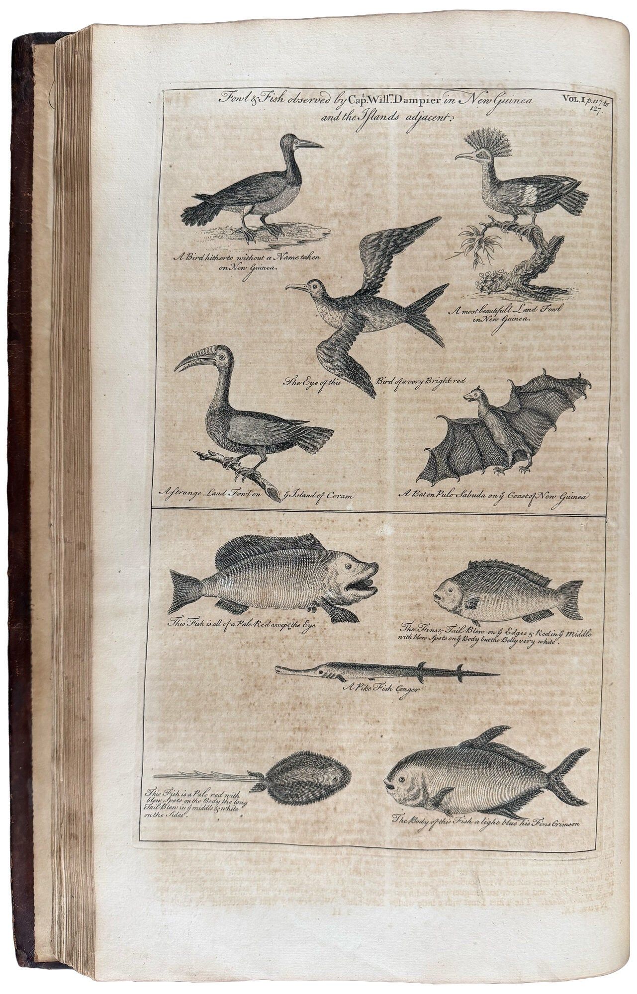
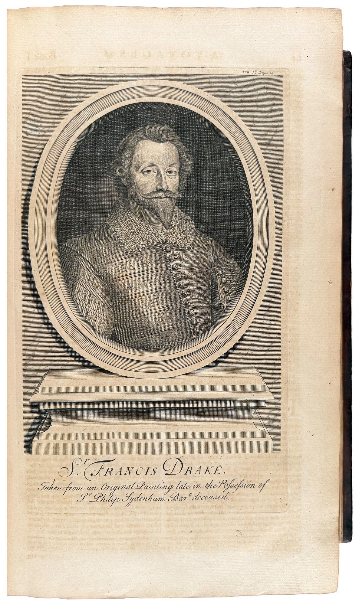
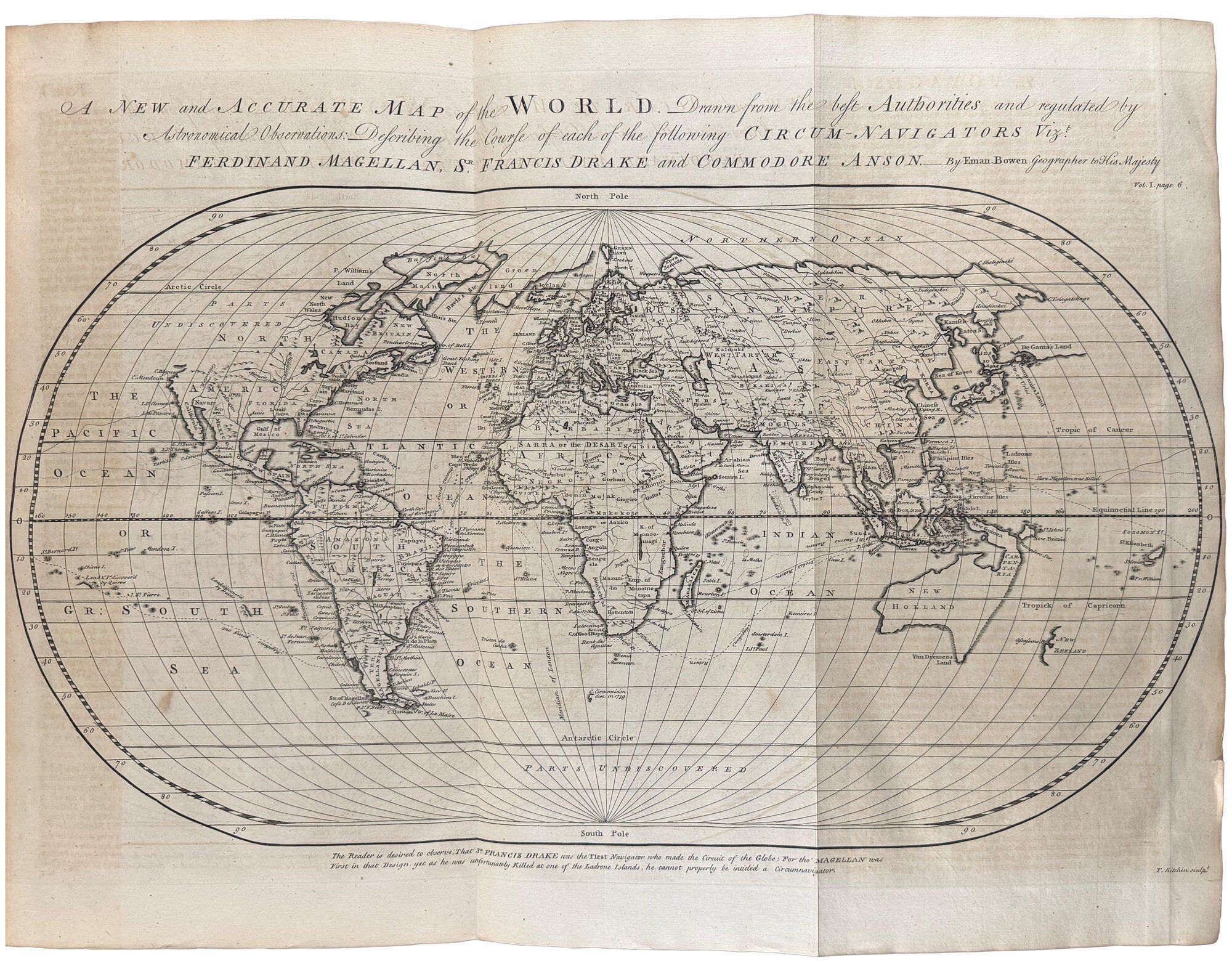
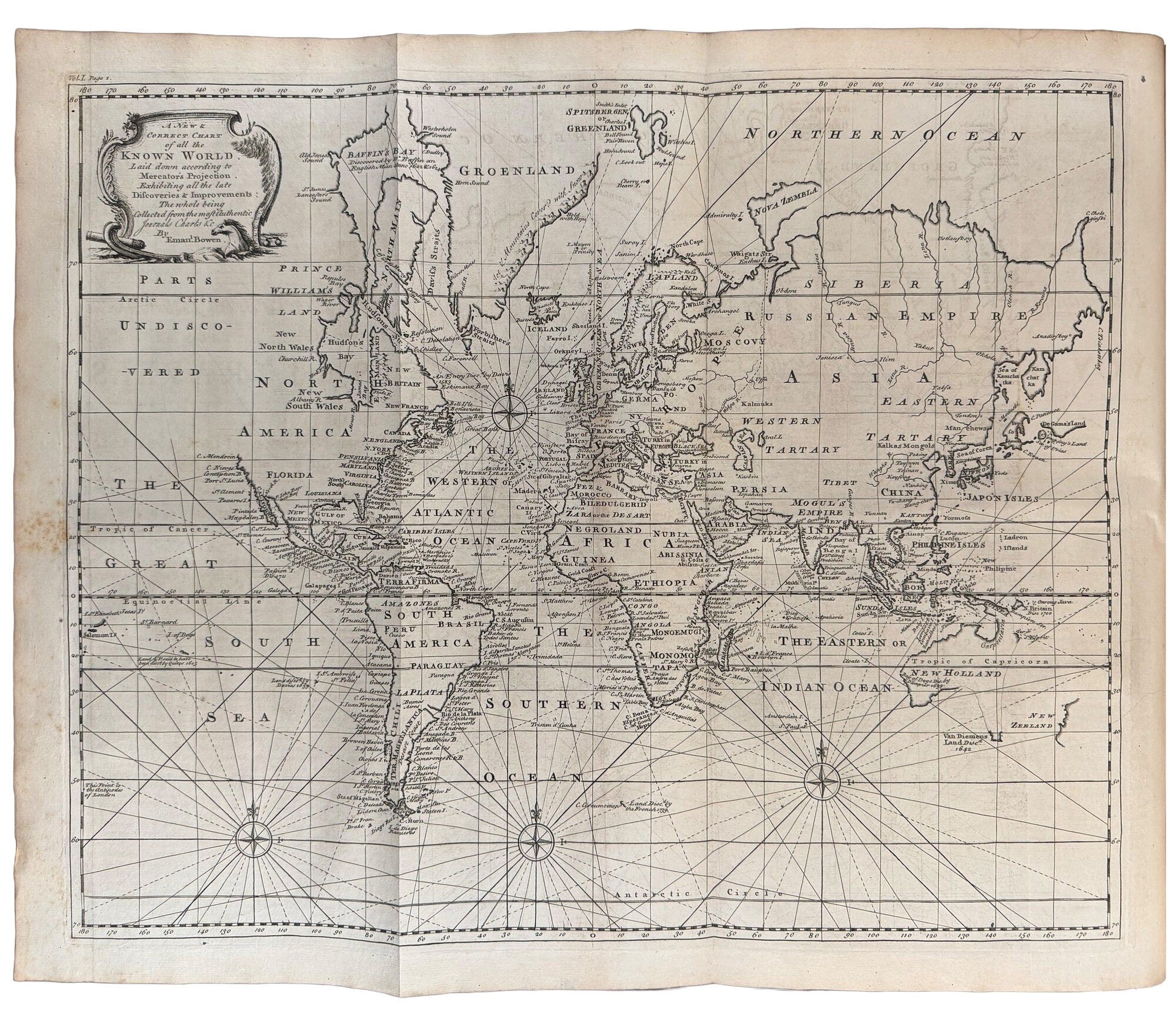
The present third edition is a resetting of the second edition of 1744-1748, with identical plates and maps. Hill's comments on the second edition are therefore also relevant here: "This is the revised and enlarged version of the 1705 first edition ...[This] edition, especially prized for its maps, has been called the most complete by several authorities. Particularly valuable is the inclusion of Tasman's original map and two short articles printed on the map ... To the original extensive collection [including Magellan, Drake, Cavendish, Schouten, Hawkins, Narborough and Dampier] are added accounts completed since the first publication: Christopher Middleton to Hudson's Bay, 1741-42; Bering to the Northeast, 1725-6; Woodes Roger's circumnavigation, 1708-11; Clipperton and Shevlocke's circumnavigation, 1719-22; Roggeveen to the Pacific, 1721-33; and the various travels of Lord Anson, 1740-44" (Hill). Two of the maps are particularly interesting. The first "A Complete Map of the Southern Continent" (facing p.325 in vol.I) is the first English map of Australia. The second, titled "A New Map of Georgia, with Part of Carolina, Florida and Louisiana" (facing p.323 in vol.II) covers from Charles Town to the Mississippi River and extends into Florida to Cape Canaveral. It was included as an accompaniment to the chapter "The History of the Rise, Progress, and Present State of the Colony of Georgia." Besides being a spectacular image, much useful information is also included, particularly the coastal settlements, Indian villages and French and English forts. A distinction is made between tribes that are friendly and hostile to the English. The trading paths and main roads are marked. The modern relevance and historical importance of this map was demonstrated when it was used in a 1981 Supreme Court case over the location of the boundary between Georgia and South Carolina at the mouth of the Savannah River.
Cf. Arnot 23; Brunet III, 49; cf. Clancy 6.25; cf. Cox I,p.10; cf. Cummings 267 (the Georgia map); cf. Davidson pp.37-38; cf./ Hill (2004) 775; cf. Perry p.60 & pl.29; Sabin 30483; cf. Schilder map 87; cf. Lada-Mocarski 3.
A lovely copy of the third edition of Harris's important compilation, edited by John Campbell, with Emmanuel Bowen's important map of Georgia and the first English map of Australia.
The present third edition is a resetting of the second edition of 1744-1748, with identical plates and maps. Hill's comments on the second edition are therefore also relevant here: "This is the revised and enlarged version of the 1705 first edition ...[This] edition, especially prized for its maps, has been called the most complete by several authorities. Particularly valuable is the inclusion of Tasman's original map and two short articles printed on the map ... To the original extensive collection [including Magellan, Drake, Cavendish, Schouten, Hawkins, Narborough and Dampier] are added accounts completed since the first publication: Christopher Middleton to Hudson's Bay, 1741-42; Bering to the Northeast, 1725-6; Woodes Roger's circumnavigation, 1708-11; Clipperton and Shevlocke's circumnavigation, 1719-22; Roggeveen to the Pacific, 1721-33; and the various travels of Lord Anson, 1740-44" (Hill). Two of the maps are particularly interesting. The first "A Complete Map of the Southern Continent" (facing p.325 in vol.I) is the first English map of Australia. The second, titled "A New Map of Georgia, with Part of Carolina, Florida and Louisiana" (facing p.323 in vol.II) covers from Charles Town to the Mississippi River and extends into Florida to Cape Canaveral. It was included as an accompaniment to the chapter "The History of the Rise, Progress, and Present State of the Colony of Georgia." Besides being a spectacular image, much useful information is also included, particularly the coastal settlements, Indian villages and French and English forts. A distinction is made between tribes that are friendly and hostile to the English. The trading paths and main roads are marked. The modern relevance and historical importance of this map was demonstrated when it was used in a 1981 Supreme Court case over the location of the boundary between Georgia and South Carolina at the mouth of the Savannah River.
Cf. Arnot 23; Brunet III, 49; cf. Clancy 6.25; cf. Cox I,p.10; cf. Cummings 267 (the Georgia map); cf. Davidson pp.37-38; cf./ Hill (2004) 775; cf. Perry p.60 & pl.29; Sabin 30483; cf. Schilder map 87; cf. Lada-Mocarski 3.
Details
Title
Navigantium atque Itinerantium Bibliotheca. Or, a complete collection of voyages and travels. Consisting of above six hundred of the most authentic writers ... Now carefully revised, with large additions, and continued down to the present time
Author
HARRIS, John (1667?-1719, compiler)
Binding
2 volumes, folio
Condition
Unknown
Publisher
printed for T. Osborne, H. Whitridge, C. Bathurst [inter alia]: London
Date
1764