Plan of Boston
- unbound
- Philadelphia: Mitchell, Samuel Augustus Jr., 1882
Philadelphia: Mitchell, Samuel Augustus Jr., 1882. unbound. Map. Steel engraving with original hand coloring. Image measures 13.5" x 21".
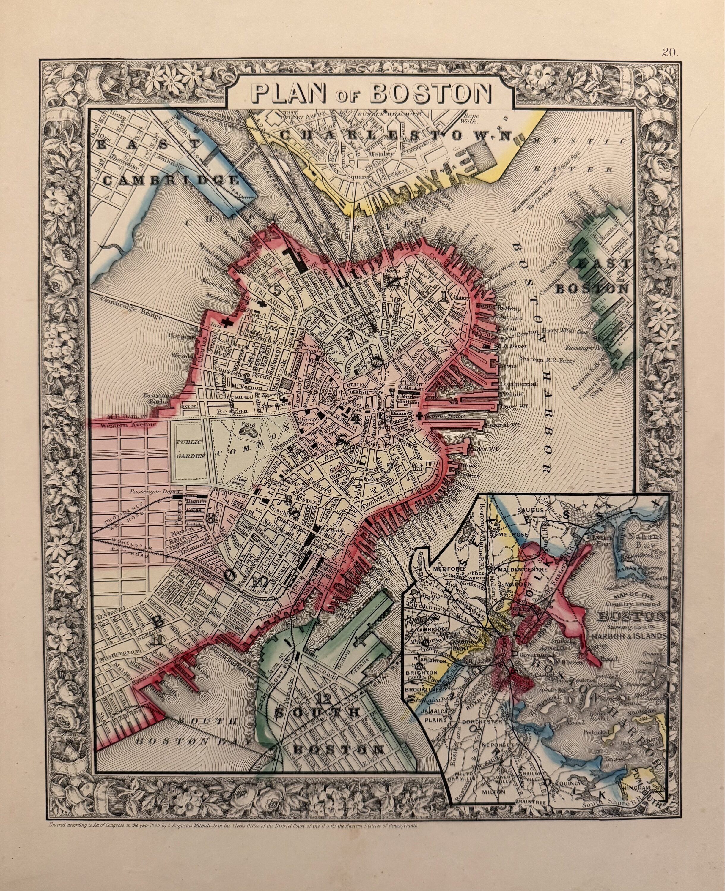
Beautifully detailed double page map of Boston and its environs with an inset of the harbor and islands. Shows streets, railroads, wards, notable buildings and sites, parks and ferry routes. Centerfold reinforced. Samuel Augustus Mitchell Sr. (1792-1868) was one of the leaders in American cartography of the 19th century and pioneered the conversion of engraved map plates to more affordable lithographic plates. His son, Samuel Augustus Mitchell Jr. continued his father's successful mapmaking and publishing business, and was one of the most prolific and renowned 19th century American publishers.
Beautifully detailed double page map of Boston and its environs with an inset of the harbor and islands. Shows streets, railroads, wards, notable buildings and sites, parks and ferry routes. Centerfold reinforced. Samuel Augustus Mitchell Sr. (1792-1868) was one of the leaders in American cartography of the 19th century and pioneered the conversion of engraved map plates to more affordable lithographic plates. His son, Samuel Augustus Mitchell Jr. continued his father's successful mapmaking and publishing business, and was one of the most prolific and renowned 19th century American publishers.
Details
Title
Plan of Boston
Author
MITCHELL, Samuel Augustus Jr.
Binding
unbound
Condition
Unknown
Publisher
Mitchell, Samuel Augustus Jr.: Philadelphia
Date
1882