Watson's New Map of the Western States Territories, Mexico, and Central America
- unbound
- Chicago: W. W. Wadsworth, 1869
Chicago: W. W. Wadsworth, 1869. unbound. Pocket map. Lithograph with original hand coloring. Image measures 38 1/4 x 29 1/4 inches.
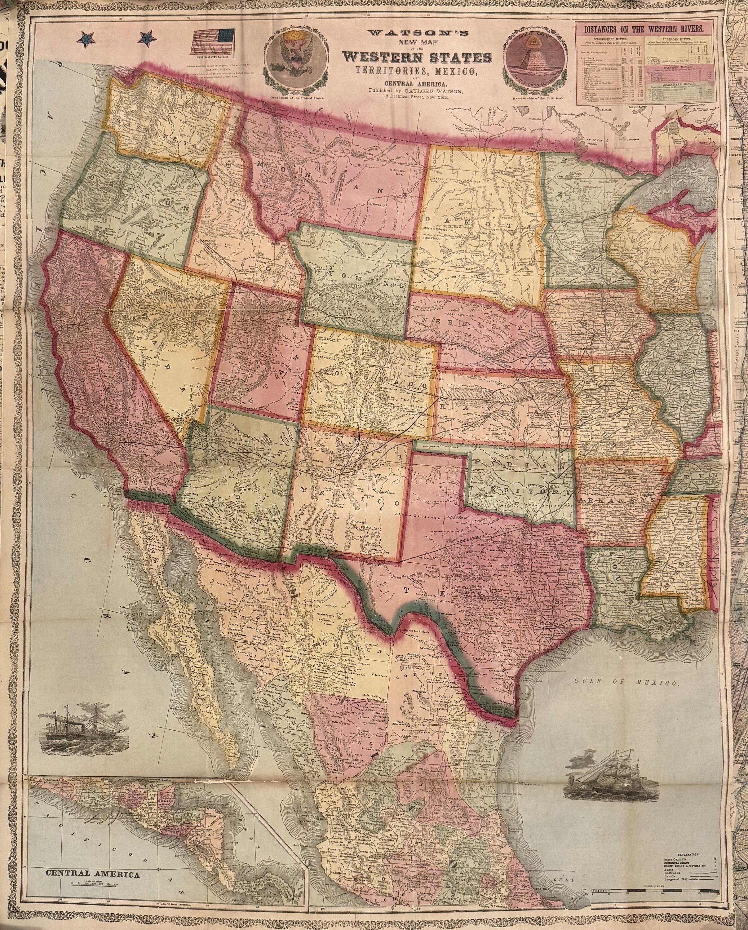
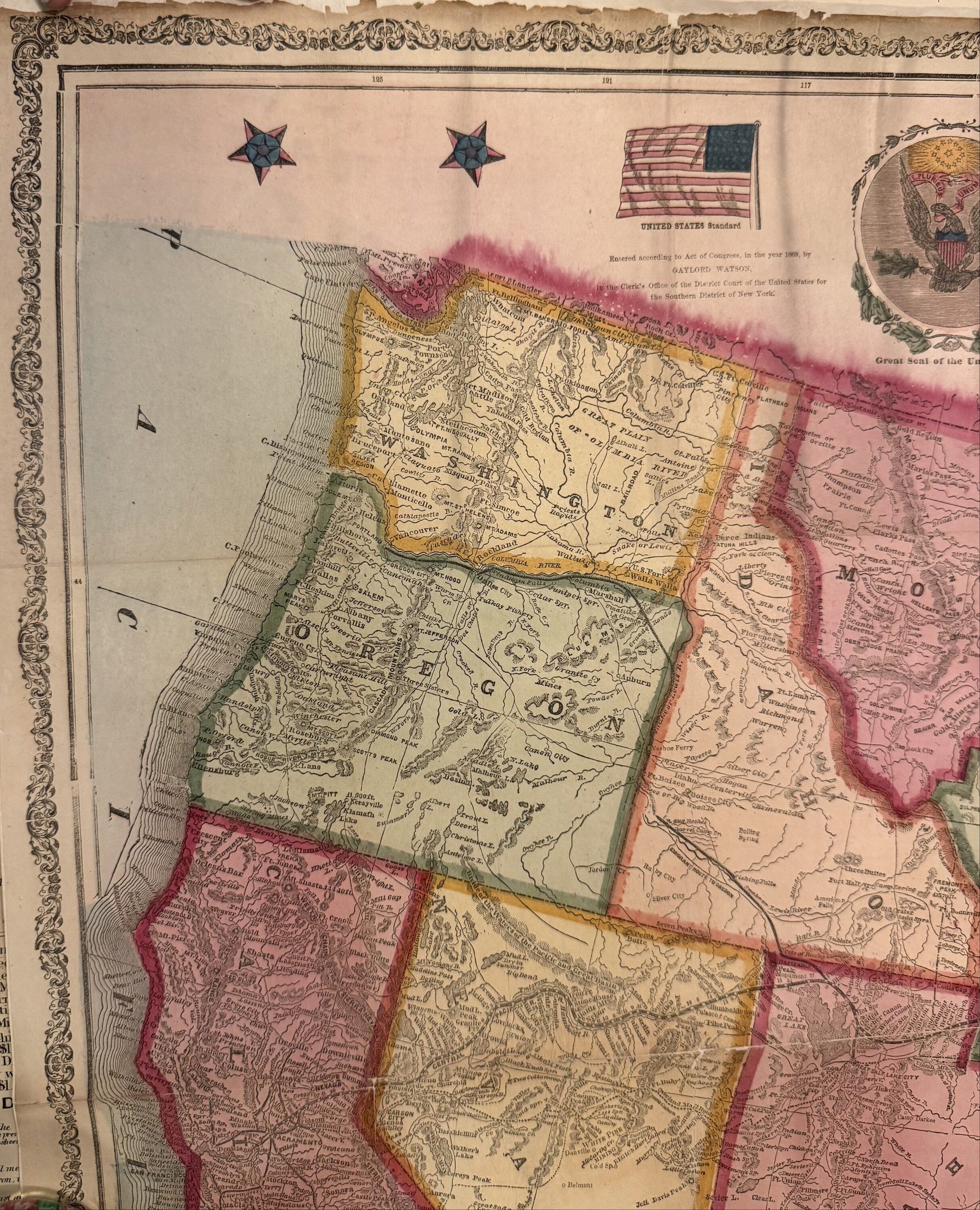
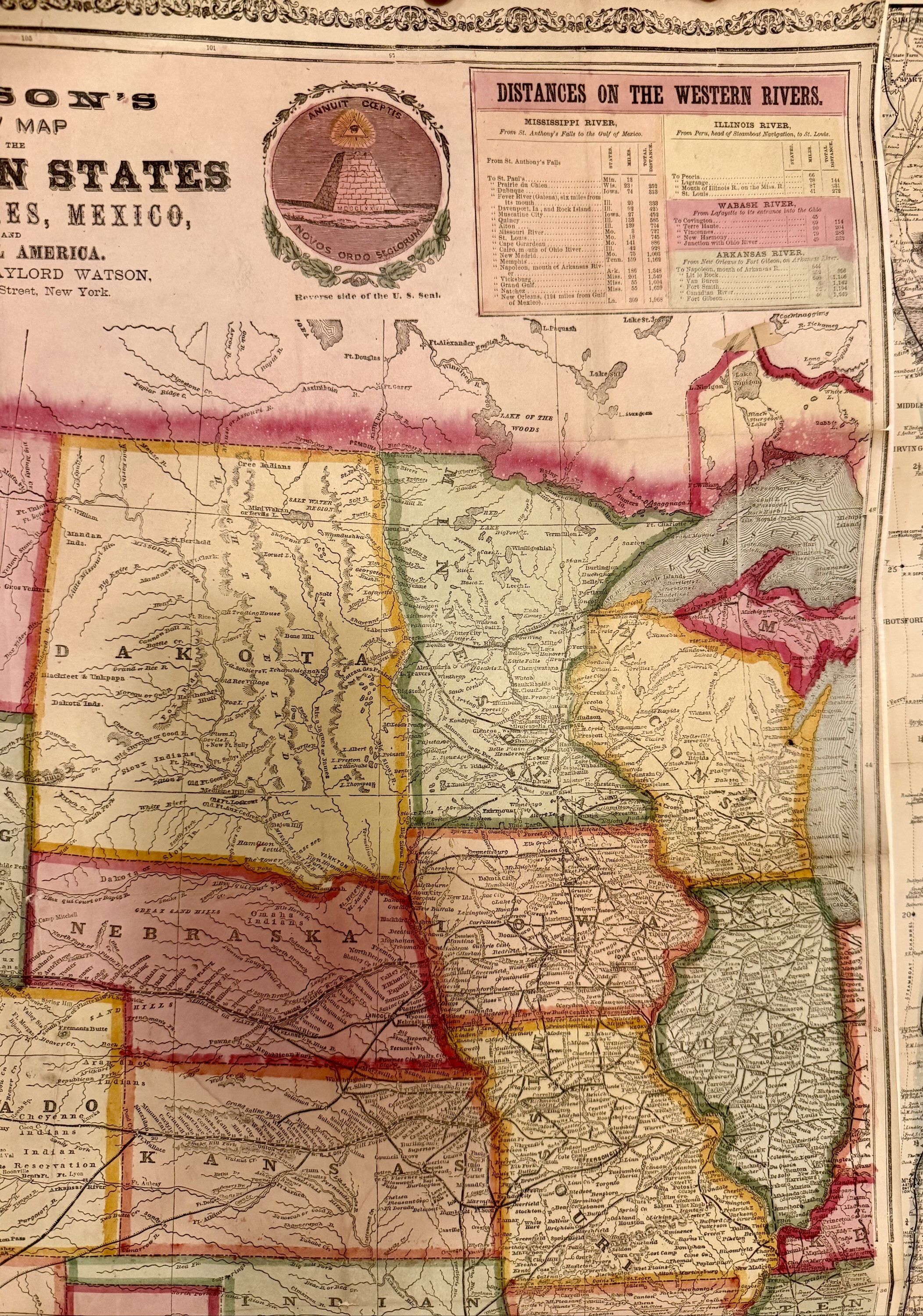
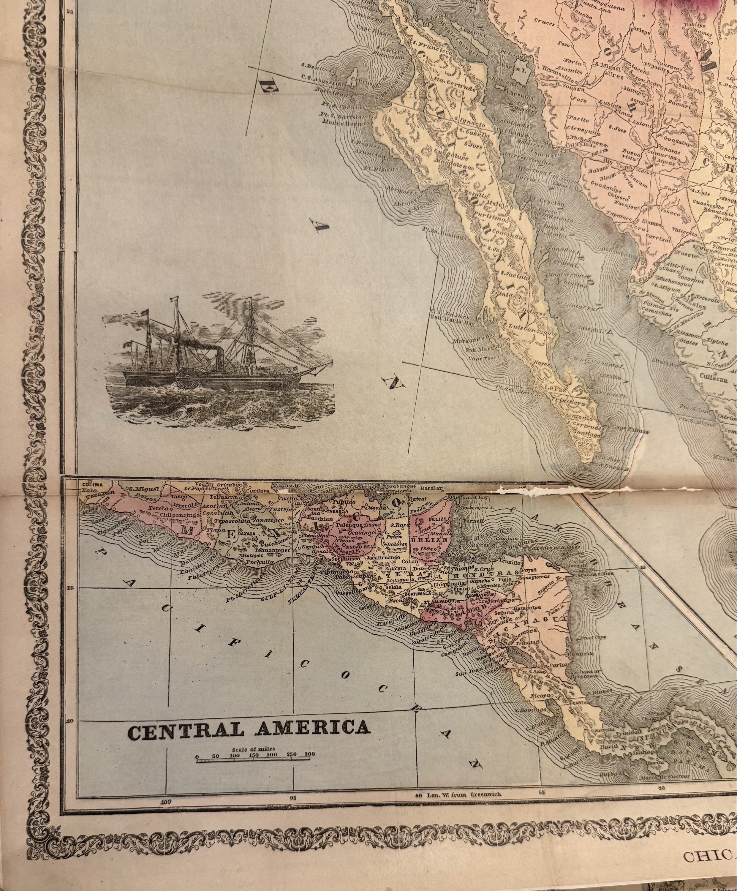
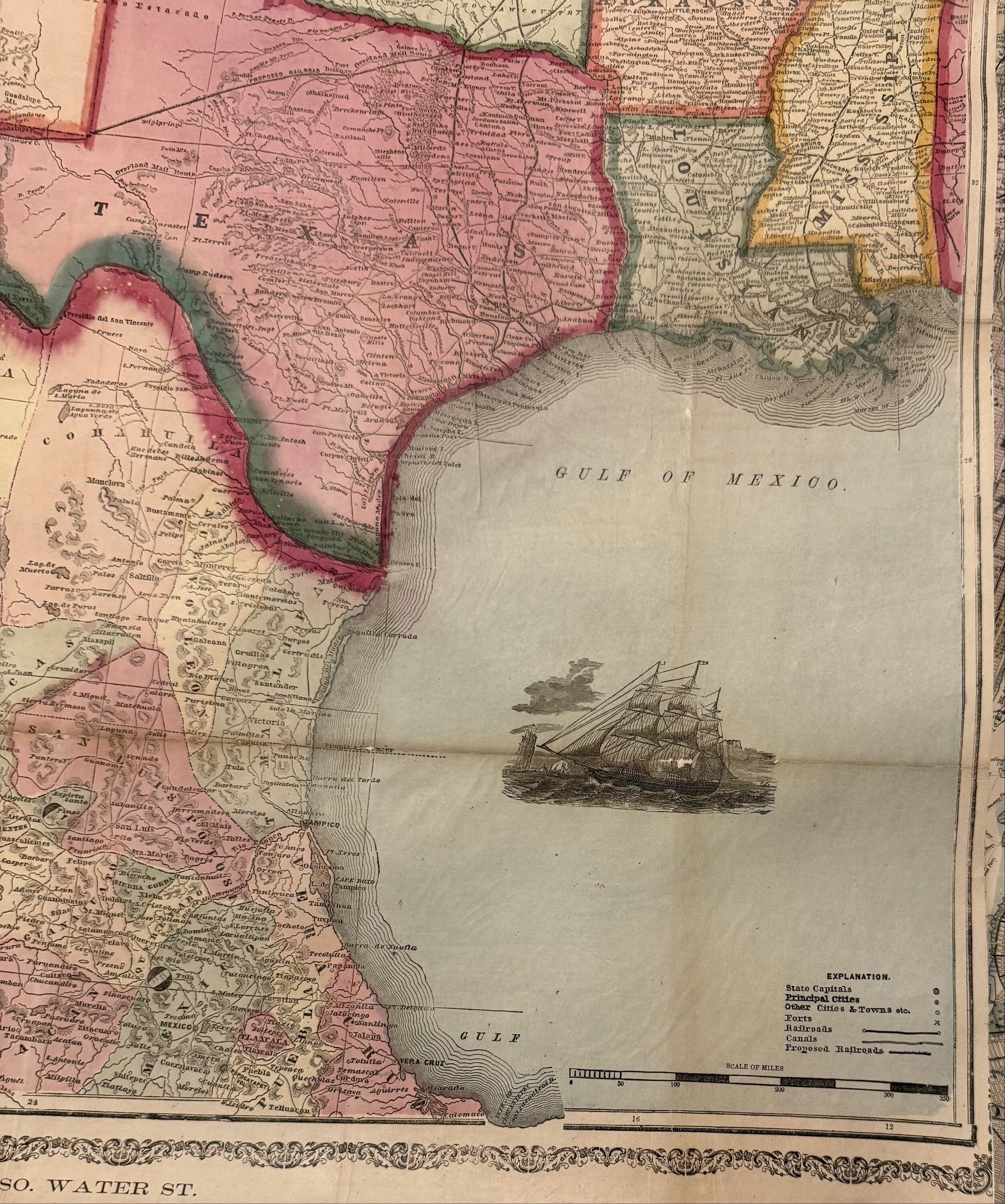
A rare separately issued folding map of the western United States, published in 1869, the same year the first Transcontinental Railroad was completed. In addition to the completed route, the map illustrates two proposed northern and southern railroad lines, reflecting the era's ambitious plans for westward expansion and transportation development. The upper border features the Star-Spangled Banner and the Great Seal of the United States, while vignettes of sailing ships animate both the Pacific Ocean and the Gulf of Mexico. The map's state boundaries are close to their current configuration, although the Dakota Territory remains undivided, predating the creation of North Dakota and South Dakota in 1889. Most of Mexico included plus an inset of Central America. Lined, right margin cropped, some repairs along folds, hard to find. Gaylord Watson (1833-1896) was an American engraver and publisher based in New York and Chicago. He specialized in railroad maps and large wall maps, and was known for his vibrant use of color.
A rare separately issued folding map of the western United States, published in 1869, the same year the first Transcontinental Railroad was completed. In addition to the completed route, the map illustrates two proposed northern and southern railroad lines, reflecting the era's ambitious plans for westward expansion and transportation development. The upper border features the Star-Spangled Banner and the Great Seal of the United States, while vignettes of sailing ships animate both the Pacific Ocean and the Gulf of Mexico. The map's state boundaries are close to their current configuration, although the Dakota Territory remains undivided, predating the creation of North Dakota and South Dakota in 1889. Most of Mexico included plus an inset of Central America. Lined, right margin cropped, some repairs along folds, hard to find. Gaylord Watson (1833-1896) was an American engraver and publisher based in New York and Chicago. He specialized in railroad maps and large wall maps, and was known for his vibrant use of color.
Details
Title
Watson's New Map of the Western States Territories, Mexico, and Central America
Author
WATSON, Gaylord
Binding
unbound
Condition
Unknown
Publisher
W. W. Wadsworth: Chicago
Date
1869