Johnson's New York and Brooklyn
- unbound
- New York: A.J. Johnson, 1866
New York: A.J. Johnson, 1866. unbound. Map. Engraving with original hand coloring. Measures 26.5" x 18"
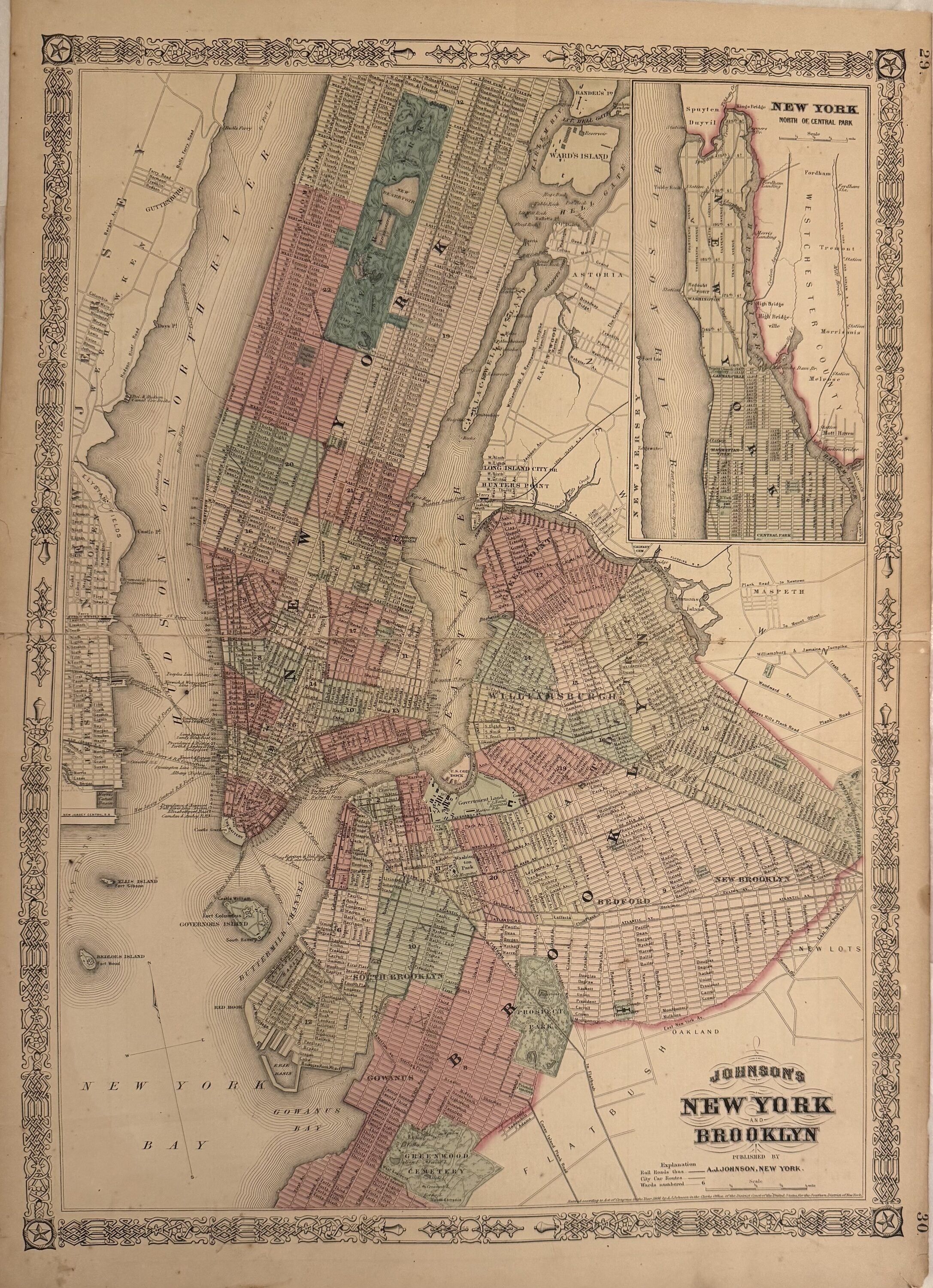
A detailed map of Manhattan south of 116th Street and Brooklyn. Borders of Brooklyn are drawn to the eastern border of Greenwood Cemetery, the southeast border of Prospect Park, along East New York Ave, and then up from Highland Park to include Williamsburg. Includes inset "New York North of Central Park," (upper Manhattan). Some repairs and toning, otherwise in good condition.
Alvin Jewett Johnson (1827-1884) is one of the most prolific American publishers of the 19th century. He opened his own company in 1856 that produced atlases, maps and encyclopedias. The company made great maps based on those by J.H. Colton and Johnson produced a newly updated version every year up until the late 19th century.
Details
Title
Johnson's New York and Brooklyn
Author
JOHNSON, A. J.
Binding
unbound
Condition
Unknown
Publisher
A.J. Johnson: New York
Date
1866