

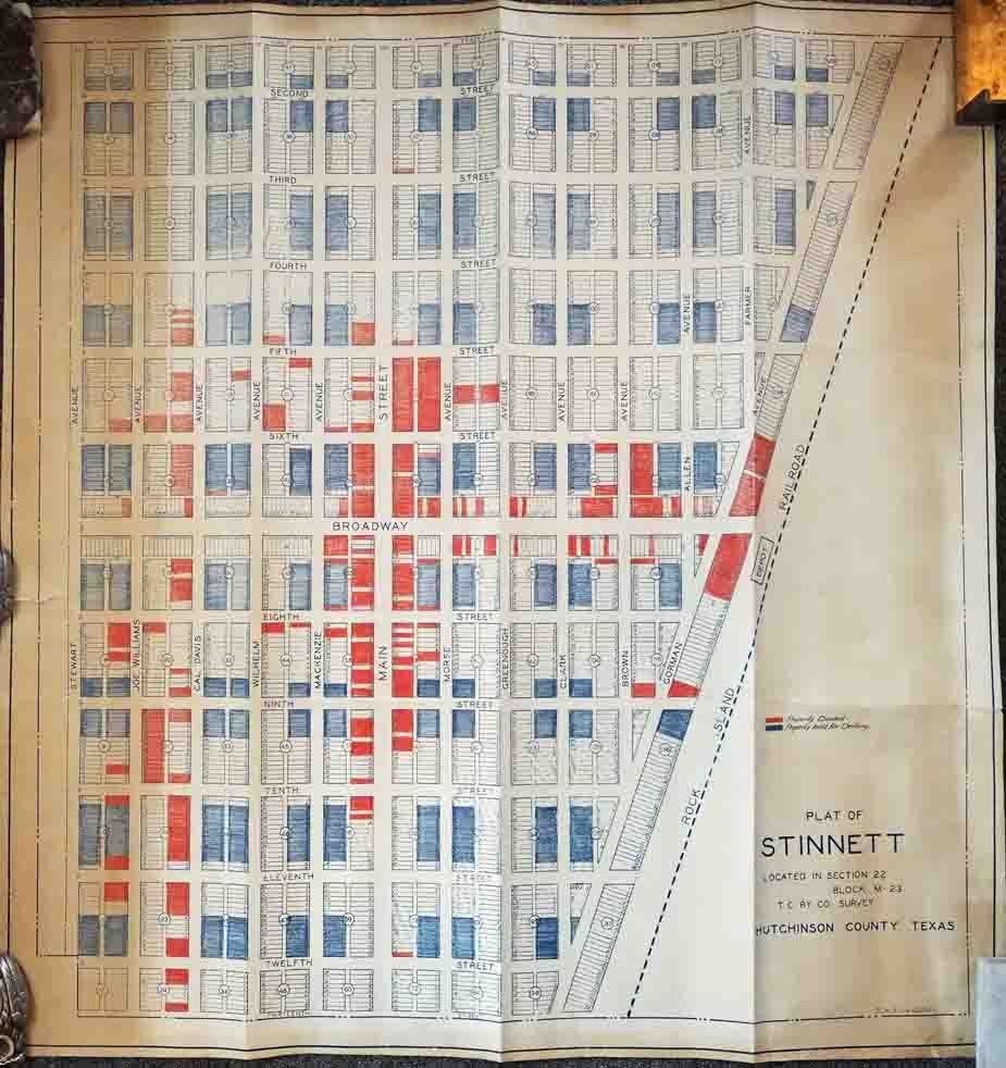
Plat of Stinnett Located in Section 22 Block M-23 T. C. Ry. Co. Survey. Hutchinson County Texas
- [N.p., probably Fort Worth , 1940
[N.p., probably Fort Worth, 1940. Blueline map, 28.75 x X inches. Rolled. A few short closed tears, minor edge wear, some uneven toning. Overall good plus condition. A seemingly unrecorded plat map of Stinnett, Texas, located just north of Amarillo in the middle of the Panhandle. Stinnett was founded in 1926 to serve as a stop along the Chicago, Rock Island, and Gulf Railway. In the middle of the 20th century, when the present map was produced, the town served as a hub for the railroad but also the oil and gas business. The present plat map of Stinnett shows the layout of the town ranged to the west of the Rock Island Railroad line and depot. The town was comprised of almost 140 block sections, each with thirty-two or fewer individual parcels. Many of the parcels on the map are colored in either red or blue pencil. A small handwritten key in the right margin notes that plots colored in red denote "Property Deeded" and those shaded in blue represent "Property held for Drilling.
Details
Title
Plat of Stinnett Located in Section 22 Block M-23 T. C. Ry. Co. Survey. Hutchinson County Texas
Author
[Texas]
Condition
Unknown
Publisher
[N.p., probably Fort Worth
Date
1940