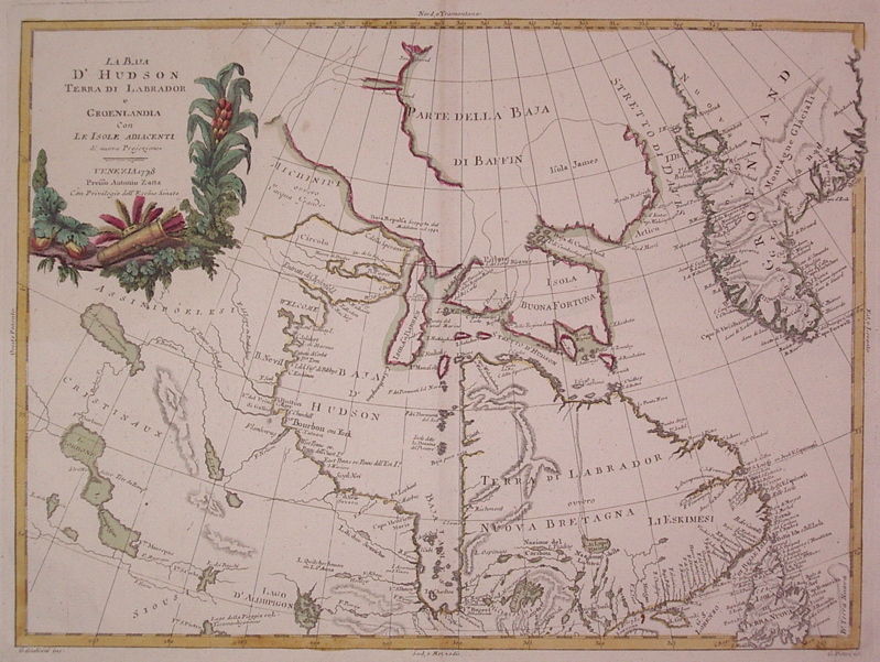
La Baja D'Hudson Terra di Labrador e Groenlandia con Le Isole Adiacenti di nuova Projezione
- unbound
- Venice: Antonio Zatta, 1778
Venice: Antonio Zatta, 1778. unbound. very good. Map. Engraving with original hand coloring. Image measures 11.75" x 16".
Beautiful map of Canada centered on Hudson's Bay and Labrador. Indigenous names are noted and Greenland is shown. Some discoloration along edges and centerfold at margins.
Antonio Zatta (1775-1797) was the most prominent Italian map publisher of the late 18th century. His Venice-based publishing company produced maps that mark an important transition from 18th- to 19th-century cartographic styles. He updates and redefines the traditional title cartouche by replacing the mythic elements common in earlier maps with more representative images.
Details
Title
La Baja D'Hudson Terra di Labrador e Groenlandia con Le Isole Adiacenti di nuova Projezione
Author
ZATTA, Antonio
Binding
unbound
Condition
Very Good
Publisher
Antonio Zatta: Venice
Date
1778