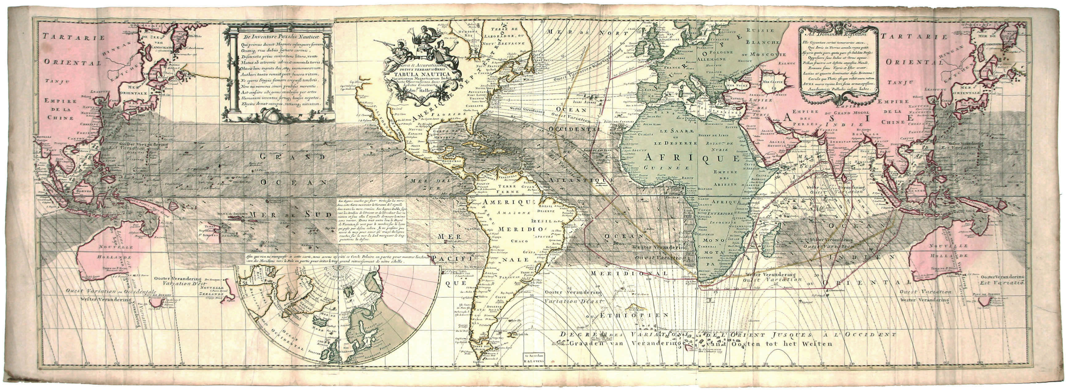
Nova & Accuratissima Totius Terrarum Orbis Tabula Nautica . . . per Edm. Halley
- No Binding
- Amsterdam , 1740
Amsterdam, 1740. No Binding. Very Good. 20 ¾ x 56 ¾ inches. Fine original color; few fold reinforcements, light stains, marginal mends, still excellent overall; archivally mounted with a silk mat in a white gold leaf frame. Scarce. A large, strikingly designed world map by the great English scientist, Edmund Halley, after whom the famous comet was named. It was the first map to delineate magnetic declination (i.e. compass variations resulting from the earth's magnetism) across most of the surface of the globe. Halley intended this chart to be used at sea by navigators, and as Whitfield points out, "a version of this chart was part of the navigator's essential equipment." In fact, no previous world map contained as much navigation-related data as this one. It also depicts prevailing winds and ocean currents, in addition to the aforementioned compass variations. Cf. Whitfield, P. The Image of the World, p. 110.
Details
Title
Nova & Accuratissima Totius Terrarum Orbis Tabula Nautica . . . per Edm. Halley
Author
HALLEY, E./ OTTENS, R. & I
Binding
No Binding
Condition
Very Good
Publisher
Amsterdam
Date
1740