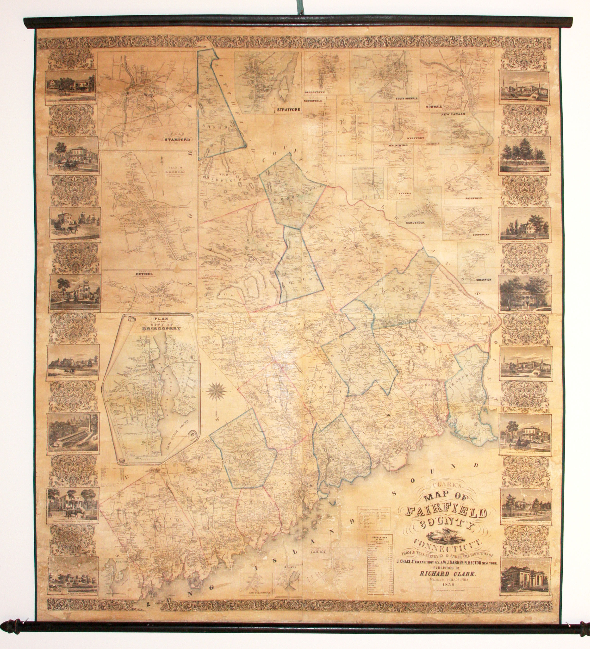
Clarks' Map of Fairfield County, Connecticut
- No Binding
- Philadelphia , 1858
Philadelphia, 1858. No Binding. Very Good. 60 x 52 inches. Attached to original wooden rollers; vibrant original color, refreshed; expertly conserved-re-mounted on new linen, usual separations, minor losses, very good. Richly illustrated wall map of Fairfield County, Connecticut, with 23 inset city and town plans, including ones of Greenwich, Westport, New Canaan, Weston, Wilton, and Fairfield. Both the main map and the insets provide the names and locations of homes throughout the area. Flanking the map are 16 finely engraved views of mansions, factories and schools, such as the Winslow estate in Westport, the Augustus Mead home in Greenwich, and the Rockwell Boarding School for Boys in New Canaan. Thompson 176.
Details
Title
Clarks' Map of Fairfield County, Connecticut
Author
CLARK, R
Binding
No Binding
Condition
Very Good
Publisher
Philadelphia
Date
1858