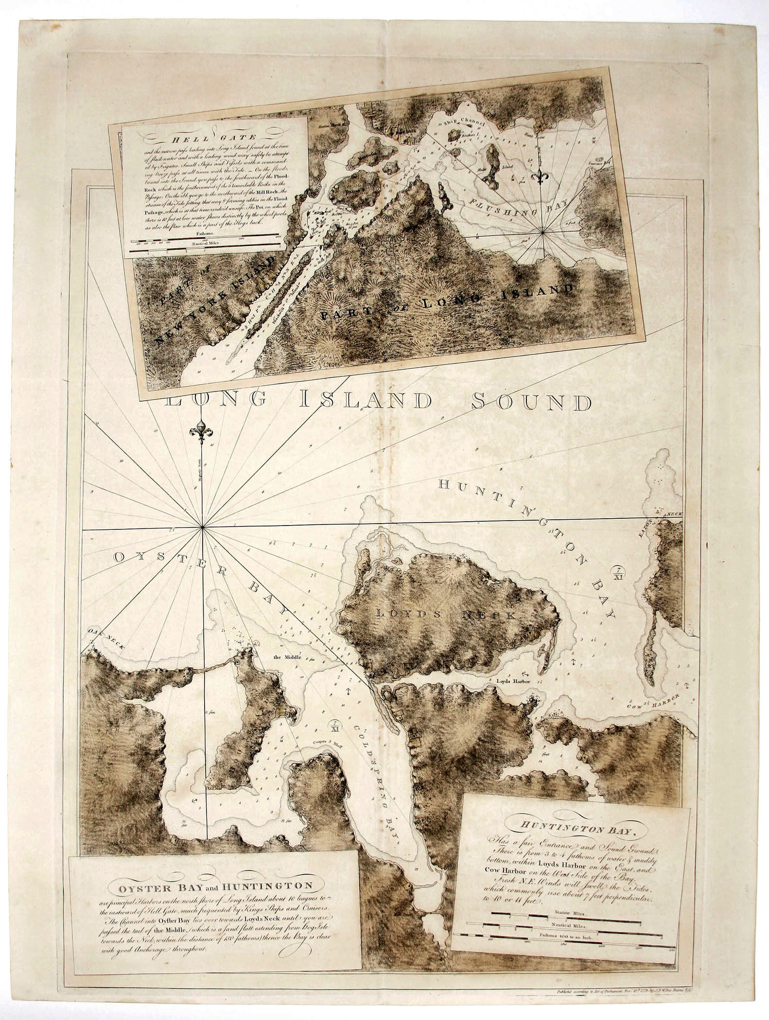
Hell Gate/ Oyster Bay and Huntington/ Huntington Bay
- No Binding
- London , 1778
London, 1778. No Binding. Near Fine. 30 ¾ x 21 ¼ inches. Original wash color; light staining in fold, else excellent condition. Rare, finely engraved work from one of the greatest maritime atlases ever produced, The Atlantic Neptune. Made for the use of the British navy during the American Revolution, the chart, in the large inset, shows hazardous water passage from Manhattan to Long Island Sound, known as Hellgate, and includes all of Roosevelt Island. The large, primary chart focuses on Locust Valley, Oyster Bay, Lloyd's Neck, and parts of Great Neck, Eaton's Neck and Cow Harbor. The chart appeared in the Atlantic Neptune, a marine atlas that contained the first generally accurate charts of the eastern seaboard of North America. As many of its charts were made on a very large scale, DesBarres' works possess a majestic beauty quite unlike any others in the history of cartography.
Details
Title
Hell Gate/ Oyster Bay and Huntington/ Huntington Bay
Author
DESBARRES, J.F.W
Binding
No Binding
Condition
Near Fine
Publisher
London
Date
1778