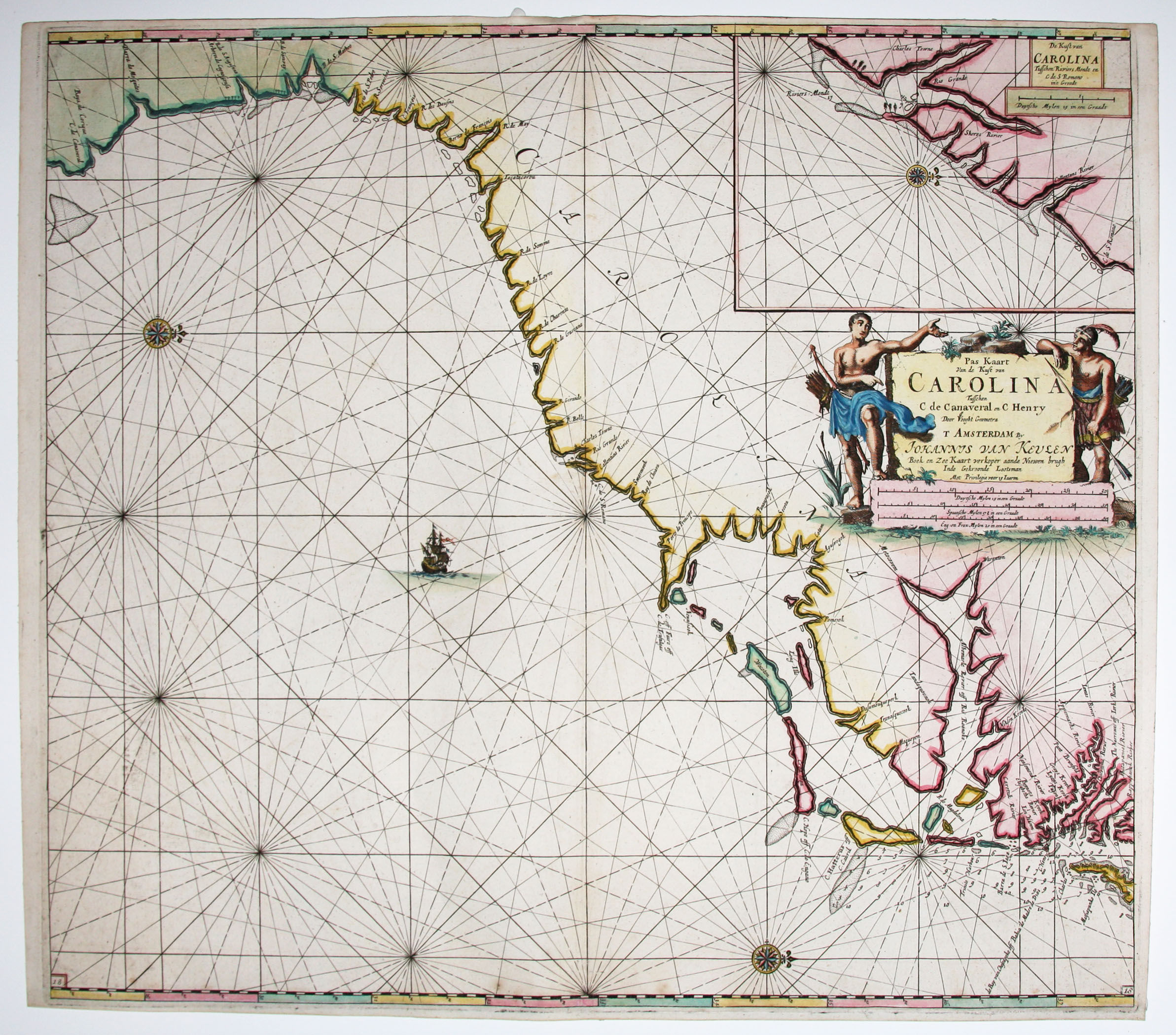
Pas Kaart van de Just van Carolina
- No Binding
- Amsterdam , 1682
Amsterdam, 1682. No Binding. Near Fine. 20 ¼ x 23 inches. Superb hand color; lower margin extended with slight loss, else fine with strong impression on heavy paper. One of the earliest printed charts to specifically focus on the Carolina coast and one of the most attractive maps of the area overall. The chart extends from the Chesapeake Bay to northern Florida. While van Keulen used a variety of sources, not all of the identifiable, generally speaking, Spanish sources inform the more southerly areas, while in the northern part of the map, more accurate English sources predominate. There is an inset of Charlestown Harbor above the cartouche. The Van Keulen firm was a leading supplier of charts, instruments, and maritime related books of uncommon longevity. It remained a family controlled business until 1823 and then continued to operate under another owner until 1885. Cumming/ De Vorsey, Southeast, no. 91; Koeman IV, no. 18, p. 376; Burden II, no. 589.
Details
Title
Pas Kaart van de Just van Carolina
Author
VAN KEULEN, J
Binding
No Binding
Condition
Near Fine
Publisher
Amsterdam
Date
1682