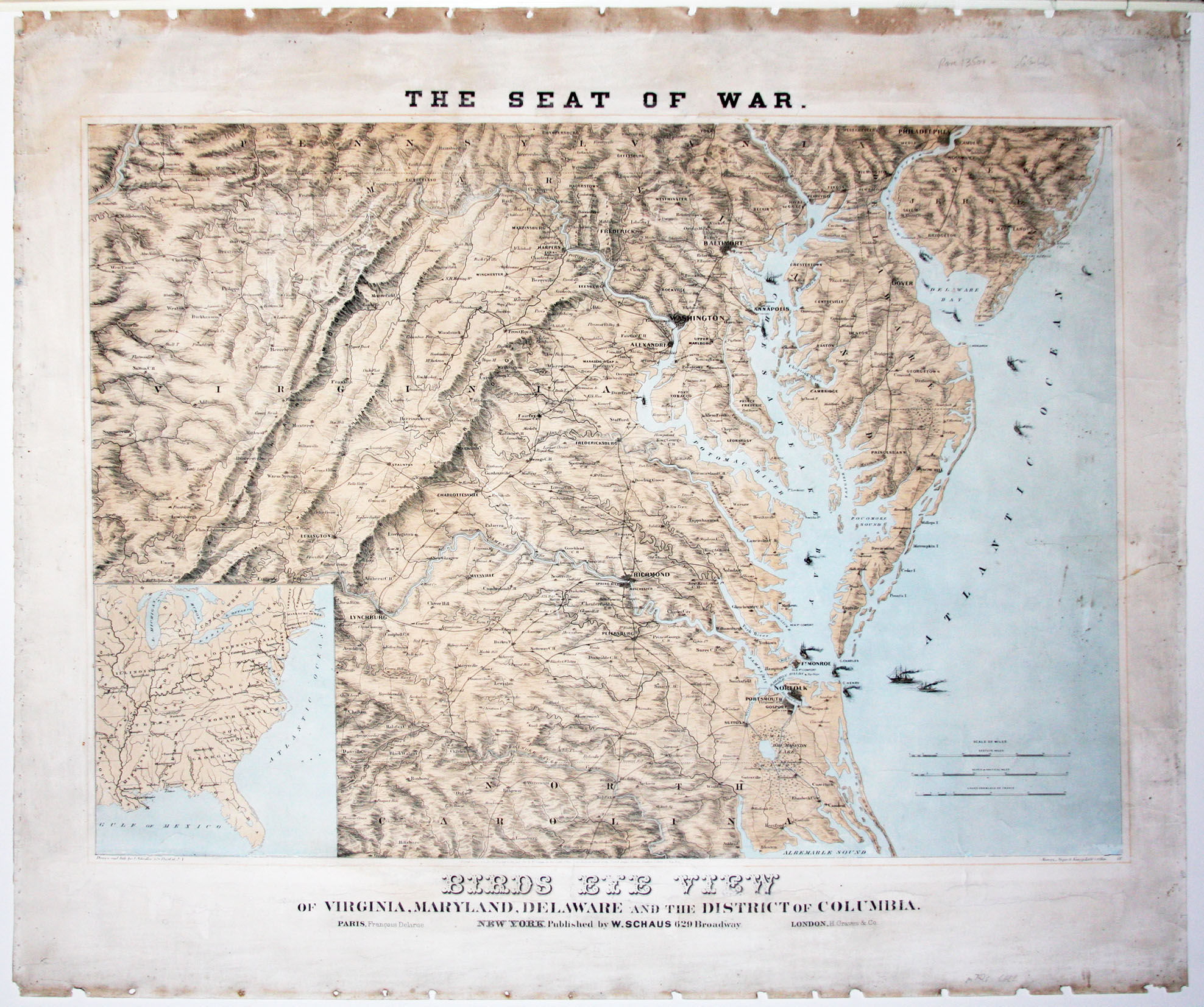
The Seat of War./ Birds Eye View of Virginia, Maryland, Delaware and the District of Columbia
- No Binding
- New York , 1861
New York, 1861. No Binding. Very Good. 25 1/2 x 29 1/2 inches. Chromolithograph. Some scuffing, soiling, a mended tear, very good. Rare. A large, attractive, well-detailed map (not bird's-eye view, as it calls itself) of the key theatre of the early phase of the Civil War. The map includes street grids for Baltimore, Washington, Norfolk, Richmond, and Lynchburg. The map skillfully renders topography, in particular the Blue Ridge, Shenandoah, and Allegheny Mountain ranges. Town, courthouses, forts, road and railroads are shown throughout and, most notably, in the western regions as well. The map was drawn and lithographed by J. Schedler and printed by Sarony, Major & Knapp. Stephenson 17.3
Details
Title
The Seat of War./ Birds Eye View of Virginia, Maryland, Delaware and the District of Columbia
Author
SCHAUS, W
Binding
No Binding
Condition
Very Good
Publisher
New York
Date
1861