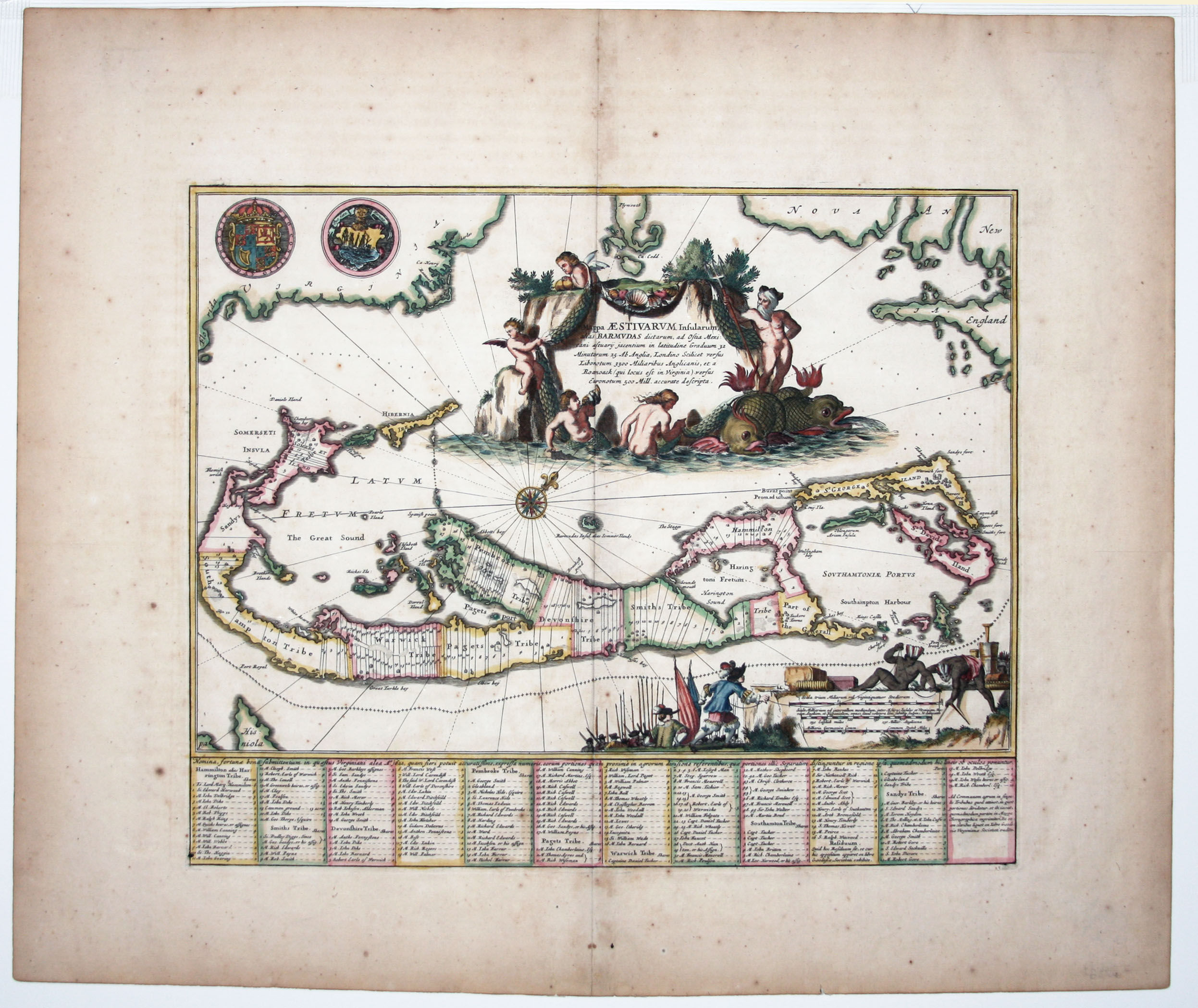
Mappa Aestivarum Insularum
- No Binding
- London , 1670
London, 1670. No Binding. Near Fine. 11 ½ x 14 inches. Fine hand color; excellent condition. A beautifully engraved, early map of Bermuda based on the first separate map of the island, Richard Norwood's 1618 chart, executed in behalf of the Bermuda Company. The Ogilby map includes the parishes and tribes allotted to the company's principal members, with their names included, most of which survive to this day. An ornate cartouche of Neptune displays the bounty of the sea, and an unusual vignette, decorating the mileage scales, depict Indians cheerfully assisting a European surveyor with armed soldiers in the background. Palmer p. 21, pl. XXI.
Details
Title
Mappa Aestivarum Insularum
Author
OGILBY, J
Binding
No Binding
Condition
Near Fine
Publisher
London
Date
1670