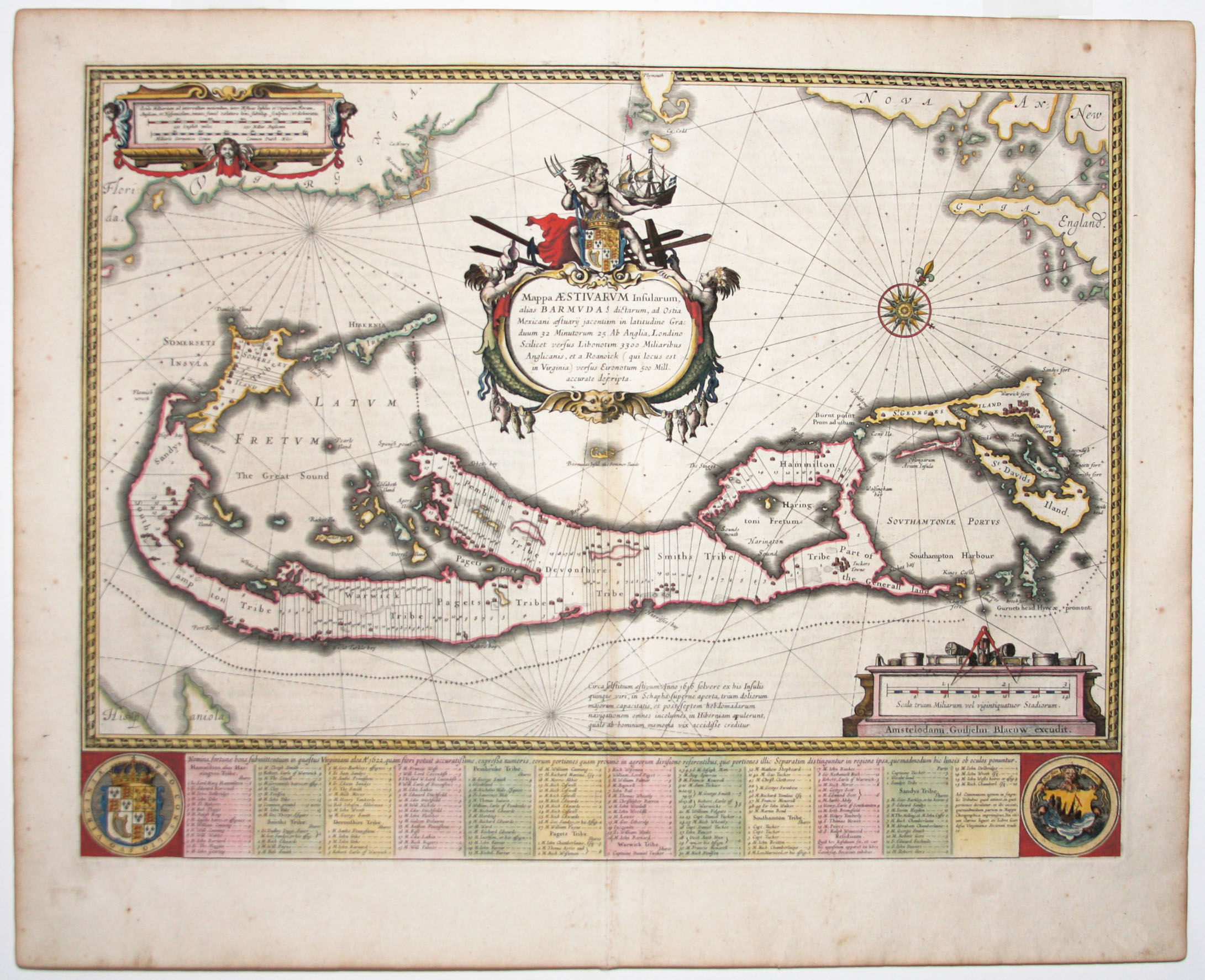
Mappa Aestivarum Insularum, alias Barmudas
- No Binding
- Amsterdam , 1630
Amsterdam, 1630. No Binding. Near Fine. 16 x 21 inches. Fine original color; excellent condition. The most richly decorative, early map of the island in a very attractive, original-colored example. It was based on Richard Norwood's 1618 chart, executed in behalf of the Bermuda Company. The map thus includes the parishes and tribes allotted to the company's principal members, with their names included, most of which survive to this day. The map vividly illustrates how hazardous the coastline of Bermuda was, and is, to shipping by the almost unbroken ring of crosses signifying wrecks surrounding the island. The map's majestic cartouche depicts Neptune, standing astride the English Royal Arms, bearing a trident in one hand and a Dutch ship in the other. The engraving actually includes two maps of Bermuda of different scales: Nestled within the hook of the island is another, smaller depiction of Bermuda, placed there to show its position and size relative to Cape Cod, Virginia and Nova Scotia. This design proved confusing to some later copiers, who dispensed with the mainland in their renditions while mistakenly retaining the smaller "Bermuda" as a small island off the coast of Bermuda. Palmer, M. Maps of Bermuda, p. 10.
Details
Title
Mappa Aestivarum Insularum, alias Barmudas
Author
BLAEU, W
Binding
No Binding
Condition
Near Fine
Publisher
Amsterdam
Date
1630